Garner is a town in Wake County, North Carolina, United States and a suburb of Raleigh. The population is 31,159 as of the 2020 Census. The city limits are entirely within Wake County, though portions of unincorporated Wake County, as well as the Cleveland community in northern Johnston County, have Garner mailing addresses. It is part of the Research Triangle region of North Carolina and serves as a bedroom community for the region.
| Name: | Garner town |
|---|---|
| LSAD Code: | 43 |
| LSAD Description: | town (suffix) |
| State: | North Carolina |
| County: | Wake County |
| Incorporated: | 1905 |
| Elevation: | 361 ft (110 m) |
| Total Area: | 18.32 sq mi (47.44 km²) |
| Land Area: | 18.27 sq mi (47.32 km²) |
| Water Area: | 0.05 sq mi (0.12 km²) |
| Total Population: | 31,159 |
| Population Density: | 1,705.38/sq mi (658.44/km²) |
| ZIP code: | 27529 |
| Area code: | 919 |
| FIPS code: | 3725480 |
| GNISfeature ID: | 0985572 |
| Website: | www.garnernc.gov |
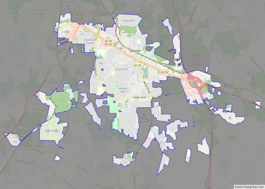
Online Interactive Map
Click on ![]() to view map in "full screen" mode.
to view map in "full screen" mode.
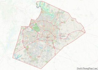
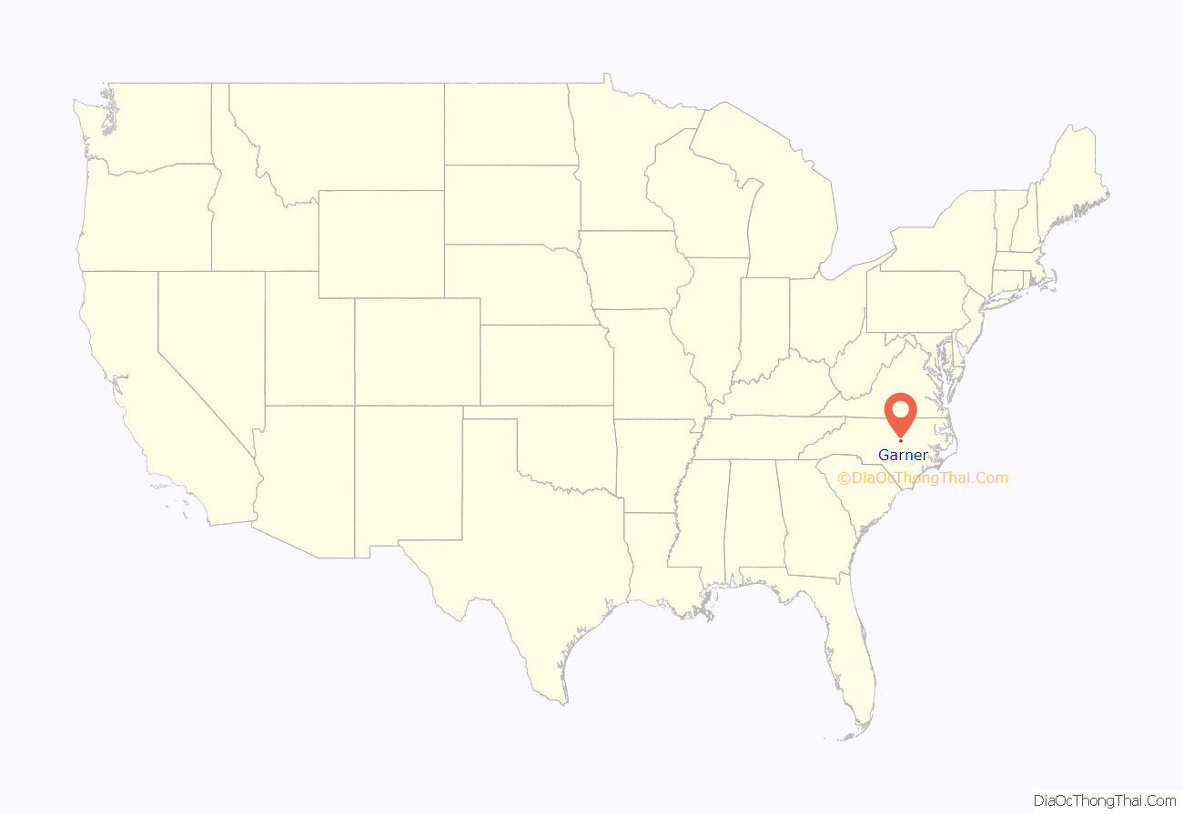
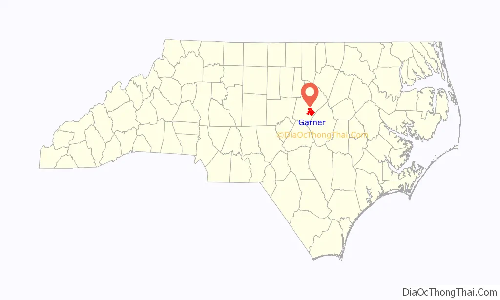
Garner location map. Where is Garner town?
History
Land near the town of Garner was first settled around 1751. In the 1850s, the North Carolina Railroad was built, and before the 1870s, a wood-and-water stop was established in present-day downtown Garner. The community of Garner’s Station received a post office in 1878 and was incorporated in 1883, but the community had its charter repealed in 1891.
In 1905, the charter was reinstated as the Town of Garner. The first mayor was J.B. Richardson, and the first aldermen were H.D. Rand, J.J. Bagwell, H. Bryan, M.C. Penny, and J.S. Buffaloe.
In 1912, the telephone came to Garner. The town is off of US 70, which in 1917 became the first paved highway to be built in North Carolina. An explosion and partial roof collapse of a ConAgra Foods plant on June 9, 2009, killed four and injured some 40 workers.
The Downtown Garner Historic District, Edenwood, and Meadowbrook Country Club are listed on the National Register of Historic Places.
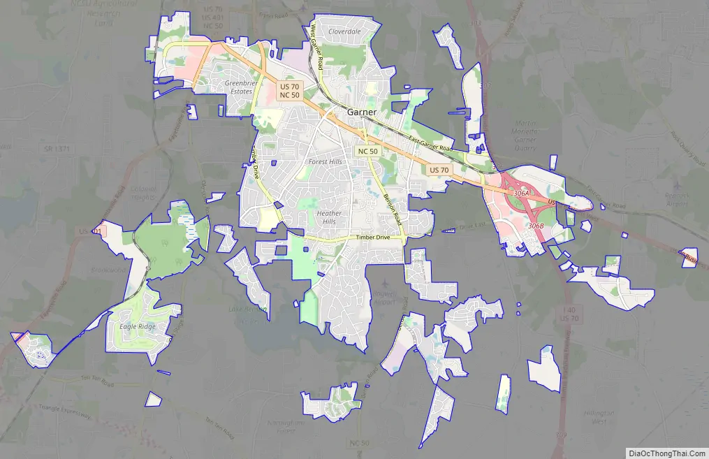
Garner Road Map
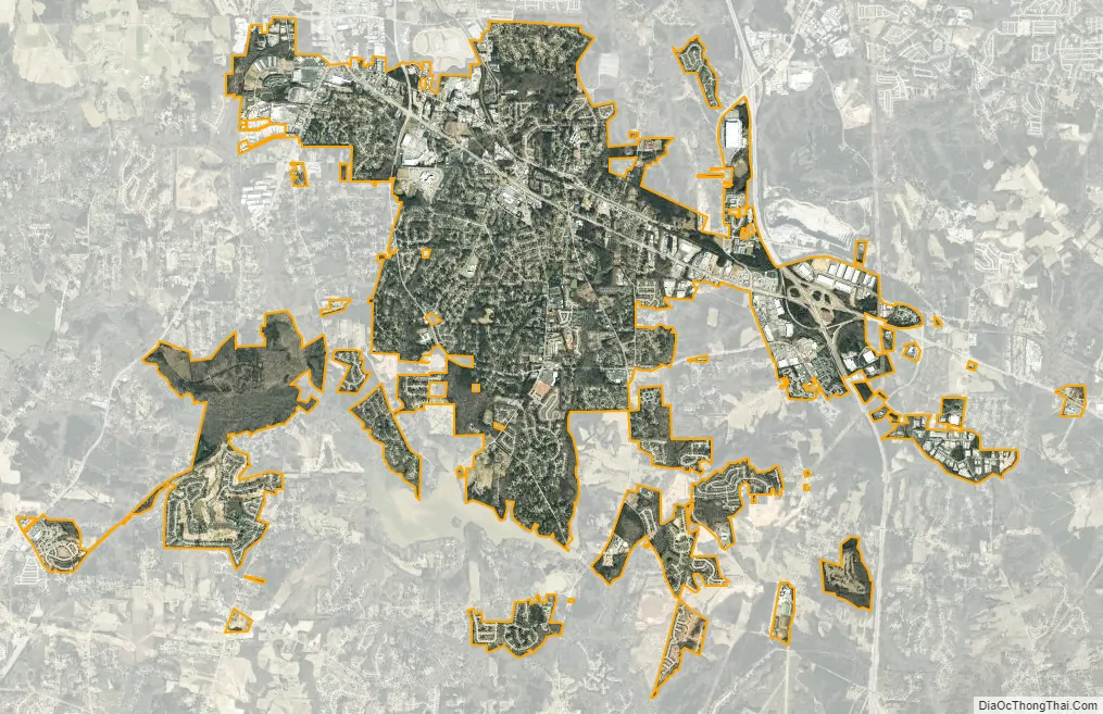
Garner city Satellite Map
Geography
Garner is located at 35°41′54″N 78°37′22″W / 35.69833°N 78.62278°W / 35.69833; -78.62278 (35.698243, -78.622865).
According to the United States Census Bureau, the town has a total area of 14.8 square miles (38.3 km), of which 14.7 square miles (38.2 km) is land and 0.04 square miles (0.1 km), or 0.34%, is water.
Garner is located entirely within Wake County. There are unincorporated areas of Wake County and Johnston County that have Garner postal addresses, including a portion of the unincorporated, but densely populated, Cleveland Community.
See also
Map of North Carolina State and its subdivision:- Alamance
- Alexander
- Alleghany
- Anson
- Ashe
- Avery
- Beaufort
- Bertie
- Bladen
- Brunswick
- Buncombe
- Burke
- Cabarrus
- Caldwell
- Camden
- Carteret
- Caswell
- Catawba
- Chatham
- Cherokee
- Chowan
- Clay
- Cleveland
- Columbus
- Craven
- Cumberland
- Currituck
- Dare
- Davidson
- Davie
- Duplin
- Durham
- Edgecombe
- Forsyth
- Franklin
- Gaston
- Gates
- Graham
- Granville
- Greene
- Guilford
- Halifax
- Harnett
- Haywood
- Henderson
- Hertford
- Hoke
- Hyde
- Iredell
- Jackson
- Johnston
- Jones
- Lee
- Lenoir
- Lincoln
- Macon
- Madison
- Martin
- McDowell
- Mecklenburg
- Mitchell
- Montgomery
- Moore
- Nash
- New Hanover
- Northampton
- Onslow
- Orange
- Pamlico
- Pasquotank
- Pender
- Perquimans
- Person
- Pitt
- Polk
- Randolph
- Richmond
- Robeson
- Rockingham
- Rowan
- Rutherford
- Sampson
- Scotland
- Stanly
- Stokes
- Surry
- Swain
- Transylvania
- Tyrrell
- Union
- Vance
- Wake
- Warren
- Washington
- Watauga
- Wayne
- Wilkes
- Wilson
- Yadkin
- Yancey
- Alabama
- Alaska
- Arizona
- Arkansas
- California
- Colorado
- Connecticut
- Delaware
- District of Columbia
- Florida
- Georgia
- Hawaii
- Idaho
- Illinois
- Indiana
- Iowa
- Kansas
- Kentucky
- Louisiana
- Maine
- Maryland
- Massachusetts
- Michigan
- Minnesota
- Mississippi
- Missouri
- Montana
- Nebraska
- Nevada
- New Hampshire
- New Jersey
- New Mexico
- New York
- North Carolina
- North Dakota
- Ohio
- Oklahoma
- Oregon
- Pennsylvania
- Rhode Island
- South Carolina
- South Dakota
- Tennessee
- Texas
- Utah
- Vermont
- Virginia
- Washington
- West Virginia
- Wisconsin
- Wyoming