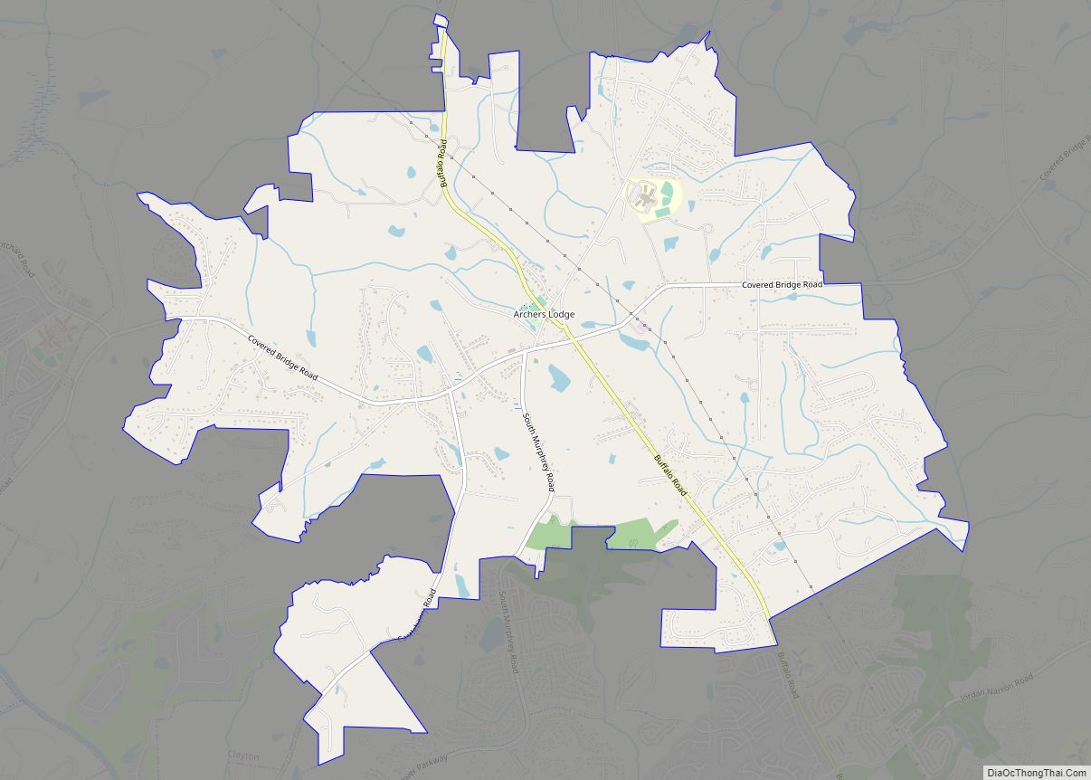
Map of Arapahoe town

Map of Arapahoe town, North Carolina

Arapahoe (/əˈræpəhoʊ/) is a town in Pamlico County, North Carolina, United States. As of the 2010 census, the town population was 556. Arapahoe shares many of its roles and duties with Minnesott Beach, North Carolina. It is part of the New Bern, North Carolina Micropolitan Statistical Area. Arapahoe town overview: Name: Arapahoe town LSAD Code: … Read more

Map of Aquadale CDP

Map of Aquadale CDP

Aquadale is an unincorporated community and census-designated place in Stanly County, North Carolina, United States. Its population was 397 as of the 2010 census. Aquadale CDP overview: Name: Aquadale CDP LSAD Code: 57 LSAD Description: CDP (suffix) State: North Carolina County: Stanly County Elevation: 459 ft (140 m) Total Area: 3.25 sq mi (8.43 km²) Land Area: 3.25 sq mi (8.43 km²) Water … Read more

Map of Apex town

Map of Apex town

Apex (/ˈeɪ.pɛks/) is a town in Wake County, North Carolina, United States. At its southern border, Apex encompasses the community of Friendship. In 1994, the downtown area was designated a historic district, and the Apex train depot, built in 1867, is designated a Wake County landmark. The depot location marks the highest point on the … Read more

Map of Ansonville town

Map of Ansonville town

Ansonville is a town in Anson County, North Carolina, United States. The population was 421 at the 2020 census. Ansonville town overview: Name: Ansonville town LSAD Code: 43 LSAD Description: town (suffix) State: North Carolina County: Anson County Founded: 1844 Incorporated: 1885 Elevation: 331 ft (101 m) Total Area: 1.47 sq mi (3.81 km²) Land Area: 1.47 sq mi (3.81 km²) Water Area: … Read more

Map of Avery Creek CDP

Map of Avery Creek CDP

Avery Creek is a census-designated place (CDP) in Buncombe County, North Carolina, United States. The population was 1,950 at the 2010 census. It is part of the Asheville Metropolitan Statistical Area. Avery Creek CDP overview: Name: Avery Creek CDP LSAD Code: 57 LSAD Description: CDP (suffix) State: North Carolina County: Buncombe County Elevation: 2,198 ft (670 m) … Read more

Map of Autryville town

Map of Autryville town

Autryville is a town in Sampson County, North Carolina, United States. The population was 167 at the 2020 census. Located along the west side of Sampson County along the banks of South River at the Cumberland County line, Autryville is governed by a mayor and a five-member town commission. The town is about 15 miles … Read more

Map of Aurora town, North Carolina

Map of Aurora town, North Carolina

Aurora is a town in Beaufort County, North Carolina, United States. The population was 520 at the 2010 Census. Aurora town overview: Name: Aurora town LSAD Code: 43 LSAD Description: town (suffix) State: North Carolina County: Beaufort County Elevation: 3 ft (1 m) Total Area: 1.03 sq mi (2.66 km²) Land Area: 0.93 sq mi (2.40 km²) Water Area: 0.10 sq mi (0.26 km²) Total Population: … Read more

Map of Aulander town

Map of Aulander town

Aulander is a town in Bertie County, North Carolina, United States. The population was 895 at the 2010 census. Aulander town overview: Name: Aulander town LSAD Code: 43 LSAD Description: town (suffix) State: North Carolina County: Bertie County Elevation: 66 ft (20 m) Total Area: 1.48 sq mi (3.83 km²) Land Area: 1.48 sq mi (3.83 km²) Water Area: 0.00 sq mi (0.00 km²) Total Population: … Read more

Map of Atlantic CDP, North Carolina

Map of Atlantic CDP, North Carolina

Atlantic is an unincorporated community and census-designated place in eastern Carteret County, North Carolina, United States. As of the 2010 census it had a population of 543. It is situated along Core Sound, located in what was known to early settlers of the area as Hunting Quarters. It is the location of US 70’s eastern … Read more

Map of Atlantic Beach town, North Carolina

Map of Atlantic Beach town, North Carolina

Atlantic Beach is a town in Carteret County, North Carolina, United States. It is one of the five communities located on Bogue Banks. The population was 1,495 at the 2010 census. Atlantic Beach town overview: Name: Atlantic Beach town LSAD Code: 43 LSAD Description: town (suffix) State: North Carolina County: Carteret County Elevation: 10 ft (3 m) … Read more

Map of Atkinson town, North Carolina

Map of Atkinson town, North Carolina

Atkinson is a town in Pender County, North Carolina, United States. At the 2010 census, the town population was 299. It is part of the Wilmington Metropolitan Statistical Area. Atkinson town overview: Name: Atkinson town LSAD Code: 43 LSAD Description: town (suffix) State: North Carolina County: Pender County Elevation: 59 ft (18 m) Total Area: 0.99 sq mi (2.56 km²) … Read more

Map of Askewville town

Map of Askewville town

Askewville is a town in Bertie County, North Carolina, United States. The population was 241 at the 2010 census. Askewville town overview: Name: Askewville town LSAD Code: 43 LSAD Description: town (suffix) State: North Carolina County: Bertie County Elevation: 62 ft (19 m) Total Area: 0.59 sq mi (1.53 km²) Land Area: 0.59 sq mi (1.53 km²) Water Area: 0.00 sq mi (0.00 km²) Total Population: … Read more