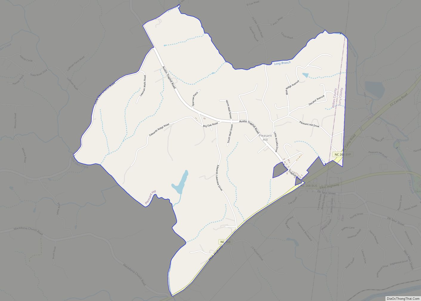
Map of Pittsboro town, North Carolina

Map of Pittsboro town, North Carolina

Pittsboro is a town in Chatham County, North Carolina, United States. The population was 3,743 at the 2010 census and 4,537 at the 2020 census. It is the county seat of Chatham County. The town was established in the late 18th century, shortly after the American Revolution, as the county seat for the newly formed … Read more

Map of Pinnacle CDP

Map of Pinnacle CDP

Pinnacle is an unincorporated community and census-designated place in southwestern Stokes County, North Carolina, United States, approximately 5 miles (8.0 km) SSE of the town of Pilot Mountain, between Pilot Mountain State Park and Hanging Rock State Park. As of March 2015, the exact population is 855. Pinnacle CDP overview: Name: Pinnacle CDP LSAD Code: 57 … Read more

Map of Ramseur town

Map of Ramseur town

Ramseur is a town in Randolph County, North Carolina, United States. The population was 1,692 at the 2010 census. Ramseur town overview: Name: Ramseur town LSAD Code: 43 LSAD Description: town (suffix) State: North Carolina County: Randolph County Elevation: 486 ft (148 m) Total Area: 2.25 sq mi (5.81 km²) Land Area: 2.00 sq mi (5.18 km²) Water Area: 0.25 sq mi (0.64 km²) Total Population: … Read more

Map of Raemon CDP

Map of Raemon CDP

Raemon is a census-designated place (CDP) in Robeson County, North Carolina, United States. The population was 212 at the 2000 census. Raemon CDP overview: Name: Raemon CDP LSAD Code: 57 LSAD Description: CDP (suffix) State: North Carolina County: Robeson County Elevation: 164 ft (50 m) Total Area: 4.34 sq mi (11.24 km²) Land Area: 4.31 sq mi (11.17 km²) Water Area: 0.03 sq mi (0.07 km²) … Read more

Map of Raeford city

Map of Raeford city

Raeford is a city in Hoke County, North Carolina, United States. Its population was 4,611 at the 2010 census, and in 2018, the estimated population was 4,962. It is the county seat of Hoke County. Raeford city overview: Name: Raeford city LSAD Code: 25 LSAD Description: city (suffix) State: North Carolina County: Hoke County Elevation: … Read more

Map of Pumpkin Center CDP

Map of Pumpkin Center CDP

Pumpkin Center is a census-designated place (CDP) in Onslow County, North Carolina, United States. The population was 2,228 at the 2000 census. It is part of the Jacksonville, North Carolina Metropolitan Statistical Area. Pumpkin Center CDP overview: Name: Pumpkin Center CDP LSAD Code: 57 LSAD Description: CDP (suffix) State: North Carolina County: Onslow County Elevation: … Read more

Map of Prospect CDP, North Carolina

Map of Prospect CDP, North Carolina

Prospect is a census-designated place (CDP) in Robeson County, North Carolina, United States. The population was 690 at the 2000 census. Located due northeast of Pembroke, Prospect is a traditionally Methodist community, with its church members largely becoming representatives for the entirety of the American Indian-Methodist community. Prospect is noted for one of its native … Read more

Map of Proctorville town

Map of Proctorville town, North Carolina

Proctorville is a town in Robeson County, North Carolina, United States. The population was 117 at the 2010 census. Proctorville town overview: Name: Proctorville town LSAD Code: 43 LSAD Description: town (suffix) State: North Carolina County: Robeson County Elevation: 112 ft (34 m) Total Area: 0.45 sq mi (1.18 km²) Land Area: 0.45 sq mi (1.18 km²) Water Area: 0.00 sq mi (0.00 km²) Total Population: … Read more

Map of Princeville town, North Carolina

Map of Princeville town, North Carolina

Princeville is a town in Edgecombe County, North Carolina, United States established by freed slaves after the Civil War. It was established in 1865 and known as Freedom Hill. It was incorporated in 1885 as Princeville, the first independently governed African American community chartered in the United States. Princeville is part of the Rocky Mount, … Read more

Map of Princeton town, North Carolina

Map of Princeton town, North Carolina

Princeton is a town in Johnston County, North Carolina, United States. As of the 2010 census it had a population of 1,194. Each May the town celebrates Princeton Community Day, a festival dedicated to promoting community involvement and town pride. The town holds municipal elections in November in odd-number years to elect its mayor and … Read more

Map of Powellsville town

Map of Powellsville town

Powellsville is a town in Bertie County, North Carolina, United States. The population was 276 at the 2010 census. The city is home to Travis Bond (NFL lineman) Powellsville town overview: Name: Powellsville town LSAD Code: 43 LSAD Description: town (suffix) State: North Carolina County: Bertie County Elevation: 66 ft (20 m) Total Area: 0.36 sq mi (0.92 km²) Land … Read more

Map of Potters Hill CDP

Map of Potters Hill CDP

Potters Hill is an unincorporated community and census-designated place (CDP) in Duplin County, North Carolina, United States. As of the 2010 United States Census, Potters Hill had a population of 481 and a land area of 5.35 square miles (13.9 km). Potters Hill is located in eastern Duplin County along North Carolina Highway 41, which leads … Read more