Raeford is a city in Hoke County, North Carolina, United States. Its population was 4,611 at the 2010 census, and in 2018, the estimated population was 4,962. It is the county seat of Hoke County.
| Name: | Raeford city |
|---|---|
| LSAD Code: | 25 |
| LSAD Description: | city (suffix) |
| State: | North Carolina |
| County: | Hoke County |
| Elevation: | 259 ft (79 m) |
| Total Area: | 4.31 sq mi (11.15 km²) |
| Land Area: | 4.28 sq mi (11.10 km²) |
| Water Area: | 0.02 sq mi (0.06 km²) |
| Total Population: | 4,559 |
| Population Density: | 1,064.19/sq mi (410.87/km²) |
| ZIP code: | 28361, 28376 |
| FIPS code: | 3754580 |
| GNISfeature ID: | 1022137 |
| Website: | www.raefordcity.org |
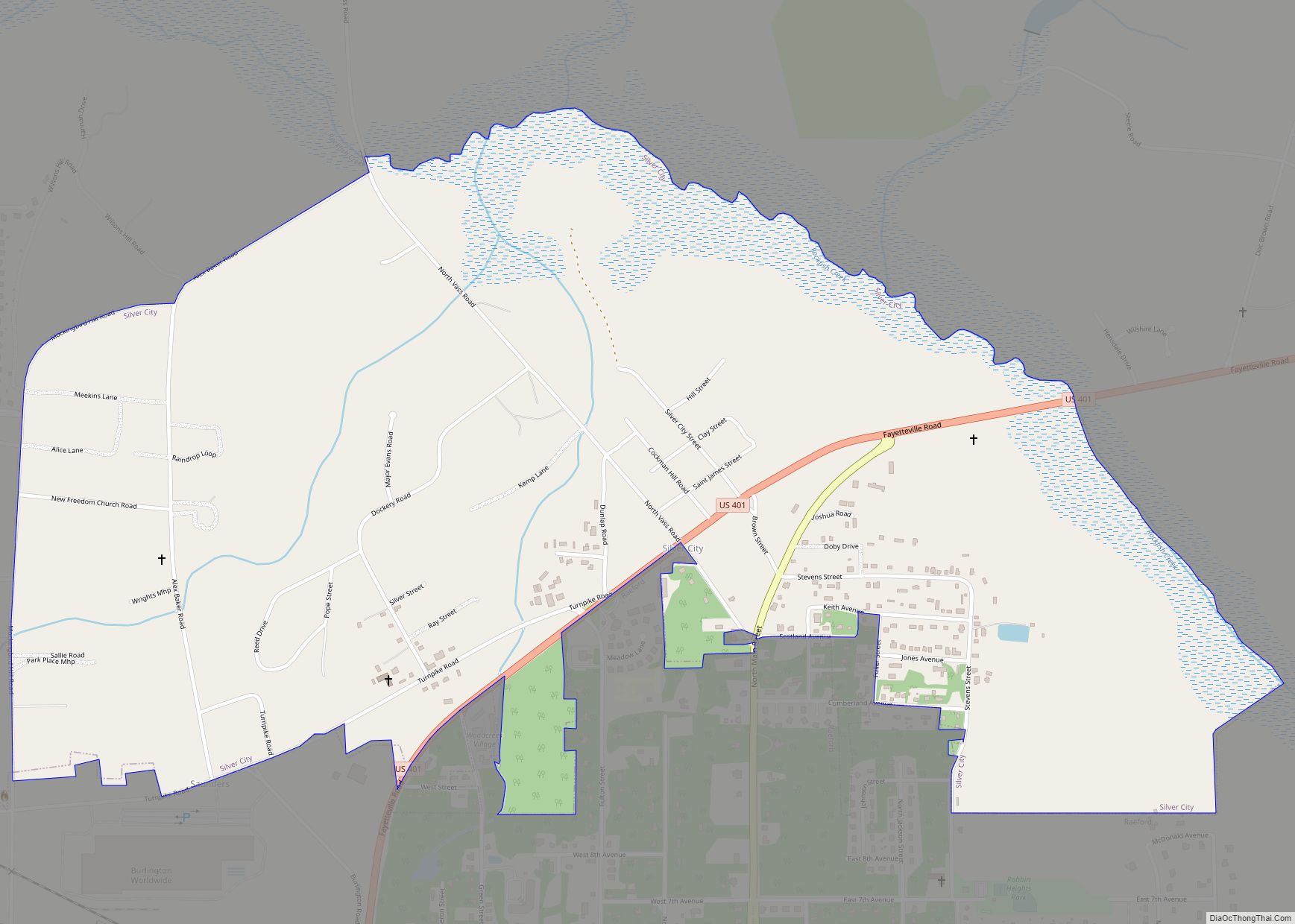
Online Interactive Map
Click on ![]() to view map in "full screen" mode.
to view map in "full screen" mode.
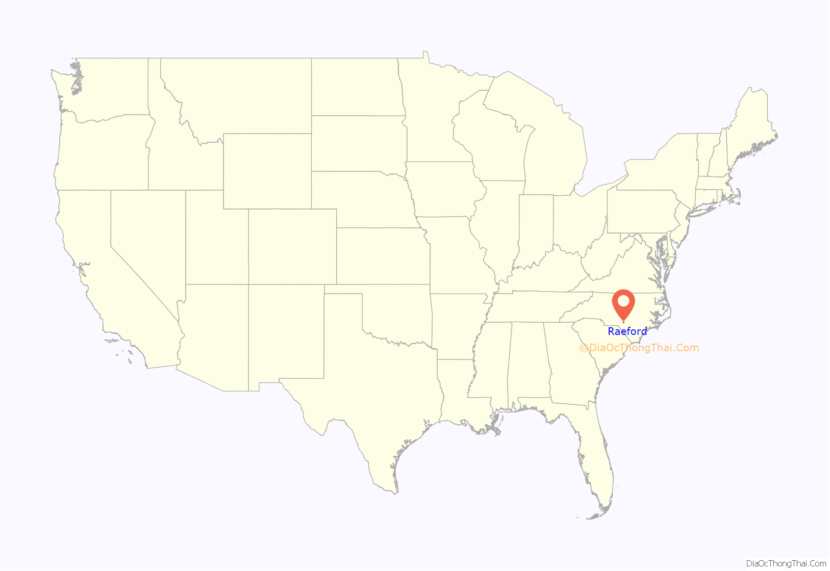
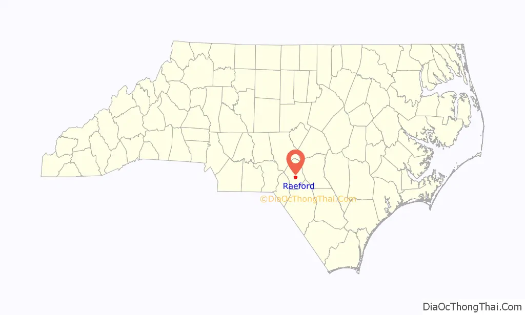
Raeford location map. Where is Raeford city?
History
John McRae and A.A. Williford operated a turpentine distillery and general store, respectively. Each took a syllable from his name and came up with the name Raeford for the post office they established. The McRae family, who lived at the “ford of the creek”, was at one time made up primarily of old Highland Scot families. Likewise, the Upper Cape Fear Valley of North Carolina was, in the 18th and 19th centuries, the largest settlement of Gaelic-speaking Highland Scots in North America. Today, many of these old families continue to live in the area, though their presence is noticeably diminished by the great numbers of newcomers to the area as a result of Fort Bragg. Since World War II, many Lumbee Indian families have moved northward from Robeson County and now constitute a significant element of the population that is otherwise European and African American.
The Hoke County Courthouse and Raeford Historic District are listed on the National Register of Historic Places.
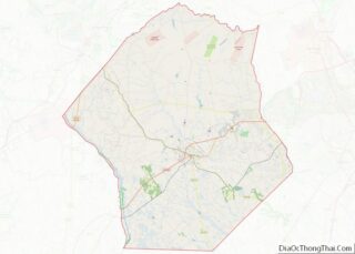
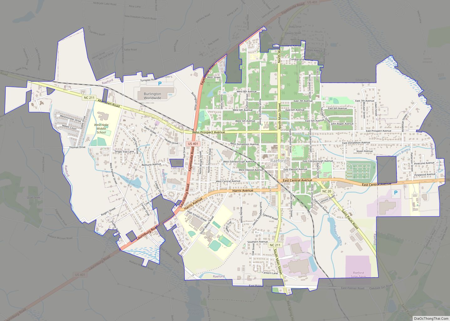
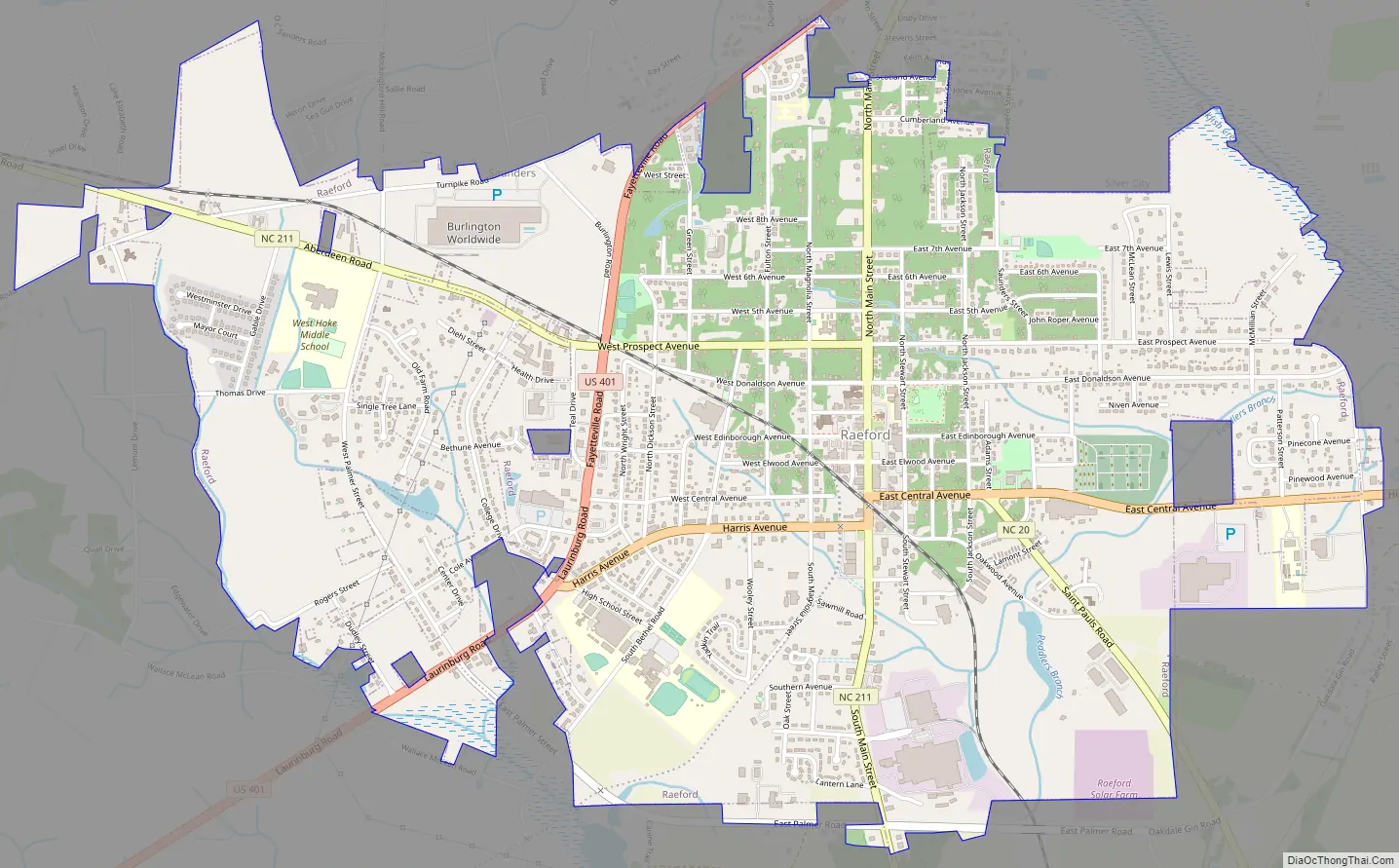
Raeford Road Map
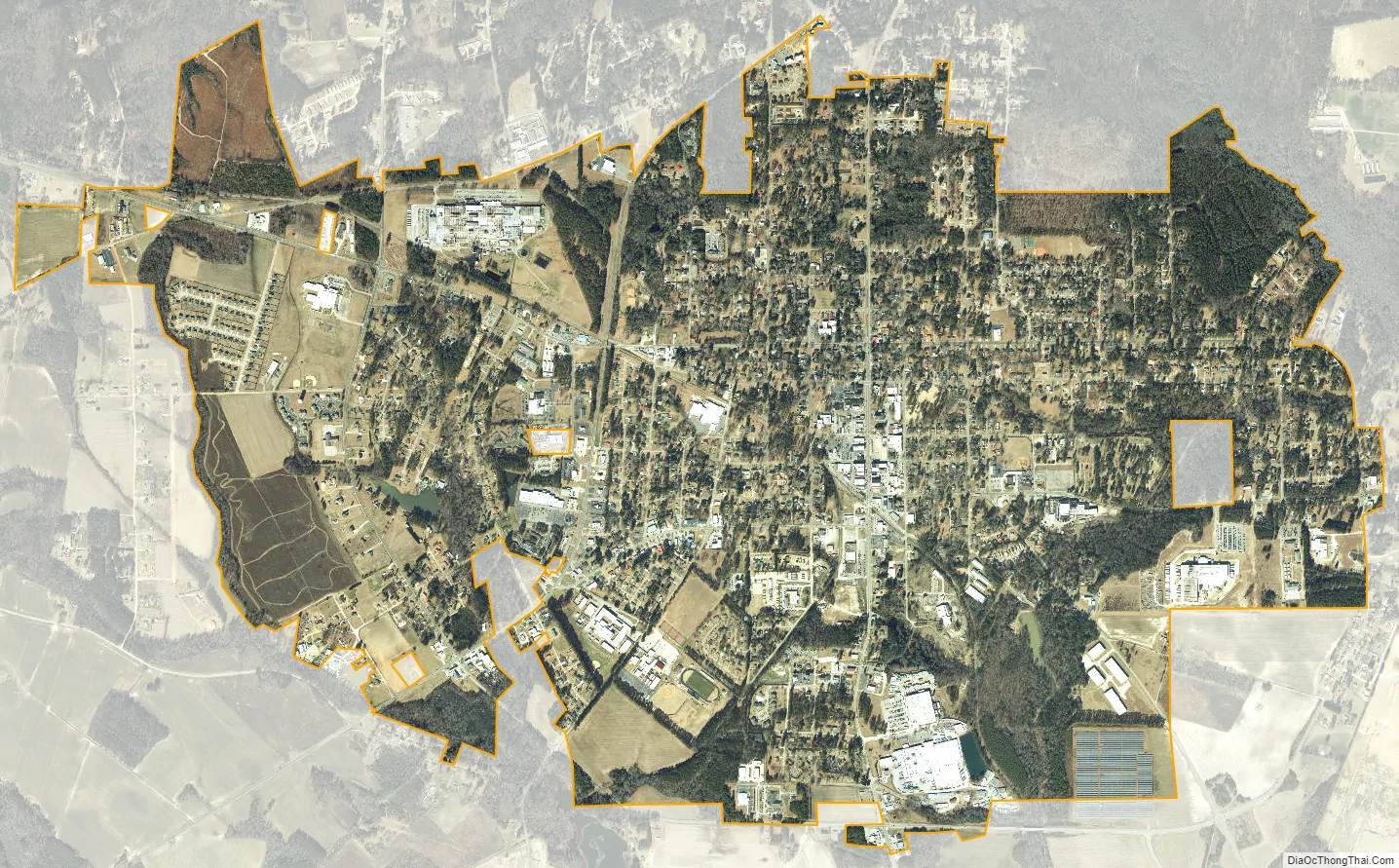
Raeford city Satellite Map
Geography
Raeford is located in central Hoke County at 34°58′54″N 79°13′39″W / 34.98167°N 79.22750°W / 34.98167; -79.22750 (34.981800, -79.227469). It is bordered to the northeast by Rockfish Creek, an east-flowing tributary of the Cape Fear River. The southern part of the city drains to Toneys Creek, a south-flowing component of the Lumber River–Pee Dee River–Waccamaw River watershed.
U.S. Route 401 runs through the north and west sides of Raeford, leading east 22 miles (35 km) to Fayetteville and southwest 20 miles (32 km) to Laurinburg. U.S. 401 Business passes through the center of town as Harris Avenue and East Central Avenue. North Carolina Highway 20 leaves the center of Raeford as St. Pauls Drive, leading southeast 19 miles (31 km) to St. Pauls. North Carolina Highway 211 runs through the center of Raeford, entering from the south on Main Street and leaving to the west on Prospect Avenue; NC-211 leads south 30 miles (48 km) to Lumberton and northwest 17 miles (27 km) to Aberdeen.
According to the United States Census Bureau, the city has a total area of 4.3 square miles (11.1 km), of which 0.02 square miles (0.06 km), or 0.53%, is covered by water.
See also
Map of North Carolina State and its subdivision:- Alamance
- Alexander
- Alleghany
- Anson
- Ashe
- Avery
- Beaufort
- Bertie
- Bladen
- Brunswick
- Buncombe
- Burke
- Cabarrus
- Caldwell
- Camden
- Carteret
- Caswell
- Catawba
- Chatham
- Cherokee
- Chowan
- Clay
- Cleveland
- Columbus
- Craven
- Cumberland
- Currituck
- Dare
- Davidson
- Davie
- Duplin
- Durham
- Edgecombe
- Forsyth
- Franklin
- Gaston
- Gates
- Graham
- Granville
- Greene
- Guilford
- Halifax
- Harnett
- Haywood
- Henderson
- Hertford
- Hoke
- Hyde
- Iredell
- Jackson
- Johnston
- Jones
- Lee
- Lenoir
- Lincoln
- Macon
- Madison
- Martin
- McDowell
- Mecklenburg
- Mitchell
- Montgomery
- Moore
- Nash
- New Hanover
- Northampton
- Onslow
- Orange
- Pamlico
- Pasquotank
- Pender
- Perquimans
- Person
- Pitt
- Polk
- Randolph
- Richmond
- Robeson
- Rockingham
- Rowan
- Rutherford
- Sampson
- Scotland
- Stanly
- Stokes
- Surry
- Swain
- Transylvania
- Tyrrell
- Union
- Vance
- Wake
- Warren
- Washington
- Watauga
- Wayne
- Wilkes
- Wilson
- Yadkin
- Yancey
- Alabama
- Alaska
- Arizona
- Arkansas
- California
- Colorado
- Connecticut
- Delaware
- District of Columbia
- Florida
- Georgia
- Hawaii
- Idaho
- Illinois
- Indiana
- Iowa
- Kansas
- Kentucky
- Louisiana
- Maine
- Maryland
- Massachusetts
- Michigan
- Minnesota
- Mississippi
- Missouri
- Montana
- Nebraska
- Nevada
- New Hampshire
- New Jersey
- New Mexico
- New York
- North Carolina
- North Dakota
- Ohio
- Oklahoma
- Oregon
- Pennsylvania
- Rhode Island
- South Carolina
- South Dakota
- Tennessee
- Texas
- Utah
- Vermont
- Virginia
- Washington
- West Virginia
- Wisconsin
- Wyoming