Princeville is a town in Edgecombe County, North Carolina, United States established by freed slaves after the Civil War. It was established in 1865 and known as Freedom Hill. It was incorporated in 1885 as Princeville, the first independently governed African American community chartered in the United States.
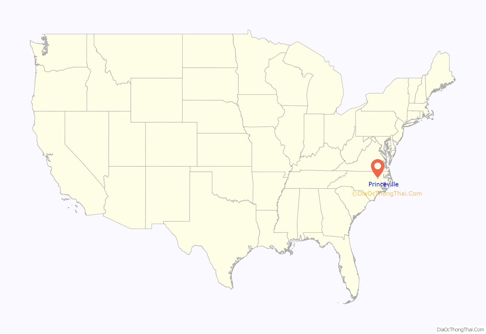
Princeville is part of the Rocky Mount, North Carolina Metropolitan Statistical Area. As of the 2020 census, the town population was 1,254 residents. The town is on the opposite bank of the Tar River from Tarboro. The city of Rocky Mount is 16 miles (26 km) to the west.
| Name: | Princeville town |
|---|---|
| LSAD Code: | 43 |
| LSAD Description: | town (suffix) |
| State: | North Carolina |
| County: | Edgecombe County |
| Founded: | 1865 |
| Incorporated: | 1885 |
| Elevation: | 26 ft (8 m) |
| Total Area: | 1.52 sq mi (3.94 km²) |
| Land Area: | 1.51 sq mi (3.91 km²) |
| Water Area: | 0.01 sq mi (0.03 km²) |
| Total Population: | 1,254 |
| Population Density: | 830.46/sq mi (320.65/km²) |
| ZIP code: | 27886 |
| Area code: | 252 |
| FIPS code: | 3753840 |
| GNISfeature ID: | 1022085 |
| Website: | townofprinceville.com |
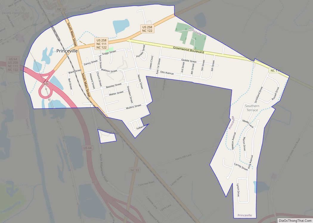
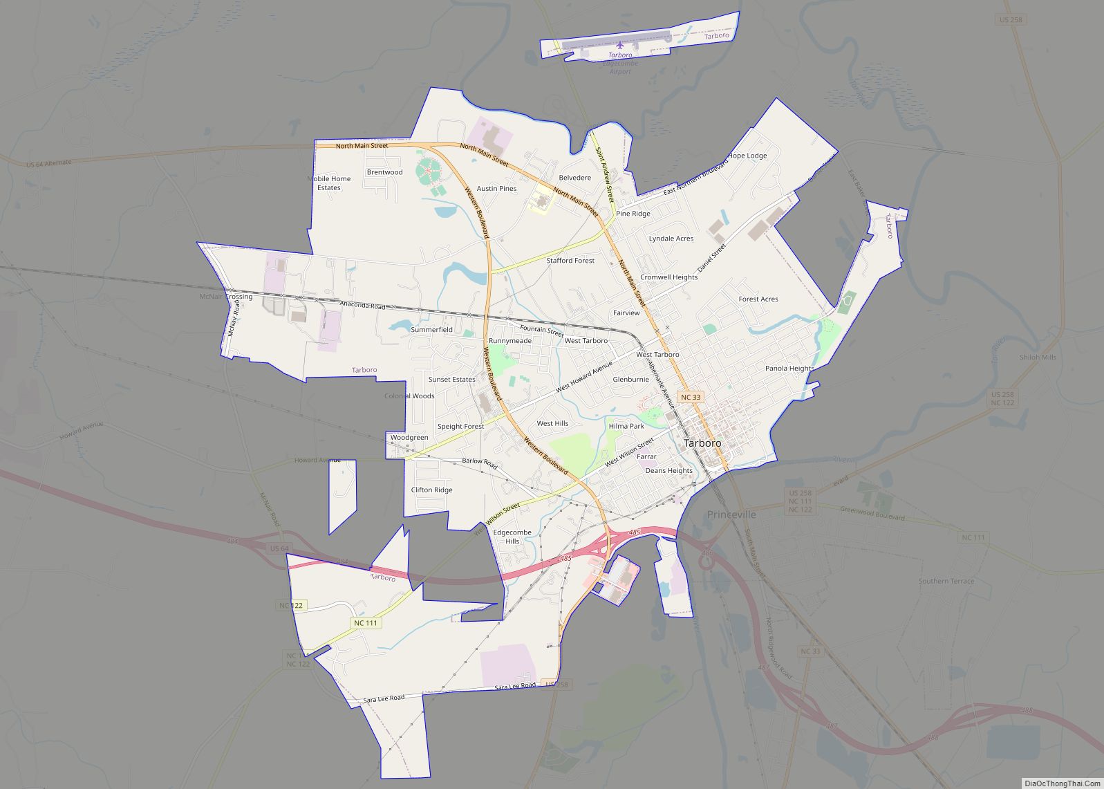
Online Interactive Map
Click on ![]() to view map in "full screen" mode.
to view map in "full screen" mode.
Princeville location map. Where is Princeville town?

History
As the American Civil War reached its conclusion, formerly enslaved African Americans sought refuge at a temporary Union encampment south of Tarboro, North Carolina along the Tar River. These inhabitants developed their own makeshift settlement at the site and chose the name Freedom Hill in recognition of a small raised area where a Union soldier first announced the Emancipation Proclamation. In 1873, community member Turner Prince joined his companions in purchasing portions of the land and used his carpentry skills to begin building permanent homes. This created a kind of racialized topography with the black community on a swampy floodplain and white citizens on safer land above. White land owners made no effort to protest the black residents’ presence, since they found the swampy terrain to be of little use, and preferred to have them kept away from white residents in Tarboro. Some of the landowners eventually sold their holdings to the black residents. Viewing state recognition as an important next step in establishing their identity as free citizens, the community successfully petitioned the North Carolina Legislature for incorporation in 1885. Despite requests to choose a name memorializing President Garfield, the new town instead called itself Princeville to honor its founder.
During Reconstruction, the town pursued educational opportunities and worked with Henry C. Cherry, one of the first black representatives serving in the North Carolina Legislature, to request a schoolteacher from the American Missionary Association. Robert S. Taylor soon arrived and began service as an educator and important community leader with a career including terms as a county justice of the peace and state senator. In 1880, the town’s population was primarily engaged in nonagricultural occupations with a skilled workforce including, carpenters, masons, blacksmiths, nurses, and six schoolteachers. The Princeville Graded School, the town’s public school, held its first classes in 1883 and began organizing graduation exercises by 1909.
Princeville faced challenges throughout the Jim Crow era. In the opening years of the 20th century, white business owners launched unsuccessful attempts to either dissolve or seize control of the town. By the end of World War I, more than half of the town’s inhabitants moved to northern cities as part of the Great Migration seeking economic opportunities and an escape from white supremacy. In 1967 the U.S. Army Corps of Engineers built a levee in the town to protect it from flooding. In February 1997 the North Carolina Local Government Commission assumed control over the town’s finances, the first time it had ever taken over the finances of a municipality.
The town also suffered continuing difficulties due to its low elevation and adjacency to the Tar River. Princeville experienced severe flooding in September 1999 when Cape Verde-type Hurricane Floyd pulled coffins from the cemetery and raised water levels to just below the height of rooftops and church steeples. The U.S. Federal Emergency Management Agency offered to buy out all residences in the town, but municipal officials rejected the offer. In October 2016, Category 5 Atlantic Hurricane Matthew struck the town with similarly devastating results leaving residents with a decision between rebuilding and moving elsewhere. As the town’s population declined in wake of the natural disasters, its tax base shrunk and the county government assumed various responsibilities from the municipality, including authority over tax collection, policing, and water and sewer services. In 2020, the Army Corps of Engineers announced $39.6 million in funding for a levee project to protect Princeville from future storms.
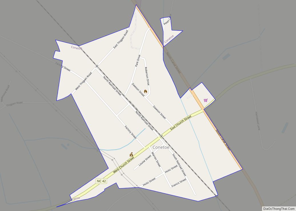
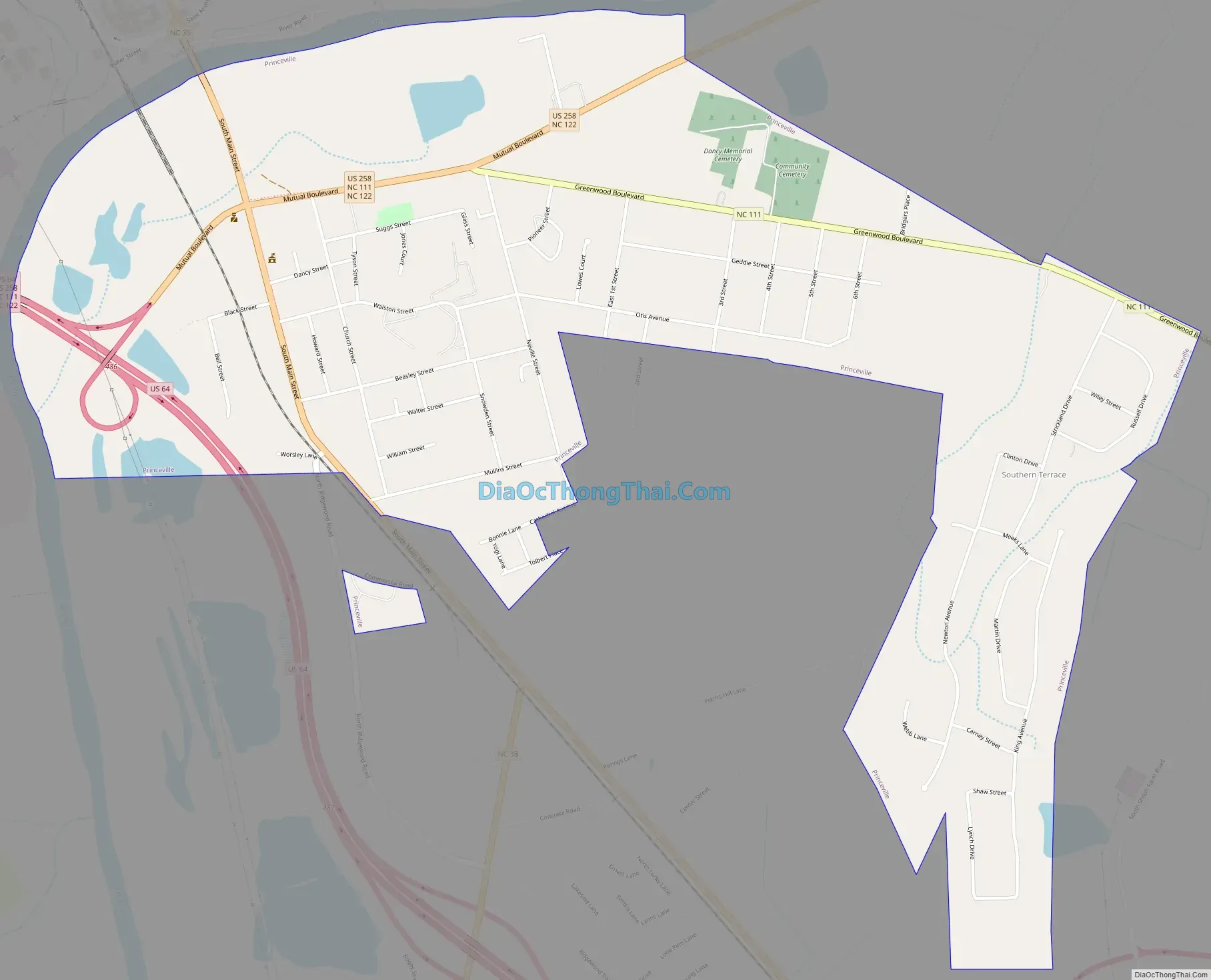
Princeville Road Map
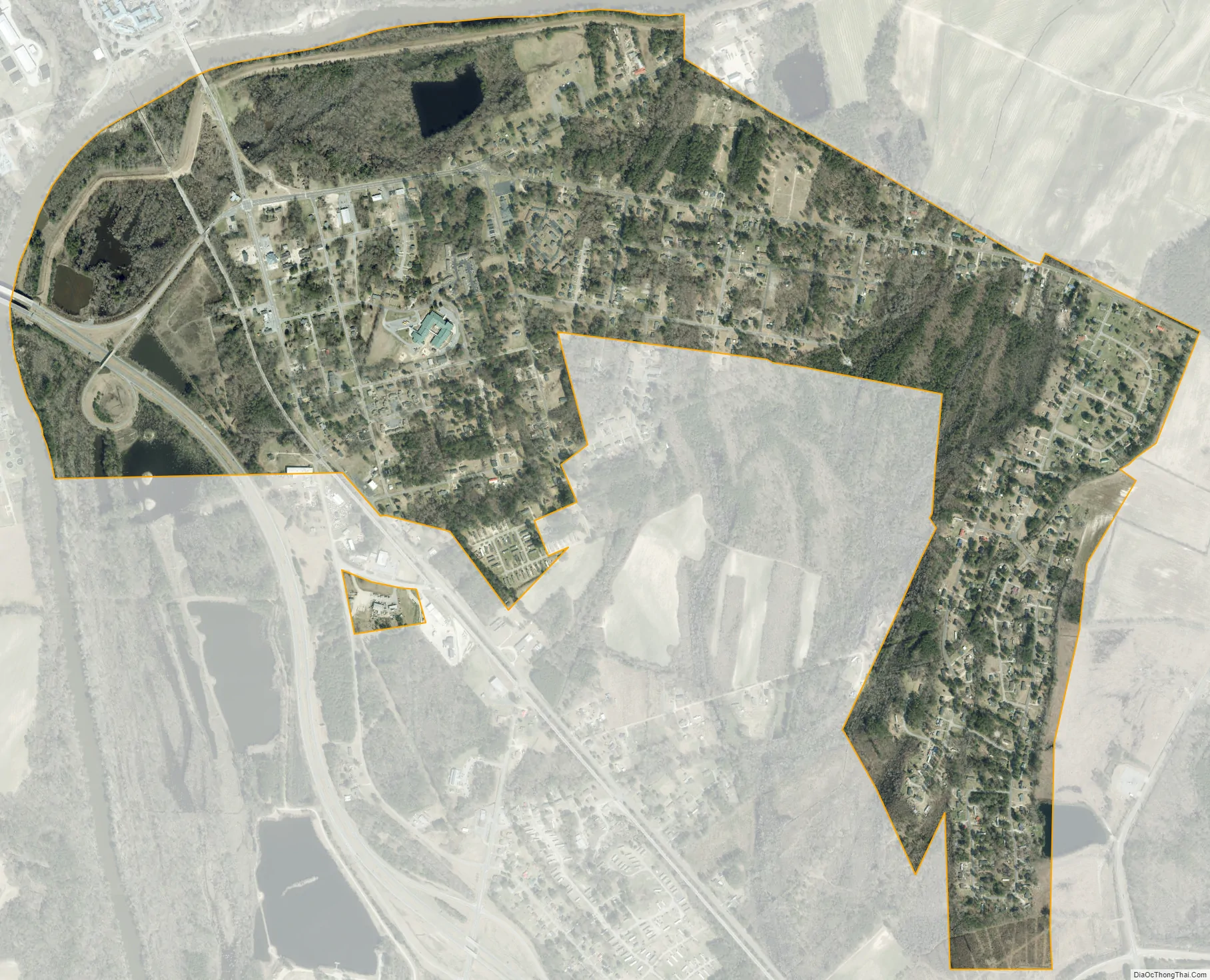
Princeville city Satellite Map
Geography
Princeville is located at 35°53′13″N 77°31′14″W / 35.88694°N 77.52056°W / 35.88694; -77.52056 (35.886974, -77.520584). According to the United States Census Bureau, the town has a total area of 1.53 square miles (3.95 km), of which 1.51 square miles (3.92 km) is land and 0.01 square miles (0.03 km), or 0.69%, is water.
See also
Map of North Carolina State and its subdivision:- Alamance
- Alexander
- Alleghany
- Anson
- Ashe
- Avery
- Beaufort
- Bertie
- Bladen
- Brunswick
- Buncombe
- Burke
- Cabarrus
- Caldwell
- Camden
- Carteret
- Caswell
- Catawba
- Chatham
- Cherokee
- Chowan
- Clay
- Cleveland
- Columbus
- Craven
- Cumberland
- Currituck
- Dare
- Davidson
- Davie
- Duplin
- Durham
- Edgecombe
- Forsyth
- Franklin
- Gaston
- Gates
- Graham
- Granville
- Greene
- Guilford
- Halifax
- Harnett
- Haywood
- Henderson
- Hertford
- Hoke
- Hyde
- Iredell
- Jackson
- Johnston
- Jones
- Lee
- Lenoir
- Lincoln
- Macon
- Madison
- Martin
- McDowell
- Mecklenburg
- Mitchell
- Montgomery
- Moore
- Nash
- New Hanover
- Northampton
- Onslow
- Orange
- Pamlico
- Pasquotank
- Pender
- Perquimans
- Person
- Pitt
- Polk
- Randolph
- Richmond
- Robeson
- Rockingham
- Rowan
- Rutherford
- Sampson
- Scotland
- Stanly
- Stokes
- Surry
- Swain
- Transylvania
- Tyrrell
- Union
- Vance
- Wake
- Warren
- Washington
- Watauga
- Wayne
- Wilkes
- Wilson
- Yadkin
- Yancey
- Alabama
- Alaska
- Arizona
- Arkansas
- California
- Colorado
- Connecticut
- Delaware
- District of Columbia
- Florida
- Georgia
- Hawaii
- Idaho
- Illinois
- Indiana
- Iowa
- Kansas
- Kentucky
- Louisiana
- Maine
- Maryland
- Massachusetts
- Michigan
- Minnesota
- Mississippi
- Missouri
- Montana
- Nebraska
- Nevada
- New Hampshire
- New Jersey
- New Mexico
- New York
- North Carolina
- North Dakota
- Ohio
- Oklahoma
- Oregon
- Pennsylvania
- Rhode Island
- South Carolina
- South Dakota
- Tennessee
- Texas
- Utah
- Vermont
- Virginia
- Washington
- West Virginia
- Wisconsin
- Wyoming