Map of Robbins town, North Carolina

Map of Robbins town, North Carolina

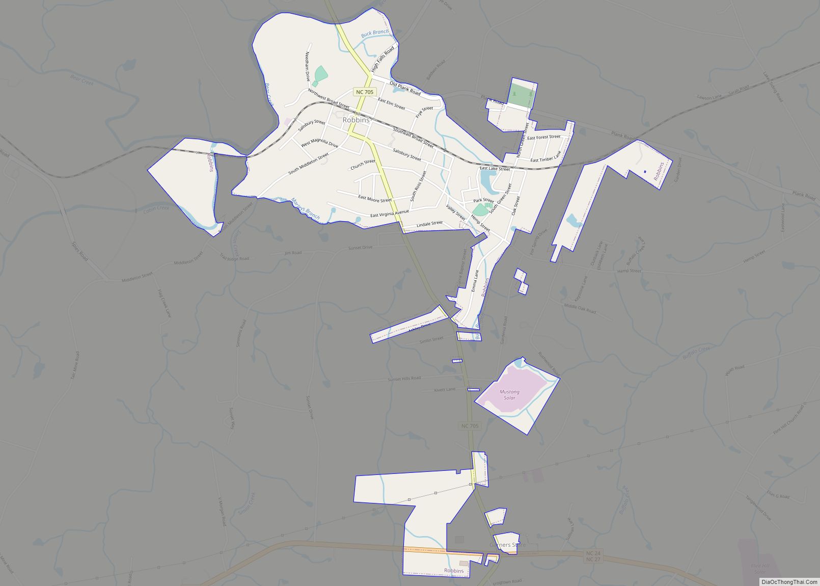
Robbins is a city in Moore County, North Carolina, United States. The population was 1,097 at the 2010 census. Robbins town overview: Name: Robbins town LSAD Code: 43 LSAD Description: town (suffix) State: North Carolina County: Moore County Incorporated: 1935 Elevation: 440 ft (134 m) Total Area: 1.59 sq mi (4.12 km²) Land Area: 1.59 sq mi (4.12 km²) Water Area: 0.00 sq mi (0.00 km²) … Read more

Map of Roanoke Rapids city

Map of Roanoke Rapids city

Roanoke Rapids (/ˈroʊəˌnoʊk/) is a city in Halifax County, North Carolina, United States. The population was 15,754 at the 2010 census. It is the principal city of the Roanoke Rapids Micropolitan Statistical Area, and is also an anchor city of the Rocky Mount-Wilson-Roanoke Rapids CSA, with a total population of 297,726 as of 2018. Roanoke … Read more

Map of River Road CDP

Map of River Road CDP, North Carolina

River Road is a census-designated place (CDP) in Beaufort County, North Carolina, United States. The population was 4,048 at the 2020 Census. River Road CDP overview: Name: River Road CDP LSAD Code: 57 LSAD Description: CDP (suffix) State: North Carolina County: Beaufort County Elevation: 13 ft (4 m) Total Area: 7.22 sq mi (18.70 km²) Land Area: 7.09 sq mi (18.36 km²) Water … Read more

Map of River Bend town, North Carolina

Map of River Bend town, North Carolina

River Bend is a town in Craven County, North Carolina, United States. The population was 3,119 as of the 2010 Census. It is part of the New Bern, North Carolina Metropolitan Statistical Area. River Bend town overview: Name: River Bend town LSAD Code: 43 LSAD Description: town (suffix) State: North Carolina County: Craven County Elevation: … Read more

Map of Riegelwood CDP

Map of Riegelwood CDP

Riegelwood is an unincorporated community and census-designated place (CDP) which sprawls across three counties: Brunswick County, North Carolina; Pender County, North Carolina; Columbus County, North Carolina, United States. As of the 2010 census it had a population of 579. It is the location of a saw mill and a paper mill. Riegelwood CDP overview: Name: … Read more

Map of Richlands town

Map of Richlands town, North Carolina

Richlands is a town in Onslow County, North Carolina, United States. The 2010 population was 1,520. It is included in the Jacksonville, North Carolina Metropolitan Statistical Area. Incorporated on March 29, 1880, it was the first town in Onslow County to have its own library and museum (home of the Onslow County Museum). Richlands was … Read more

Map of Richfield town, North Carolina

Map of Richfield town, North Carolina

Richfield is a town in Stanly County, North Carolina, United States. The town was originally called “Ritchie’s Field,” for the prominent Ritchie family who established the post office, sawmill, and streets of the settlement. Richfield town overview: Name: Richfield town LSAD Code: 43 LSAD Description: town (suffix) State: North Carolina County: Stanly County Elevation: 643 ft … Read more

Map of Rich Square town

Map of Rich Square town

Rich Square is a town in Northampton County, North Carolina, United States. The population was 958 at the 2010 census. It is part of the Roanoke Rapids, North Carolina Micropolitan Statistical Area. Rich Square town overview: Name: Rich Square town LSAD Code: 43 LSAD Description: town (suffix) State: North Carolina County: Northampton County Elevation: 72 ft … Read more

Map of Rocky Point CDP, North Carolina

Map of Rocky Point CDP, North Carolina

Rocky Point CDP overview: Name: Rocky Point CDP LSAD Code: 57 LSAD Description: CDP (suffix) State: North Carolina County: Pender County FIPS code: 3757540 Online Interactive Map Rocky Point online map. Source: Basemap layers from Google Map, Open Street Map (OSM), Arcgisonline, Wmflabs. Boundary Data from Database of Global Administrative Areas. Rocky Point location map. … Read more

Map of Rocky Mount city

Map of Rocky Mount city, North Carolina

Rocky Mount is a city in Edgecombe and Nash counties in the U.S. state of North Carolina. The city’s population was 54,341 as of the 2020 census, making it the 20th-most populous city in North Carolina at the time. The city is 45 mi (72 km) east of Raleigh, the state capital. It is the principal city … Read more

Map of Rockwell town, North Carolina

Map of Rockwell town, North Carolina

Rockwell is a town in Rowan County, North Carolina, United States. The population was 2,302 at the 2020 census. Rockwell town overview: Name: Rockwell town LSAD Code: 43 LSAD Description: town (suffix) State: North Carolina County: Rowan County Elevation: 791 ft (241 m) Total Area: 1.85 sq mi (4.79 km²) Land Area: 1.85 sq mi (4.79 km²) Water Area: 0.00 sq mi (0.00 km²) Total Population: … Read more

Map of Rockingham city, North Carolina

Map of Rockingham city, North Carolina

Rockingham is a city in Richmond County, North Carolina, United States, named after the Marquess of Rockingham. The population was 9,558 at the 2010 census. It is the county seat of Richmond County. The city is the home of Rockingham Speedway, formerly the North Carolina Speedway. It was a staple of the NASCAR schedule for … Read more