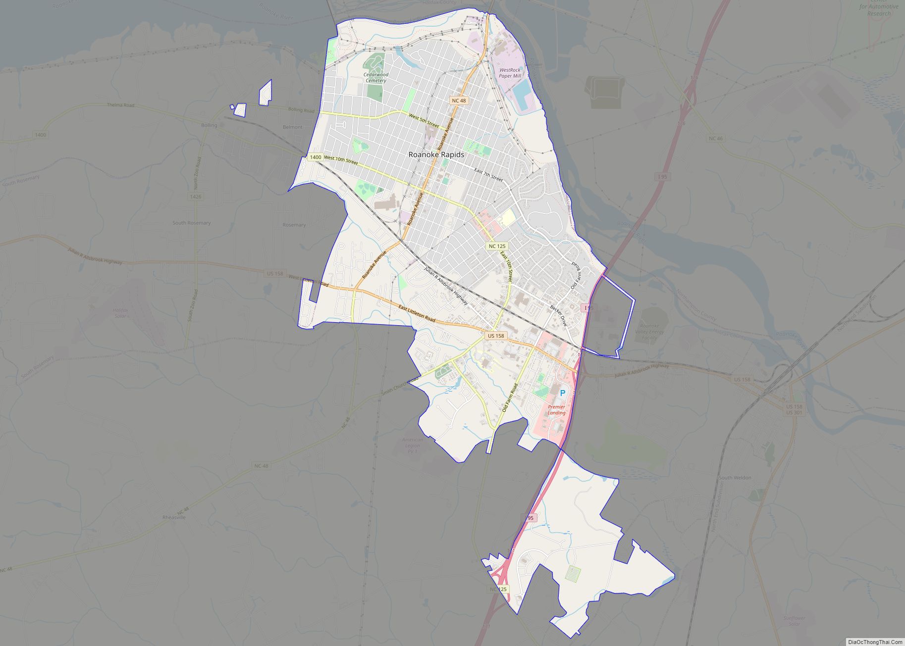
Roanoke Rapids (/ˈroʊəˌnoʊk/) is a city in Halifax County, North Carolina, United States. The population was 15,754 at the 2010 census. It is the principal city of the Roanoke Rapids Micropolitan Statistical Area, and is also an anchor city of the Rocky Mount-Wilson-Roanoke Rapids CSA, with a total population of 297,726 as of 2018.
| Name: | Roanoke Rapids city |
|---|---|
| LSAD Code: | 25 |
| LSAD Description: | city (suffix) |
| State: | North Carolina |
| County: | Halifax County |
| Elevation: | 157 ft (48 m) |
| Total Area: | 9.95 sq mi (25.77 km²) |
| Land Area: | 9.91 sq mi (25.67 km²) |
| Water Area: | 0.04 sq mi (0.09 km²) |
| Total Population: | 15,229 |
| Population Density: | 1,536.27/sq mi (593.16/km²) |
| ZIP code: | 27870 |
| Area code: | 252 |
| FIPS code: | 3756900 |
| GNISfeature ID: | 1022310 |
| Website: | www.roanokerapidsnc.com |
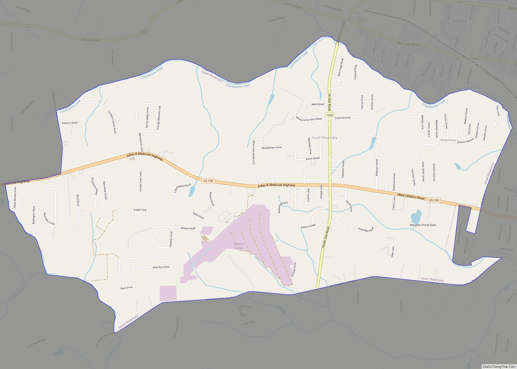
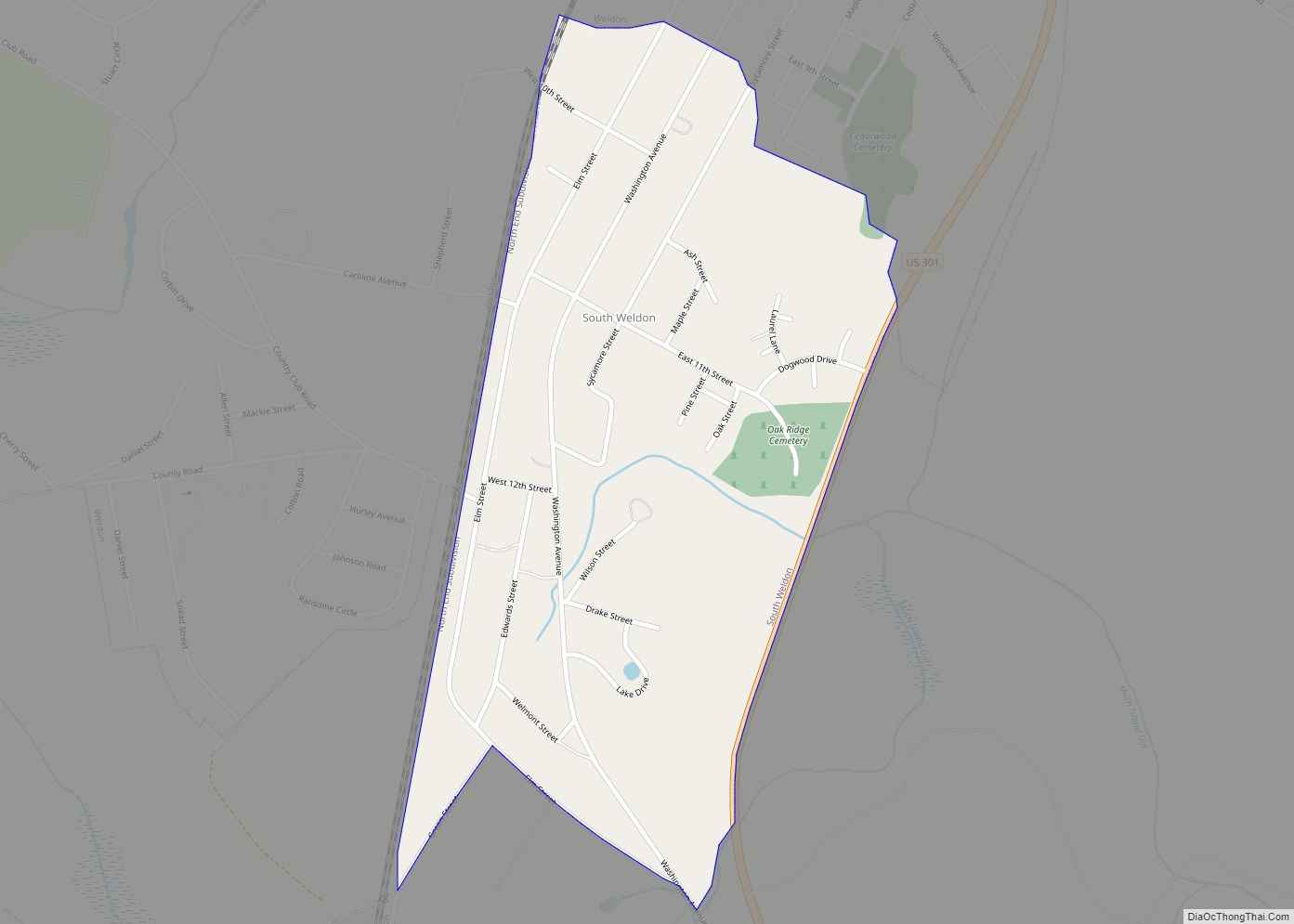
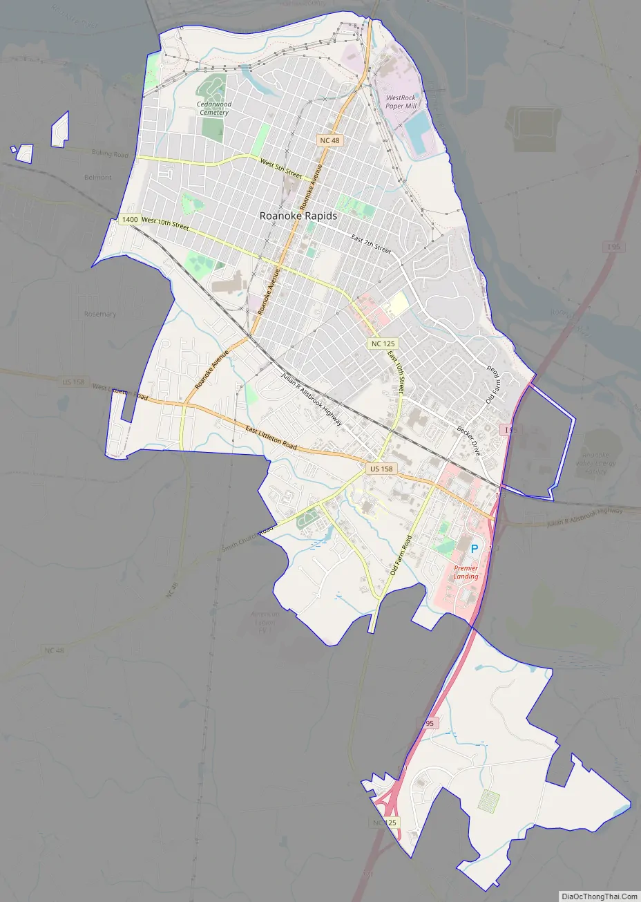
Online Interactive Map
Click on ![]() to view map in "full screen" mode.
to view map in "full screen" mode.
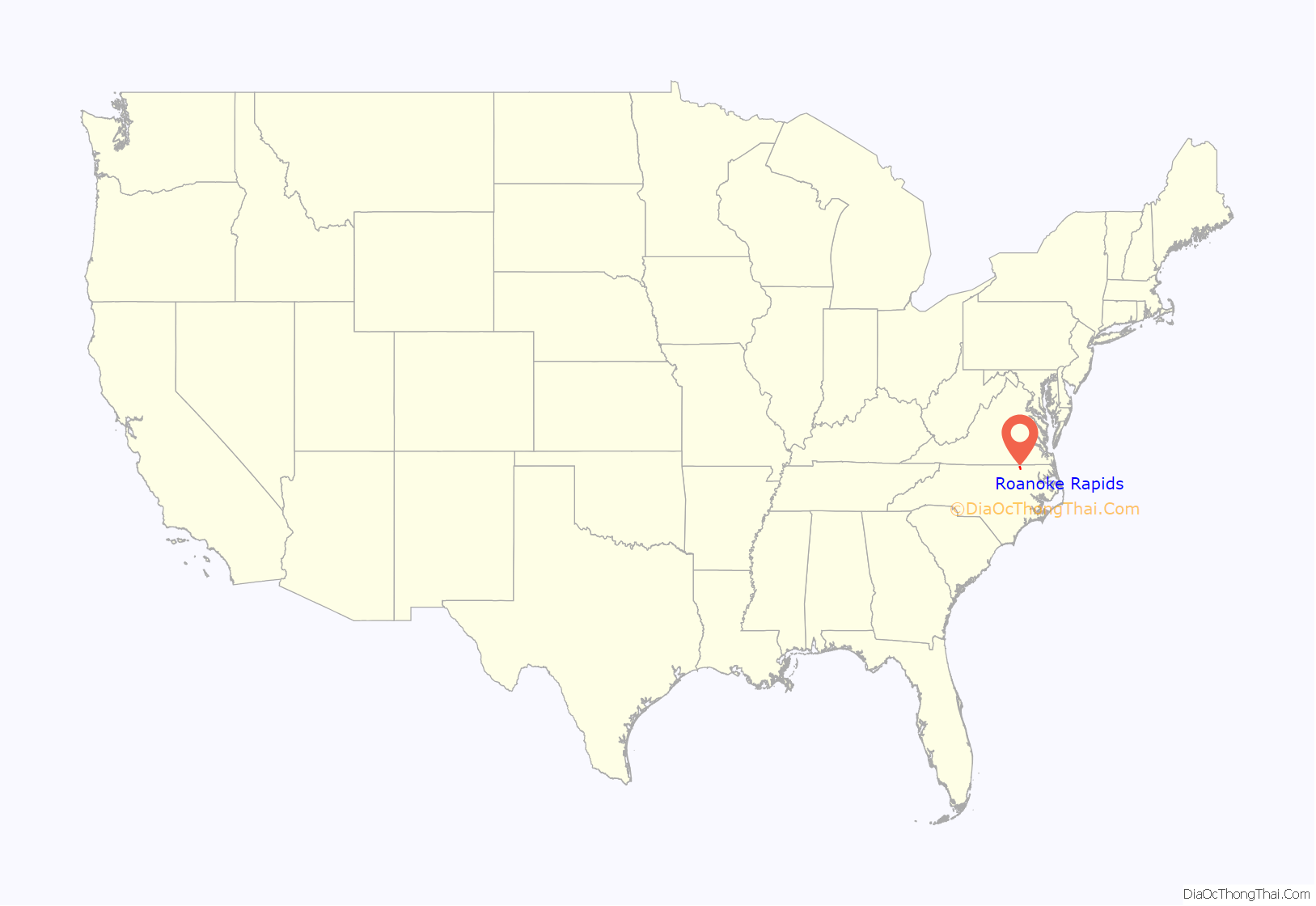
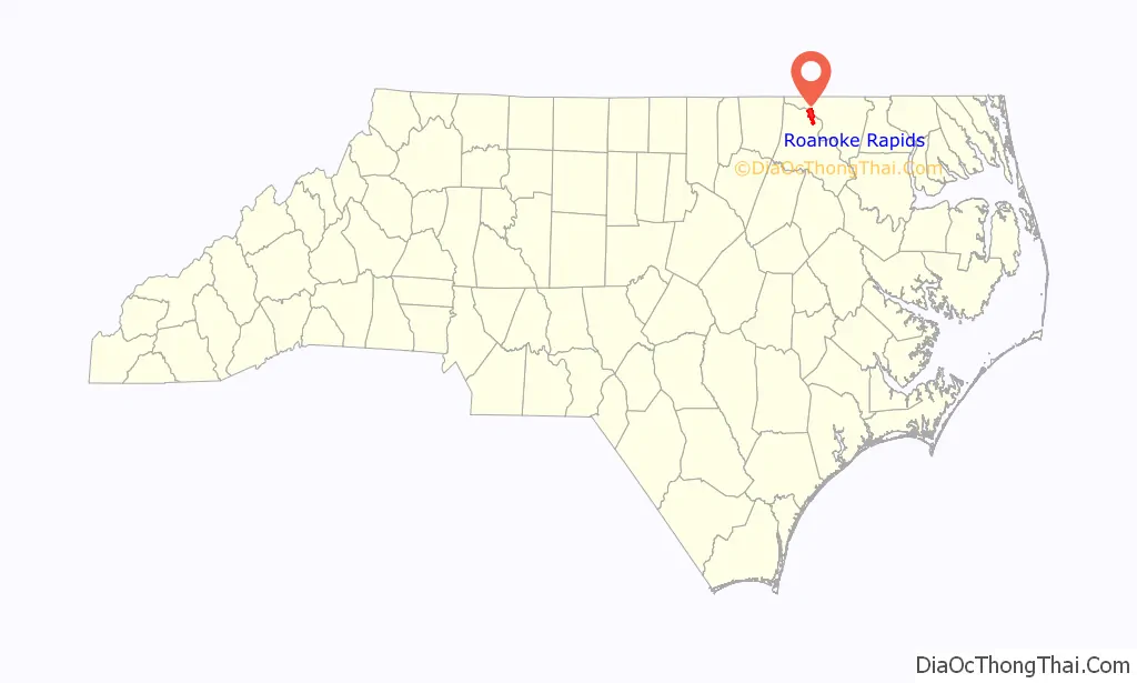
Roanoke Rapids location map. Where is Roanoke Rapids city?
Roanoke Rapids Road Map
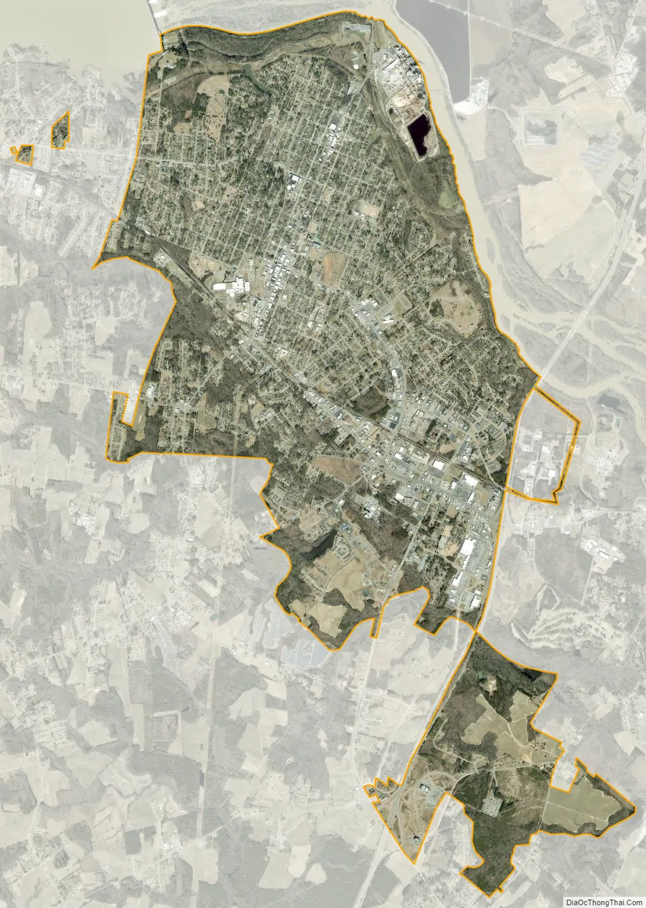
Roanoke Rapids city Satellite Map
Geography
Roanoke Rapids is located in northern Halifax County at 36°27′16″N 77°39′17″W / 36.45444°N 77.65472°W / 36.45444; -77.65472 (36.454528, -77.654822), bordered to the north by Northampton County, with the county line following the Roanoke River.
According to the United States Census Bureau, the city has a total area of 10.0 square miles (25.9 km), of which 10.0 square miles (25.8 km) are land and 0.04 square miles (0.1 km), or 0.36%, are water.
The town is located at the eastern edge of the North Carolina Piedmont, on the Roanoke River at the fall line, which marks the area where an upland region (continental bedrock) and a coastal plain (coastal alluvia) meet. The fall line is typically prominent where a river crosses it, for there will usually be rapids or waterfalls. Because of these features, riverboats normally could not travel any further inland. Because settlements needed a port and a ready supply of water power, they often developed where the river crosses the fall line. The Roanoke River and its falls inspired the development of Roanoke Rapids; businessmen such as Sam Patterson and other textile manufacturers used the river to power their mills.
The most prominent example of fall line settlement was the establishment of the cities along the eastern coast of the United States where the Appalachian Rise and the coastal plains meet.
The seven-mile-long (11 km) Roanoke Rapids Canal trail starts at the Roanoke dam and ends roughly a mile after passing the historic aqueduct. The trail is fairly narrow, which limits access to walkers, runners, and bikers.
See also
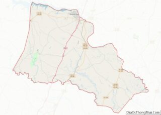
Map of North Carolina State and its subdivision:- Alamance
- Alexander
- Alleghany
- Anson
- Ashe
- Avery
- Beaufort
- Bertie
- Bladen
- Brunswick
- Buncombe
- Burke
- Cabarrus
- Caldwell
- Camden
- Carteret
- Caswell
- Catawba
- Chatham
- Cherokee
- Chowan
- Clay
- Cleveland
- Columbus
- Craven
- Cumberland
- Currituck
- Dare
- Davidson
- Davie
- Duplin
- Durham
- Edgecombe
- Forsyth
- Franklin
- Gaston
- Gates
- Graham
- Granville
- Greene
- Guilford
- Halifax
- Harnett
- Haywood
- Henderson
- Hertford
- Hoke
- Hyde
- Iredell
- Jackson
- Johnston
- Jones
- Lee
- Lenoir
- Lincoln
- Macon
- Madison
- Martin
- McDowell
- Mecklenburg
- Mitchell
- Montgomery
- Moore
- Nash
- New Hanover
- Northampton
- Onslow
- Orange
- Pamlico
- Pasquotank
- Pender
- Perquimans
- Person
- Pitt
- Polk
- Randolph
- Richmond
- Robeson
- Rockingham
- Rowan
- Rutherford
- Sampson
- Scotland
- Stanly
- Stokes
- Surry
- Swain
- Transylvania
- Tyrrell
- Union
- Vance
- Wake
- Warren
- Washington
- Watauga
- Wayne
- Wilkes
- Wilson
- Yadkin
- Yancey
- Alabama
- Alaska
- Arizona
- Arkansas
- California
- Colorado
- Connecticut
- Delaware
- District of Columbia
- Florida
- Georgia
- Hawaii
- Idaho
- Illinois
- Indiana
- Iowa
- Kansas
- Kentucky
- Louisiana
- Maine
- Maryland
- Massachusetts
- Michigan
- Minnesota
- Mississippi
- Missouri
- Montana
- Nebraska
- Nevada
- New Hampshire
- New Jersey
- New Mexico
- New York
- North Carolina
- North Dakota
- Ohio
- Oklahoma
- Oregon
- Pennsylvania
- Rhode Island
- South Carolina
- South Dakota
- Tennessee
- Texas
- Utah
- Vermont
- Virginia
- Washington
- West Virginia
- Wisconsin
- Wyoming