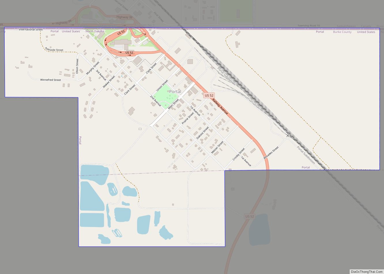
Map of Porcupine CDP, North Dakota
Porcupine is a census-designated place in Sioux County, North Dakota, United States. It lies only a few minutes’ drive from the city of Selfridge. The community includes the headquarters of the Selfridge/Porcupine district. An unincorporated community, it was designated as part of the U.S. Census Bureau’s Participant Statistical Areas Program on March 22, 2010. It ... Read more
Map of Porcupine CDP, North Dakota
Map of Plaza city
Plaza is a city in Mountrail County, North Dakota, United States. The population was 211 at the 2020 census. Plaza was founded in 1906. The business district is built around a central town square, city park or “plaza”. A key feature of the plaza is a recently completed large covered gazebo. Plaza city overview: Name: ... Read more
Map of Plaza city
Map of Pisek city
Pisek (/ˈpiːsɪk/ PEES-ik) is a city in Walsh County, North Dakota, United States. The population was 89 at the 2020 census. Pisek city overview: Name: Pisek city LSAD Code: 25 LSAD Description: city (suffix) State: North Dakota County: Walsh County Founded: 1882 Elevation: 988 ft (301 m) Total Area: 0.11 sq mi (0.30 km²) Land Area: 0.11 sq mi (0.30 km²) Water Area: ... Read more
Map of Pisek city
Map of Pingree city
Pingree is a city in Stutsman County, North Dakota, United States. The population was 41 at the 2020 census. Pingree was founded in 1882. Pingree city overview: Name: Pingree city LSAD Code: 25 LSAD Description: city (suffix) State: North Dakota County: Stutsman County Elevation: 1,558 ft (475 m) Total Area: 0.19 sq mi (0.50 km²) Land Area: 0.19 sq mi (0.50 km²) Water ... Read more
Map of Pingree city
Map of Pillsbury city
Pillsbury is a city in Barnes County, North Dakota, United States. The population was 12 at the 2020 census. Pillsbury was founded in 1911. Pillsbury city overview: Name: Pillsbury city LSAD Code: 25 LSAD Description: city (suffix) State: North Dakota County: Barnes County Founded: 1911 Elevation: 1,280 ft (390 m) Total Area: 0.26 sq mi (0.66 km²) Land Area: 0.26 sq mi ... Read more
Map of Pillsbury city
Map of Pick City
Pick City is a town in Mercer County, North Dakota, United States. The population was 123 at the 2020 census. Pick City was founded in 1946 and named after Lewis A. Pick, director of the Missouri River office of the United States Army Corps of Engineers. It overlooks the Garrison Dam. Pick City city overview: ... Read more
Map of Pick City
Map of Reile’s Acres city
Reile’s Acres is a city in Cass County, North Dakota, United States. The population was 703 at the 2020 census. It is a suburb of Fargo. Reile’s Acres was founded in 1977. Reile’s Acres city overview: Name: Reile’s Acres city LSAD Code: 25 LSAD Description: city (suffix) State: North Dakota County: Cass County Founded: 1977 ... Read more
Map of Reile’s Acres city
Map of Regent city
Regent is a city in Hettinger County, North Dakota, United States. The population was 170 at the 2020 census. Regent city overview: Name: Regent city LSAD Code: 25 LSAD Description: city (suffix) State: North Dakota County: Hettinger County Elevation: 2,461 ft (750 m) Total Area: 0.56 sq mi (1.45 km²) Land Area: 0.56 sq mi (1.45 km²) Water Area: 0.00 sq mi (0.00 km²) Total Population: ... Read more
Map of Regent city
Map of Regan city
Regan is a city in Burleigh County, North Dakota, United States. Its population was 35 at the 2020 census. Regan was founded in 1912. Regan city overview: Name: Regan city LSAD Code: 25 LSAD Description: city (suffix) State: North Dakota County: Burleigh County Elevation: 2,034 ft (620 m) Total Area: 1.01 sq mi (2.63 km²) Land Area: 1.01 sq mi (2.63 km²) Water ... Read more
Map of Regan city
Map of Reeder city
Reeder is a city in Adams County, North Dakota, United States. The population was 125 at the 2020 census. Reeder was founded in 1907 along the Chicago, Milwaukee, St. Paul and Pacific Railroad and named after E. O. Reeder, the railroad’s assistant chief engineer. Reeder is a stop along the old Yellowstone Trail, the first ... Read more
Map of Reeder city
Map of Ray city, North Dakota
Ray is a city in Williams County, North Dakota, United States. The population was 740 at the 2020 census. Ray city overview: Name: Ray city LSAD Code: 25 LSAD Description: city (suffix) State: North Dakota County: Williams County Founded: 1902 Elevation: 2,274 ft (693 m) Total Area: 1.36 sq mi (3.51 km²) Land Area: 1.32 sq mi (3.42 km²) Water Area: 0.04 sq mi (0.09 km²) ... Read more
Map of Ray city, North Dakota
Map of Raleigh CDP, North Dakota
Raleigh is a census-designated place (CDP) in Grant County, North Dakota, United States. An unincorporated community, it was designated as part of the U.S. Census Bureau’s Participant Statistical Areas Program on March 31, 2010. It was not counted separately during the 2000 Census, but was included in the 2010 Census, where a population of 12 ... Read more
Map of Raleigh CDP, North Dakota