Map of Cayuga city, North Dakota
Cayuga is a city in Sargent County, North Dakota, United States. It sits on the banks of the Wild Rice River. The population was 40 at the 2020 census. Cayuga was founded in 1887. Cayuga city overview: Name: Cayuga city LSAD Code: 25 LSAD Description: city (suffix) State: North Dakota County: Sargent County Founded: 1887 ... Read more
Map of Cayuga city, North Dakota
Map of Cavalier city
Cavalier is the largest city in Pembina County, North Dakota, United States. It is the county seat of Pembina County. The population was 1,246 at the 2020 census. Cavalier was founded in 1875 and became the county seat in 1911. Although they bear the same name, Cavalier is not located in nearby Cavalier County. The ... Read more
Map of Cavalier city
Map of Cathay city
Cathay is a city in Wells County, North Dakota, United States. The population was 20 at the 2020 census. Cathay was founded in 1893. Cathay city overview: Name: Cathay city LSAD Code: 25 LSAD Description: city (suffix) State: North Dakota County: Wells County Founded: 1893 Elevation: 1,581 ft (482 m) Total Area: 0.19 sq mi (0.49 km²) Land Area: 0.18 sq mi ... Read more
Map of Cathay city
Map of Casselton city
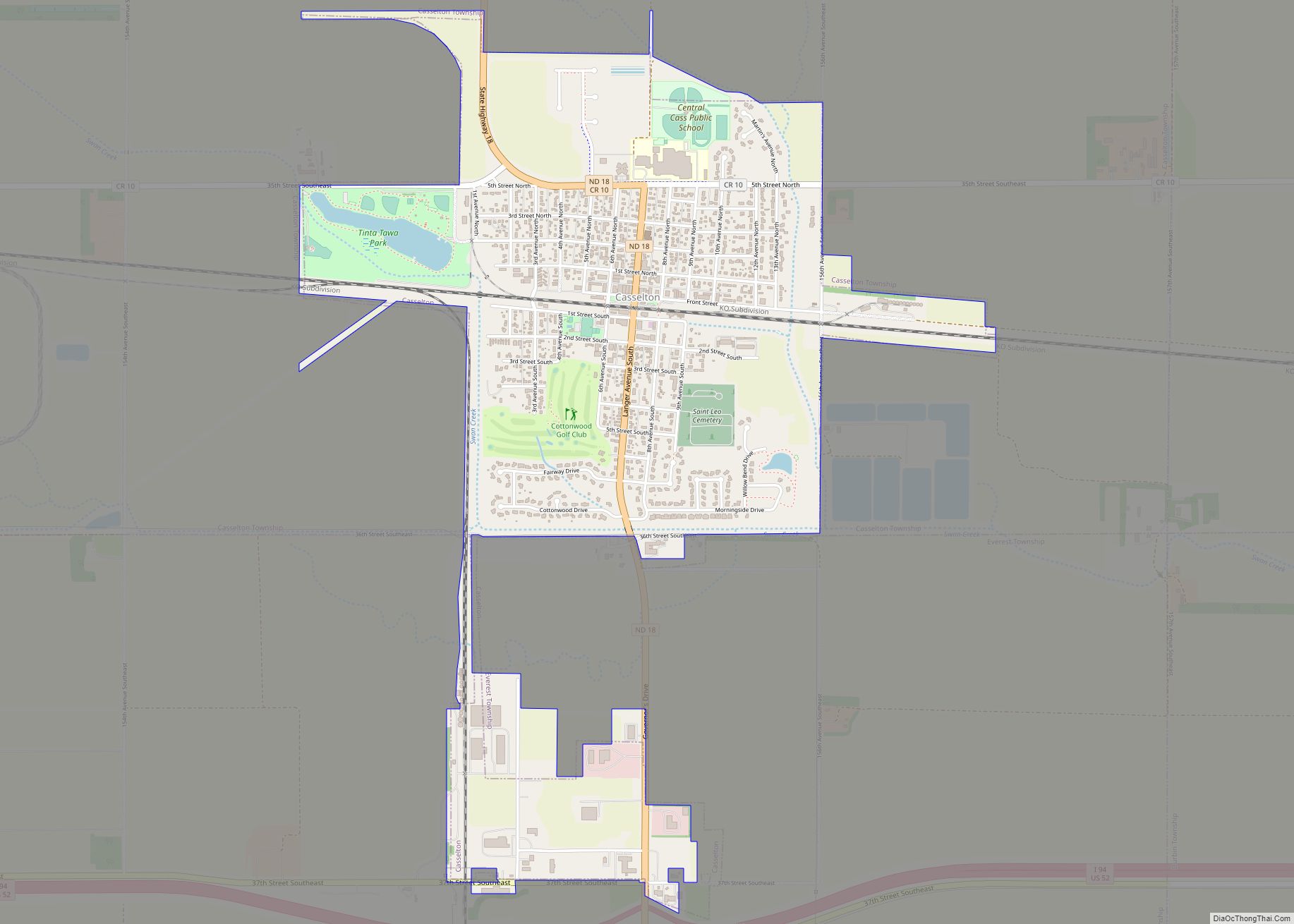
Casselton is a city in Cass County, North Dakota, United States. The population was 2,479 at the 2020 census. making it the 20th largest city in North Dakota. Casselton was founded in 1876. The city is named in honor of George Washington Cass, a president of the Northern Pacific Railway, which established a station there ... Read more
Map of Casselton city
Map of Courtenay city
Courtenay is a city in Stutsman County, North Dakota, United States. The population was 36 at the 2020 census. Courtenay was founded in 1893. Courtenay city overview: Name: Courtenay city LSAD Code: 25 LSAD Description: city (suffix) State: North Dakota County: Stutsman County Elevation: 1,529 ft (466 m) Total Area: 0.42 sq mi (1.08 km²) Land Area: 0.42 sq mi (1.08 km²) Water ... Read more
Map of Courtenay city
Map of Cooperstown city, North Dakota
Cooperstown is a city in Griggs County, North Dakota, United States. It is the county seat of Griggs County. The population was 983 at the 2020 census. Cooperstown was founded in 1882. Cooperstown city overview: Name: Cooperstown city LSAD Code: 25 LSAD Description: city (suffix) State: North Dakota County: Griggs County Founded: 1882 Elevation: 1,434 ft ... Read more
Map of Cooperstown city, North Dakota
Map of Conway city, North Dakota
Conway is a city in Walsh County, North Dakota, United States. The population was 15 at the 2020 census. Conway was founded in 1885. Conway city overview: Name: Conway city LSAD Code: 25 LSAD Description: city (suffix) State: North Dakota County: Walsh County Founded: 1885 Elevation: 981 ft (299 m) Total Area: 0.21 sq mi (0.53 km²) Land Area: 0.21 sq mi ... Read more
Map of Conway city, North Dakota
Map of Columbus city, North Dakota
Columbus is a city in Burke County, North Dakota, United States. The population was 139 at the 2020 census. Columbus was founded in 1906. Both this town and nearby Larson were named for an early postmaster who served the area (Columbus Larson), making it possibly the only town so named that was not named for ... Read more
Map of Columbus city, North Dakota
Map of Colfax city, North Dakota
Colfax is a city in Richland County, North Dakota, United States. The population was 172 at the 2020 census. Colfax was founded in 1881. It is part of the Wahpeton, ND–MN Micropolitan Statistical Area. In the mid-1960s it billed itself as the “smallest town in the U.S. with a public swimming pool”. Colfax city overview: ... Read more
Map of Colfax city, North Dakota
Map of Coleharbor city
Coleharbor is a city in McLean County, North Dakota, United States. The population was 59 at the 2020 census. Coleharbor was founded in 1904. Coleharbor city overview: Name: Coleharbor city LSAD Code: 25 LSAD Description: city (suffix) State: North Dakota County: McLean County Founded: 1904 Elevation: 1,906 ft (581 m) Total Area: 0.18 sq mi (0.47 km²) Land Area: 0.18 sq mi ... Read more
Map of Coleharbor city
Map of Dahlen CDP
Dahlen (Urban East Norwegian: [ˈdɑːɳ]) is a census-designated place and an unincorporated community in Nelson County, North Dakota, United States. It was designated as part of the United States Census Bureau’s Participant Statistical Areas Program on March 31, 2010. It was not counted separately during the 2000 census, but was included in the 2010 census, where ... Read more
Map of Dahlen CDP
Map of Crystal city, North Dakota
Crystal is a city in Pembina County, North Dakota, United States. The population was 116 at the 2020 census. Crystal was founded in 1879. Crystal city overview: Name: Crystal city LSAD Code: 25 LSAD Description: city (suffix) State: North Dakota County: Pembina County Founded: 1879 Elevation: 909 ft (277 m) Total Area: 0.69 sq mi (1.78 km²) Land Area: 0.69 sq mi ... Read more
Map of Crystal city, North Dakota