Map of Ashland city, Ohio

Map of Ashland city, Ohio

Ashland is a city in and the county seat of Ashland County, Ohio, United States, 66 miles southwest of Cleveland and 82 miles northeast of Columbus. The population was 19,225 at the 2020 census. It is the center of the Ashland Micropolitan Statistical Area (as defined by the United States Census Bureau in 2003). Ashland … Read more

Map of Arlington village, Ohio

Map of Arlington village, Ohio

Arlington is a village in Hancock County, Ohio, United States. The population was 1,455 at the 2010 census. Arlington village overview: Name: Arlington village LSAD Code: 47 LSAD Description: village (suffix) State: Ohio County: Hancock County Elevation: 863 ft (263 m) Total Area: 0.79 sq mi (2.03 km²) Land Area: 0.79 sq mi (2.03 km²) Water Area: 0.00 sq mi (0.00 km²) Total Population: 1,492 Population … Read more

Map of Arlington Heights village, Ohio

Map of Arlington Heights village, Ohio

Arlington Heights is a village in Hamilton County, Ohio, United States. It is a northeastern suburb of Cincinnati. The population was 823 at the 2020 census. The village is almost completely contained within the wide median of the Mill Creek Expressway (Interstate 75), one of the few urban splits of freeway lanes in the country. … Read more

Map of Archbold village

Map of Archbold village

Archbold is a village in Fulton County, Ohio, United States. The population was 4,346 at the 2010 census. Archbold is home to Northwest State Community College. It was designated a Tree City USA by the National Arbor Day Foundation in 1983. Archbold village overview: Name: Archbold village LSAD Code: 47 LSAD Description: village (suffix) State: … Read more

Map of Arcanum village

Map of Arcanum village

Arcanum (/ɑːrˈkænəm/ ar-CAN-əm) is a village in Darke County, Ohio, United States. The population was 2,457 at the 2020 census. Arcanum village overview: Name: Arcanum village LSAD Code: 47 LSAD Description: village (suffix) State: Ohio County: Darke County Elevation: 1,050 ft (320 m) Total Area: 1.27 sq mi (3.29 km²) Land Area: 1.27 sq mi (3.29 km²) Water Area: 0.00 sq mi (0.00 km²) Total Population: … Read more

Map of Arcadia village, Ohio

Map of Arcadia village, Ohio

Arcadia is a village in Hancock County, Ohio, United States. The population was 590 at the 2010 census. Arcadia village overview: Name: Arcadia village LSAD Code: 47 LSAD Description: village (suffix) State: Ohio County: Hancock County Elevation: 807 ft (246 m) Total Area: 0.57 sq mi (1.47 km²) Land Area: 0.57 sq mi (1.47 km²) Water Area: 0.00 sq mi (0.00 km²) Total Population: 564 Population … Read more

Map of Athalia village

Map of Athalia village

Athalia is a village in Lawrence County, Ohio, United States, along the Ohio River. The population was 373 at the 2010 census. Athalia is a part of the Huntington–Ashland, WV–KY–OH, Metropolitan Statistical Area (MSA). As of the 2000 census, the MSA had a population of 288,649. According to tradition, Athalia was named after the daughter … Read more

Map of Ashville village, Ohio

Map of Ashville village, Ohio

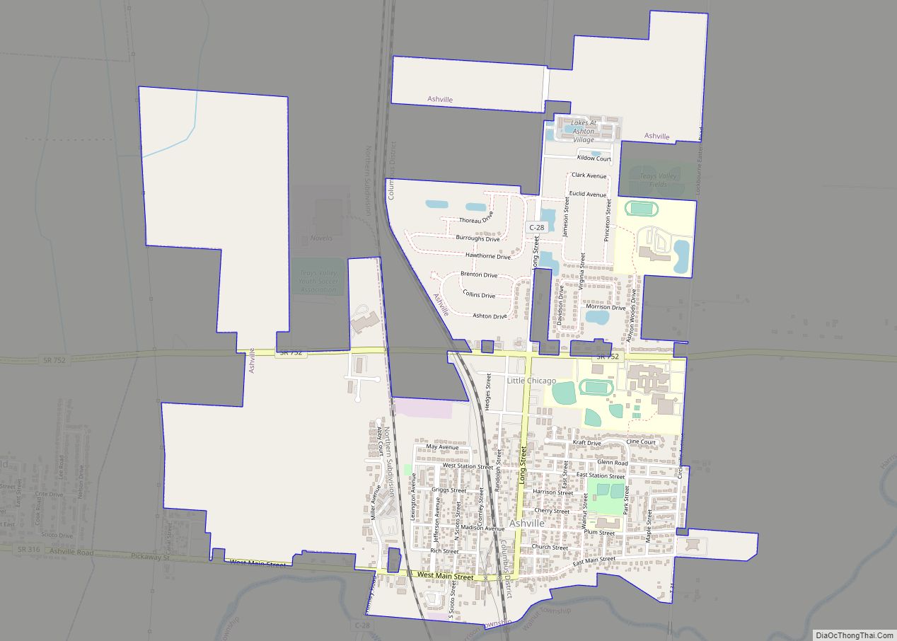
Ashville is a village in Pickaway County, Ohio, United States. The population was 4,621 at the 2020 census. Ashville is located 17 miles south of Columbus and 8 miles north of Circleville. Ashville village overview: Name: Ashville village LSAD Code: 47 LSAD Description: village (suffix) State: Ohio County: Pickaway County Elevation: 715 ft (238 m) Total Area: … Read more

Map of Ashtabula city

Map of Ashtabula city

Ashtabula (/ˌæʃtəˈbjuːlə/ ASH-tə-BYU-lə) is a city in Ashtabula County, Ohio, United States, and the center of the Ashtabula micropolitan area. It is located at the mouth of the Ashtabula River on Lake Erie, 53 miles (85 km) northeast of Cleveland. As of the 2020 census, the city had a total population of 17,975. Like many other … Read more

Map of Bainbridge CDP, Ohio

Map of Bainbridge CDP, Ohio

Bainbridge is a census-designated place (CDP) in Bainbridge Township, Geauga County, Ohio, United States. As of the 2010 census, the CDP had a population of 3,267. Bainbridge CDP overview: Name: Bainbridge CDP LSAD Code: 57 LSAD Description: CDP (suffix) State: Ohio County: Geauga County Elevation: 1,165 ft (355 m) Total Area: 12.66 sq mi (32.79 km²) Land Area: 12.50 sq mi (32.38 km²) … Read more

Map of Bailey Lakes village

Map of Bailey Lakes village

Bailey Lakes is a village in Clear Creek Township, Ashland County, Ohio, United States. The population was 349 at the 2020 census. Bailey Lakes village overview: Name: Bailey Lakes village LSAD Code: 47 LSAD Description: village (suffix) State: Ohio County: Ashland County Elevation: 1,053 ft (321 m) Total Area: 0.46 sq mi (1.18 km²) Land Area: 0.38 sq mi (0.99 km²) Water Area: … Read more

Map of Avon city, Ohio

Map of Avon city, Ohio

Avon (/ˈeɪvɒn/ AY-von) is a city in northeastern Lorain County, Ohio, United States. The population was 24,847 at the 2020 census. It is part of the Cleveland metropolitan area. Avon city overview: Name: Avon city LSAD Code: 25 LSAD Description: city (suffix) State: Ohio County: Lorain County Elevation: 670 ft (203 m) Total Area: 20.85 sq mi (53.99 km²) Land … Read more