Athens is a city and the county seat of Athens County, Ohio. The population was 23,849 at the 2020 census. Located along the Hocking River within Appalachian Ohio about 65 miles (105 km) southeast of Columbus, Athens is best known as the home of Ohio University, a large public research university with an undergraduate and graduate enrollment of more than 21,000 students. It is the principal city of the Athens micropolitan area.
Athens is a qualified Tree City USA as recognized by the National Arbor Day Foundation.
| Name: | Athens city |
|---|---|
| LSAD Code: | 25 |
| LSAD Description: | city (suffix) |
| State: | Ohio |
| County: | Athens County |
| Elevation: | 719 ft (219 m) |
| Total Area: | 10.21 sq mi (26.44 km²) |
| Land Area: | 9.96 sq mi (25.79 km²) |
| Water Area: | 0.25 sq mi (0.65 km²) |
| Total Population: | 23,849 |
| Population Density: | 2,394.72/sq mi (924.58/km²) |
| ZIP code: | 45701 |
| FIPS code: | 3902736 |
| GNISfeature ID: | 1075290 |
| Website: | www.ci.athens.oh.us |
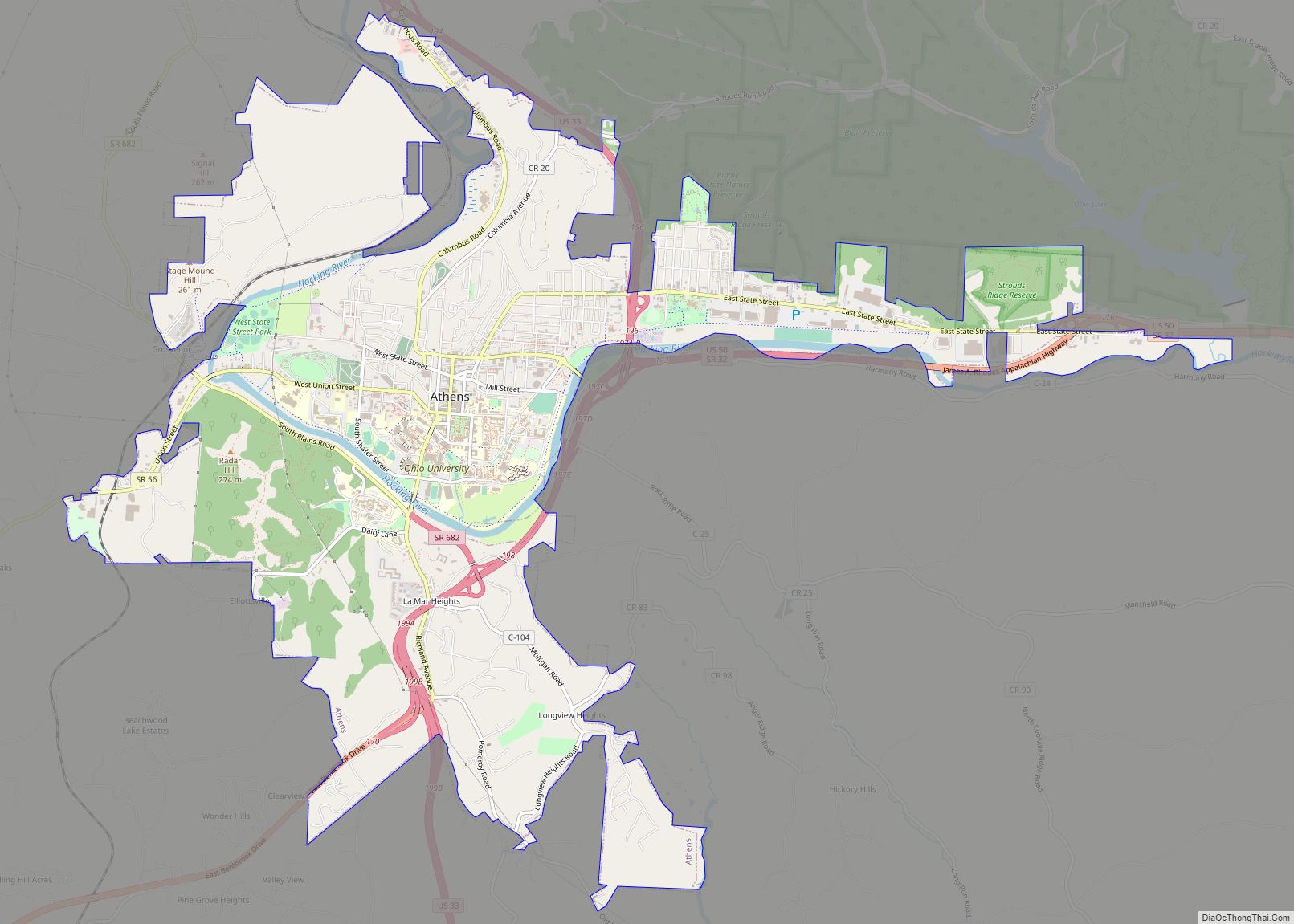
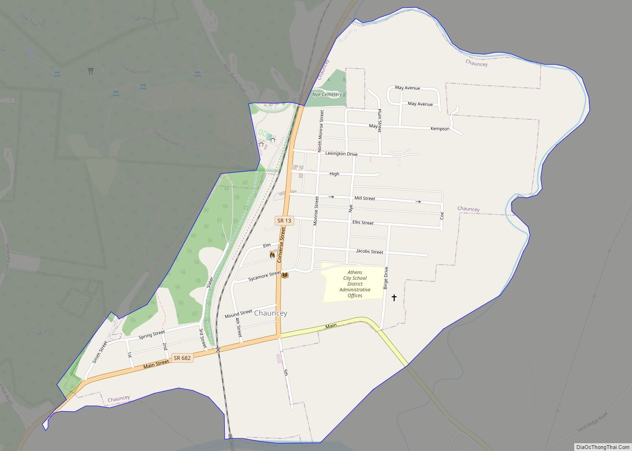
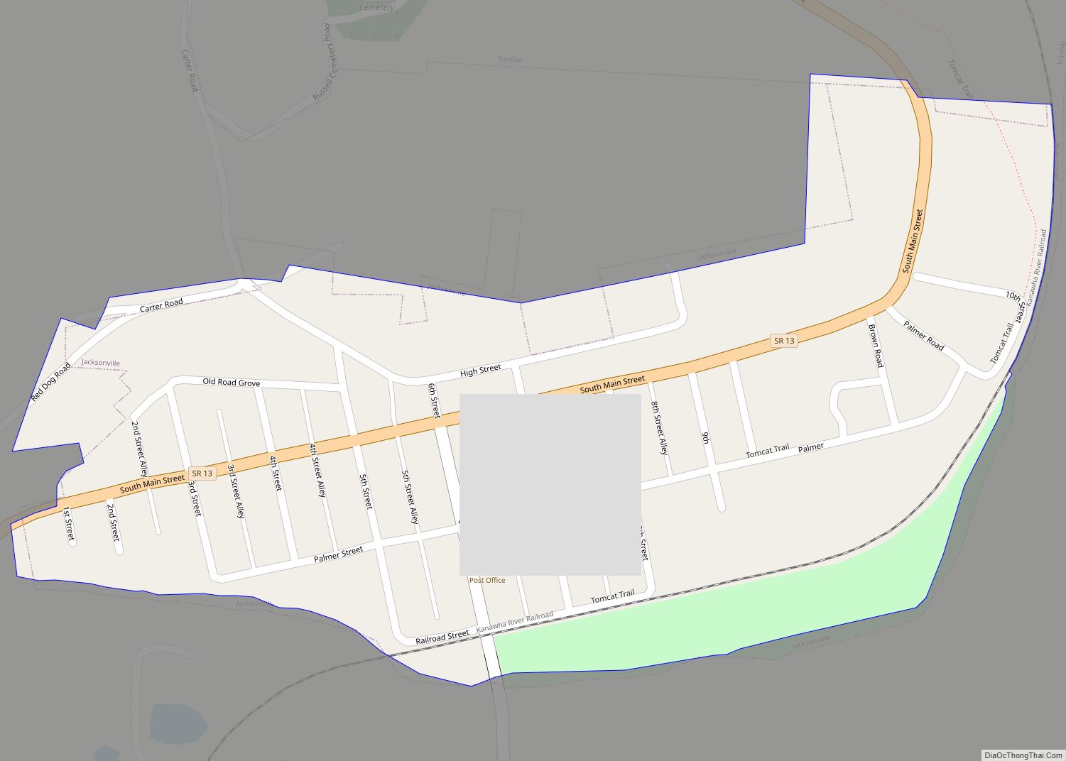
Online Interactive Map
Click on ![]() to view map in "full screen" mode.
to view map in "full screen" mode.
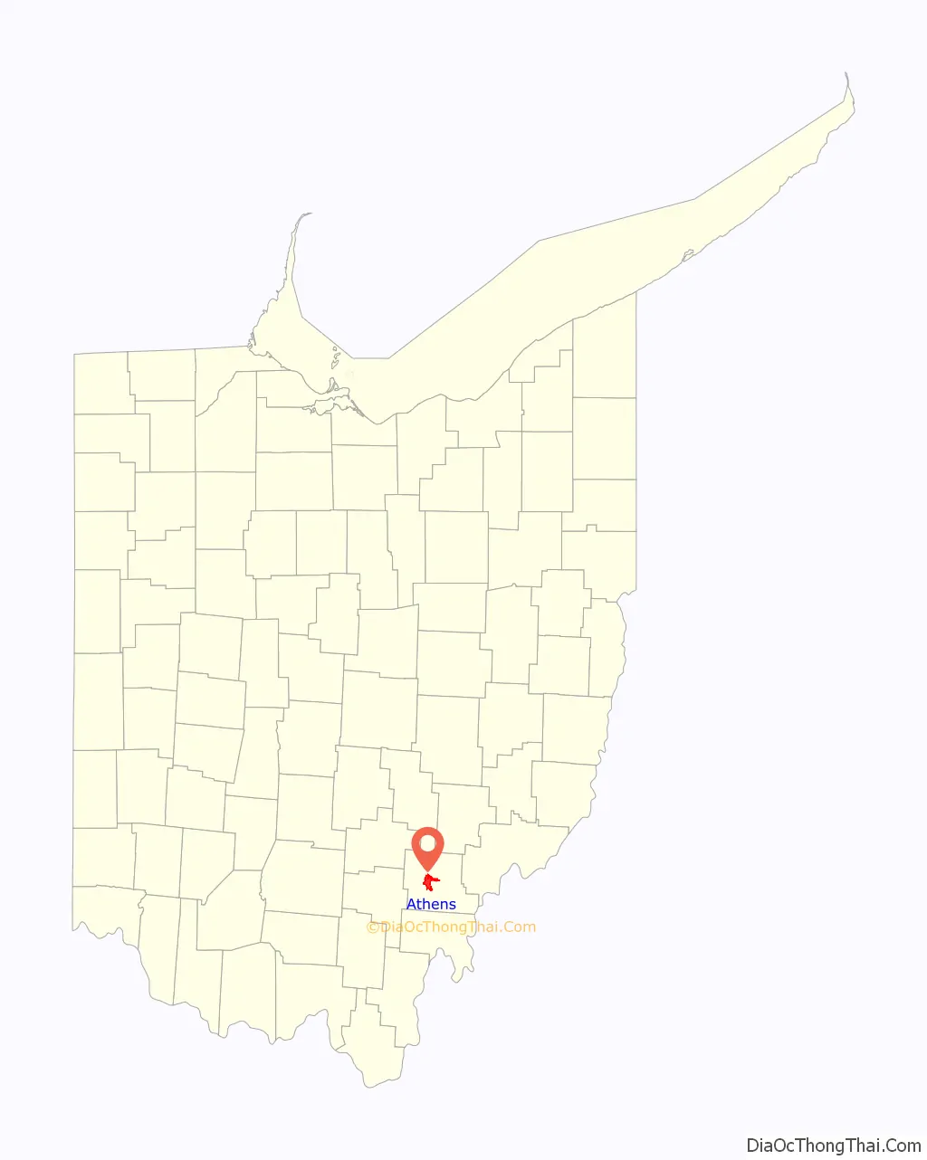
Athens location map. Where is Athens city?

History
The first permanent European settlers arrived in Athens in 1797, more than a decade after the United States victory in the American Revolutionary War. In 1800, the town site was first surveyed and plotted and incorporated as a village in 1811. Ohio had become a state in 1803. Ohio University was chartered in 1804, the first public institution of higher learning in the Northwest Territory. Previously part of Washington County, Ohio, Athens County was formed in 1805, named for the ancient center of learning, Athens, Greece.
Ohio University in Athens was established with the first federal endowment of an educational institution in the United States. In July 1787, the Congress of the Confederation gave to the Ohio Company of Associates “two townships of good land for the support of a literary institution” in the newly created Northwest Territory.
During The First Session of the Second Territorial General Assembly, held in Chillicothe from November 23, 1801, to January 23, 1802, the General Assembly passed an act establishing the “American Western University” at Athens. The act was approved by Arthur St. Clair, Governor of the Northwest Territory on January 9, 1802. However, no university with the name of American Western University would be established. Ohio became a state in 1803 and on February 18, 1804, the state legislature passed an act establishing the “Ohio University” in the town of Athens. Athens received city status in 1912, following the 1910 census showing the population had passed 5,000 residents, the requirement for city status in Ohio.
Originally, large tracts of land in Athens and Alexander Townships were set aside through a contract between the Congress (under the Articles of Confederation) and the Ohio Company of Associates, a group of American Revolutionary War veterans. These lands were given to Ohio University by the Federal government. This was the first federal land grant for a university, pre-dating the Morrill Act by more than 70 years. At first, lands were mostly leased out, but the failure of many lessors to pay their rents resulted in most of the land being sold. The sale of these lands funded the growth of Ohio University. Today it is one of the largest institutions of higher learning in Ohio, with an enrollment of over 20,000 on the Athens campus and over 28,000 for all campuses.
The earliest industry in the area was salt production, followed by iron production and coal extraction. The largest employer in the county is Ohio University. In 1843, the Hocking Canal opened, enabling shipping from the Ohio River up the Hocking River, which passes through Athens, to Nelsonville, Ohio, and points beyond. However, the canal was closed during cold winters when it froze over.
The first railroad reached Athens in 1857. In the late 19th century, an interurban line opened between Athens and Nelsonville and operated for some years. The Athens Lunatic Asylum, later named the Athens State Hospital, opened in 1874. This was on high ground to the south of town and to the south of the Hocking River. In the late 19th century the hospital was the town’s largest employer. The state hospital was eventually decommissioned and the property was deeded to Ohio University. It is now known as The Ridges. Much of the building space has been renovated for offices and research space, and most of the grounds have been set aside as open space, including a land lab.
In 1904, the U. S. Army and the Ohio National Guard conducted joint training exercises near the city. Multiple US army regulars became drunk and were arrested by National Guard Provosts for causing disturbances. The arrests angered the regulars; on Friday a large contingent set out from camp to free an arrested comrade. The armed regulars were stopped by provosts and the ensuing quarrel quickly escalated into a shoot-out on Washington Street, during which one guardsman was killed and five others were wounded.
By 1935, Athens was known as a coal and fruit-producing region and a state center of higher education and psychiatric care. The major manufactured goods included stoves, lumber, parquetry flooring, caskets, and flooring.
The university (and in turn, the city) saw large growth during the post-World War Two era and again during the Vietnam War era. Growth slowed in the 1980s with small increases in growth into present times.
Athens Road Map

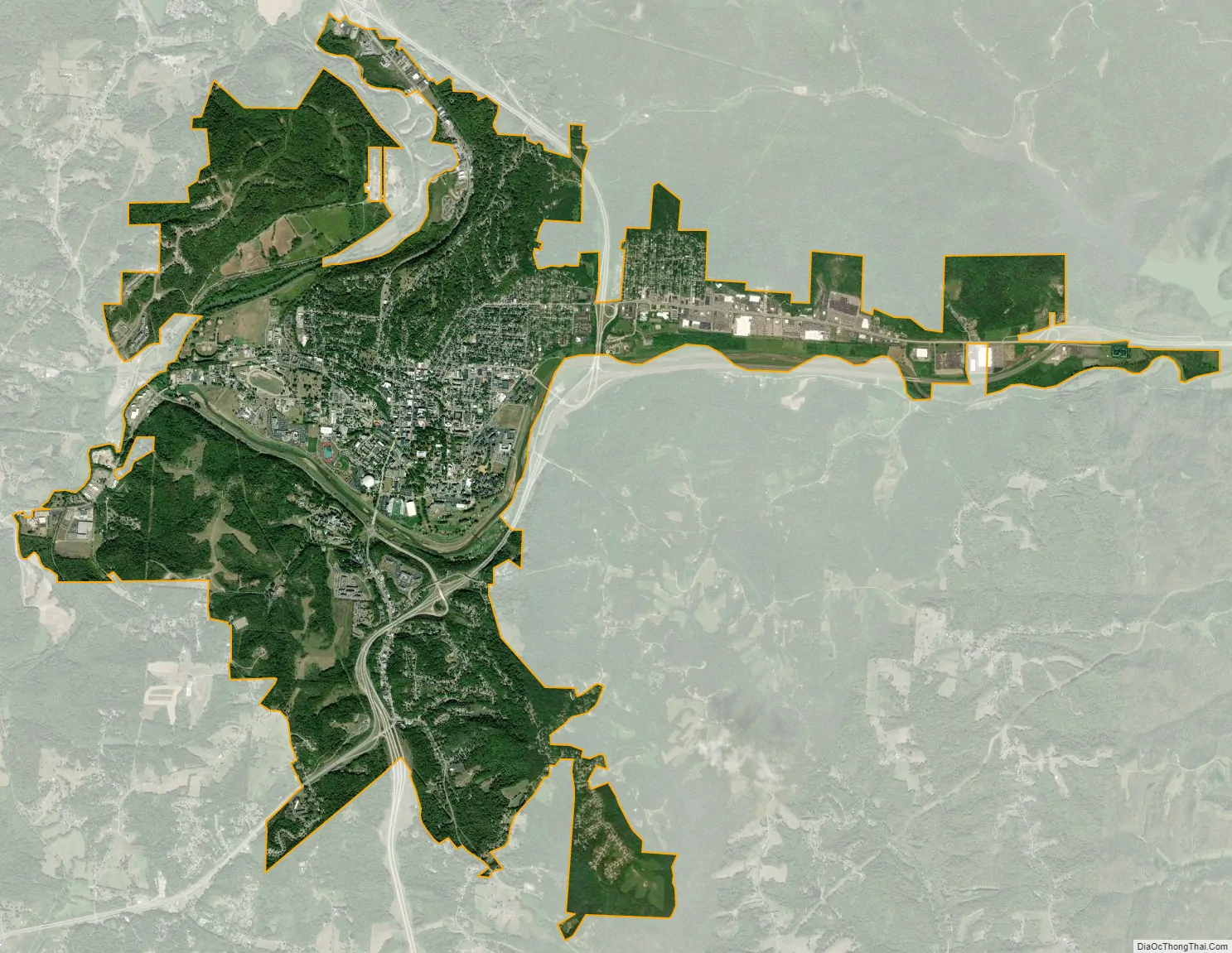
Athens city Satellite Map
Geography
Athens is located in the unglaciated Allegheny Plateau about 47 miles from Chillicothe and 35 miles west of Marietta. Athens is surrounded by hills that rise about three hundred feet from river valley to the narrow ridge tops. The county extends west from the Ohio River, mostly centered around the lower Hocking River watershed. According to the 2010 census, the city has a total area of 10.05 square miles (26.0 km), of which 9.83 square miles (25.5 km) (or 97.81%) is land and 0.22 square miles (0.57 km) (or 2.19%) is water. Large sections of Athens and Ohio University are located in the floodplain of the Hocking River. Over the last two centuries the town suffered from many destructive floods, including notable floods in 1832, 1873, 1907, 1937, 1949, 1964 and 1968. In 1969 the Army Corps of Engineers completed a major work that rerouted and expanded the channel of the Hocking River, for a stretch of several miles around the town, moving the river hundreds of feet to the south. That project and the ongoing efforts to maintain the channel have greatly reduced the negative effects of seasonally high river levels.
Athens is located mostly on and around a south-jutting ridge bordered by a loop in the Hocking River. The underlying geology is mostly sandstone and shale, including “redbed” shale that presents a severe slip hazard when structures are built over it on hillsides. However, there are safe zones above sandstone beds, most notably the Connelsville Sandstone that outcrops high on the hillsides. The old Athens Mental Hospital grounds (now part of the university) was built on the top of a hillside in the late 1860s, and is completely stable due to its position atop the hill rather than on a slope. The recent University Courtyard Apartments is also built on similar underlying geology across a small valley, but the hilltop was extensively removed in order to create a stable base. The city receives all its water supply from wells in unconsolidated river aquifers, and is reputed to be the largest city in the United States to do so.
Climate
See also
Map of Ohio State and its subdivision:- Adams
- Allen
- Ashland
- Ashtabula
- Athens
- Auglaize
- Belmont
- Brown
- Butler
- Carroll
- Champaign
- Clark
- Clermont
- Clinton
- Columbiana
- Coshocton
- Crawford
- Cuyahoga
- Darke
- Defiance
- Delaware
- Erie
- Fairfield
- Fayette
- Franklin
- Fulton
- Gallia
- Geauga
- Greene
- Guernsey
- Hamilton
- Hancock
- Hardin
- Harrison
- Henry
- Highland
- Hocking
- Holmes
- Huron
- Jackson
- Jefferson
- Knox
- Lake
- Lake Erie
- Lawrence
- Licking
- Logan
- Lorain
- Lucas
- Madison
- Mahoning
- Marion
- Medina
- Meigs
- Mercer
- Miami
- Monroe
- Montgomery
- Morgan
- Morrow
- Muskingum
- Noble
- Ottawa
- Paulding
- Perry
- Pickaway
- Pike
- Portage
- Preble
- Putnam
- Richland
- Ross
- Sandusky
- Scioto
- Seneca
- Shelby
- Stark
- Summit
- Trumbull
- Tuscarawas
- Union
- Van Wert
- Vinton
- Warren
- Washington
- Wayne
- Williams
- Wood
- Wyandot
- Alabama
- Alaska
- Arizona
- Arkansas
- California
- Colorado
- Connecticut
- Delaware
- District of Columbia
- Florida
- Georgia
- Hawaii
- Idaho
- Illinois
- Indiana
- Iowa
- Kansas
- Kentucky
- Louisiana
- Maine
- Maryland
- Massachusetts
- Michigan
- Minnesota
- Mississippi
- Missouri
- Montana
- Nebraska
- Nevada
- New Hampshire
- New Jersey
- New Mexico
- New York
- North Carolina
- North Dakota
- Ohio
- Oklahoma
- Oregon
- Pennsylvania
- Rhode Island
- South Carolina
- South Dakota
- Tennessee
- Texas
- Utah
- Vermont
- Virginia
- Washington
- West Virginia
- Wisconsin
- Wyoming