Map of Pepper Pike city
Pepper Pike is a city in eastern Cuyahoga County, Ohio, United States. It is a suburb of Cleveland. The population was 6,796 as of the 2020 census. Pepper Pike city overview: Name: Pepper Pike city LSAD Code: 25 LSAD Description: city (suffix) State: Ohio County: Cuyahoga County Elevation: 1,056 ft (322 m) Total Area: 7.15 sq mi (18.53 km²) Land ... Read more
Map of Pepper Pike city
Map of Peninsula village
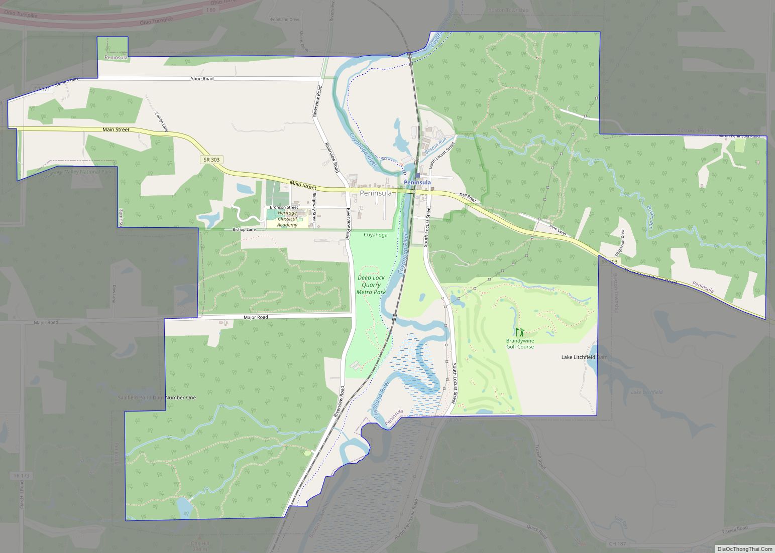
Peninsula is a village in Summit County, Ohio, United States. The population was 565 at the 2010 census. It is part of the Akron Metropolitan Statistical Area. Peninsula is in the middle of the Cuyahoga Valley National Park, which provides a source of tourism to the village. Blossom Music Center is located on its outskirts. ... Read more
Map of Peninsula village
Map of Pemberville village
Pemberville is a village located on the banks of the Portage River in Wood County, Ohio, United States. The population was 1,371 at the 2010 census. Pemberville village overview: Name: Pemberville village LSAD Code: 47 LSAD Description: village (suffix) State: Ohio County: Wood County Elevation: 650 ft (198 m) Total Area: 1.20 sq mi (3.10 km²) Land Area: 1.20 sq mi (3.10 km²) ... Read more
Map of Pemberville village
Map of Piqua city, Ohio
Piqua (/ˈpɪkwə/ PIK-wə) is a city in Miami County, southwest Ohio, United States, 27 miles north of Dayton. The population was 20,522 at the 2010 census. It is part of the Dayton Metropolitan Statistical Area. It was founded as the village of Washington in 1807 by a soldier under Gen. Anthony Wayne. Piqua city overview: ... Read more
Map of Piqua city, Ohio
Map of Pioneer village, Ohio
Pioneer is a village in Williams County, Ohio, United States. The population was 1,369 at the 2010 census. Pioneer village overview: Name: Pioneer village LSAD Code: 47 LSAD Description: village (suffix) State: Ohio County: Williams County Elevation: 879 ft (268 m) Total Area: 2.11 sq mi (5.47 km²) Land Area: 2.04 sq mi (5.28 km²) Water Area: 0.07 sq mi (0.18 km²) Total Population: 1,429 Population ... Read more
Map of Pioneer village, Ohio
Map of Piketon village
Piketon is a village in Pike County in the U.S. state of Ohio, along the Scioto River. The village is best known for the uranium enrichment plant located there, which is one of only three such plants in the United States. The population was 2,111 at the 2020 U.S. census. Originally called Jefferson, it was ... Read more
Map of Piketon village
Map of Pigeon Creek CDP
Pigeon Creek is a census-designated place (CDP) in Summit County, Ohio, United States. The population was 945 at the 2000 census. It is part of the Akron metropolitan statistical area. Pigeon Creek CDP overview: Name: Pigeon Creek CDP LSAD Code: 57 LSAD Description: CDP (suffix) State: Ohio County: Summit County Elevation: 1,040 ft (317 m) Total Area: ... Read more
Map of Pigeon Creek CDP
Map of Pickerington city
Pickerington is a city in Fairfield and Franklin counties in the central region of the U.S. state of Ohio. It is a suburb of Columbus. The population was 23,094 at the 2020 census. It was founded in 1815 as Jacksonville, named after Andrew Jackson. The name was changed in 1827 in honor of its founder, ... Read more
Map of Pickerington city
Map of Philo village, Ohio
Philo is a village in Muskingum County, Ohio, United States, along the Muskingum River. The population was 720 at the 2020 census. It is part of the Zanesville micropolitan area. Philo is the closest municipality to Blue Rock State Park. Philo village overview: Name: Philo village LSAD Code: 47 LSAD Description: village (suffix) State: Ohio ... Read more
Map of Philo village, Ohio
Map of Phillipsburg village, Ohio
Phillipsburg is a village in Montgomery County, Ohio, United States. The population was 498 at the 2020 census. It is part of the Dayton Metropolitan Statistical Area. Phillipsburg village overview: Name: Phillipsburg village LSAD Code: 47 LSAD Description: village (suffix) State: Ohio County: Montgomery County Elevation: 1,037 ft (316 m) Total Area: 0.27 sq mi (0.69 km²) Land Area: 0.27 sq mi ... Read more
Map of Phillipsburg village, Ohio
Map of Plainfield village, Ohio
Plainfield is a village in Coshocton County, Ohio, United States, along Wills Creek. The population was 157 at the 2010 census. Plainfield village overview: Name: Plainfield village LSAD Code: 47 LSAD Description: village (suffix) State: Ohio County: Coshocton County Elevation: 797 ft (243 m) Total Area: 0.39 sq mi (1.02 km²) Land Area: 0.39 sq mi (1.02 km²) Water Area: 0.00 sq mi (0.00 km²) Total ... Read more
Map of Plainfield village, Ohio
Map of Plain City village, Ohio
Plain City is a village in Madison and Union counties in the U.S. state of Ohio, along Big Darby Creek. The population was 4,225 at the 2010 census. According to the official website, their mission statement is “to govern with integrity and fiscal responsibility providing quality services and programs to promote prosperity, safety and the ... Read more
Map of Plain City village, Ohio