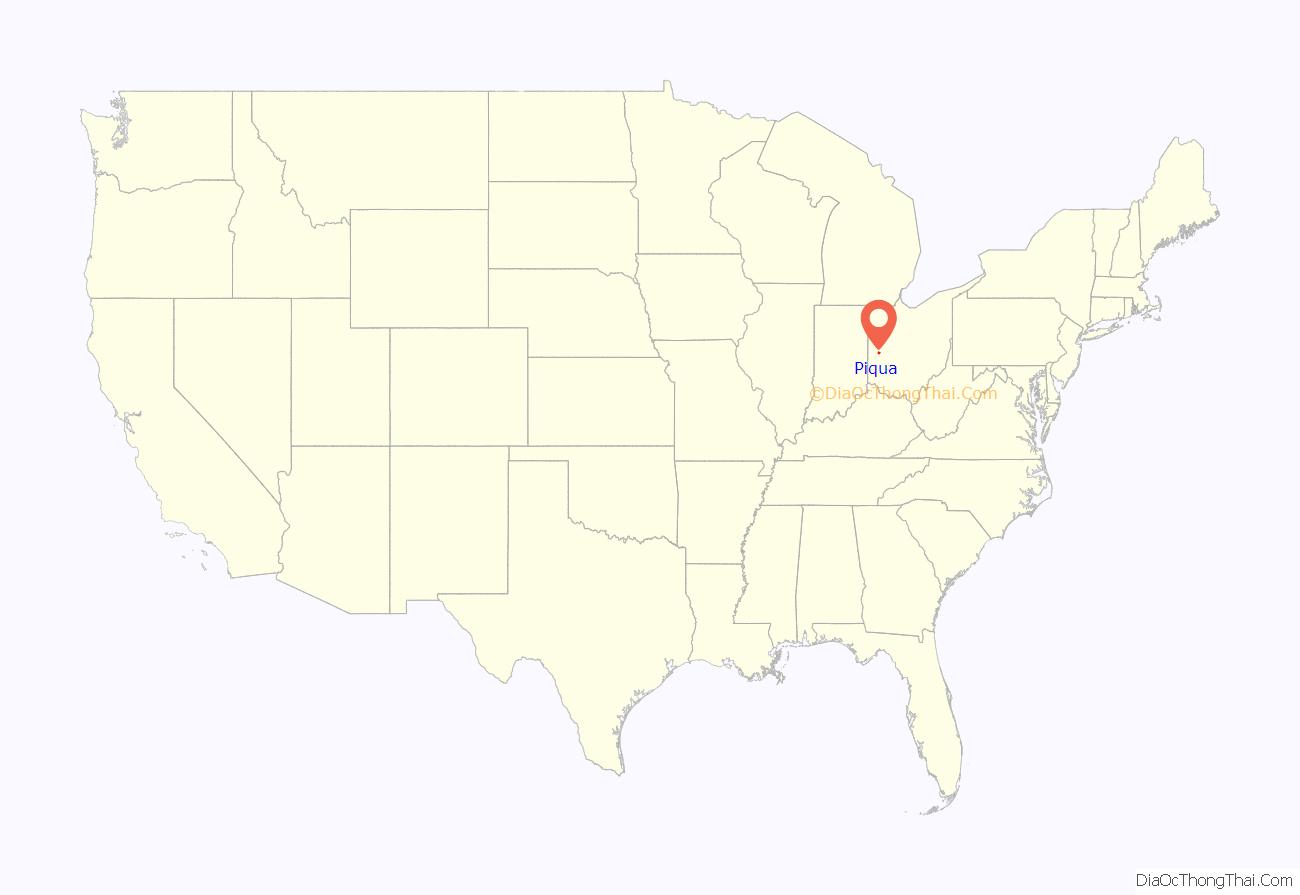
Piqua (/ˈpɪkwə/ PIK-wə) is a city in Miami County, southwest Ohio, United States, 27 miles north of Dayton. The population was 20,522 at the 2010 census. It is part of the Dayton Metropolitan Statistical Area.
It was founded as the village of Washington in 1807 by a soldier under Gen. Anthony Wayne.
| Name: | Piqua city |
|---|---|
| LSAD Code: | 25 |
| LSAD Description: | city (suffix) |
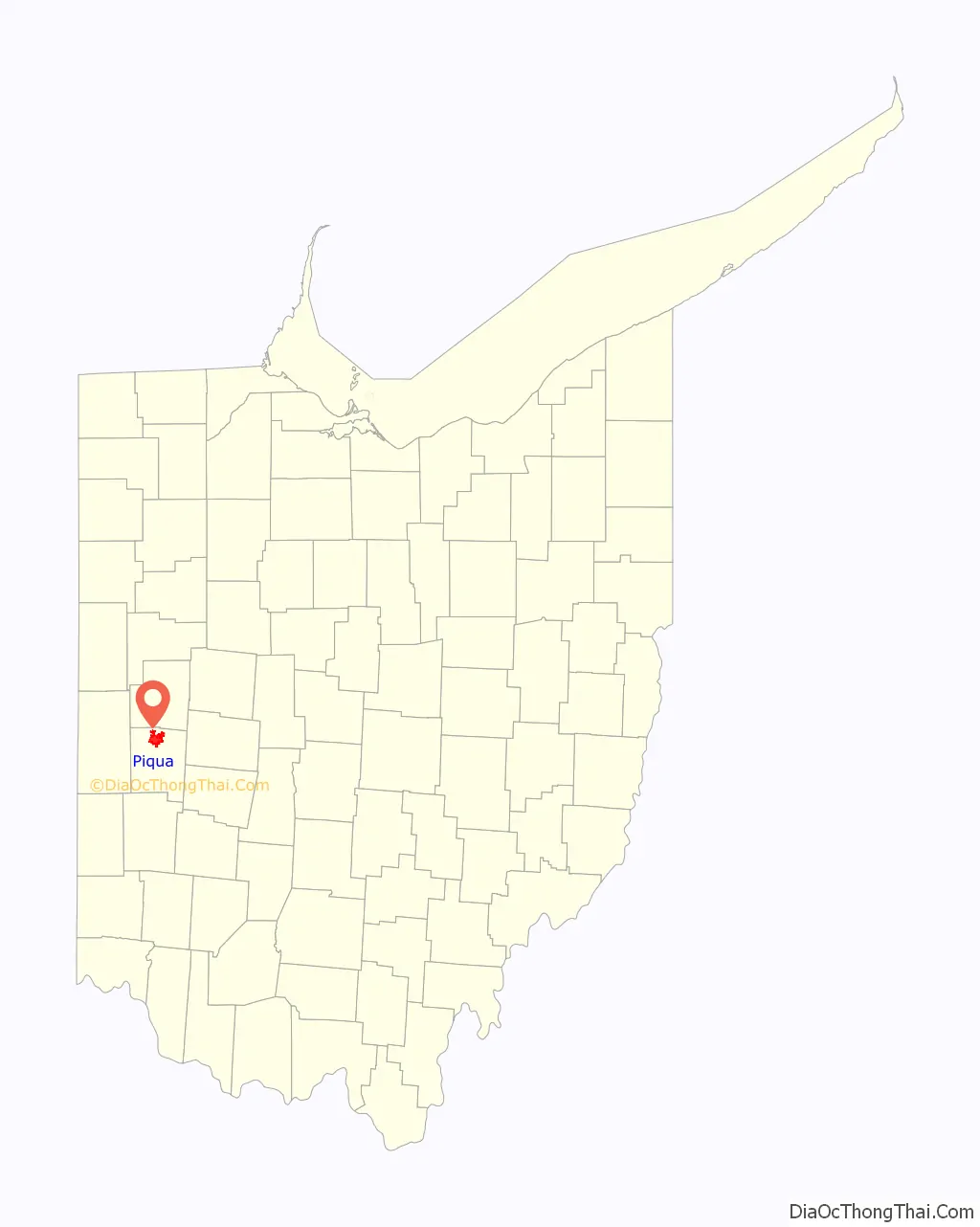
| State: | Ohio |
| County: | Miami County |
| Elevation: | 873 ft (266 m) |
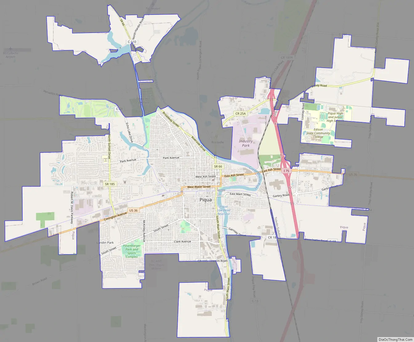
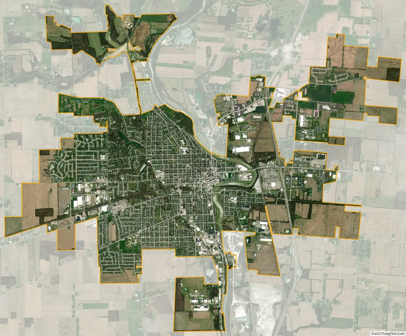
| Total Area: | 12.04 sq mi (31.18 km²) |
| Land Area: | 11.77 sq mi (30.50 km²) |
| Water Area: | 0.26 sq mi (0.68 km²) |
| Total Population: | 20,354 |
| Population Density: | 1,728.72/sq mi (667.45/km²) |
| ZIP code: | 45356 |
| Area code: | 937, 326 |
| FIPS code: | 3962848 |
| GNISfeature ID: | 1061544 |
| Website: | http://www.piquaoh.org/ |
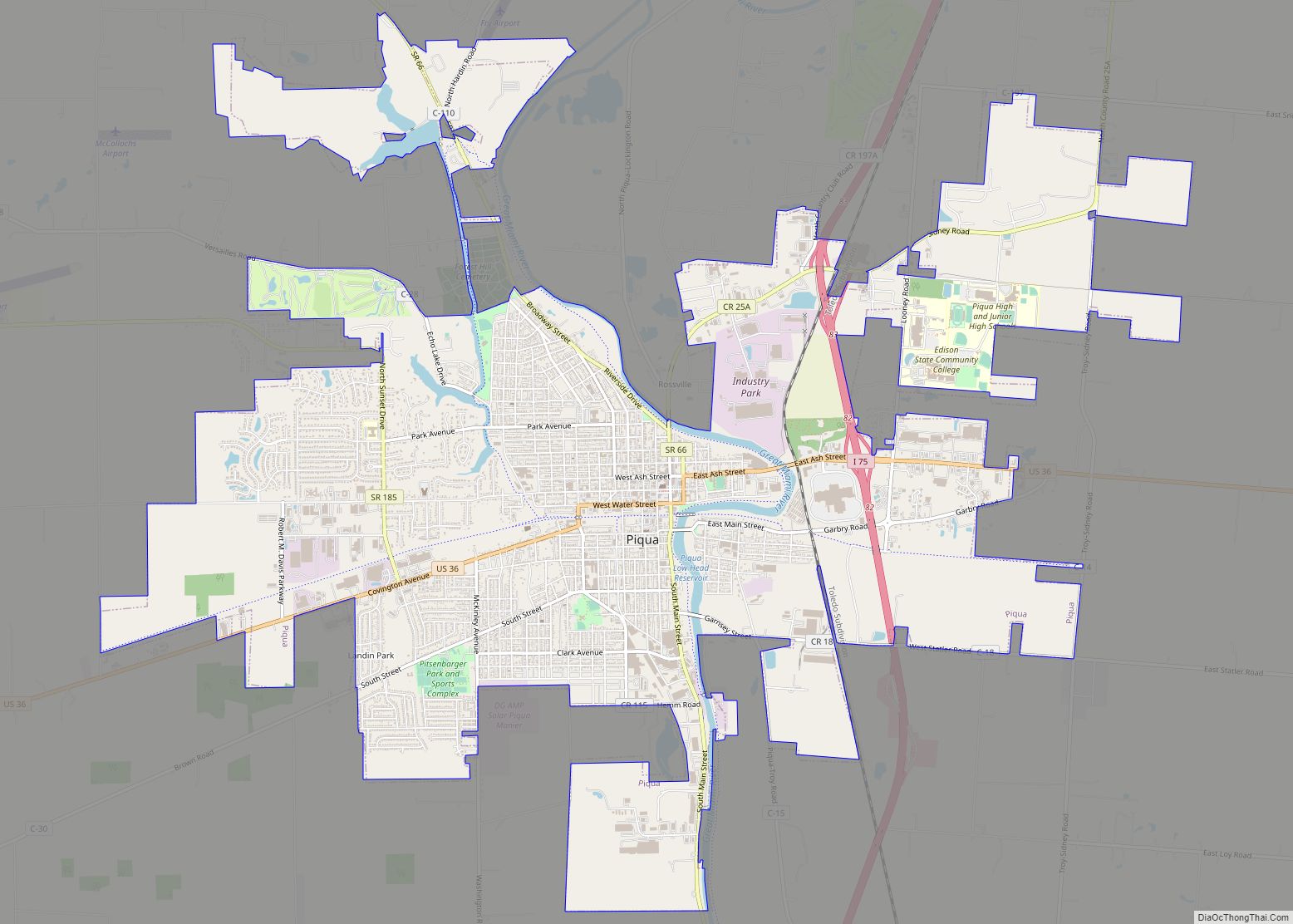
Online Interactive Map
Click on ![]() to view map in "full screen" mode.
to view map in "full screen" mode.
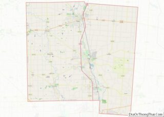
Piqua location map. Where is Piqua city?
History
Etymology
The word ‘Piqua’ is believed to be derived from a Shawnee language phrase: Othath-He-Waugh-Pe-Qua, translated as “He has risen from the ashes,” related to a legend of the people. It became associated with the Pekowi, one of the five divisions of the Shawnee people, who were eventually known as the Piqua.
Fort and trading post
In 1749, Fort Pickawillany was constructed by the British to protect their trading post at a Miami village of the same name. It was located at the confluence of Loramie Creek and the Great Miami River. (The present city of Piqua developed about a mile to the southwest).
In 1752 Charles de Langlade, an Odawa war chief of partial French Canadian descent, attacked the fort. He led more than 240 Odawa and Ojibwe warriors allied with French forces against the British and the Miami village in the Battle of Pickawillany. The Miami chief and a British trader were killed in the conflict.
After the battle, the British and Miami abandoned this site. The Miami rebuilt Pickawillany, and Piqua later developed near their village. The British soon took over the area after defeating the French in the French and Indian War.
Until 1780, Piqua had been the capital town of the Shawnee located on the Mad River about 23 miles southeast of the modern town (near Springfield). That year, an expedition by Gen. George Rogers Clark culminated in the Battle of Piqua, after which the town and surrounding fields were burned. The Shawnee relocated north and west to the Great Miami River. Piqua was settled as two separate Shawnee villages late in 1780, known as Upper Piqua and Lower Piqua.
In 1790, General Harmar found the site on the Great Miami River abandoned and in ruins, as did General Wayne in 1794.
As Gen. Anthony Wayne’s Legion was returning to Greenville via Loramie’s trading post and Piqua at the termination of their Indian Country campaign in fall 1794, Wayne wrote a letter to Henry Knox dated Oct. 17, 1794, in which he recommended that forts be built at those two locations as waystations along the Miami River. A detachment of Wayne’s forces from Greenville built or repaired a small fort and supply depot named Fort Piqua in Upper Piqua on the same site as the (later) farm of Col. John Johnston in winter 1794–95. Capt. J.N. Visher was made commander of the garrison. The fort was garrisoned through 1794 and 1795, and abandoned after the signing of the Treaty of Greenville in 1795.
By 1795, most of Ohio’s Shawnee had moved to Missouri and those that remained migrated north to the Auglaize – the southwestern Indian towns were no more. Piqua itself was well below the Greenville Treaty line and would remain abandoned until white settlers arrived.
Settlement and incorporation
The first European settlers arrived in 1798, after the signing of the Treaty of Greenville ending the Northwest Indian War and opening much of Ohio to settlement. In 1807 the village, consisting of seven houses, was surveyed by Armstrong Brandon, a soldier under Gen. Anthony Wayne, and named Washington. It was about a mile southwest of the old Indian villages of Piqua.
By 1816 the Shawnee village of Piqua had been long abandoned; the state legislature, acting on citizen petition, changed the name of Washington village to Piqua. Piqua was incorporated as a town by the Ohio General Assembly in 1823.
During the war of 1812, Piqua was a waystation for men and supplies moving north. In 1819, a land office was established in Piqua which facilitated its growth.
Piqua developed along with construction of the Miami and Erie Canal between 1825 and 1845.
Rossville
Rossville, Ohio was the first free-black enclave in the region. Virginia planter John Randolph of Roanoke, who served as a U.S. representative and senator, arranged for the emancipation of his nearly 400 slaves in his will of 1833. He also provided money for his executor to relocate the freedmen to the free state of Ohio, and to buy land and supplies to help them establish a settlement. The will was challenged but in 1846, his 383 slaves gained their freedom. Most of these freedmen settled in Rumley, Ohio. Some eventually founded Rossville and an associated cemetery, known as the African Jackson Cemetery. These are located on the northeast side of the Great Miami River; they may be accessed by nearby North County Road 25-A. The community has since been incorporated into Piqua.
Piqua Road Map
Piqua city Satellite Map
Geography
Piqua is located at 40°8′51″N 84°14′53″W / 40.14750°N 84.24806°W / 40.14750; -84.24806 (40.147474, -84.247968).
According to the United States Census Bureau, the city has a total area of 11.89 square miles (30.79 km), of which 11.62 square miles (30.10 km) is land and 0.27 square miles (0.70 km) is water.
The Great Miami River runs through Piqua. The area at the south end of town on the east side of the river is known as Shawnee.
See also
Map of Ohio State and its subdivision:- Adams
- Allen
- Ashland
- Ashtabula
- Athens
- Auglaize
- Belmont
- Brown
- Butler
- Carroll
- Champaign
- Clark
- Clermont
- Clinton
- Columbiana
- Coshocton
- Crawford
- Cuyahoga
- Darke
- Defiance
- Delaware
- Erie
- Fairfield
- Fayette
- Franklin
- Fulton
- Gallia
- Geauga
- Greene
- Guernsey
- Hamilton
- Hancock
- Hardin
- Harrison
- Henry
- Highland
- Hocking
- Holmes
- Huron
- Jackson
- Jefferson
- Knox
- Lake
- Lake Erie
- Lawrence
- Licking
- Logan
- Lorain
- Lucas
- Madison
- Mahoning
- Marion
- Medina
- Meigs
- Mercer
- Miami
- Monroe
- Montgomery
- Morgan
- Morrow
- Muskingum
- Noble
- Ottawa
- Paulding
- Perry
- Pickaway
- Pike
- Portage
- Preble
- Putnam
- Richland
- Ross
- Sandusky
- Scioto
- Seneca
- Shelby
- Stark
- Summit
- Trumbull
- Tuscarawas
- Union
- Van Wert
- Vinton
- Warren
- Washington
- Wayne
- Williams
- Wood
- Wyandot
- Alabama
- Alaska
- Arizona
- Arkansas
- California
- Colorado
- Connecticut
- Delaware
- District of Columbia
- Florida
- Georgia
- Hawaii
- Idaho
- Illinois
- Indiana
- Iowa
- Kansas
- Kentucky
- Louisiana
- Maine
- Maryland
- Massachusetts
- Michigan
- Minnesota
- Mississippi
- Missouri
- Montana
- Nebraska
- Nevada
- New Hampshire
- New Jersey
- New Mexico
- New York
- North Carolina
- North Dakota
- Ohio
- Oklahoma
- Oregon
- Pennsylvania
- Rhode Island
- South Carolina
- South Dakota
- Tennessee
- Texas
- Utah
- Vermont
- Virginia
- Washington
- West Virginia
- Wisconsin
- Wyoming