Map of Council Hill town

Map of Council Hill town

Council Hill is a town in Muskogee County, Oklahoma, United States. The population was 158 at the 2010 census, an increase of 28.5 percent over the figure of 129 recorded in 2000. Council Hill town overview: Name: Council Hill town LSAD Code: 43 LSAD Description: town (suffix) State: Oklahoma County: Muskogee County Elevation: 659 ft (201 m) … Read more

Map of Cornish town

Map of Cornish town, Oklahoma

Cornish is an incorporated town in eastern Jefferson County, Oklahoma, United States. The population was 163 at the 2010 census, a decline of 5.2 percent from the figure of 172 in 2000. Cornish town overview: Name: Cornish town LSAD Code: 43 LSAD Description: town (suffix) State: Oklahoma County: Jefferson County Elevation: 850 ft (259 m) Total Area: … Read more

Map of Cushing city, Oklahoma

Map of Cushing city, Oklahoma

Cushing (Meskwaki: Koshineki, Iowa-Oto: Amína P^óp^oye Chína, meaning: “Soft-seat town”) is a city in Payne County, Oklahoma, United States. The population was 7,826 at the time of the 2010 census, a decline of 6.5% since 8,371 in 2000. Cushing was established after the Land Run of 1891 by William “Billy Rae” Little. It was named … Read more

Map of Crowder town, Oklahoma

Map of Crowder town, Oklahoma

Crowder is a town in Pittsburg County, Oklahoma, United States. The population was 430 at the 2010 census. Crowder town overview: Name: Crowder town LSAD Code: 43 LSAD Description: town (suffix) State: Oklahoma County: Pittsburg County Elevation: 623 ft (190 m) Total Area: 3.06 sq mi (7.93 km²) Land Area: 2.05 sq mi (5.31 km²) Water Area: 1.01 sq mi (2.62 km²) Total Population: 306 Population … Read more

Map of Cromwell town, Oklahoma

Map of Cromwell town, Oklahoma

Cromwell is a town in Seminole County, Oklahoma, United States. It is within the jurisdiction of the Muscogee (Creek) Nation. The population was 286 at the 2010 census, an 8 percent increase from the figure of 265 recorded in 2000. It was named for oilman Joe I. Cromwell, who platted the original town in 1923. … Read more

Map of Crescent city, Oklahoma

Map of Crescent city, Oklahoma

Crescent is a city in Logan County, Oklahoma, United States. The population inside the city limits was 1,411 at the 2010 census. It is part of the Oklahoma City Metropolitan Statistical Area. Crescent city overview: Name: Crescent city LSAD Code: 25 LSAD Description: city (suffix) State: Oklahoma County: Logan County Elevation: 1,142 ft (348 m) Total Area: … Read more

Map of Coyle town

Map of Coyle town

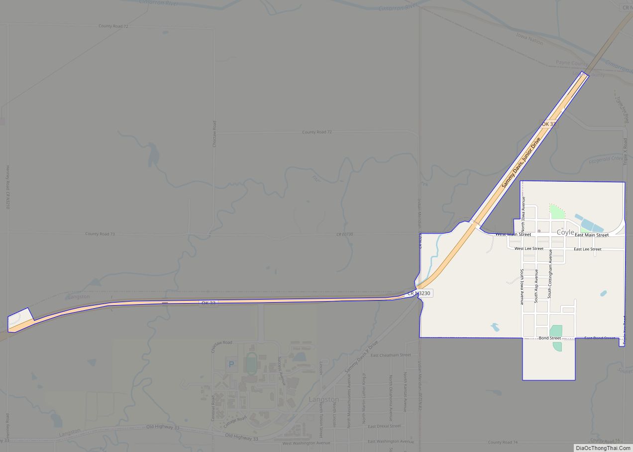
Coyle is a town in Logan County, Oklahoma, United States. The population was 325 at the 2010 census, compared to the figure of 337 in 2000. It is part of the Oklahoma City metropolitan area. The town was named for William Coyle, an influential Guthrie business man. Founded in Oklahoma Territory before statehood, Coyle initially … Read more

Map of Cowlington town

Map of Cowlington town

Cowlington is a town in LeFlore County, Oklahoma. It is part of the Fort Smith metropolitan area. The population was 155 at the time of the 2010 census, a gain of 16.5 percent over the figure of 133 recorded in 2000. Cowlington town overview: Name: Cowlington town LSAD Code: 43 LSAD Description: town (suffix) State: … Read more

Map of Del City city

Map of Del City

Del City is a city in Oklahoma County, Oklahoma, United States, and a part of the Oklahoma City metropolitan area. The population was 21,822 at the United States Census, 2020, a 2.3% increase from 2010. Del City is located near two major interstate highways, both of which connect it to Oklahoma City. Interstate 40 bisects … Read more

Map of Deer Lick CDP

Map of Deer Lick CDP

Deer Lick is an unincorporated community and census-designated place (CDP) in Delaware County, Oklahoma, United States. The population was 46 at the 2010 census. Deer Lick CDP overview: Name: Deer Lick CDP LSAD Code: 57 LSAD Description: CDP (suffix) State: Oklahoma County: Delaware County Elevation: 1,060 ft (320 m) Total Area: 0.95 sq mi (2.47 km²) Land Area: 0.95 sq mi (2.47 km²) … Read more

Map of Deer Creek town, Oklahoma

Map of Deer Creek town, Oklahoma

Deer Creek is a town in Grant County, Oklahoma, United States. The population was 130 at the 2010 census, an 11.6 percent decrease from the figure of 147 in 2000. It was named for a nearby stream, which is a tributary of the Salt Fork of the Arkansas River. Deer Creek town overview: Name: Deer … Read more

Map of Davis city, Oklahoma

Map of Davis city, Oklahoma

Davis is a city in Garvin and Murray counties in the U.S. state of Oklahoma. The population was 2,683 at the 2010 census. Davis city overview: Name: Davis city LSAD Code: 25 LSAD Description: city (suffix) State: Oklahoma County: Garvin County, Murray County Elevation: 846 ft (258 m) Total Area: 9.28 sq mi (24.03 km²) Land Area: 9.26 sq mi (23.98 km²) Water … Read more