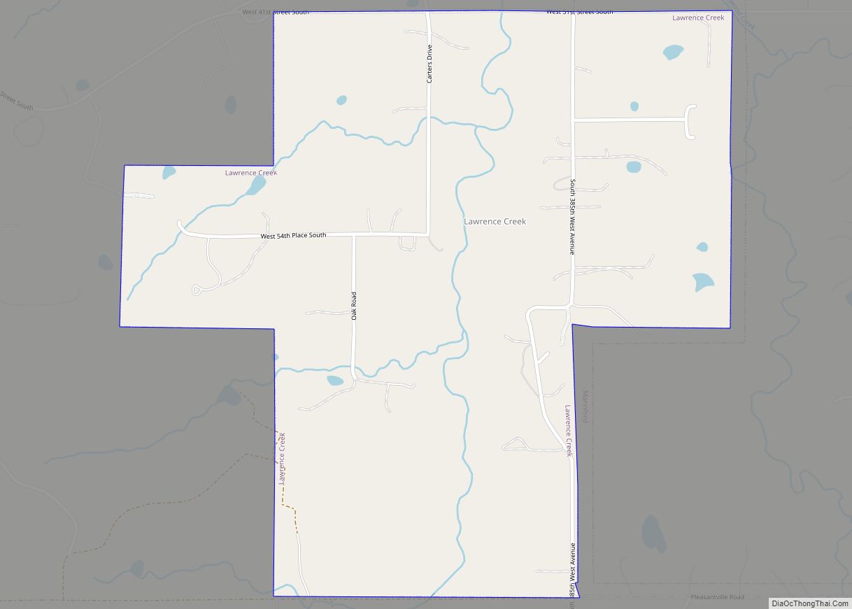
Map of Lenapah town
Lenapah is a town in north central Nowata County, Oklahoma, United States, eleven miles north of Nowata and sixty two miles northeast of Tulsa. Its name is an adaptation of Lenape, the name of a Delaware Tribe of Indians. The population was 293 at the 2010 census, a 1.7 percent decrease from the figure of ... Read more
Map of Lenapah town
Map of Lehigh city, Oklahoma
Lehigh is a city in Coal County, Oklahoma, United States. Its population was 356 at the 2010 census. Lehigh city overview: Name: Lehigh city LSAD Code: 25 LSAD Description: city (suffix) State: Oklahoma County: Coal County Elevation: 620 ft (189 m) Total Area: 1.62 sq mi (4.20 km²) Land Area: 1.57 sq mi (4.07 km²) Water Area: 0.05 sq mi (0.14 km²) Total Population: 272 Population ... Read more
Map of Lehigh city, Oklahoma
Map of Lone Wolf town
Lone Wolf is a town in Kiowa County, Oklahoma, United States. The population was 438 at the 2010 census, a decline of 12.4 percent from 500 in 2000. The town was named for Chief Lone Wolf (1843–1923), a warrior chief of the Kiowa who fought to preserve his people’s autonomy and way of life. Lone ... Read more
Map of Lone Wolf town
Map of Lone Grove city
Lone Grove is a city in Carter County, Oklahoma, United States. The population was 5,054 at the 2010 census. It is part of the Micropolitan Statistical Area of Ardmore. The city, located 7 miles (11 km) west of Ardmore on U.S. Route 70, is a bedroom community, with many residents employed in Ardmore. Lone Grove city ... Read more
Map of Lone Grove city
Map of Locust Grove town, Oklahoma
Locust Grove is a town in Mayes County, Oklahoma, United States. The population was 1,423 at the 2010 census, a 4.2 percent increase over the figure of 1,366 recorded in 2000. Locust Grove town overview: Name: Locust Grove town LSAD Code: 43 LSAD Description: town (suffix) State: Oklahoma County: Mayes County Elevation: 676 ft (206 m) Total ... Read more
Map of Locust Grove town, Oklahoma
Map of Loco town
Loco is a village in Stephens County, Oklahoma, United States. The population was 150 at the 2000 census. Loco town overview: Name: Loco town LSAD Code: 43 LSAD Description: town (suffix) State: Oklahoma County: Stephens County Elevation: 968 ft (295 m) Total Area: 0.26 sq mi (0.68 km²) Land Area: 0.26 sq mi (0.68 km²) Water Area: 0.00 sq mi (0.00 km²) Total Population: 99 Population ... Read more
Map of Loco town
Map of Lindsay city, Oklahoma
Lindsay is a city in Garvin County, Oklahoma, United States. The population was 2,840 at the 2010 census. It once promoted itself as “The Broomcorn Capital of the World” but no longer uses that slogan, as broomcorn is no longer raised in the area. Lindsay city overview: Name: Lindsay city LSAD Code: 25 LSAD Description: ... Read more
Map of Lindsay city, Oklahoma
Map of Limestone CDP, Oklahoma
Limestone is a census-designated place (CDP) in Rogers County, Oklahoma, United States, at an elevation of 705 feet. It is located less than 10 miles west of Claremore, Oklahoma on Oklahoma State Highway 20. The population was 753 as of July 2020. Limestone CDP overview: Name: Limestone CDP LSAD Code: 57 LSAD Description: CDP (suffix) ... Read more
Map of Limestone CDP, Oklahoma
Map of Lima town, Oklahoma
Lima is a town in Seminole County, Oklahoma, United States. The population was 53 at the 2010 census, a 28.4 percent decline from the figure of 74 recorded in 2000. Lima town overview: Name: Lima town LSAD Code: 43 LSAD Description: town (suffix) State: Oklahoma County: Seminole County Elevation: 876 ft (267 m) Total Area: 0.47 sq mi (1.22 km²) ... Read more
Map of Lima town, Oklahoma
Map of Liberty CDP, Oklahoma
Liberty is an unincorporated community and census-designated place in Sequoyah County, Oklahoma, United States. Its population was 220 as of the 2010 census. Liberty had a post office from August 24, 1914, until August 15, 1927. Liberty CDP overview: Name: Liberty CDP LSAD Code: 57 LSAD Description: CDP (suffix) State: Oklahoma County: Sequoyah County Elevation: ... Read more
Map of Liberty CDP, Oklahoma
Map of Lexington city, Oklahoma
Lexington is a city in Cleveland County, Oklahoma, United States. The city population was 2010 at the 2020 census, a 6.6% decrease from 2010. Lexington city overview: Name: Lexington city LSAD Code: 25 LSAD Description: city (suffix) State: Oklahoma County: Cleveland County Elevation: 1,033 ft (315 m) Total Area: 2.48 sq mi (6.43 km²) Land Area: 2.41 sq mi (6.24 km²) Water Area: ... Read more
Map of Lexington city, Oklahoma
Map of Lequire CDP
Lequire CDP overview: Name: Lequire CDP LSAD Code: 57 LSAD Description: CDP (suffix) State: Oklahoma FIPS code: 4042600 Online Interactive Map Lequire online map. Source: Basemap layers from Google Map, Open Street Map (OSM), Arcgisonline, Wmflabs. Boundary Data from Database of Global Administrative Areas. Lequire location map. Where is Lequire CDP? Lequire Road Map Lequire ... Read more
Map of Lequire CDP