Oakwood is a town in Dewey County, Oklahoma, United States. The population was 65 at the 2010 census. Oakwood town overview: Name: Oakwood town LSAD Code: 43 LSAD Description: town (suffix) State: Oklahoma County: Dewey County Elevation: 1,834 ft (559 m) Total Area: 0.24 sq mi (0.61 km²) Land Area: 0.24 sq mi (0.61 km²) Water Area: 0.00 sq mi (0.00 km²) Total Population: 74 Population ... Read more
Oklahoma Cities and Places
Oaks is a town in Cherokee and Delaware counties in the U.S. state of Oklahoma. The population was 288 at the 2010 census, a decrease from the figure of 412 recorded in 2000. Oaks town overview: Name: Oaks town LSAD Code: 43 LSAD Description: town (suffix) State: Oklahoma County: Cherokee County, Delaware County Elevation: 1,030 ft ... Read more
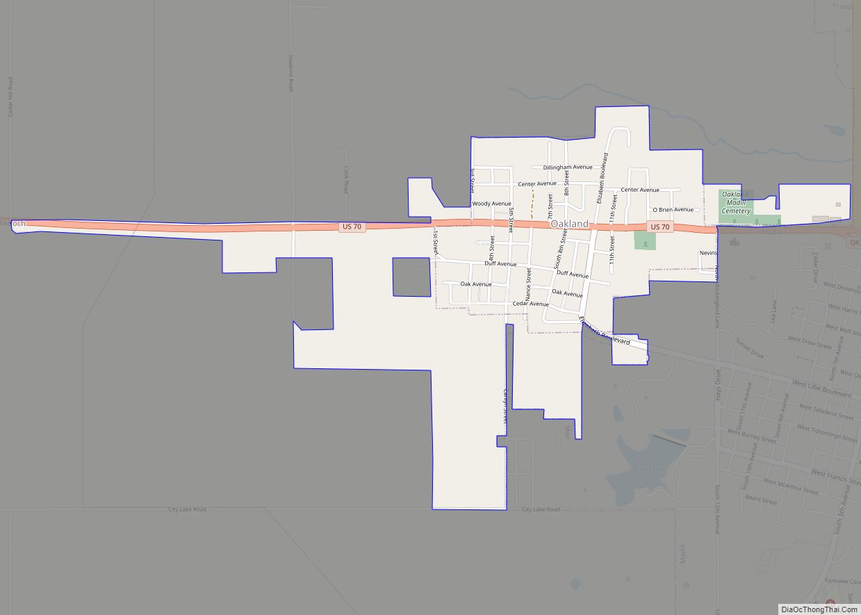
Oakland is a town in Marshall County, Oklahoma, United States. The population was 674 at the 2000 census and grew to a population of 1,057 as of the 2010 census, an increase of 56.8%. Oakland town overview: Name: Oakland town LSAD Code: 43 LSAD Description: town (suffix) State: Oklahoma County: Marshall County Elevation: 810 ft (247 m) ... Read more
Oakhurst is an unincorporated community and census-designated place (CDP) in Creek and Tulsa counties in the U.S. state of Oklahoma. The population was 2,185 at the 2010 census, a loss of 20 percent from 2,731 at the 2000 census. Oakhurst CDP overview: Name: Oakhurst CDP LSAD Code: 57 LSAD Description: CDP (suffix) State: Oklahoma County: ... Read more
Oak Grove town overview: Name: Oak Grove town LSAD Code: 43 LSAD Description: town (suffix) State: Oklahoma County: Pawnee County FIPS code: 4053210 Online Interactive Map Oak Grove online map. Source: Basemap layers from Google Map, Open Street Map (OSM), Arcgisonline, Wmflabs. Boundary Data from Database of Global Administrative Areas. Oak Grove location map. Where ... Read more
Nowata (Lenape: Nuwatu, Nuwi ta ) is a city and county seat of Nowata County, Oklahoma, United States. The population was 3,731 at the United States Census, 2010, a 6.0 percent decline from the figure of 3,971 recorded in 2000. The area where it was established was then part of the Cherokee Nation in Indian ... Read more
Okeene is a town in Blaine County, Oklahoma, United States. The population was 1,204 at the 2010 census. The name was created by combining the last letters of Cherokee and Cheyenne. Okeene town overview: Name: Okeene town LSAD Code: 43 LSAD Description: town (suffix) State: Oklahoma County: Blaine County Elevation: 1,217 ft (371 m) Total Area: 2.26 sq mi ... Read more
Orlando is a town in Logan and Payne counties in the U.S. state of Oklahoma. The population was 148 at the 2010 census, compared to the figure of 201 in 2000. It is part of the Oklahoma City Metropolitan Statistical Area. Orlando town overview: Name: Orlando town LSAD Code: 43 LSAD Description: town (suffix) State: ... Read more
Optima is a town in Texas County, Oklahoma, United States. The population was 356 at the 2010 census. Optima town overview: Name: Optima town LSAD Code: 43 LSAD Description: town (suffix) State: Oklahoma County: Texas County Elevation: 3,022 ft (921 m) Total Area: 0.53 sq mi (1.38 km²) Land Area: 0.53 sq mi (1.38 km²) Water Area: 0.00 sq mi (0.00 km²) Total Population: 338 Population ... Read more
Oologah is a town in Rogers County, Oklahoma, United States. The renowned humorist Will Rogers was born on a ranch two miles east of Oologah, although he usually claimed Claremore as his birthplace “because nobody but an Indian can pronounce ‘Oologah.'” There has been disagreement about the proper spelling for the town name, but, nowadays, ... Read more
Olustee is a town in Jackson County, Oklahoma, United States. “Olustee” is said to be a Seminole word meaning “pond” or from the Creek (Muscogee) language ue-lvste (/oy-lást-i/) meaning “black water”, and being taken from the Battle of Olustee in Florida. The population was 607 at the 2010 census. Olustee town overview: Name: Olustee town ... Read more
Old Green is a census-designated place (CDP) in Adair County, Oklahoma, United States. The population was 315 at the 2010 census. Old Green CDP overview: Name: Old Green CDP LSAD Code: 57 LSAD Description: CDP (suffix) State: Oklahoma County: Adair County Elevation: 1,093 ft (333 m) Total Area: 3.16 sq mi (8.18 km²) Land Area: 3.14 sq mi (8.14 km²) Water Area: 0.02 sq mi ... Read more