Nowata (Lenape: Nuwatu, Nuwi ta ) is a city and county seat of Nowata County, Oklahoma, United States. The population was 3,731 at the United States Census, 2010, a 6.0 percent decline from the figure of 3,971 recorded in 2000. The area where it was established was then part of the Cherokee Nation in Indian Territory.
| Name: | Nowata city |
|---|---|
| LSAD Code: | 25 |
| LSAD Description: | city (suffix) |
| State: | Oklahoma |
| County: | Nowata County |
| Elevation: | 709 ft (216 m) |
| Total Area: | 3.41 sq mi (8.83 km²) |
| Land Area: | 3.40 sq mi (8.82 km²) |
| Water Area: | 0.00 sq mi (0.01 km²) |
| Total Population: | 3,517 |
| Population Density: | 1,032.89/sq mi (398.83/km²) |
| ZIP code: | 74048 |
| Area code: | 539/918 |
| FIPS code: | 4052900 |
| GNISfeature ID: | 1096069 |
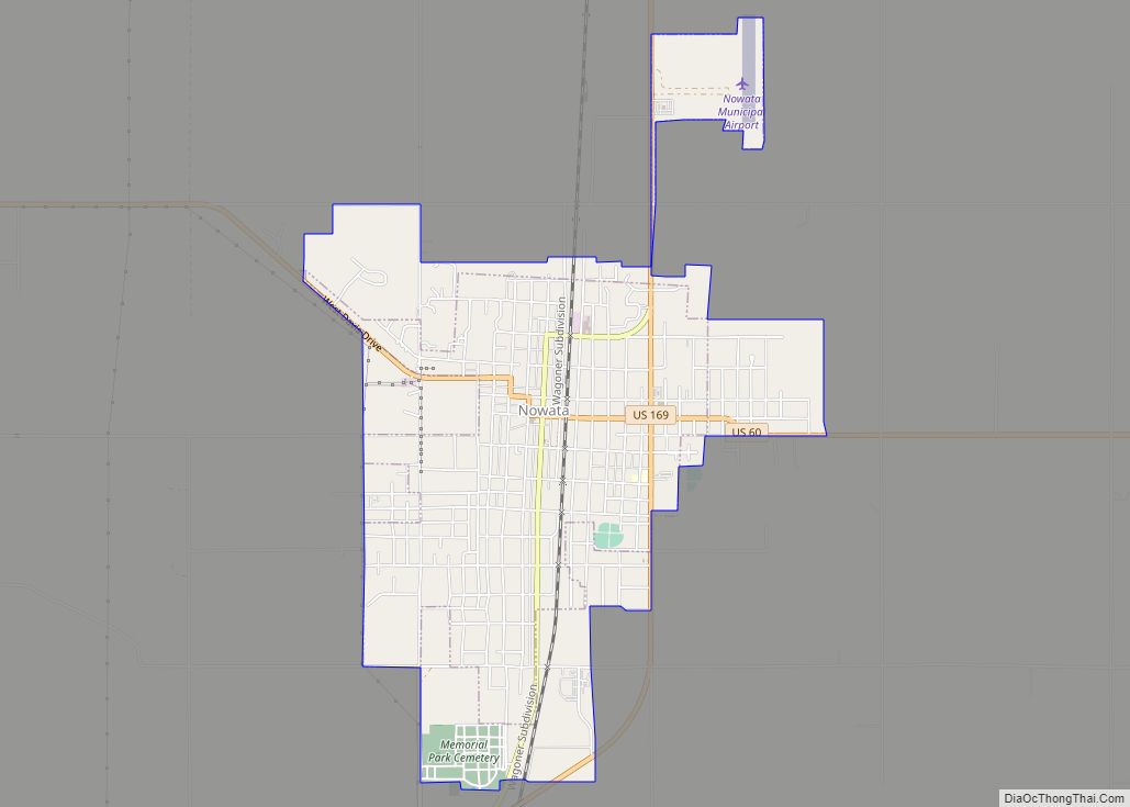
Online Interactive Map
Click on ![]() to view map in "full screen" mode.
to view map in "full screen" mode.
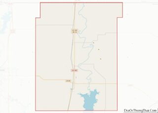
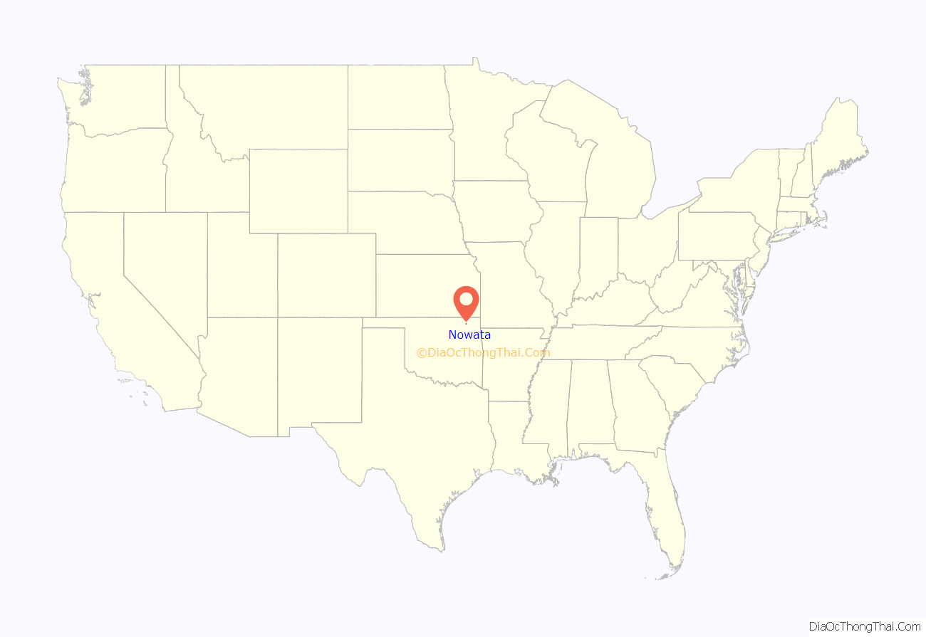
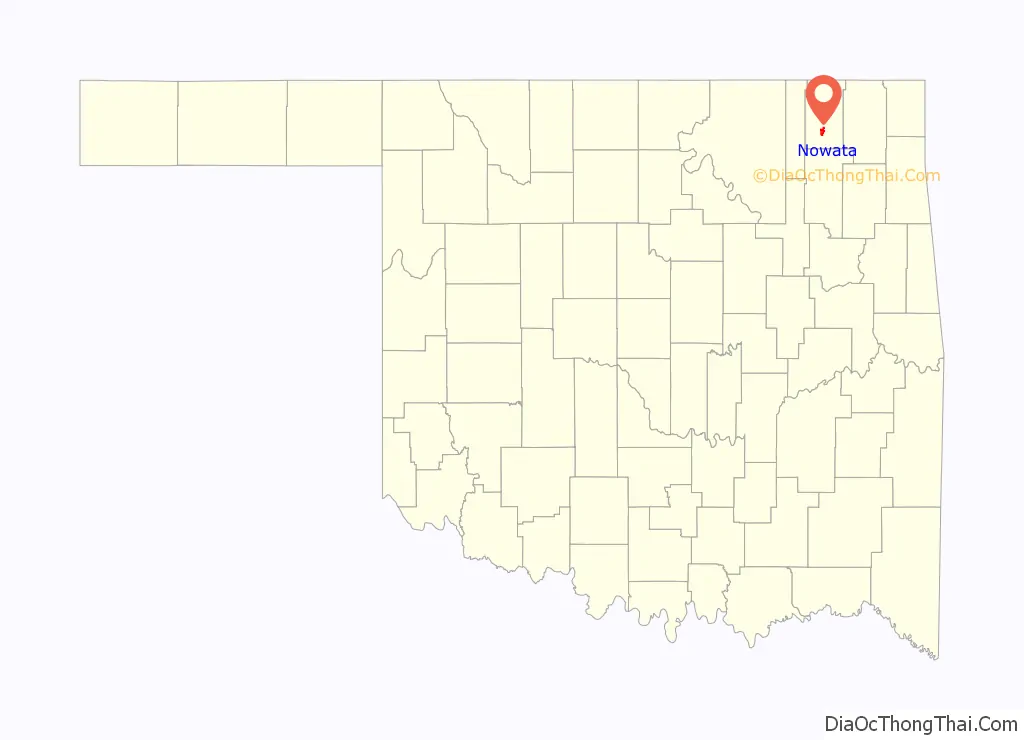
Nowata location map. Where is Nowata city?
History
The first community established at this site was named Metz, named for its first postmaster, Fred Metzner. The name was changed even before the railroad was built in 1889. Nowata served as a train stop for Native Americans from the East being forced to resettle by the United States government. Some controversy exists about the meaning of the town name. The Lenape tribesmen who passed through named it “nuwita,” meaning “friendly” or “welcome.” In the Cherokee language, the town is called ᎠᎹᏗᎧᏂᎬᎬ (A-ma-di-ka-ni-gunh-gunh, roughly), which means, “water is all gone,” translating what it sounded like the word meant: No Water.
In 1889, the Kansas and Arkansas Valley Railway (later part of the Missouri Pacific Railway) built a line through Nowata. A post office was established in the town on November 8, 1889. Nowata was incorporated April 17, 1899. By 1900, Nowata had 498 residents.
Oil and gas were discovered nearby in 1904, stimulating the Nowata economy. The find established Nowata as “…a region (having) a reputation for being the world’s largest shallow oil field.” Some wells in this field have continued to produce into the twenty-first century.
A Federal court was established in 1904, and met on the third floor of the new building owned by the First National Bank of Nowata. The building housing the court burned down in 1909, destroying all records and forcing the court to move temporarily to another building. When Oklahoma became a state on November 16, 1907, Nowata County was created and named for the city, which was designated as the county seat. By that time, the city population had climbed to 2,233. A permanent Nowata County Courthouse was completed in 1912, and remains in use at present. It is the only local property listed on the National Record of Historic Places.
On September 29, 1916, two men, accused of killing a deputy sheriff, were taken from the Nowata jail by a mob and lynched in front of the courthouse.
Nowata’s peak population was 4,435 in 1920. It became the southern terminus of the Union Electric Railway, which continued to serve the city until 1948. Newspapers included the Nowata Herald and the Nowata Advertiser. The town had 850 telephones by 1930, when the census showed its first population decline, to nearly the 1910 level.
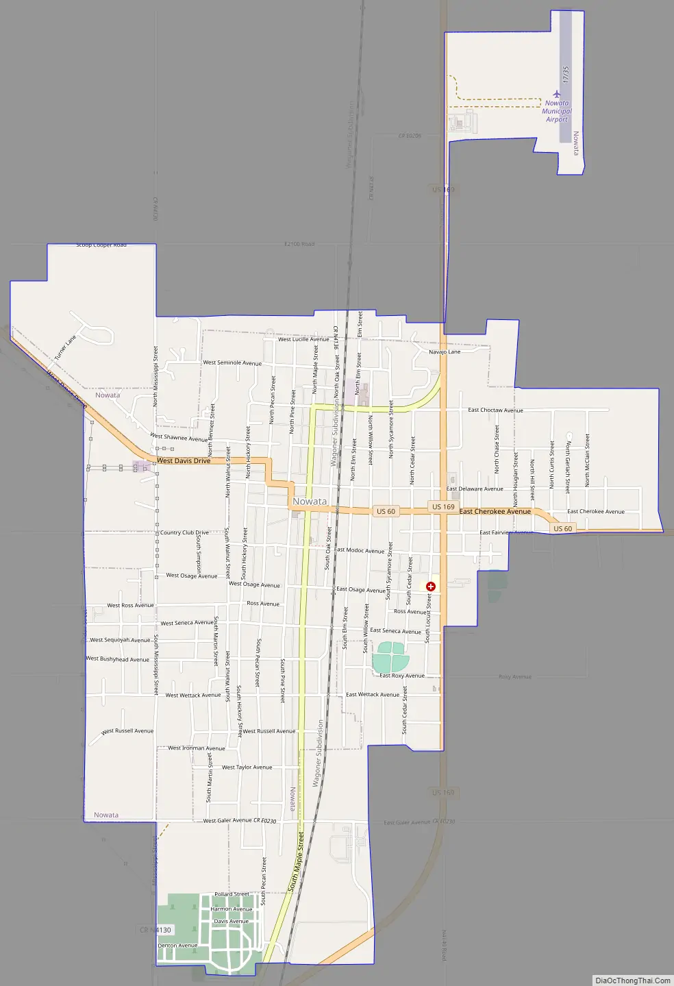
Nowata Road Map
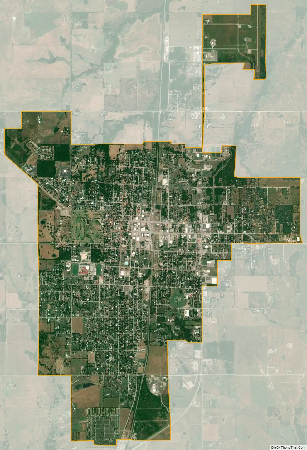
Nowata city Satellite Map
Geography
Nowata is 51 miles (82 km) north of Tulsa and 21 miles (34 km) south of the Kansas state line. According to the United States Census Bureau, the city has a total area of 3.1 square miles (8.0 km), all land. Yet the Virdigris River runs through it.
Climate
Nowata is the home of the coldest temperature ever recorded in the state of Oklahoma. A thermometer at an Oklahoma Mesonet site in Nowata recorded a low temperature of −31 °F (−35 °C) on the morning of February 10, 2011. A week later, the high temperature was 79 °F (26 °C), which is 110°F (61°C) higher.
See also
Map of Oklahoma State and its subdivision:- Adair
- Alfalfa
- Atoka
- Beaver
- Beckham
- Blaine
- Bryan
- Caddo
- Canadian
- Carter
- Cherokee
- Choctaw
- Cimarron
- Cleveland
- Coal
- Comanche
- Cotton
- Craig
- Creek
- Custer
- Delaware
- Dewey
- Ellis
- Garfield
- Garvin
- Grady
- Grant
- Greer
- Harmon
- Harper
- Haskell
- Hughes
- Jackson
- Jefferson
- Johnston
- Kay
- Kingfisher
- Kiowa
- Latimer
- Le Flore
- Lincoln
- Logan
- Love
- Major
- Marshall
- Mayes
- McClain
- McCurtain
- McIntosh
- Murray
- Muskogee
- Noble
- Nowata
- Okfuskee
- Oklahoma
- Okmulgee
- Osage
- Ottawa
- Pawnee
- Payne
- Pittsburg
- Pontotoc
- Pottawatomie
- Pushmataha
- Roger Mills
- Rogers
- Seminole
- Sequoyah
- Stephens
- Texas
- Tillman
- Tulsa
- Wagoner
- Washington
- Washita
- Woods
- Woodward
- Alabama
- Alaska
- Arizona
- Arkansas
- California
- Colorado
- Connecticut
- Delaware
- District of Columbia
- Florida
- Georgia
- Hawaii
- Idaho
- Illinois
- Indiana
- Iowa
- Kansas
- Kentucky
- Louisiana
- Maine
- Maryland
- Massachusetts
- Michigan
- Minnesota
- Mississippi
- Missouri
- Montana
- Nebraska
- Nevada
- New Hampshire
- New Jersey
- New Mexico
- New York
- North Carolina
- North Dakota
- Ohio
- Oklahoma
- Oregon
- Pennsylvania
- Rhode Island
- South Carolina
- South Dakota
- Tennessee
- Texas
- Utah
- Vermont
- Virginia
- Washington
- West Virginia
- Wisconsin
- Wyoming