Oakland is a town in Marshall County, Oklahoma, United States. The population was 674 at the 2000 census and grew to a population of 1,057 as of the 2010 census, an increase of 56.8%.
| Name: | Oakland town |
|---|---|
| LSAD Code: | 43 |
| LSAD Description: | town (suffix) |
| State: | Oklahoma |
| County: | Marshall County |
| Elevation: | 810 ft (247 m) |
| Total Area: | 1.43 sq mi (3.70 km²) |
| Land Area: | 1.43 sq mi (3.70 km²) |
| Water Area: | 0.00 sq mi (0.00 km²) |
| Total Population: | 831 |
| Population Density: | 581.12/sq mi (224.40/km²) |
| ZIP code: | 73446 |
| Area code: | 580 |
| FIPS code: | 4053400 |
| GNISfeature ID: | 1096148 |
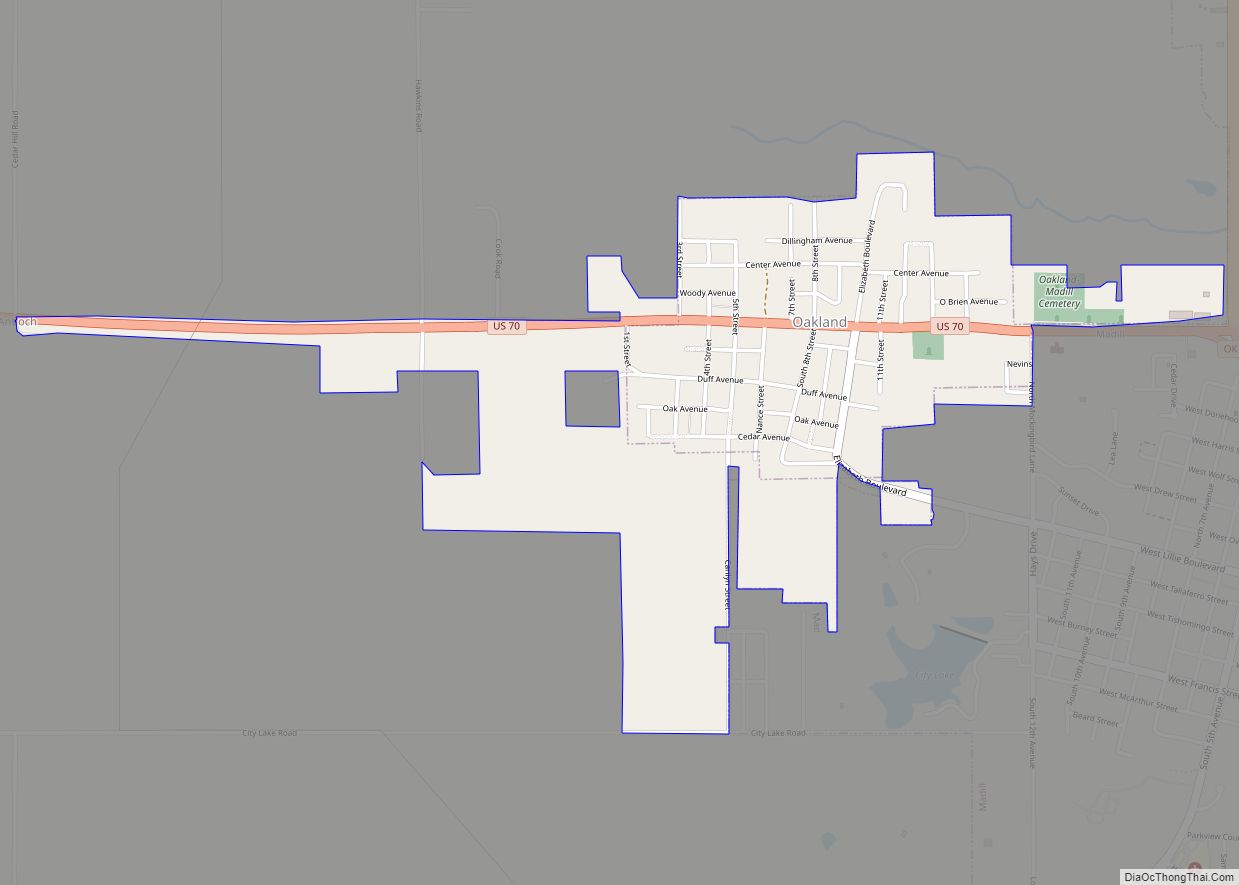
Online Interactive Map
Click on ![]() to view map in "full screen" mode.
to view map in "full screen" mode.
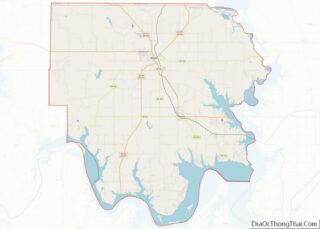
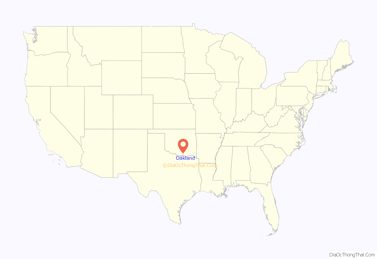
Oakland location map. Where is Oakland town?

History
Oakland was county seat of Pickens County, Chickasaw Nation. As county seat, it hosted the county courthouse. Although never a sizable population center, the community was busy during sessions of county court, particularly since Pickens County sprawled from Chickasha in the far northwest to Madill in the southeast.
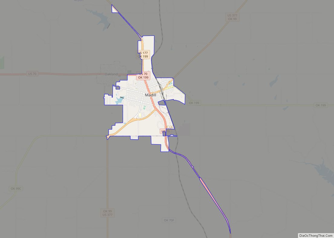
Oakland Road Map
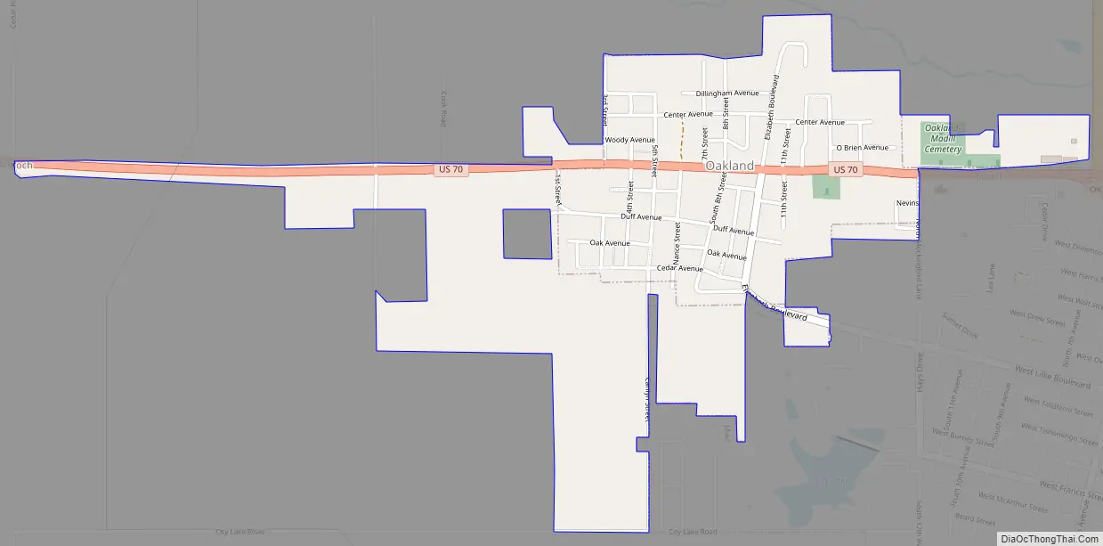
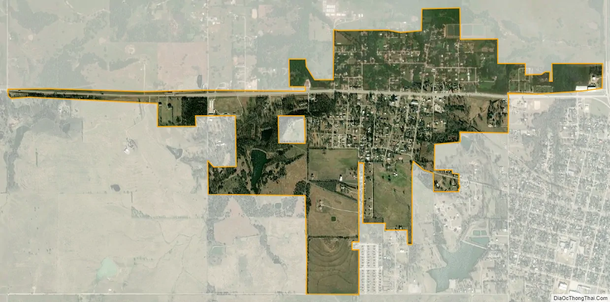
Oakland city Satellite Map
Geography
Oakland is located at 34°5′58″N 96°47′36″W / 34.09944°N 96.79333°W / 34.09944; -96.79333 (34.099509, -96.793409).
According to the United States Census Bureau, the town has a total area of 0.6 square miles (1.6 km), all land.
See also
Map of Oklahoma State and its subdivision:- Adair
- Alfalfa
- Atoka
- Beaver
- Beckham
- Blaine
- Bryan
- Caddo
- Canadian
- Carter
- Cherokee
- Choctaw
- Cimarron
- Cleveland
- Coal
- Comanche
- Cotton
- Craig
- Creek
- Custer
- Delaware
- Dewey
- Ellis
- Garfield
- Garvin
- Grady
- Grant
- Greer
- Harmon
- Harper
- Haskell
- Hughes
- Jackson
- Jefferson
- Johnston
- Kay
- Kingfisher
- Kiowa
- Latimer
- Le Flore
- Lincoln
- Logan
- Love
- Major
- Marshall
- Mayes
- McClain
- McCurtain
- McIntosh
- Murray
- Muskogee
- Noble
- Nowata
- Okfuskee
- Oklahoma
- Okmulgee
- Osage
- Ottawa
- Pawnee
- Payne
- Pittsburg
- Pontotoc
- Pottawatomie
- Pushmataha
- Roger Mills
- Rogers
- Seminole
- Sequoyah
- Stephens
- Texas
- Tillman
- Tulsa
- Wagoner
- Washington
- Washita
- Woods
- Woodward
- Alabama
- Alaska
- Arizona
- Arkansas
- California
- Colorado
- Connecticut
- Delaware
- District of Columbia
- Florida
- Georgia
- Hawaii
- Idaho
- Illinois
- Indiana
- Iowa
- Kansas
- Kentucky
- Louisiana
- Maine
- Maryland
- Massachusetts
- Michigan
- Minnesota
- Mississippi
- Missouri
- Montana
- Nebraska
- Nevada
- New Hampshire
- New Jersey
- New Mexico
- New York
- North Carolina
- North Dakota
- Ohio
- Oklahoma
- Oregon
- Pennsylvania
- Rhode Island
- South Carolina
- South Dakota
- Tennessee
- Texas
- Utah
- Vermont
- Virginia
- Washington
- West Virginia
- Wisconsin
- Wyoming