Map of Pond Creek city

Map of Pond Creek city

Pond Creek is a city in Grant County, Oklahoma, United States, along the Salt Fork Arkansas River. As of the 2010 census, the city population was 856, a 4.5 percent decline from the figure of 896 in 2000. Pond Creek city overview: Name: Pond Creek city LSAD Code: 25 LSAD Description: city (suffix) State: Oklahoma … Read more

Map of Ponca City city

Map of Ponca City

Ponca City (Iowa-Oto: Chína Uhánⁿdhe) is a city in Kay County in the U.S. state of Oklahoma. The city was named after the Ponca tribe. Ponca City had a population of 25,387 at the time of the 2010 census- and a population of 24,424 in the 2020 census. Ponca City overview: Name: Ponca City LSAD … Read more

Map of Pocola town

Map of Pocola town

Pocola is a town in Le Flore County, Oklahoma, United States. It is part of the Fort Smith, Arkansas-Oklahoma metropolitan area. The population was 4,056 in 2010, a gain of 1.6 percent over the figure of 3,994 recorded in 2000. Pocola is a Choctaw word meaning “ten”, the approximate distance in miles from Fort Smith, … Read more

Map of Pocasset town, Oklahoma

Map of Pocasset town, Oklahoma

Pocasset is a town in Grady County, Oklahoma, United States. The population was 183 at the 2020 census, a 17.3% increase from 2010. Pocasset town overview: Name: Pocasset town LSAD Code: 43 LSAD Description: town (suffix) State: Oklahoma County: Grady County Elevation: 1,194 ft (364 m) Total Area: 2.71 sq mi (7.03 km²) Land Area: 2.71 sq mi (7.03 km²) Water Area: 0.00 sq mi … Read more

Map of Platter CDP

Map of Platter CDP

Platter CDP overview: Name: Platter CDP LSAD Code: 57 LSAD Description: CDP (suffix) State: Oklahoma FIPS code: 4059500 Online Interactive Map Platter online map. Source: Basemap layers from Google Map, Open Street Map (OSM), Arcgisonline, Wmflabs. Boundary Data from Database of Global Administrative Areas. Platter location map. Where is Platter CDP? Platter Road Map Platter … Read more

Map of Pittsburg town, Oklahoma

Map of Pittsburg town, Oklahoma

Pittsburg is a town in Pittsburg County, Oklahoma, United States. The population was 280 at the 2000 census. Pittsburg town overview: Name: Pittsburg town LSAD Code: 43 LSAD Description: town (suffix) State: Oklahoma County: Pittsburg County Elevation: 764 ft (233 m) Total Area: 0.48 sq mi (1.24 km²) Land Area: 0.48 sq mi (1.24 km²) Water Area: 0.00 sq mi (0.00 km²) Total Population: 180 Population … Read more

Map of Pink town

Map of Pink town

Pink is a town in Pottawatomie County, Oklahoma, United States, and is part of the Oklahoma City Metropolitan Area. The only town in the United States bearing this name, Pink lies within the boundaries of the Citizen Potawatomi Nation. The 2010 census population was 2,058, a 76.7 percent increase from the figure of 1,165 in … Read more

Map of Pinhook Corner CDP

Map of Pinhook Corner CDP

Pinhook Corners is a census-designated place (CDP) in Sequoyah County, Oklahoma, United States. It is part of the Fort Smith, Arkansas-Oklahoma Metropolitan Statistical Area. The population was 161 at the 2000 census. Pinhook Corner CDP overview: Name: Pinhook Corner CDP LSAD Code: 57 LSAD Description: CDP (suffix) State: Oklahoma County: Sequoyah County Elevation: 692 ft (211 m) … Read more

Map of Piney CDP, Oklahoma

Map of Piney CDP, Oklahoma

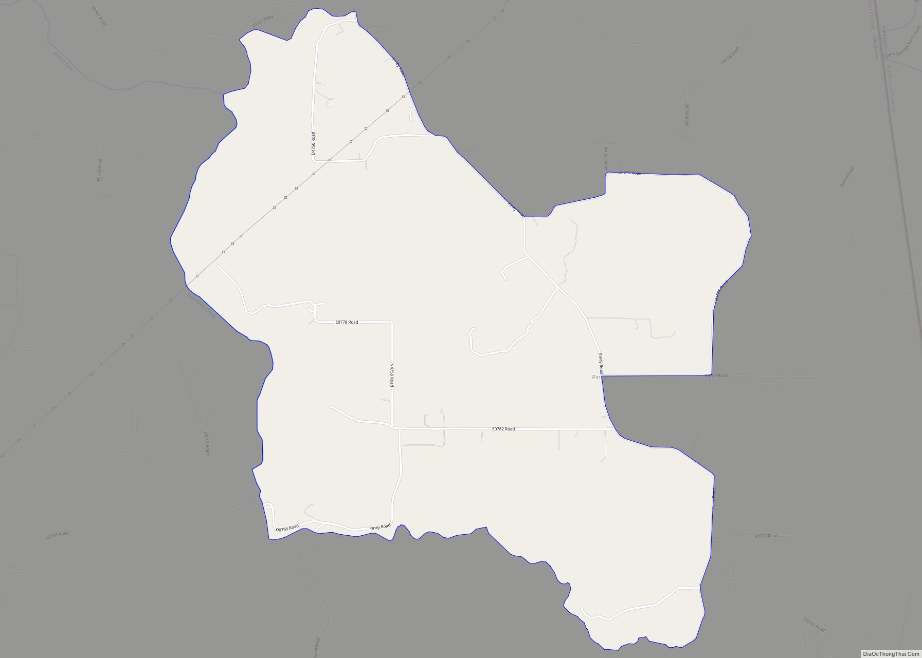
Piney is a census-designated place (CDP) in Adair County, Oklahoma, United States. The population was 115 at the 2010 census. Piney was the “head town” of the first wave of relocated Cherokee people (the “Old Settlers”) who relocated there from their ancestral homelands in the southeastern United States. Piney CDP overview: Name: Piney CDP LSAD … Read more

Map of Pin Oak Acres CDP

Map of Pin Oak Acres CDP

Pin Oak Acres is a census-designated place (CDP) in Mayes County, Oklahoma, United States. The population was 427 at the 2000 census. Pin Oak Acres CDP overview: Name: Pin Oak Acres CDP LSAD Code: 57 LSAD Description: CDP (suffix) State: Oklahoma County: Mayes County Elevation: 643 ft (196 m) Total Area: 5.61 sq mi (14.53 km²) Land Area: 5.61 sq mi (14.53 km²) … Read more

Map of Poteau city

Map of Poteau city

Poteau (/ˈpoʊtoʊ/ POH-toh) is a city in, and county seat of, Le Flore County, Oklahoma, United States. The population was 8,520 as of the 2010 census. Poteau city overview: Name: Poteau city LSAD Code: 25 LSAD Description: city (suffix) State: Oklahoma County: Le Flore County Elevation: 489 ft (149 m) Total Area: 28.73 sq mi (74.40 km²) Land Area: 26.61 sq mi … Read more

Map of Porum town

Map of Porum town

Porum is a town in Muskogee County, Oklahoma, United States. It was named for John Porum Davis, a rancher, Civil War veteran, and Cherokee Nation councilman from the Canadian District in Indian Territory. The community was first known as Porum Gap, which united with another village named Starvilla in 1905. The product of this union … Read more