Ponca City (Iowa-Oto: Chína Uhánⁿdhe) is a city in Kay County in the U.S. state of Oklahoma. The city was named after the Ponca tribe. Ponca City had a population of 25,387 at the time of the 2010 census- and a population of 24,424 in the 2020 census.
| Name: | Ponca City city |
|---|---|
| LSAD Code: | 25 |
| LSAD Description: | city (suffix) |
| State: | Oklahoma |
| County: | Kay County |
| Founded: | 1893 |
| Incorporated: | 1899 |
| Elevation: | 1,011 ft (308 m) |
| Total Area: | 19.61 sq mi (50.78 km²) |
| Land Area: | 18.38 sq mi (47.60 km²) |
| Water Area: | 1.23 sq mi (3.19 km²) |
| Total Population: | 24,424 |
| Population Density: | 1,329.05/sq mi (513.15/km²) |
| ZIP code: | 74601-74604 |
| Area code: | 580 |
| FIPS code: | 4059850 |
| GNISfeature ID: | 1096815 |
| Website: | poncacityok.gov |
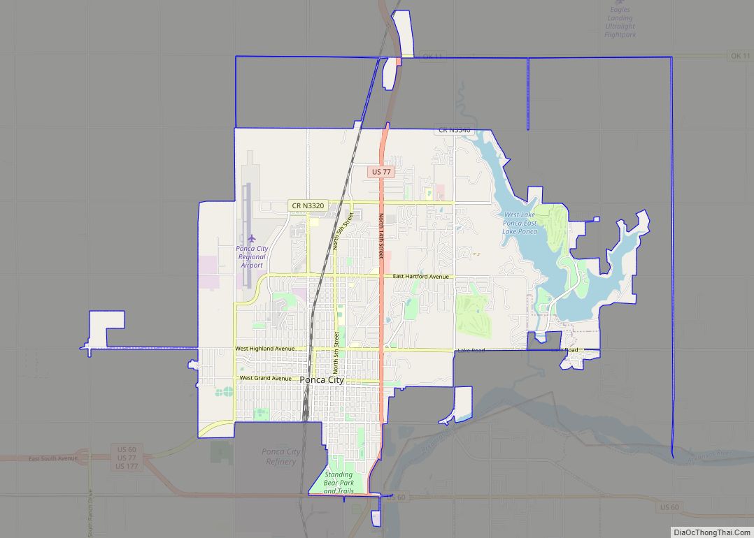
Online Interactive Map
Click on ![]() to view map in "full screen" mode.
to view map in "full screen" mode.
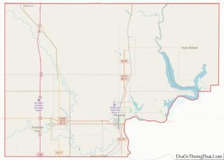
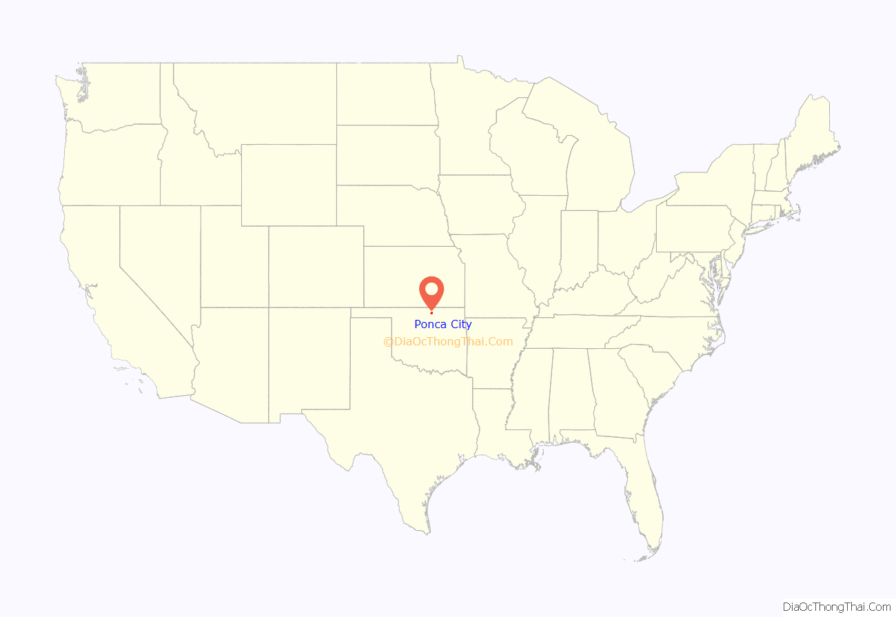
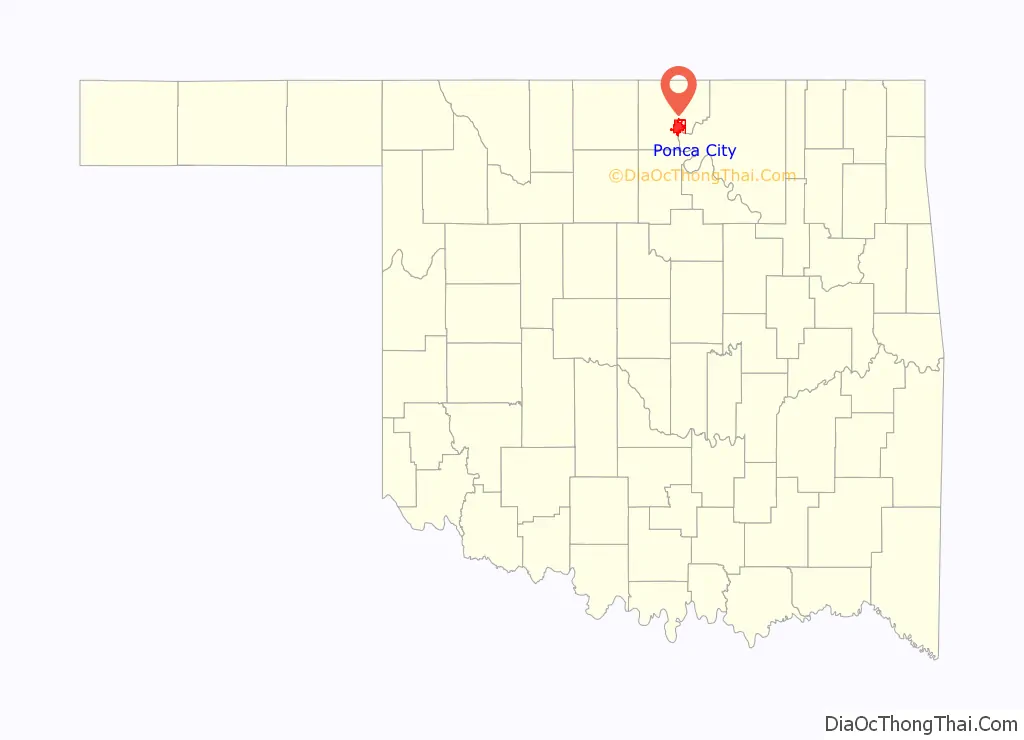
Ponca City location map. Where is Ponca City city?
History
Ponca City was created in 1893 as “New Ponca” after the United States opened the Cherokee Outlet for European-American settlement during the Cherokee Strip land run, the largest land run in United States history. The site for Ponca City was selected for its proximity to the Arkansas River and the presence of a freshwater spring near the river. The city was laid out by Burton Barnes, who drew up the first survey of the city and sold certificates for the lots he had surveyed. After the drawing for lots in the city was completed, Barnes was elected the city’s first mayor.
Another city, Cross, vied with Ponca City to become the leading city in the area. After the Atchison, Topeka and Santa Fe Railway had opened a station in Cross, people thought it would not open another in Ponca City because of the two cities’ proximity. New Ponca boosters eventually secured a station after offering the Santa Fe station agent two town lots and the free relocation of his house from Cross. Ponca City reportedly obtained its first boxcar station by some Ponca City supporters going to Cross and returning with the town’s station pulled behind them. Cross eventually became defunct, and today, what was once Cross is now a residential district in Ponca City. In 1913, New Ponca changed its name to Ponca City.
Petroleum industry
Ponca City’s history and economy has been shaped chiefly by the ebb and flow of the petroleum industry. E. W. Marland, a Pennsylvania oil man, came to Oklahoma and founded the Marland Oil Company, which once controlled about 10% of the world’s oil reserves. He founded the 101 Ranch Oil Company, located on the Miller Brothers 101 Ranch, and drilled his first successful oil well on land he leased in 1911 from the Ponca tribe of American Indians. He was elected in 1932 as a U.S. congressman and in 1934 as governor of Oklahoma.
Marland’s exploitation of oil reserves generated growth and wealth that were previously unimaginable on the Oklahoma prairie, and his company virtually built the city from the ground up. Marland and his associates built mansions to display their new wealth, including the Grand Home and the E.W. Marland Estate (once called the “Palace on the Prairie”). Because of this period of wealth and affluence, Ponca City has a high concentration of buildings that exemplify the popular Spanish Colonial Revival architecture of the period, as well as Art Deco-influenced buildings and homes.
The “Roaring ’20s” came to an end for Ponca City shortly before the Great Depression. After a successful takeover bid by J.P. Morgan, Jr., son of financier J.P. Morgan, Marland Oil Co. merged with Continental Oil Co. in the late 1920s. It was known as Conoco for more than 70 years. The company maintained its headquarters in Ponca City until 1949 and continued to grow into a global corporation.
During the oil boom years of the 1980s, Conoco was owned by the DuPont Corp., which took control of the company in 1981. After nearly two decades of ownership and an oil bust that crippled Oklahoma’s economy in the late 1980s, DuPont sold off its Conoco assets in 1998. In 2002, Conoco merged with Phillips Petroleum (another major petroleum player with roots in northern Oklahoma) to become ConocoPhillips. ConocoPhillips was then the sixth-largest publicly traded oil company in the world, and the third largest in the United States. It maintains a significant presence in its historic home state.
Since the company has reduced its workforce and facilities in the city, the population has declined steadily since the early 1990s. In February 2009, ConocoPhillips announced that all of its remaining nonrefinery operations in Ponca City (representing 750 jobs) would be moved out of the city. The city’s recent efforts to grow its economy beyond the petroleum industry have attracted a number of technology, manufacturing, and service jobs.Phillips 66 | Ponca City Refinery
In 2005, ConocoPhillips announced plans to build a $5 million museum across from its Ponca City refinery. Opened to the public in May 2007, the Conoco Museum features artifacts, photographs, and other historical items related to the petroleum industry and its culture in northern Oklahoma. A sister museum, Phillips Petroleum Company Museum, was to be opened in Bartlesville, Oklahoma. Funded by a private foundation, the Conoco Museum charges no admission fee.
In 2012, ConocoPhillips split into two separate companies, with the upstream portion retaining the ConocoPhillips name and the refining and transportation portions taking the name Phillips 66.
Based in Houston, Texas, Phillips 66 continues to operate a 200,000-barrel-per-day refinery. Phillips 66 | Ponca City Refinery in Ponca City.
Native Americans
Until recently, European Americans’ accounts of their settlement and the growth of the oil industry in Ponca City have often overshadowed both the long ancient history of indigenous peoples in the area, and those tribes who were resettled to Oklahoma in the 19th century under Indian Removal.
Ponca City is named after the Ponca tribe, part of whom were relocated from Nebraska to northern Oklahoma from 1877 to 1880. Like all of the forced American Indigenous removals of the 19th century, the Poncas’ trek was arduous. Followed by the United States government’s failure to provide adequate supplies and malaria at their destination, nearly one-third of the Ponca died from illness and exposure. “Out of 700 Ponca who left the Nebraska reservation, 158 died in Oklahoma within two years.”
The Ponca protested their conditions. An additional irritant occurred upon the death of Standing Bear’s oldest son in 1879. The chief had promised to bury him in his homeland, and about 60 Ponca accompanied him back to Nebraska. The U.S. Army was ordered to arrest them for having left the reservation, and they were confined to Fort Omaha. Most of the tribal members who left eventually returned to the reservation in Oklahoma. With the aid of prominent attorneys working pro bono, Standing Bear filed a writ of habeas corpus challenging his arrest. The case of Standing Bear v. Crook (1879) was a landmark decision in the U.S. District Court, where the judge ruled that Indians had the same legal rights as other United States citizens.
A statue of Standing Bear was erected in his honor at the intersection of Highway 60 and Standing Bear Parkway in Ponca City. In the late 20th century, the city developed a park and museum named in his honor. In addition to the Standing Bear Museum, the 63-acre park includes more than eight fully developed acres with off street parking, a one-acre pond and a walking trail.
The Ponca Nation, which has kept its headquarters south of Ponca City since 1879, played a major part in the development of the Marland Oil Company and the city. Chief White Eagle leased resource-containing portions of the tribe’s allotted land to E.W. Marland in 1911 for oil exploration and development.
Since the late 20th century, the Ponca tribe has worked to build its infrastructure and improve services for its people. In February 2006, the tribe received a grant of more than $800,000 from the Shakopee Mdewakanton Sioux Community of Minnesota for debt retirement and economic development.
Nearby north-central tribes are the Kaw, Osage, Otoe-Missouria, Pawnee, and Tonkawa. These are all federally recognized tribes, as is the Ponca Tribe of Indians of Oklahoma. In 1994, the six tribes established the Standing Bear Foundation and Pow-wow, beginning the first of annual shared pow-wows, to which they invite the public. They wanted to build collaboration among the tribes and with the non-Native residents of Ponca City. The pow-wow is now held in Standing Bear Park.
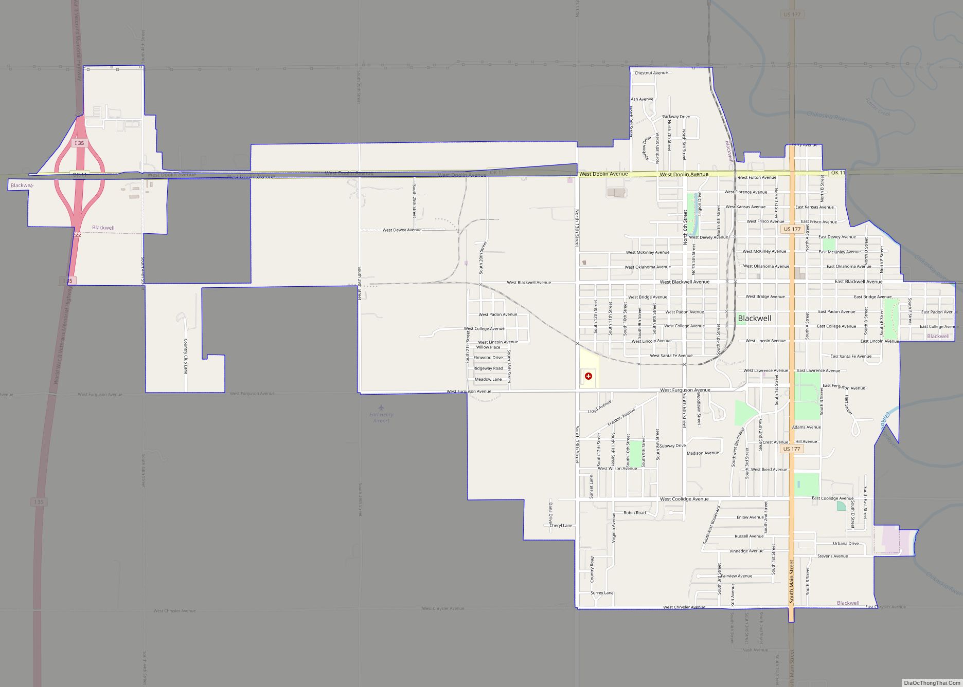
Ponca City Road Map
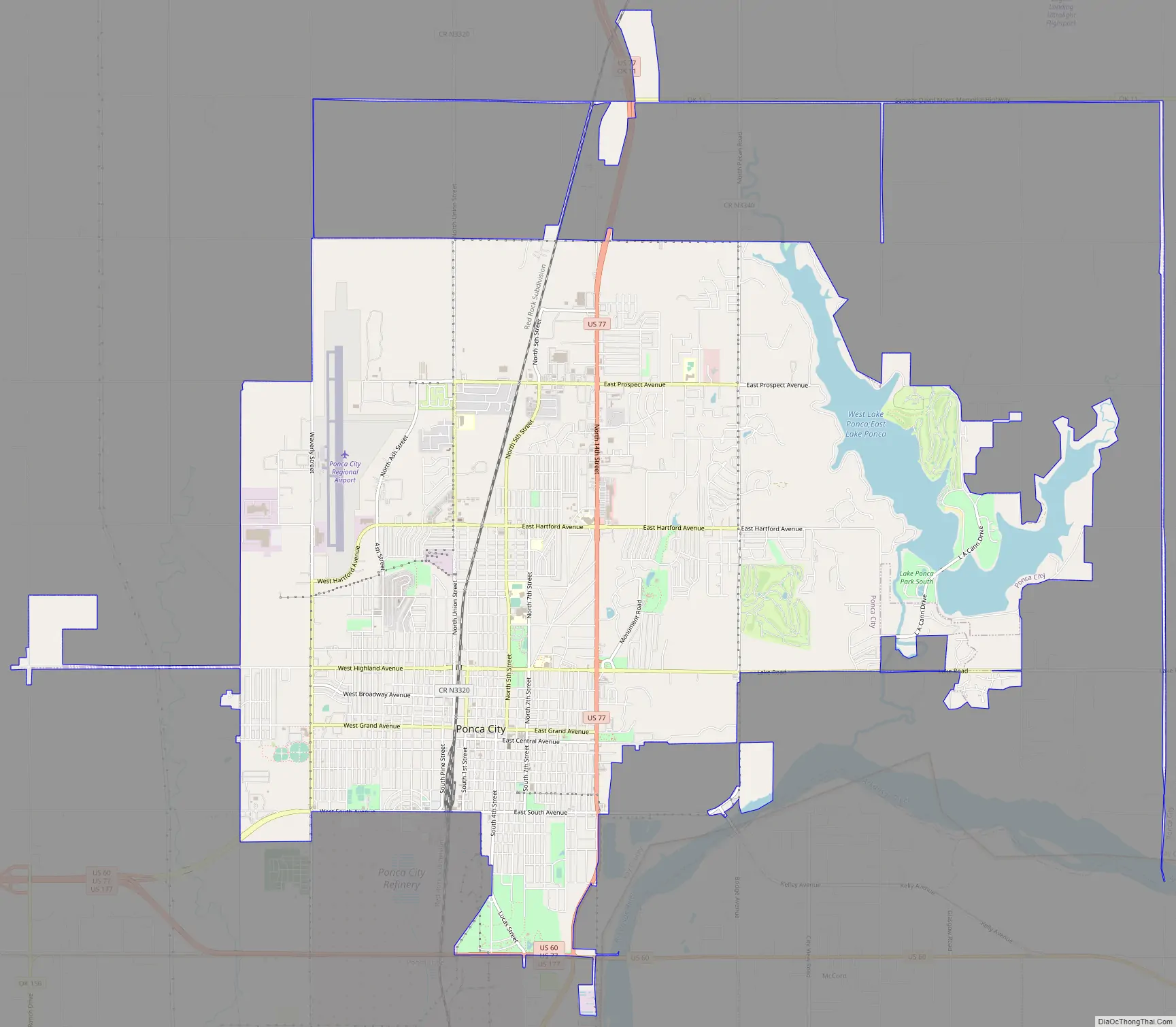
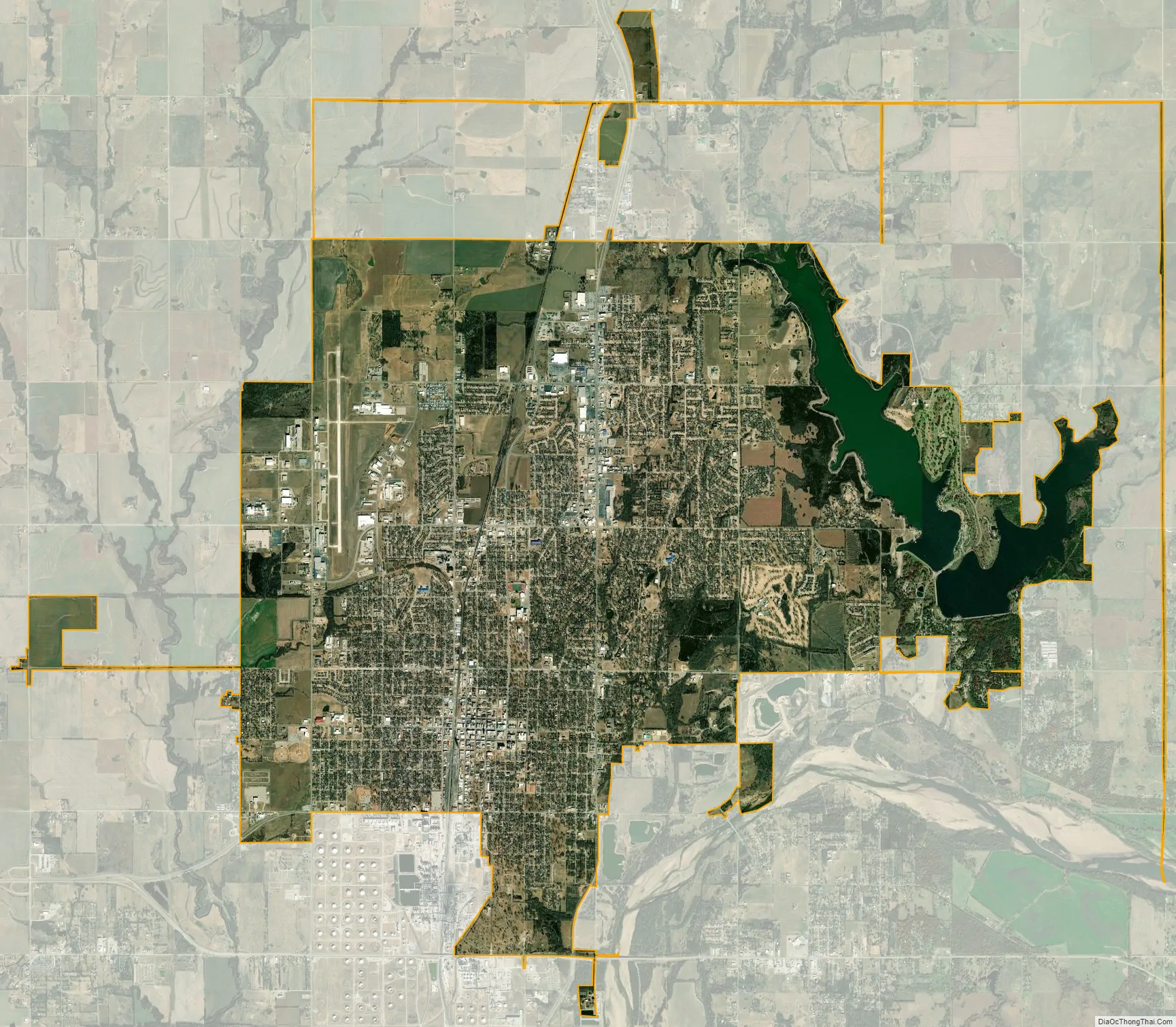
Ponca City city Satellite Map
Geography
Ponca City is located in southeastern Kay County at 36°42′45″N 97°4′21″W / 36.71250°N 97.07250°W / 36.71250; -97.07250 (36.712422, -97.072431), northwest of the Arkansas River. The city sits on roughly 47.6 km (18.4 sq mi) of land, and also has about 3.2 km (1.2 sq mi) of water, for a total area of 50.8 km (19.6 sq mi).
The city is in north-central Oklahoma, around 21 mi (34 km) south of the Kansas border, and approximately 15 mi (24 km) east of Interstate 35.
The city is near the Arkansas River, the Salt Fork of the Arkansas River, Kaw Lake, and Lake Ponca, which all provide numerous recreational opportunities.
Climate
The Ponca City region of Oklahoma is part of “Tornado Alley”. Tornadoes are most common in April, May, and June. Ponca City faces very hot and humid summers with temperatures frequently rising to over 100 °F (38 °C), as well as severe storms. During the winters, Ponca City has mild to cold temperatures with occasional snowstorms and ice.
See also
Map of Oklahoma State and its subdivision:- Adair
- Alfalfa
- Atoka
- Beaver
- Beckham
- Blaine
- Bryan
- Caddo
- Canadian
- Carter
- Cherokee
- Choctaw
- Cimarron
- Cleveland
- Coal
- Comanche
- Cotton
- Craig
- Creek
- Custer
- Delaware
- Dewey
- Ellis
- Garfield
- Garvin
- Grady
- Grant
- Greer
- Harmon
- Harper
- Haskell
- Hughes
- Jackson
- Jefferson
- Johnston
- Kay
- Kingfisher
- Kiowa
- Latimer
- Le Flore
- Lincoln
- Logan
- Love
- Major
- Marshall
- Mayes
- McClain
- McCurtain
- McIntosh
- Murray
- Muskogee
- Noble
- Nowata
- Okfuskee
- Oklahoma
- Okmulgee
- Osage
- Ottawa
- Pawnee
- Payne
- Pittsburg
- Pontotoc
- Pottawatomie
- Pushmataha
- Roger Mills
- Rogers
- Seminole
- Sequoyah
- Stephens
- Texas
- Tillman
- Tulsa
- Wagoner
- Washington
- Washita
- Woods
- Woodward
- Alabama
- Alaska
- Arizona
- Arkansas
- California
- Colorado
- Connecticut
- Delaware
- District of Columbia
- Florida
- Georgia
- Hawaii
- Idaho
- Illinois
- Indiana
- Iowa
- Kansas
- Kentucky
- Louisiana
- Maine
- Maryland
- Massachusetts
- Michigan
- Minnesota
- Mississippi
- Missouri
- Montana
- Nebraska
- Nevada
- New Hampshire
- New Jersey
- New Mexico
- New York
- North Carolina
- North Dakota
- Ohio
- Oklahoma
- Oregon
- Pennsylvania
- Rhode Island
- South Carolina
- South Dakota
- Tennessee
- Texas
- Utah
- Vermont
- Virginia
- Washington
- West Virginia
- Wisconsin
- Wyoming