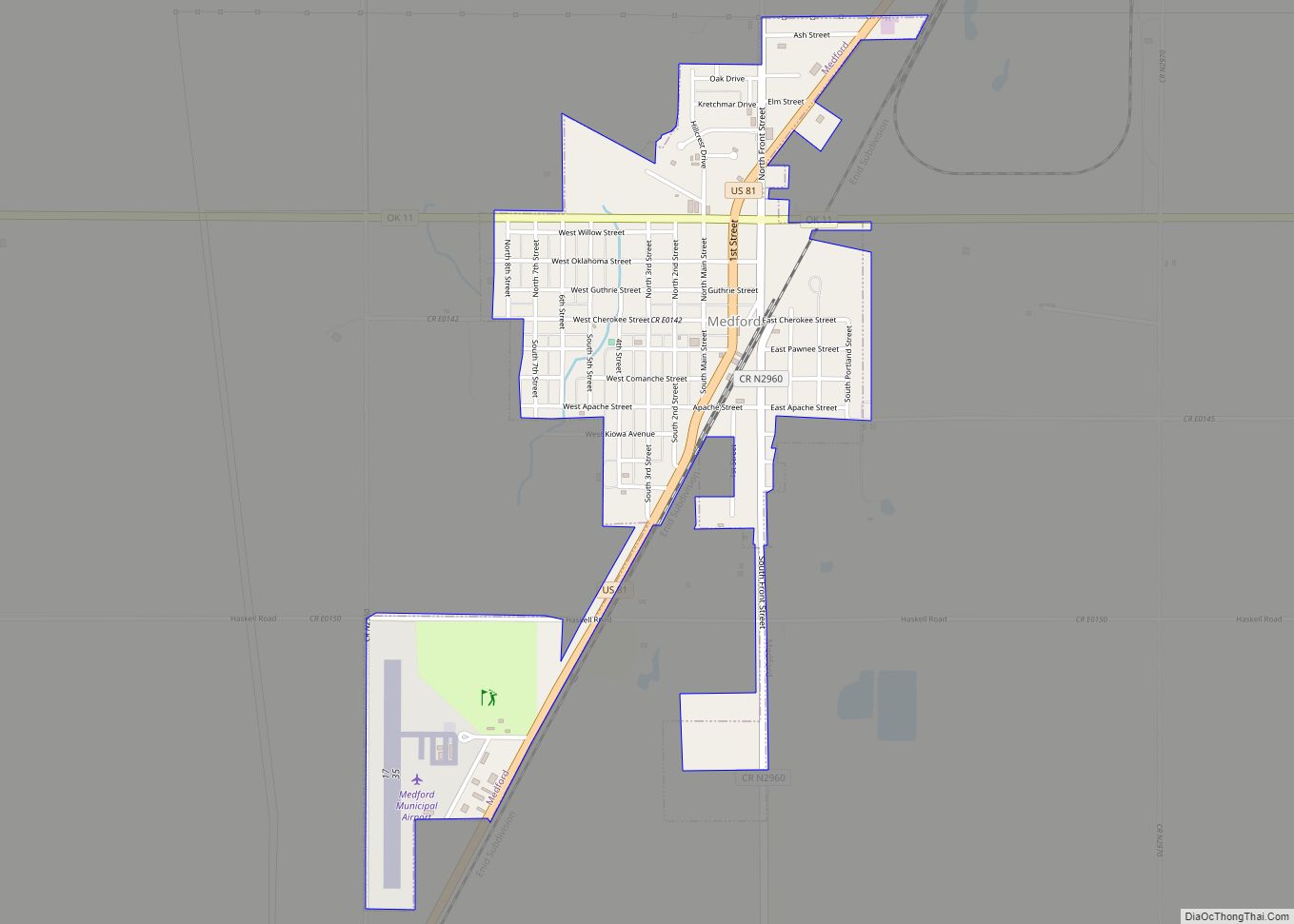
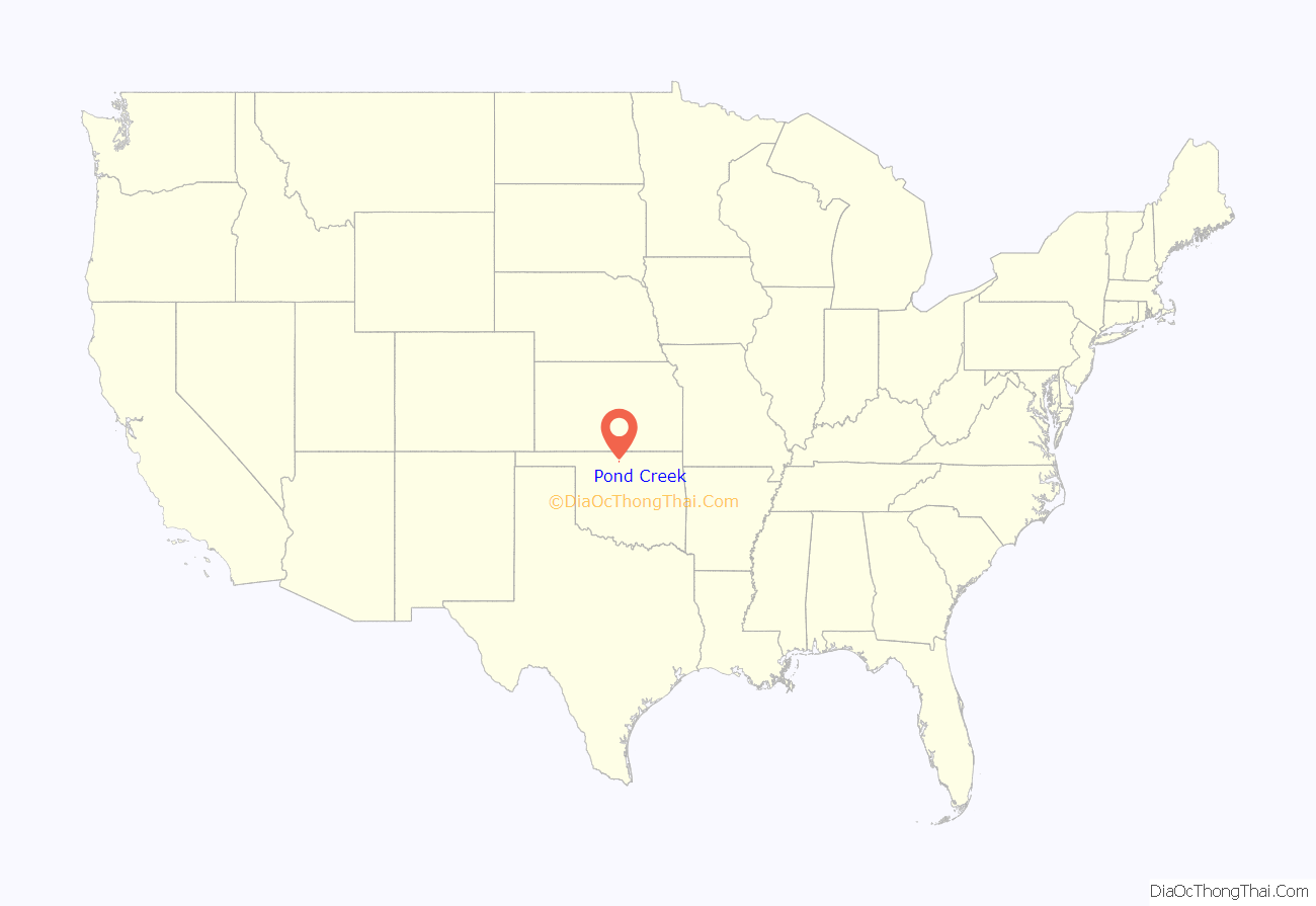
Pond Creek is a city in Grant County, Oklahoma, United States, along the Salt Fork Arkansas River. As of the 2010 census, the city population was 856, a 4.5 percent decline from the figure of 896 in 2000.
| Name: | Pond Creek city |
|---|---|
| LSAD Code: | 25 |
| LSAD Description: | city (suffix) |
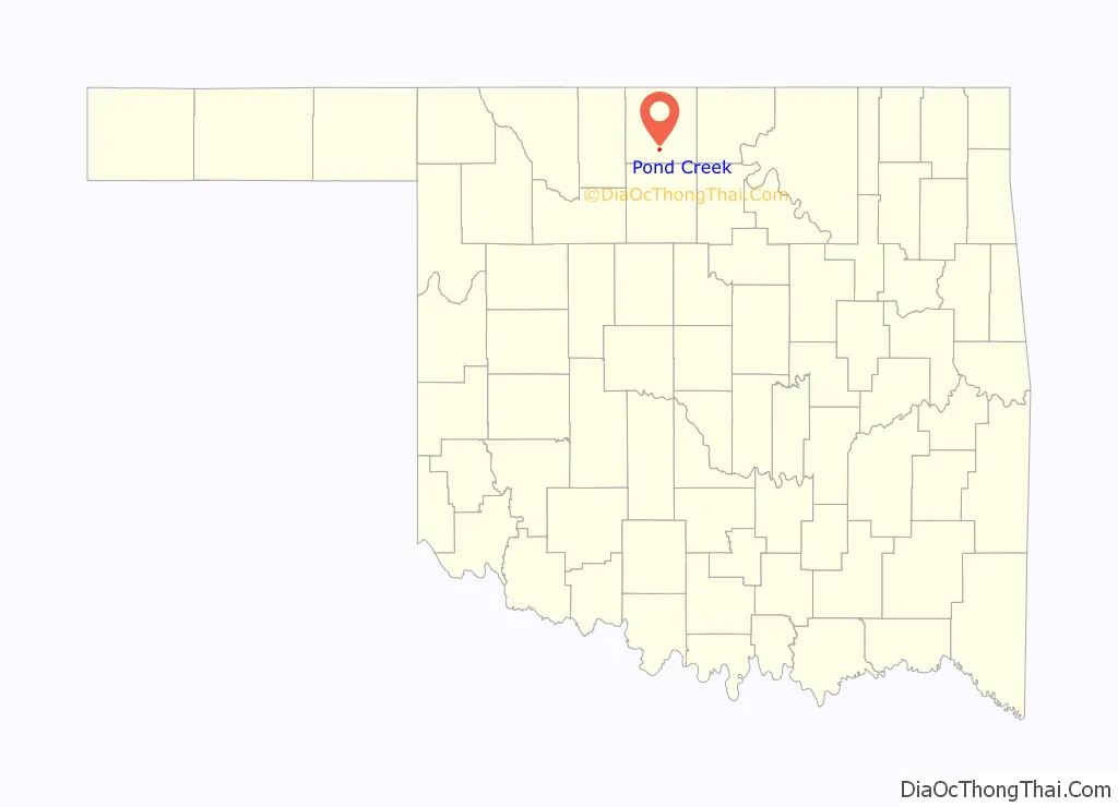
| State: | Oklahoma |
| County: | Grant County |
| Elevation: | 1,050 ft (320 m) |
| Total Area: | 0.85 sq mi (2.20 km²) |
| Land Area: | 0.85 sq mi (2.20 km²) |
| Water Area: | 0.00 sq mi (0.00 km²) |
| Total Population: | 885 |
| Population Density: | 1,042.40/sq mi (402.48/km²) |
| ZIP code: | 73766 |
| Area code: | 580 |
| FIPS code: | 4059950 |
| GNISfeature ID: | 1096819 |
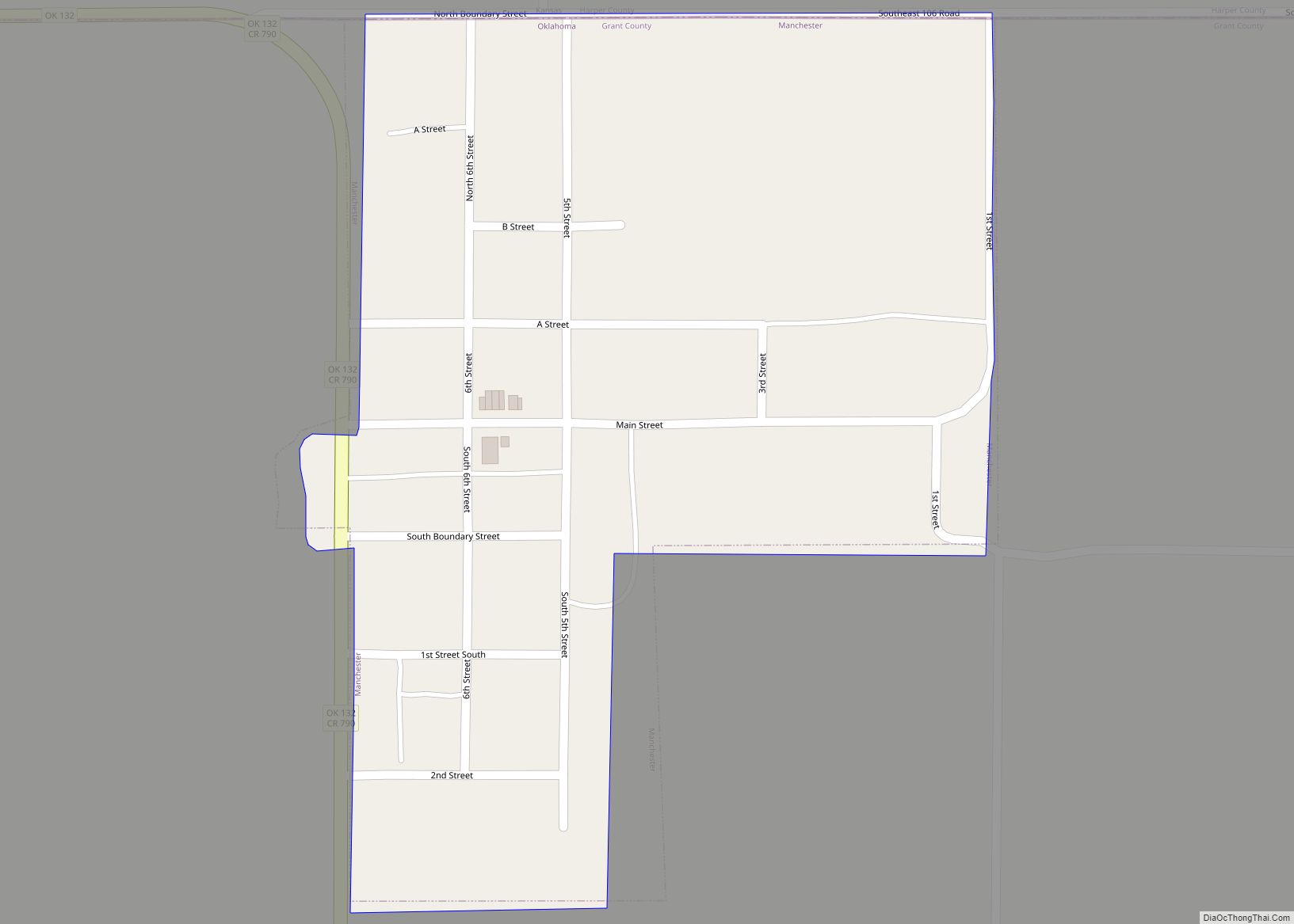
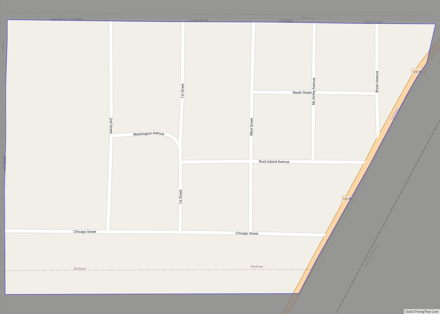
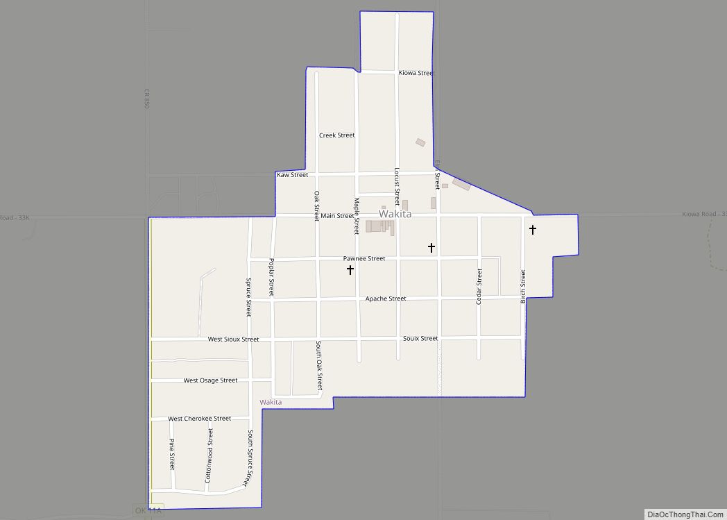
Online Interactive Map
Click on ![]() to view map in "full screen" mode.
to view map in "full screen" mode.
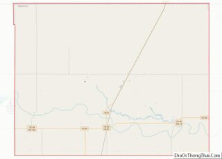
Pond Creek location map. Where is Pond Creek city?
History
Before people of European descent came on the scene, the region around the present town of Pond Creek was traversed by many of the nomadic Native Americans of the Great Plains. Although the land is now heavily agricultural there are still traces of campsites along the numerous creeks of the drainage of the Salt Fork of the Arkansas River. When many of the Native American groups were moved onto reservations in what is now Oklahoma, towns and trading posts were established. Eventually the present-day Oklahoma was divided into Oklahoma Territory and Indian Territory. The history of Pond Creek and the surrounding area can be easily confused with other streams called Pond Creek (see e.g.). The present community of Pond Creek is located in what is called the Cherokee Strip, more properly known as the Cherokee Outlet. The land at the confluence of Osage Creek and Pond Creek was known as the Pond Creek Stockade on the original Chisholm Trail used by cattle drivers bringing herds of Texas longhorns north to the railroad head first at Abilene, Kansas then later to Wichita and Caldwell. This location is about 4 miles north of the present town of Pond Creek near the present village of Jefferson. Two markers have been placed in this area commemorating the untimely demise of two cowboys. There are two granite markers placed near Pond Creek on the old Chisholm Trail.
In 1887, the Chicago, Kansas and Nebraska Railway built a branch line north-south from Caldwell, Kansas to Pond Creek in 1888. By 1893, it was incrementally built to Fort Worth, Texas. It was foreclosed on in 1891 and taken over by Chicago, Rock Island and Pacific Railway, which shut-down in 1980. The Kansas-Texas mainline was sold to a subsidiary of the Missouri-Kansas-Texas Railroad as the Oklahoma, Kansas and Texas Railroad, merging in 1988 with Missouri Pacific Railroad, which merged in 1997 with Union Pacific Railroad. Most locals still refer to this railroad as the “Rock Island.”
Pond Creek was settled as a town during the Cherokee Strip Land Run in 1893. According to the Chronicles of Oklahoma, “The government townsite of Pond Creek was first entered at 2:10 on the day of the run. By evening, it contained some 8,000 inhabitants, and boasted a good hotel, several restaurants, a dozen law offices, two general stores and six or seven grocery stores.” The settlers soon found that there was not enough water to support the new town; the government had dug wells for all of the government townsites, including Pond Creek, but all the water in Pond Creek’s well was quickly used up. Soldiers dug a new well but found only salt water. Water from the Salt Fork River was brought to Pond Creek and sold for five cents a cup, but it was not fit for human or animal consumption. Beer became a precious commodity, selling for fifty to seventy-five cents a bottle. Water from stagnant creek pools was given to animals. The area also experienced a violent sand storm and wildfires.
In addition to these tribulations, the citizens of Pond Creek had to do battle with the powerful railroad interests, in this case the “Rock Island Line” or CRI&P railroad, to get a coveted depot. This conflict has been called the Enid-Pond Creek Railroad War. Briefly, the railroad had established a station for Pond Creek and the federal government established a different station about 4 miles south of the railroad town. The railroad refused to stop at the government Pond Creek until a combination of citizen action and congressional action forced them to change. Pond Creek legend has it that the railroad specified a mail stop at Pond Creek so to keep face they merely changed the name of railroad Pond Creek to Jefferson and made government Pond Creek the Pond Creek station. This story doesn’t quite correspond with most personal histories of the controversy but it makes a colorful tale.
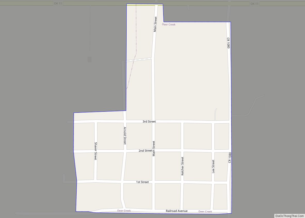
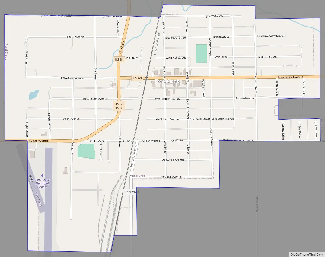
Pond Creek Road Map
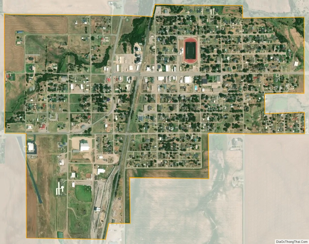
Pond Creek city Satellite Map
Geography
Pond Creek is located on the west side of the Salt Fork Arkansas River. The city lies at the intersection of U.S. routes 60 and 81.
According to the United States Census Bureau, the city has a total area of 0.8 square miles (2.1 km), all land.
See also
Map of Oklahoma State and its subdivision:- Adair
- Alfalfa
- Atoka
- Beaver
- Beckham
- Blaine
- Bryan
- Caddo
- Canadian
- Carter
- Cherokee
- Choctaw
- Cimarron
- Cleveland
- Coal
- Comanche
- Cotton
- Craig
- Creek
- Custer
- Delaware
- Dewey
- Ellis
- Garfield
- Garvin
- Grady
- Grant
- Greer
- Harmon
- Harper
- Haskell
- Hughes
- Jackson
- Jefferson
- Johnston
- Kay
- Kingfisher
- Kiowa
- Latimer
- Le Flore
- Lincoln
- Logan
- Love
- Major
- Marshall
- Mayes
- McClain
- McCurtain
- McIntosh
- Murray
- Muskogee
- Noble
- Nowata
- Okfuskee
- Oklahoma
- Okmulgee
- Osage
- Ottawa
- Pawnee
- Payne
- Pittsburg
- Pontotoc
- Pottawatomie
- Pushmataha
- Roger Mills
- Rogers
- Seminole
- Sequoyah
- Stephens
- Texas
- Tillman
- Tulsa
- Wagoner
- Washington
- Washita
- Woods
- Woodward
- Alabama
- Alaska
- Arizona
- Arkansas
- California
- Colorado
- Connecticut
- Delaware
- District of Columbia
- Florida
- Georgia
- Hawaii
- Idaho
- Illinois
- Indiana
- Iowa
- Kansas
- Kentucky
- Louisiana
- Maine
- Maryland
- Massachusetts
- Michigan
- Minnesota
- Mississippi
- Missouri
- Montana
- Nebraska
- Nevada
- New Hampshire
- New Jersey
- New Mexico
- New York
- North Carolina
- North Dakota
- Ohio
- Oklahoma
- Oregon
- Pennsylvania
- Rhode Island
- South Carolina
- South Dakota
- Tennessee
- Texas
- Utah
- Vermont
- Virginia
- Washington
- West Virginia
- Wisconsin
- Wyoming