Map of Simms CDP, Oklahoma

Map of Simms CDP, Oklahoma

Simms is a census-designated place (CDP) in Muskogee County, Oklahoma, United States. The population was 295 at the 2000 census. Simms CDP overview: Name: Simms CDP LSAD Code: 57 LSAD Description: CDP (suffix) State: Oklahoma County: Muskogee County Total Area: 14.10 sq mi (36.51 km²) Land Area: 14.10 sq mi (36.51 km²) Water Area: 0.00 sq mi (0.00 km²) Total Population: 261 Population Density: … Read more

Map of Silo town

Map of Silo town

Silo is a town in Bryan County, Oklahoma, United States. The population was 331 at the 2010 census, an increase of 17.4 percent from the figure of 282 recorded in 2000. Silo town overview: Name: Silo town LSAD Code: 43 LSAD Description: town (suffix) State: Oklahoma County: Bryan County Elevation: 817 ft (249 m) Total Area: 0.52 sq mi … Read more

Map of Short CDP

Map of Short CDP

Short is a census-designated place (CDP) in Sequoyah County, Oklahoma, United States. It is part of the Fort Smith, Arkansas-Oklahoma Metropolitan Statistical Area. The population was 328 at the 2000 census. Short CDP overview: Name: Short CDP LSAD Code: 57 LSAD Description: CDP (suffix) State: Oklahoma County: Sequoyah County Elevation: 751 ft (229 m) Total Area: 10.92 sq mi … Read more

Map of Shidler city

Map of Shidler city

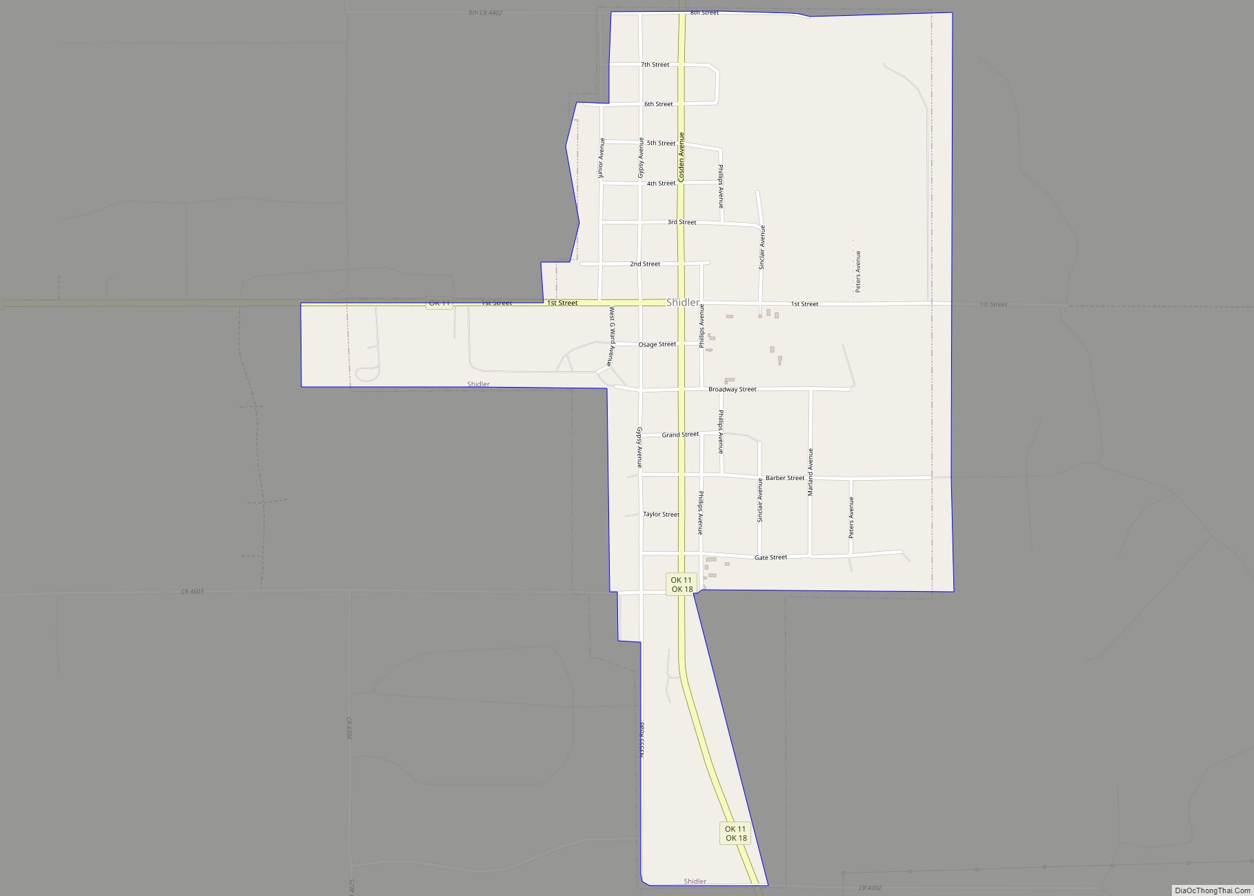
Shidler is a city in Osage County, Oklahoma, United States. The population was 328 in the 2020 census, a decline from the figure of 441 recorded in 2010. Shidler city overview: Name: Shidler city LSAD Code: 25 LSAD Description: city (suffix) State: Oklahoma County: Osage County Elevation: 1,168 ft (356 m) Total Area: 0.75 sq mi (1.93 km²) Land Area: … Read more

Map of Shawnee city, Oklahoma

Map of Shawnee city, Oklahoma

Shawnee (Meskwaki: Shânîheki) is a city in and the county seat of Pottawatomie County, Oklahoma, United States. The population was 29,857 in 2010, a 4.9 percent increase from the figure of 28,692 in 2000. The city is part of the Oklahoma City-Shawnee Combined Statistical Area and the principal city of the Shawnee Micropolitan Statistical Area. … Read more

Map of Shattuck town

Map of Shattuck town

Shattuck is a town in Ellis County, Oklahoma, United States. The population was 1,356 at the 2010 census. Shattuck town overview: Name: Shattuck town LSAD Code: 43 LSAD Description: town (suffix) State: Oklahoma County: Ellis County Elevation: 2,247 ft (685 m) Total Area: 2.20 sq mi (5.69 km²) Land Area: 2.20 sq mi (5.69 km²) Water Area: 0.00 sq mi (0.00 km²) Total Population: 1,249 Population … Read more

Map of Sharon town, Oklahoma

Map of Sharon town, Oklahoma

Sharon is a town in Woodward County, Oklahoma, United States. The population was 135 at the 2010 census. Sharon town overview: Name: Sharon town LSAD Code: 43 LSAD Description: town (suffix) State: Oklahoma County: Woodward County Elevation: 2,044 ft (623 m) Total Area: 0.14 sq mi (0.35 km²) Land Area: 0.14 sq mi (0.35 km²) Water Area: 0.00 sq mi (0.00 km²) Total Population: 133 Population … Read more

Map of Shamrock town

Map of Shamrock town, Oklahoma

Shamrock town overview: Name: Shamrock town LSAD Code: 43 LSAD Description: town (suffix) State: Oklahoma County: Creek County FIPS code: 4066600 Online Interactive Map Shamrock online map. Source: Basemap layers from Google Map, Open Street Map (OSM), Arcgisonline, Wmflabs. Boundary Data from Database of Global Administrative Areas. Shamrock location map. Where is Shamrock town? Shamrock … Read more

Map of Snyder city, Oklahoma

Map of Snyder city, Oklahoma

Snyder is a city in Kiowa County, Oklahoma, United States. The population was 1,394 at the 2010 census. This figure represented a decline of 7.6 percent from 1,509 persons in 2000. Snyder city overview: Name: Snyder city LSAD Code: 25 LSAD Description: city (suffix) State: Oklahoma County: Kiowa County Elevation: 1,355 ft (413 m) Total Area: 1.21 sq mi … Read more

Map of Snake Creek CDP

Map of Snake Creek CDP

Snake Creek is a census-designated place (CDP) in Mayes County, Oklahoma, United States. The population was 255 at the 2020 census. Snake Creek CDP overview: Name: Snake Creek CDP LSAD Code: 57 LSAD Description: CDP (suffix) State: Oklahoma County: Mayes County Elevation: 932 ft (284 m) Total Area: 8.36 sq mi (21.64 km²) Land Area: 8.36 sq mi (21.64 km²) Water Area: 0.00 sq mi … Read more

Map of Smithville town, Oklahoma

Map of Smithville town, Oklahoma

Smithville town overview: Name: Smithville town LSAD Code: 43 LSAD Description: town (suffix) State: Oklahoma County: McCurtain County FIPS code: 4068250 Online Interactive Map Smithville online map. Source: Basemap layers from Google Map, Open Street Map (OSM), Arcgisonline, Wmflabs. Boundary Data from Database of Global Administrative Areas. Smithville location map. Where is Smithville town? Smithville … Read more

Map of Smith Village town

Map of Smith Village town

Smith Village is a town in Oklahoma County, Oklahoma, United States, and a part of the Oklahoma City Metropolitan Area. The population was 66 at the 2010 census. Smith Village town overview: Name: Smith Village town LSAD Code: 43 LSAD Description: town (suffix) State: Oklahoma County: Oklahoma County Elevation: 1,217 ft (371 m) Total Area: 0.03 sq mi (0.07 km²) … Read more