Map of Sour John CDP

Map of Sour John CDP

Sour John is a census-designated place (CDP) in Muskogee County, Oklahoma, United States. The population was 61 at the 2000 census. Sour John CDP overview: Name: Sour John CDP LSAD Code: 57 LSAD Description: CDP (suffix) State: Oklahoma County: Muskogee County Total Area: 5.68 sq mi (14.70 km²) Land Area: 5.68 sq mi (14.70 km²) Water Area: 0.00 sq mi (0.00 km²) Total Population: … Read more

Map of Soper town

Map of Soper town

Soper is a town in Choctaw County, Oklahoma, United States. The population was 261 at the 2010 census. The town was named for Pliny L. Soper, who was an attorney for the Arkansas and Choctaw Railway. Soper town overview: Name: Soper town LSAD Code: 43 LSAD Description: town (suffix) State: Oklahoma County: Choctaw County Elevation: … Read more

Map of Snyder city, Oklahoma

Map of Snyder city, Oklahoma

Snyder is a city in Kiowa County, Oklahoma, United States. The population was 1,394 at the 2010 census. This figure represented a decline of 7.6 percent from 1,509 persons in 2000. Snyder city overview: Name: Snyder city LSAD Code: 25 LSAD Description: city (suffix) State: Oklahoma County: Kiowa County Elevation: 1,355 ft (413 m) Total Area: 1.21 sq mi … Read more

Map of Snake Creek CDP

Map of Snake Creek CDP

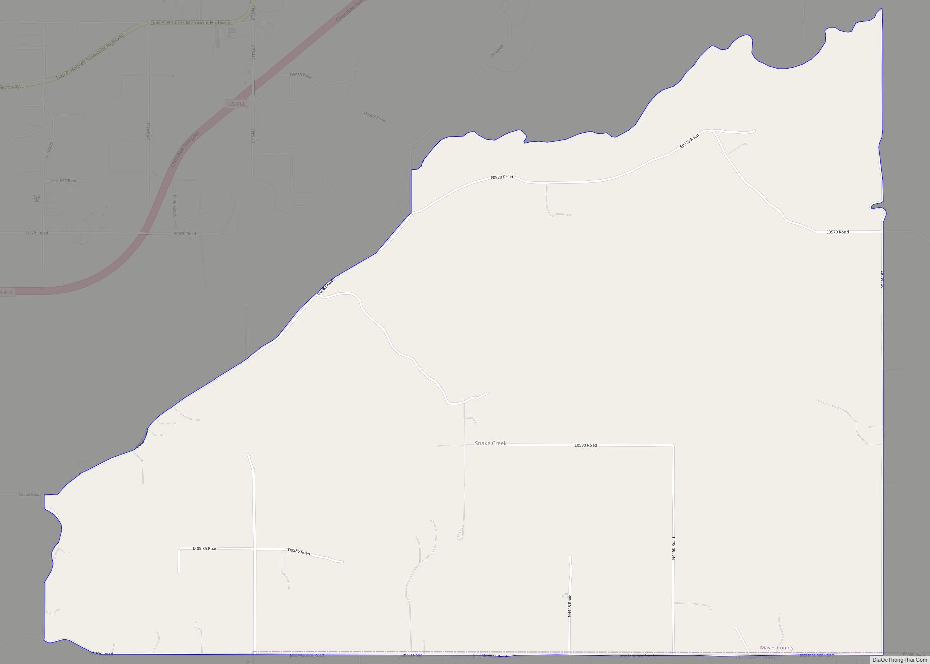
Snake Creek is a census-designated place (CDP) in Mayes County, Oklahoma, United States. The population was 255 at the 2020 census. Snake Creek CDP overview: Name: Snake Creek CDP LSAD Code: 57 LSAD Description: CDP (suffix) State: Oklahoma County: Mayes County Elevation: 932 ft (284 m) Total Area: 8.36 sq mi (21.64 km²) Land Area: 8.36 sq mi (21.64 km²) Water Area: 0.00 sq mi … Read more

Map of Smithville town, Oklahoma

Map of Smithville town, Oklahoma

Smithville town overview: Name: Smithville town LSAD Code: 43 LSAD Description: town (suffix) State: Oklahoma County: McCurtain County FIPS code: 4068250 Online Interactive Map Smithville online map. Source: Basemap layers from Google Map, Open Street Map (OSM), Arcgisonline, Wmflabs. Boundary Data from Database of Global Administrative Areas. Smithville location map. Where is Smithville town? Smithville … Read more

Map of Smith Village town

Map of Smith Village town

Smith Village is a town in Oklahoma County, Oklahoma, United States, and a part of the Oklahoma City Metropolitan Area. The population was 66 at the 2010 census. Smith Village town overview: Name: Smith Village town LSAD Code: 43 LSAD Description: town (suffix) State: Oklahoma County: Oklahoma County Elevation: 1,217 ft (371 m) Total Area: 0.03 sq mi (0.07 km²) … Read more

Map of St. Louis town, Oklahoma

Map of St. Louis town, Oklahoma

St. Louis is a town in Pottawatomie County, Oklahoma, United States. The population was 158 at the 2010 census, a 23.3 percent decline from the figure of 206 in 2000. St. Louis town overview: Name: St. Louis town LSAD Code: 43 LSAD Description: town (suffix) State: Oklahoma County: Pottawatomie County Total Area: 9.44 sq mi (24.45 km²) Land … Read more

Map of Springer town, Oklahoma

Map of Springer town, Oklahoma

Springer is a town in Carter County, Oklahoma, United States. The population was 700 at the 2010 census. It is part of the Ardmore, Oklahoma Micropolitan Statistical Area. Springer town overview: Name: Springer town LSAD Code: 43 LSAD Description: town (suffix) State: Oklahoma County: Carter County Elevation: 919 ft (280 m) Total Area: 15.12 sq mi (39.16 km²) Land Area: … Read more

Map of Sportsmen Acres town

Map of Sportsmen Acres town

Sportsmen Acres is a town in Mayes County, Oklahoma, United States. The population was 322 at the 2010 census. Incorporated in 1972, Sportsmen Acres is primarily a residential community. It is located seven miles southeast of Pryor on Oklahoma State Highway 69A, and one mile east of the MidAmerica Industrial Park. Sportsmen Acres town overview: … Read more

Map of Spiro town

Map of Spiro town

Spiro is a town in Le Flore County, Oklahoma, United States. It is part of the Fort Smith, Arkansas-Oklahoma Metropolitan Statistical Area. The population was 2,164 at the 2010 census, a 2.8 percent decline from the figure of 2,227 recorded in 2000. Developed as a railroad station in an agricultural area in the late 19th … Read more

Map of Sperry town

Map of Sperry town

Sperry is a town in Tulsa County, Oklahoma, United States. The population was 1,205 in the 2010 U. S. census, compared to 1,351 in 2000. It is primarily a bedroom community, since approximately 85 percent of the employed residents commute to work in Tulsa and other nearby towns. Sperry also has an active retirement community. … Read more

Map of Spencer city, Oklahoma

Map of Spencer city, Oklahoma

Spencer is a city in Oklahoma County, Oklahoma, United States, and a part of the Oklahoma City metropolitan area. The population was 3,978 at the 2020 census, a 1.7% increase from 2010. Established in 1903, the City of Spencer is a historic community located just east of the North Canadian River. Spencer is approximately ten … Read more