Map of Mulino CDP

Map of Mulino CDP

Mulino, Oregon is a hamlet and census-designated place (CDP) located in Clackamas County, Oregon, United States, on Oregon Route 213 between the cities of Oregon City and Molalla. As of the 2010 census it had a population of 2,103. Mulino CDP overview: Name: Mulino CDP LSAD Code: 57 LSAD Description: CDP (suffix) State: Oregon County: … Read more

Map of Mount Vernon city, Oregon

Map of Mount Vernon city, Oregon

Mount Vernon is a city in Grant County, Oregon, United States. Its post office was established in 1877 and named after a black stallion that belonged to settler David W. Jenkins. The stallion’s stable, a small stone building, is still standing in a field on the north side of U.S. Highway 26 about 2.2 miles … Read more

Map of Mount Hood CDP

Map of Mount Hood CDP

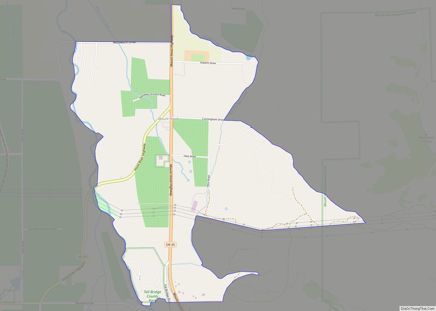
Mount Hood is an unincorporated community and census-designated place (CDP) in Hood River County, Oregon, United States, about 3 miles (5 km) northeast of Parkdale on Oregon Route 35. As of the 2010 census it had a population of 286. Mount Hood is the terminus of Oregon Route 281, the Hood River Highway. The community was … Read more

Map of Netarts CDP

Map of Netarts CDP

Netarts /ˈniːtɑːrts/ is an unincorporated community in Tillamook County, Oregon, United States; it is a census-designated place (CDP). The population was 744 at the 2000 census. Netarts CDP overview: Name: Netarts CDP LSAD Code: 57 LSAD Description: CDP (suffix) State: Oregon County: Tillamook County Elevation: 66 ft (20 m) Total Area: 2.60 sq mi (6.73 km²) Land Area: 2.60 sq mi (6.73 km²) … Read more

Map of Neskowin CDP

Map of Neskowin CDP

Neskowin /ˈnɛskoʊ.ɪn/ is an unincorporated community in Tillamook County, Oregon, United States, along the Pacific Ocean between Cascade Head and Nestucca Bay. For statistical purposes, the United States Census Bureau has defined Neskowin as a census-designated place (CDP). The census definition of the area may not precisely correspond to local understanding of the area with … Read more

Map of Nesika Beach CDP

Map of Nesika Beach CDP

Nesika Beach is census-designated place and unincorporated community in Curry County, Oregon, United States. It is located 8 miles (13 km) north of Gold Beach on the Oregon Coast. As of the 2020 census it had a population of 432. Nesika means “we”, “us”, or “our” in Chinook Jargon. Nesika Beach CDP overview: Name: Nesika Beach … Read more

Map of Oak Grove CDP, Oregon

Map of Oak Grove CDP, Oregon

Oak Grove is an unincorporated community in Clackamas County, Oregon, United States, in the Portland metropolitan area. For statistical purposes, the United States Census Bureau has defined Oak Grove as a census-designated place (CDP). The census definition of the area may not precisely correspond to local understanding of the area with the same name. The … Read more

Map of O'Brien CDP

Map of O’Brien CDP, Oregon

O’Brien is an unincorporated community and census-designated place (CDP) in Josephine County, Oregon, United States. As of the 2010 census, O’Brien had a population of 504. The unemployment rate is 6.9%, slightly higher than the national average of 5.2% The community was named after John O’Brien, who was one of the first settlers to arrive … Read more

Map of Nyssa city

Map of Nyssa city

Nyssa /ˈnɪsə/ is a city in Malheur County, Oregon, United States. The population was 3,267 at the 2010 census. The city is located along the Snake River on the Idaho border, in the region of far eastern Oregon known as the “Treasure Valley”. It is part of the Ontario, OR–ID Micropolitan Statistical Area. The primary … Read more

Map of North Powder city

Map of North Powder city

North Powder is a city in Union County, Oregon, United States. The population was 439 at the 2010 census. North Powder city overview: Name: North Powder city LSAD Code: 25 LSAD Description: city (suffix) State: Oregon County: Union County Incorporated: 1903 Elevation: 3,256 ft (992 m) Total Area: 0.63 sq mi (1.63 km²) Land Area: 0.63 sq mi (1.63 km²) Water Area: 0.00 sq mi … Read more

Map of North Plains city

Map of North Plains city

North Plains is a city in Washington County, Oregon, United States, off U.S. 26 on the northwest outskirts of the Portland metropolitan area. The population was 3,441 at the 2020 census. North Plains city overview: Name: North Plains city LSAD Code: 25 LSAD Description: city (suffix) State: Oregon County: Washington County Incorporated: 1963 Elevation: 176 ft … Read more

Map of North Bend city, Oregon

Map of North Bend city, Oregon

North Bend is a city in Coos County, Oregon, United States with a population of 9,695 as of the 2010 census. North Bend is surrounded on three sides by Coos Bay, an S-shaped water inlet and estuary where the Coos River enters Coos Bay and borders the city of Coos Bay to the south. North … Read more