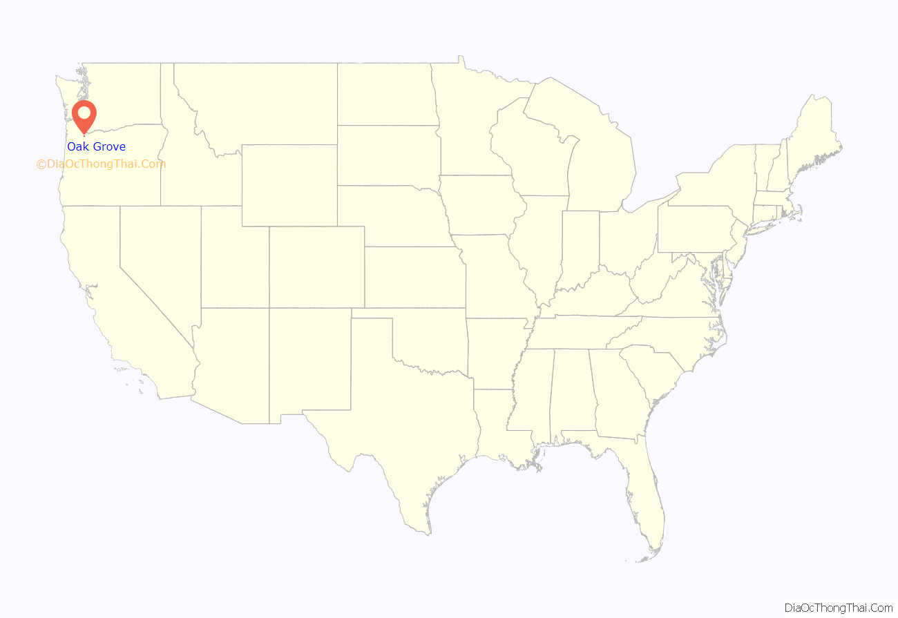
Oak Grove is an unincorporated community in Clackamas County, Oregon, United States, in the Portland metropolitan area. For statistical purposes, the United States Census Bureau has defined Oak Grove as a census-designated place (CDP). The census definition of the area may not precisely correspond to local understanding of the area with the same name. The population was 16,629 at the 2010 census.
| Name: | Oak Grove CDP |
|---|---|
| LSAD Code: | 57 |
| LSAD Description: | CDP (suffix) |
| State: | Oregon |
| County: | Clackamas County |
| Elevation: | 184 ft (56 m) |
| Total Area: | 4.17 sq mi (10.80 km²) |
| Land Area: | 3.90 sq mi (10.11 km²) |
| Water Area: | 0.27 sq mi (0.69 km²) |
| Total Population: | 17,290 |
| Population Density: | 4,429.93/sq mi (1,710.30/km²) |
| ZIP code: | 97222, 97267, 97268 |
| Area code: | 503, 971 |
| FIPS code: | 4153900 |
| GNISfeature ID: | 1136591 |
Online Interactive Map
Click on ![]() to view map in "full screen" mode.
to view map in "full screen" mode.
Oak Grove location map. Where is Oak Grove CDP?
History
Oak Grove was named at the suggestion of Edward W. Cornell, a member of the surveying party that platted the townsite in the 1890s. The company that was developing the property had not been able to come up with a good name for the place, and Cornell suggested “Oak Grove” after a crew ate lunch in a stand of oak trees in the northwestern part of the tract.
The area was served first from the Milwaukie post office. In 1904, Creighton post office was established, named for Susan Creighton, on whose donation land claim the office stood. Postal authorities did not name the office “Oak Grove” in order to avoid duplication. There had once been an Oak Grove post office in Josephine County. The first postmaster was noted Oregon botanist Thomas J. Howell.
Oak Grove railroad station was originally named “Center”, and another station, St. Theresa, was originally named “Oak Grove”. In order to prevent confusion, in 1907 the Post Office Department changed the name of the post office to “Oak Grove”, and the Center railroad station was renamed to match. The railroad no longer passes through the community.
Concord School is a historic building and former school (Concord Elementary School) in Oak Grove.
Oak Grove is home to a LINCC library operated by Clackamas County.
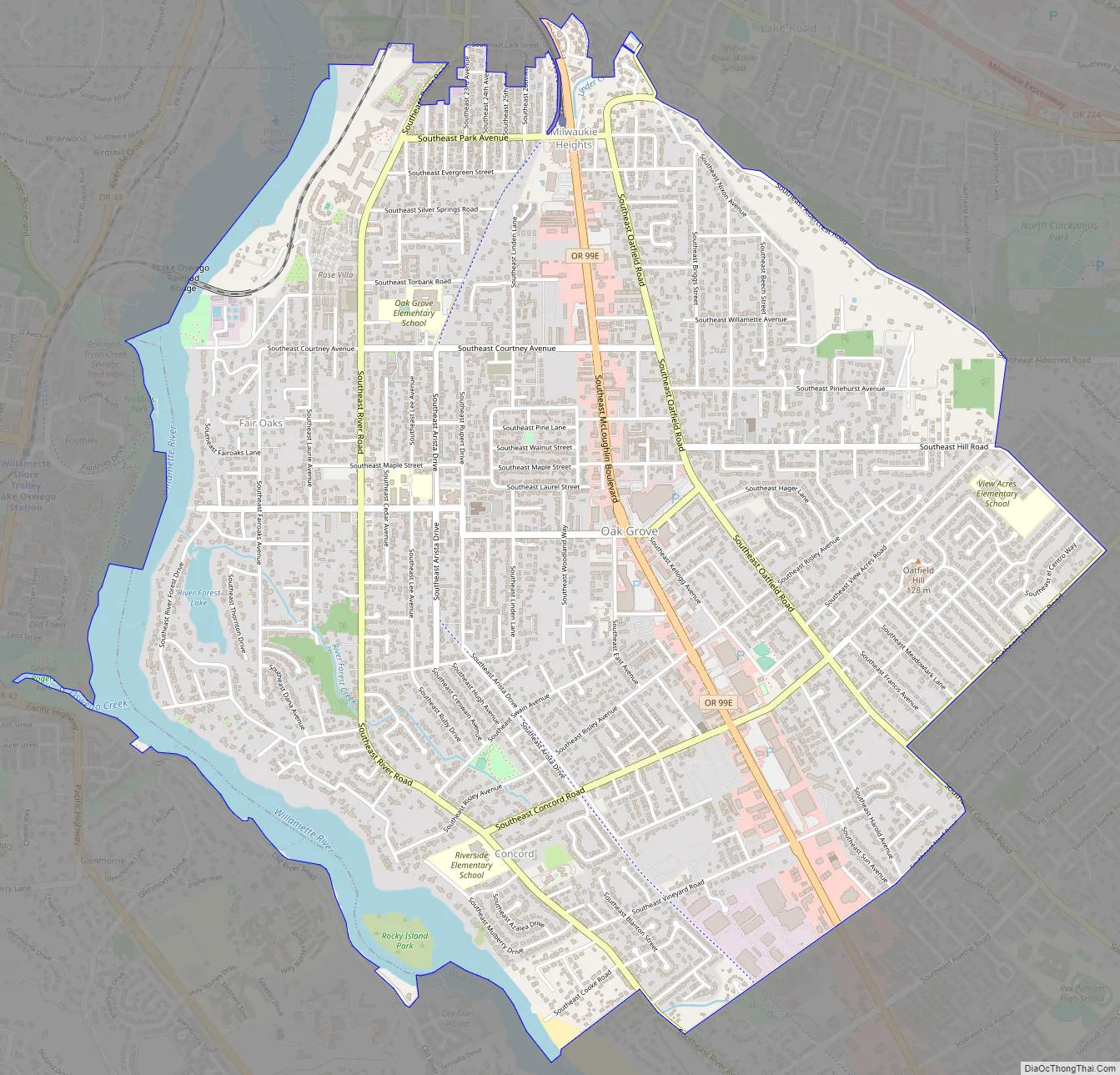
Oak Grove Road Map
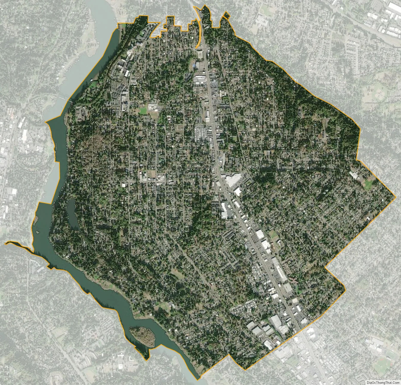
Oak Grove city Satellite Map
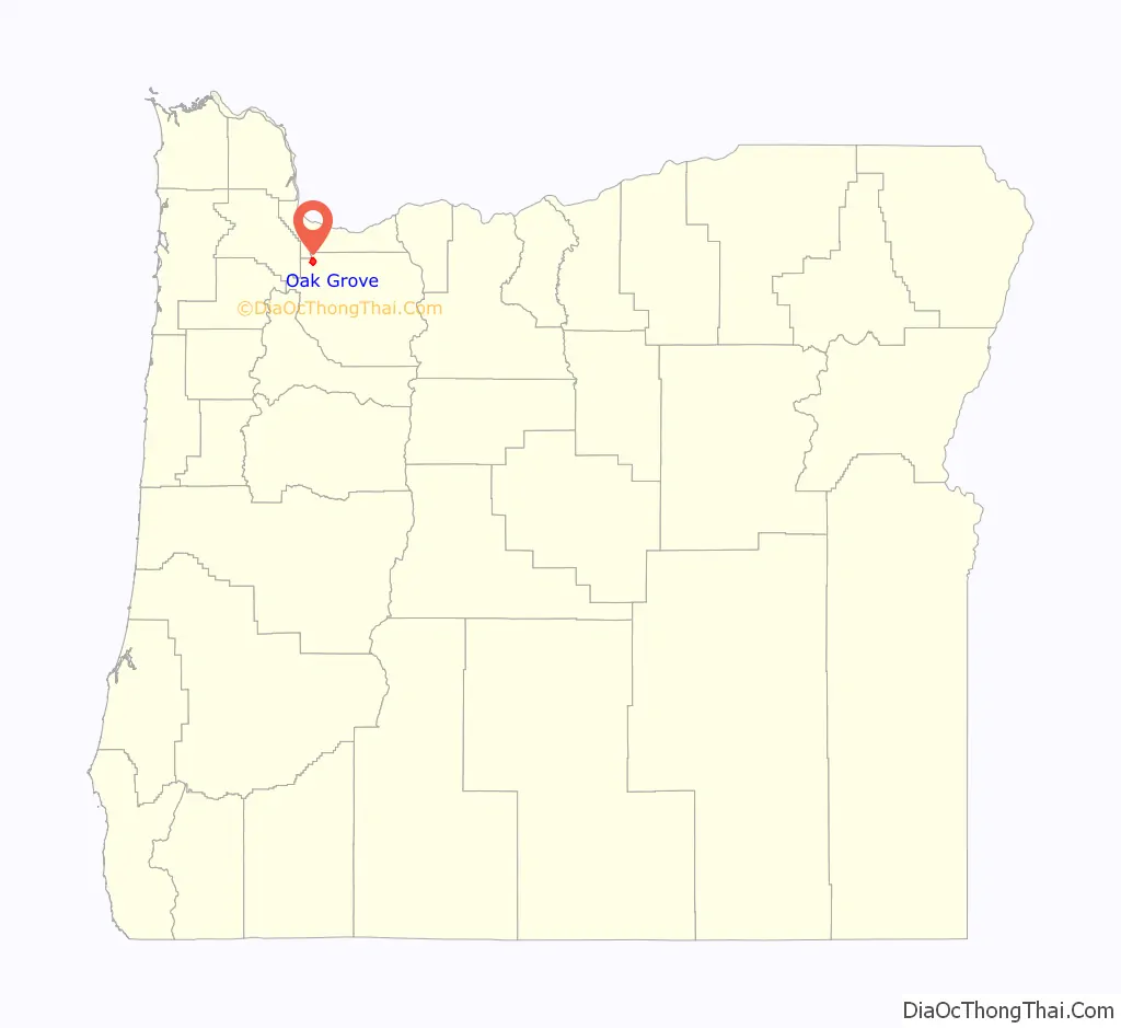
Geography
Oak Grove is located in northwestern Clackamas County, bordered to the north by the city of Milwaukie, to the east by unincorporated Oatfield, to the south by unincorporated Jennings Lodge, and to the west by the Willamette River, whose opposite shore hosts the cities of West Linn and Lake Oswego. Oregon Route 99E runs through Oak Grove as McLoughlin Boulevard; it leads north 8 miles (13 km) to downtown Portland and south 4 miles (6 km) to Oregon City.
According to the United States Census Bureau, the Oak Grove CDP has a total area of 4.1 square miles (10.7 km), of which 3.9 square miles (10.1 km) is land and 0.27 square miles (0.7 km), or 6.35%, is water.
Hog Island, an island in the Willamette River, is located within the boundaries of Oak Grove.
See also
Map of Oregon State and its subdivision: Map of other states:- Alabama
- Alaska
- Arizona
- Arkansas
- California
- Colorado
- Connecticut
- Delaware
- District of Columbia
- Florida
- Georgia
- Hawaii
- Idaho
- Illinois
- Indiana
- Iowa
- Kansas
- Kentucky
- Louisiana
- Maine
- Maryland
- Massachusetts
- Michigan
- Minnesota
- Mississippi
- Missouri
- Montana
- Nebraska
- Nevada
- New Hampshire
- New Jersey
- New Mexico
- New York
- North Carolina
- North Dakota
- Ohio
- Oklahoma
- Oregon
- Pennsylvania
- Rhode Island
- South Carolina
- South Dakota
- Tennessee
- Texas
- Utah
- Vermont
- Virginia
- Washington
- West Virginia
- Wisconsin
- Wyoming