Map of Ukiah city, Oregon
Ukiah (/juːkaɪʌ/) is a city in Umatilla County, Oregon, United States. The population was 186 at the 2010 census. It is part of the Hermiston-Pendleton Micropolitan Statistical Area. It was named by an early settler after the town of Ukiah, California. Ukiah is tied with Seneca, in Grant County, for the coldest official temperature in ... Read more
Map of Ukiah city, Oregon
Map of Tygh Valley CDP
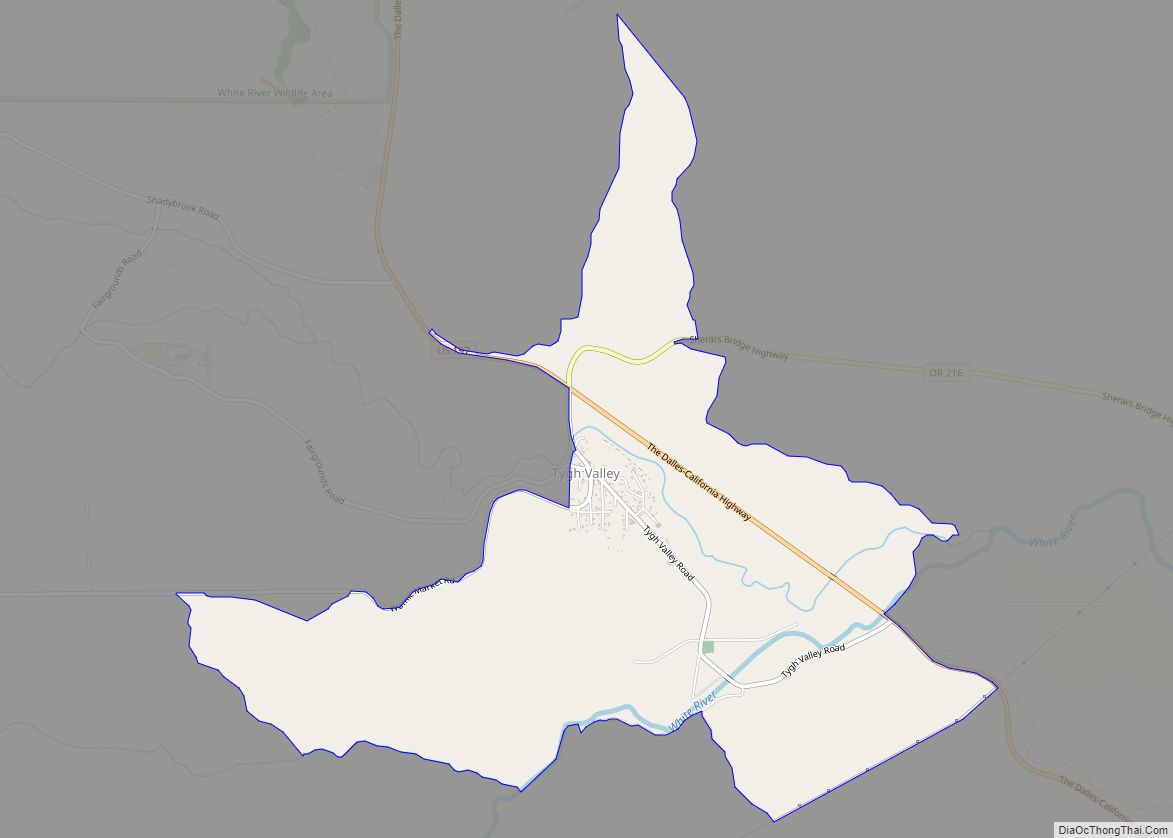
Tygh Valley is a census-designated place (CDP) and unincorporated community in Wasco County, Oregon, United States. The population was 224 at the 2000 census. Tygh Valley CDP overview: Name: Tygh Valley CDP LSAD Code: 57 LSAD Description: CDP (suffix) State: Oregon County: Wasco County Elevation: 1,142 ft (348 m) Total Area: 3.73 sq mi (9.66 km²) Land Area: 3.73 sq mi (9.66 km²) ... Read more
Map of Tygh Valley CDP
Map of Tutuilla CDP
Tutuilla is a census-designated place (CDP) in Umatilla County, Oregon, United States. The population was 460 at the 2000 census. It is part of the Pendleton–Hermiston Micropolitan Statistical Area. Tutuilla CDP overview: Name: Tutuilla CDP LSAD Code: 57 LSAD Description: CDP (suffix) State: Oregon County: Umatilla County Elevation: 1,427 ft (435 m) Total Area: 20.00 sq mi (51.79 km²) Land ... Read more
Map of Tutuilla CDP
Map of Turner city, Oregon
Turner is a city in Marion County, Oregon, United States. The population was 2,454 at the 2020 census. It is part of the Salem Metropolitan Statistical Area. The community was incorporated by the Oregon Legislative Assembly on February 10, 1905. Since 1971, it is the location of the Enchanted Forest amusement park. Turner city overview: ... Read more
Map of Turner city, Oregon
Map of Tumalo CDP
Tumalo (/ˈtʌməloʊ/ TUM-ə-loh) is an unincorporated community and census-designated place (CDP) in Deschutes County, Oregon, United States. As of the 2010 census it had a population of 488. In the Klamath language, tumolo means “wild plum,” a plentiful shrub in south central Oregon. Tumola means “ground fog,” which may have described Tumalo Creek. Tumallowa, the ... Read more
Map of Tumalo CDP
Map of Tualatin city
Tualatin (/tuˈɔːlətɪn/ TWAW-lə-tin) is a city located primarily in Washington County in the U.S. state of Oregon. A small portion of the city is also located in neighboring Clackamas County. It is a southwestern suburb in the Portland Metropolitan Area that is located south of Tigard. The population was 27,942 at the 2020 census. Tualatin ... Read more
Map of Tualatin city
Map of Troutdale city, Oregon
Troutdale is a city in Multnomah County, Oregon, United States, immediately north of Gresham and east of Wood Village. As of the 2020 census, the city population was 16,300. The city serves as the western gateway to the Historic Columbia River Highway, the Mount Hood Scenic Byway, and the Columbia River Gorge. It is approximately ... Read more
Map of Troutdale city, Oregon
Map of Tri-City CDP
Tri-City (or Tri City) is a census-designated place (CDP) and unincorporated community in Douglas County, Oregon, United States. The population was 3,931 at the 2010 census. The community in Missouri Bottom near the Umpqua River is named for the three cities among which it is centered: Myrtle Creek, Canyonville and Riddle. The Tri City School ... Read more
Map of Tri-City CDP
Map of Waldport city
Waldport is a city in Lincoln County, Oregon, United States. The population was 2,033 at the 2010 census. The city is located on the Alsea River and Alsea Bay, 15 miles (24 km) south of Newport and 8 miles (13 km) north of Yachats. Waldport city overview: Name: Waldport city LSAD Code: 25 LSAD Description: city (suffix) ... Read more
Map of Waldport city
Map of Vernonia city
Vernonia is a city in Columbia County, Oregon, United States. It is located on the Nehalem River, in a valley on the eastern side of the Northern Oregon Coast Range that is the heart of one of the most important timber-producing areas of the state. Logging has played a large role in the history of ... Read more
Map of Vernonia city
Map of Veneta city
Veneta is a city in Lane County, Oregon, United States. As of the 2010 census, the city population was 4,561. Veneta city overview: Name: Veneta city LSAD Code: 25 LSAD Description: city (suffix) State: Oregon County: Lane County Incorporated: 1962 Elevation: 418 ft (127.4 m) Total Area: 2.57 sq mi (6.66 km²) Land Area: 2.57 sq mi (6.66 km²) Water Area: 0.00 sq mi (0.00 km²) ... Read more
Map of Veneta city
Map of Vale city, Oregon
Vale is a city in and the county seat of Malheur County, Oregon, United States, about 12 miles (19 km) west of the Idaho border. It is at the intersection of U.S. Routes 20 and 26, on the Malheur River at its confluence with Bully Creek. Vale was selected as Malheur’s county seat in 1888 in ... Read more
Map of Vale city, Oregon