Troutdale is a city in Multnomah County, Oregon, United States, immediately north of Gresham and east of Wood Village. As of the 2020 census, the city population was 16,300. The city serves as the western gateway to the Historic Columbia River Highway, the Mount Hood Scenic Byway, and the Columbia River Gorge. It is approximately 12 miles (19 km) east of Portland.
| Name: | Troutdale city |
|---|---|
| LSAD Code: | 25 |
| LSAD Description: | city (suffix) |
| State: | Oregon |
| County: | Multnomah County |
| Incorporated: | 1907 |
| Elevation: | 30–200 ft (9.1–61.0 m) |
| Total Area: | 6.03 sq mi (15.62 km²) |
| Land Area: | 5.95 sq mi (15.40 km²) |
| Water Area: | 0.09 sq mi (0.22 km²) |
| Total Population: | 16,300 |
| Population Density: | 2,741.34/sq mi (1,058.44/km²) |
| ZIP code: | 97060 |
| Area code: | 503 & 971 |
| FIPS code: | 4174850 |
| GNISfeature ID: | 1128248 |
| Website: | www.troutdaleoregon.gov |
Online Interactive Map
Click on ![]() to view map in "full screen" mode.
to view map in "full screen" mode.
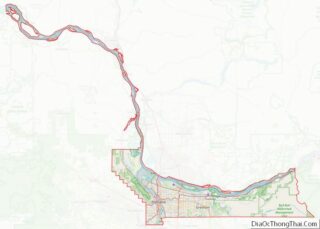
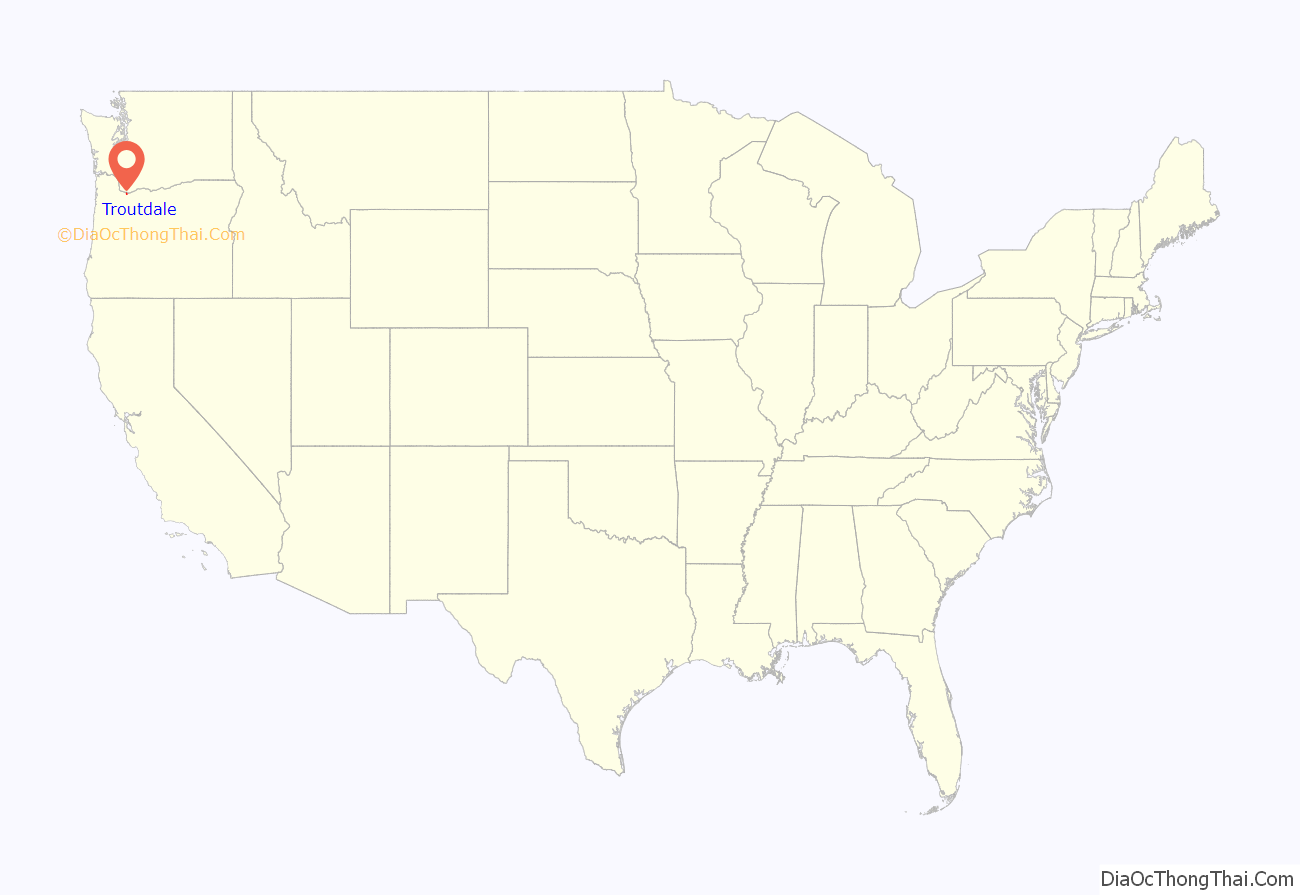
Troutdale location map. Where is Troutdale city?

History
The community was once known as Sandy, after the nearby Sandy River; the post office in Sandy was established in 1854 and closed in 1868. In 1873, the current city of Sandy in Clackamas County, which was formerly named “Revenue”, established a different Sandy post office that is still in operation. Troutdale was named by pioneer John Harlow for the trout pond in a dale near his house. Troutdale post office was founded in 1880. In 1925, a company, the Bissinger Wool Pullery, was moved from Sellwood, Oregon, and opened for business on Macadam Road along the west bank of the Sandy River. An iconic water tower stands nearby. The company was featured in a Ripley’s Believe it or Not! column because a cat was reportedly found in a stack of animal hides that the company was going to use for its products. The cat was taken care of and became the company’s mascot, and was said to have lived a long and healthy life. The water tower is now known as the “Old Historic Water Tower”.
Reynolds Aluminum was once the area’s biggest employer. The Reynolds plant in Troutdale was established in 1941 to provide aluminum for the war effort. The plant closed in 2000. The nearby city of Wood Village was a company town founded to house workers from the Reynolds plant.
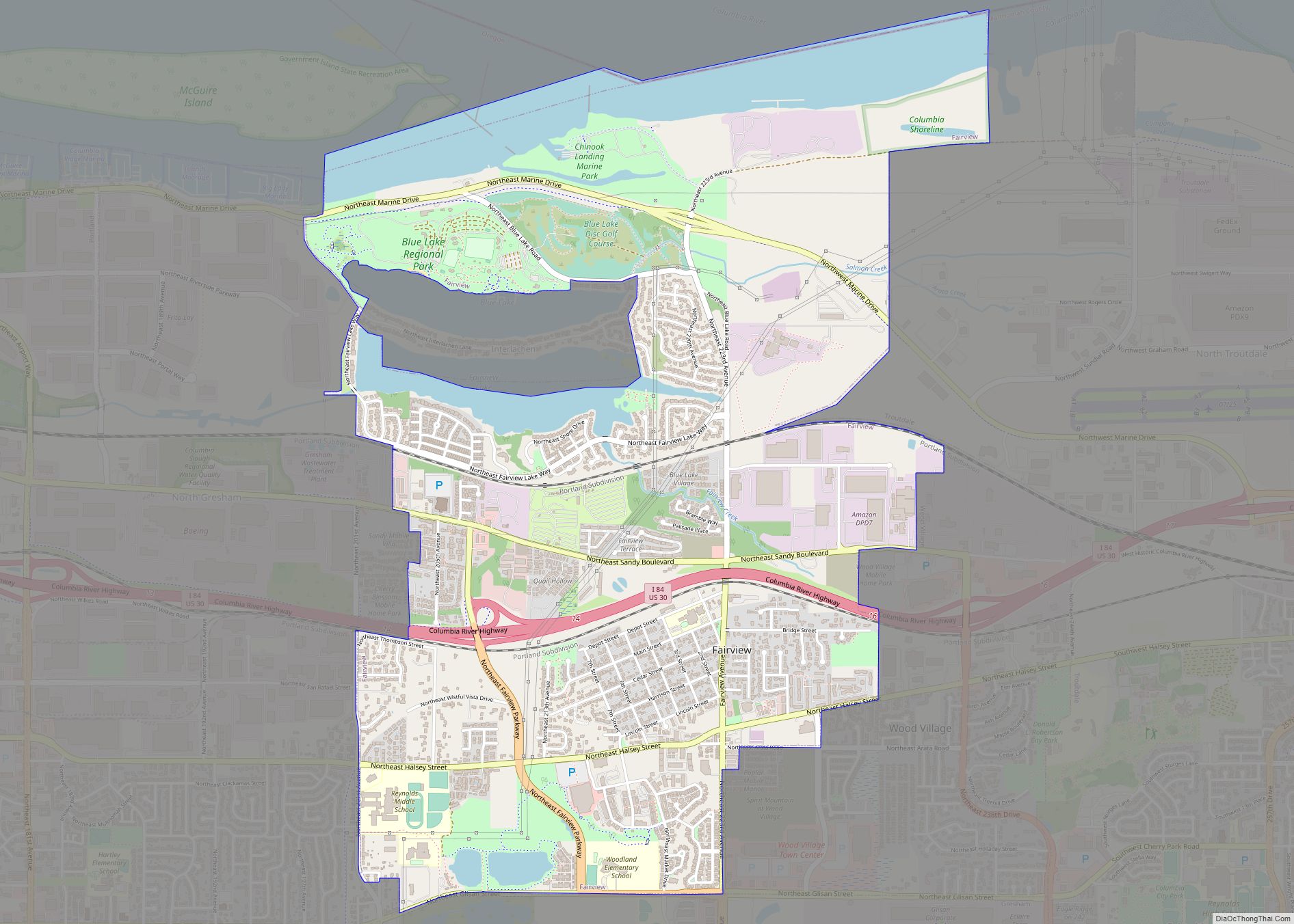
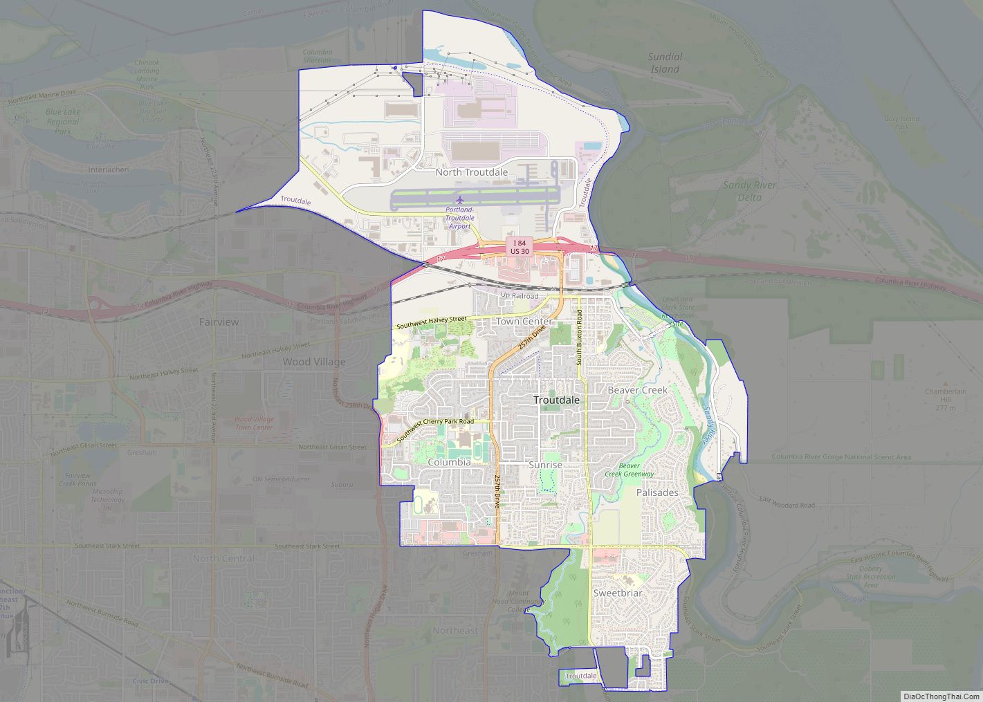
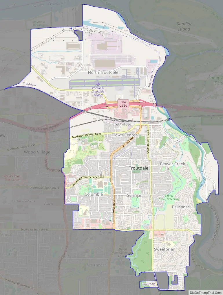
Troutdale Road Map
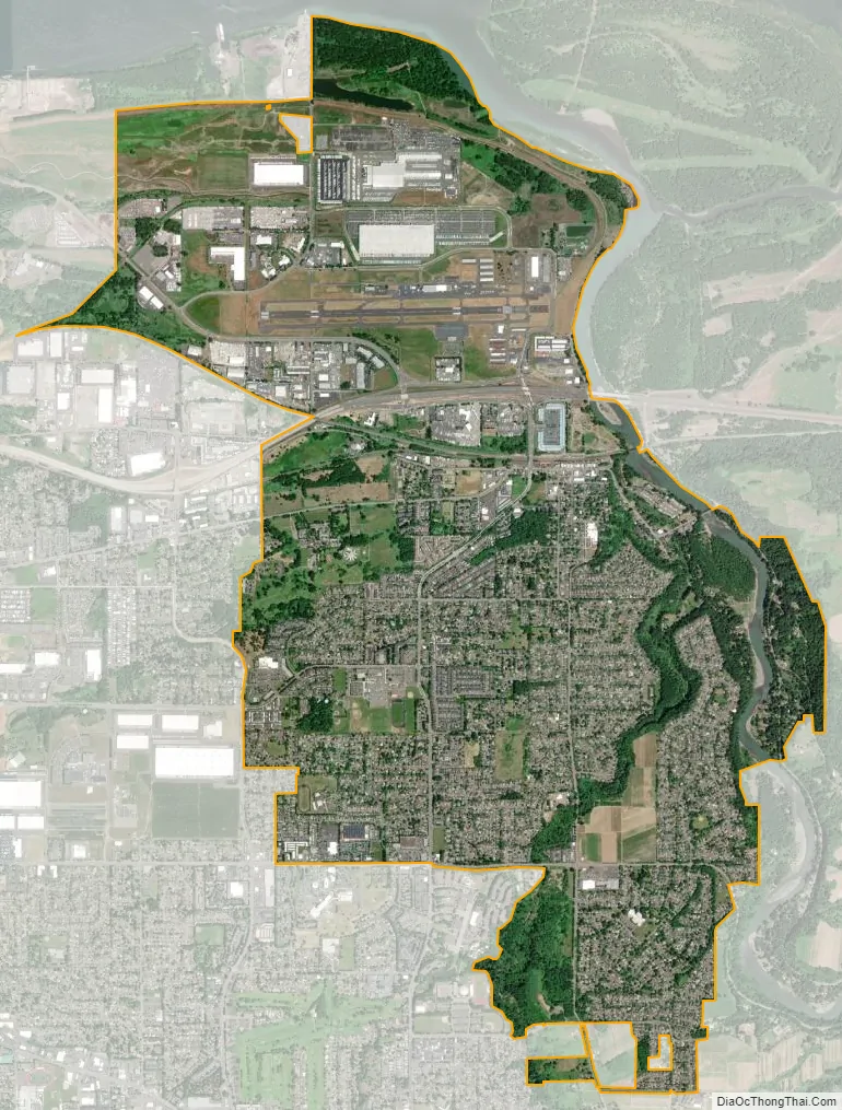
Troutdale city Satellite Map
Geography
According to the United States Census Bureau, the city has a total area of 6.02 square miles (15.59 km), of which 5.94 square miles (15.38 km) is land and 0.08 square miles (0.21 km) is water.
Troutdale is located at the confluence of the Sandy and Columbia rivers.
The city is about 12 miles (19 km) east of Portland.
Climate
This region experiences warm (but not hot) and dry summers, with no average monthly temperatures above 71.6 °F (22 °C). According to the Köppen climate classification system, Troutdale has a warm-summer Mediterranean climate, abbreviated “Csb” on climate maps.
Troutdale is renowned for having some of the windiest conditions in the Pacific Northwest. Periodically, strong east winds emerge from the Columbia River Gorge that affect the city’s temperature and general climate. As a result, several businesses and locations utilize the East Wind identifier in their names or services.
See also
Map of Oregon State and its subdivision: Map of other states:- Alabama
- Alaska
- Arizona
- Arkansas
- California
- Colorado
- Connecticut
- Delaware
- District of Columbia
- Florida
- Georgia
- Hawaii
- Idaho
- Illinois
- Indiana
- Iowa
- Kansas
- Kentucky
- Louisiana
- Maine
- Maryland
- Massachusetts
- Michigan
- Minnesota
- Mississippi
- Missouri
- Montana
- Nebraska
- Nevada
- New Hampshire
- New Jersey
- New Mexico
- New York
- North Carolina
- North Dakota
- Ohio
- Oklahoma
- Oregon
- Pennsylvania
- Rhode Island
- South Carolina
- South Dakota
- Tennessee
- Texas
- Utah
- Vermont
- Virginia
- Washington
- West Virginia
- Wisconsin
- Wyoming