Map of Hemby Bridge town
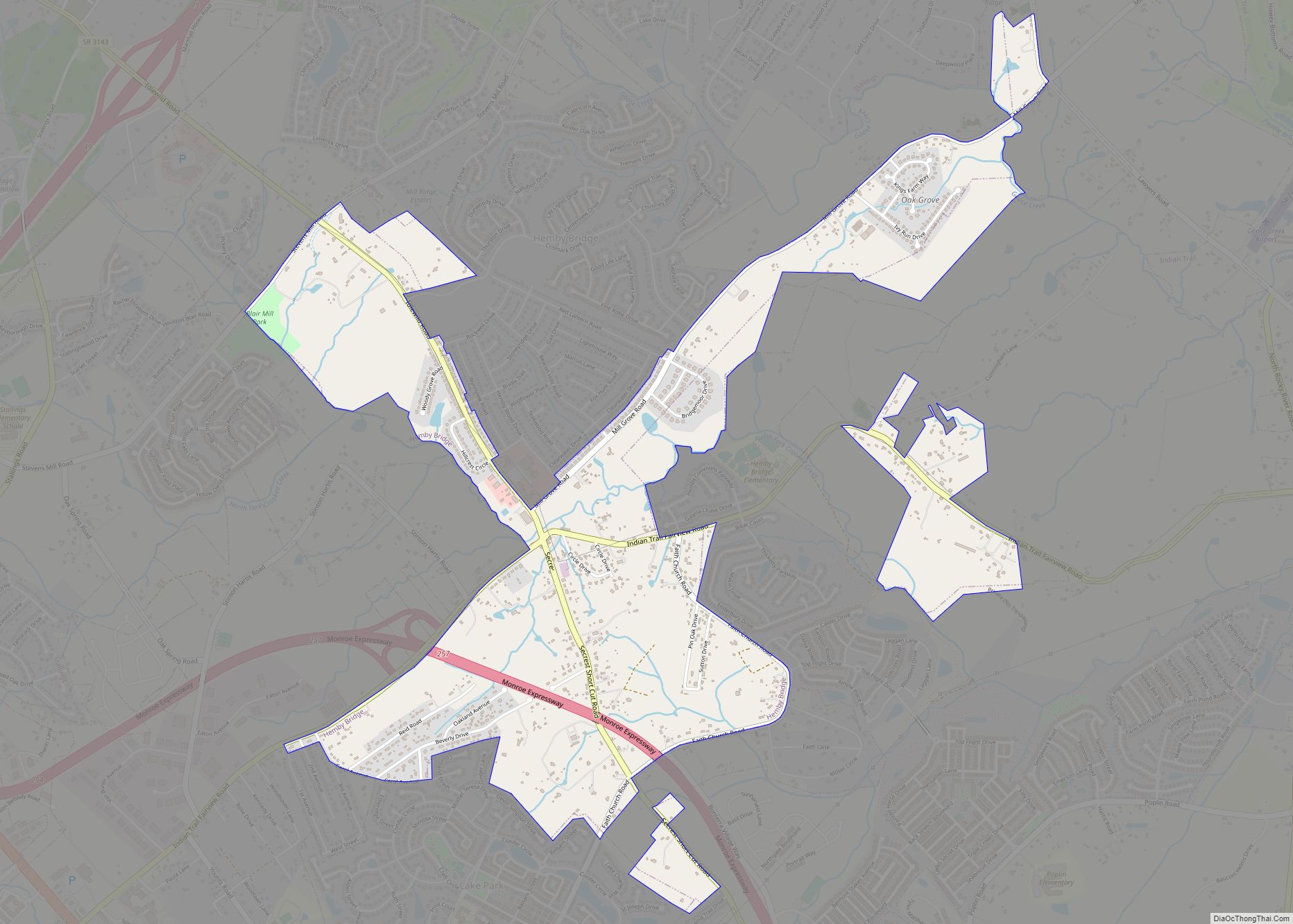
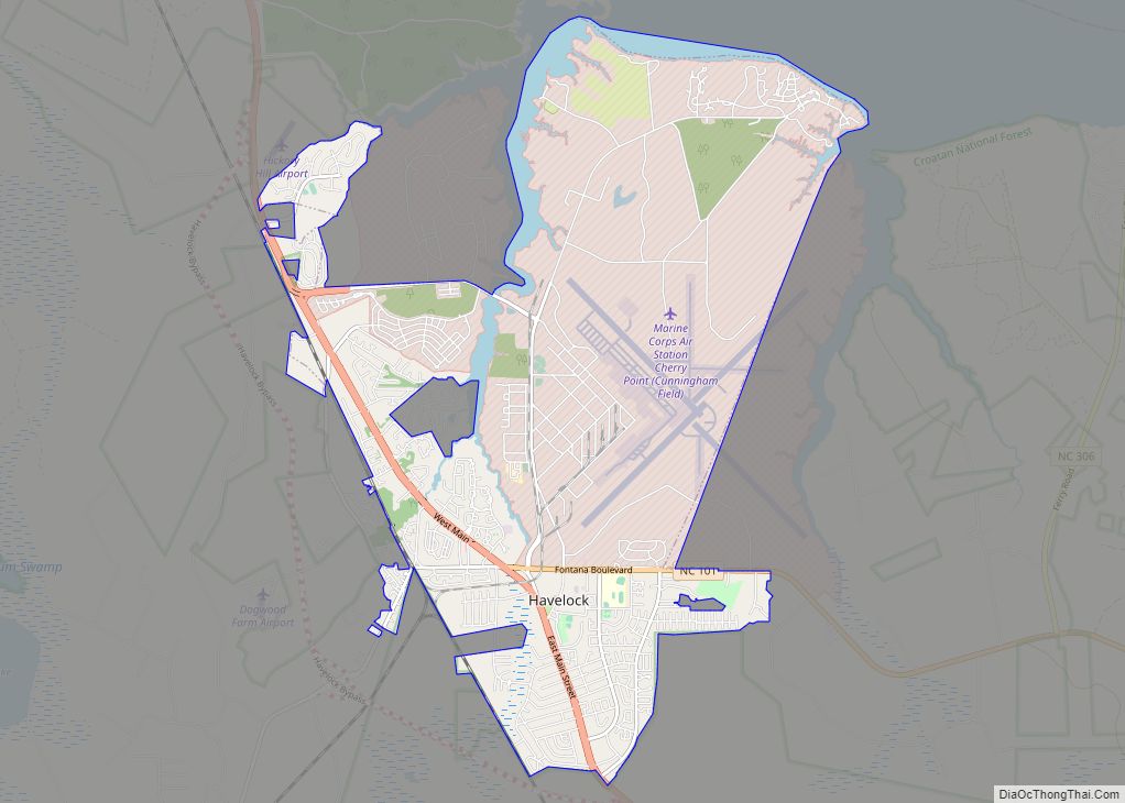
Hemby Bridge is a town in Union County, North Carolina, United States. The population was 1,615 at the 2020 Census. Hemby Bridge town overview: Name: Hemby Bridge town LSAD Code: 43 LSAD Description: town (suffix) State: North Carolina County: Union County Elevation: 663 ft (202 m) Total Area: 2.33 sq mi (6.04 km²) Land Area: 2.29 sq mi (5.93 km²) Water Area: 0.04 sq mi ... Read more
Map of Hemby Bridge town
Map of Hays CDP, North Carolina
Hays is a census-designated place (CDP) in Wilkes County, North Carolina, United States. The population was 1,595 at the 2020 census. North Wilkes High School, one of Wilkes County’s four public high schools, is located in Hays. Hays CDP overview: Name: Hays CDP LSAD Code: 57 LSAD Description: CDP (suffix) State: North Carolina County: Wilkes ... Read more
Map of Hays CDP, North Carolina
Map of Hayesville town, North Carolina
Hayesville is a town in Clay County, North Carolina, United States. The population was 311 at the 2010 census. It is the county seat of Clay County. Hayesville town overview: Name: Hayesville town LSAD Code: 43 LSAD Description: town (suffix) State: North Carolina County: Clay County Elevation: 1,893 ft (577 m) Total Area: 0.64 sq mi (1.65 km²) Land Area: ... Read more
Map of Hayesville town, North Carolina
Map of Haw River town
Haw River is a town in Alamance County, North Carolina, United States. It is part of the Burlington, North Carolina Metropolitan Statistical Area. As of the 2010 census the population was 2,298. Haw River town overview: Name: Haw River town LSAD Code: 43 LSAD Description: town (suffix) State: North Carolina County: Alamance County Elevation: 564 ft ... Read more
Map of Haw River town
Map of Havelock city, North Carolina
Havelock is a city in Craven County, North Carolina, United States. The population was 20,735 at the 2010 census. The city is home to Marine Corps Air Station Cherry Point, the world’s largest Marine Corps air station, and home to the 2nd Marine Aircraft Wing. Havelock is part of the New Bern Metropolitan Statistical Area. ... Read more
Map of Havelock city, North Carolina
Map of Hatteras CDP
Hatteras CDP overview: Name: Hatteras CDP LSAD Code: 57 LSAD Description: CDP (suffix) State: North Carolina County: Dare County FIPS code: 3730100 Online Interactive Map Hatteras online map. Source: Basemap layers from Google Map, Open Street Map (OSM), Arcgisonline, Wmflabs. Boundary Data from Database of Global Administrative Areas. Hatteras location map. Where is Hatteras CDP? ... Read more
Map of Hatteras CDP
Map of Hildebran town
Hildebran is a town in Burke County, North Carolina, United States. The population was 2,023 at the 2010 census. It is part of the Hickory–Lenoir–Morganton Metropolitan Statistical Area. Hildebran town overview: Name: Hildebran town LSAD Code: 43 LSAD Description: town (suffix) State: North Carolina County: Burke County Incorporated: 1899 Elevation: 1,188 ft (362 m) Total Area: 2.83 sq mi ... Read more
Map of Hildebran town
Map of Hightsville CDP
Hightsville is a census-designated place (CDP) in New Hanover County, North Carolina, United States. The population was 739 at the 2010 census. It is part of the Wilmington Metropolitan Statistical Area. Hightsville CDP overview: Name: Hightsville CDP LSAD Code: 57 LSAD Description: CDP (suffix) State: North Carolina County: New Hanover County Elevation: 20 ft (6 m) Total ... Read more
Map of Hightsville CDP
Map of Highlands town, North Carolina
Highlands is an incorporated town in Macon County in the U.S. state of North Carolina. Located on a plateau in the southern Appalachian Mountains, within the Nantahala National Forest, it lies mostly in southeastern Macon County and slightly in southwestern Jackson County, in the Highlands and Cashiers Townships, respectively. The permanent population was 1,014 at ... Read more
Map of Highlands town, North Carolina
Map of High Shoals city
High Shoals is a city in Gaston County, North Carolina, United States, named for the high rocky shoal across the Catawba River. The population was 696 at the 2010 census. High Shoals city overview: Name: High Shoals city LSAD Code: 25 LSAD Description: city (suffix) State: North Carolina County: Gaston County Incorporated: November 6, 1973 ... Read more
Map of High Shoals city
Map of Hiddenite CDP
Hiddenite CDP overview: Name: Hiddenite CDP LSAD Code: 57 LSAD Description: CDP (suffix) State: North Carolina County: Alexander County FIPS code: 3731260 Online Interactive Map Hiddenite online map. Source: Basemap layers from Google Map, Open Street Map (OSM), Arcgisonline, Wmflabs. Boundary Data from Database of Global Administrative Areas. Hiddenite location map. Where is Hiddenite CDP? ... Read more
Map of Hiddenite CDP
Map of Hickory city, North Carolina
Hickory is a North Carolina city located approximately 60 miles (97 km) northwest of Charlotte. Its population in the 2020 census was 43,490. Primarily located in Catawba County, its formal boundaries extend into Burke and Caldwell counties. Hickory is the principal city of the Hickory–Lenoir–Morganton Metropolitan Statistical Area, which had a population of 365,276 in the ... Read more
Map of Hickory city, North Carolina