Hayesville is a town in Clay County, North Carolina, United States. The population was 311 at the 2010 census. It is the county seat of Clay County.
| Name: | Hayesville town |
|---|---|
| LSAD Code: | 43 |
| LSAD Description: | town (suffix) |
| State: | North Carolina |
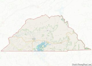
| County: | Clay County |
| Elevation: | 1,893 ft (577 m) |
| Total Area: | 0.64 sq mi (1.65 km²) |
| Land Area: | 0.64 sq mi (1.65 km²) |
| Water Area: | 0.00 sq mi (0.00 km²) |
| Total Population: | 461 |
| Population Density: | 724.84/sq mi (279.84/km²) |
| ZIP code: | 28904 |
| Area code: | 828 |
| FIPS code: | 3730280 |
| GNISfeature ID: | 1011930 |
| Website: | www.townofhayesville.com |
Online Interactive Map
Click on ![]() to view map in "full screen" mode.
to view map in "full screen" mode.
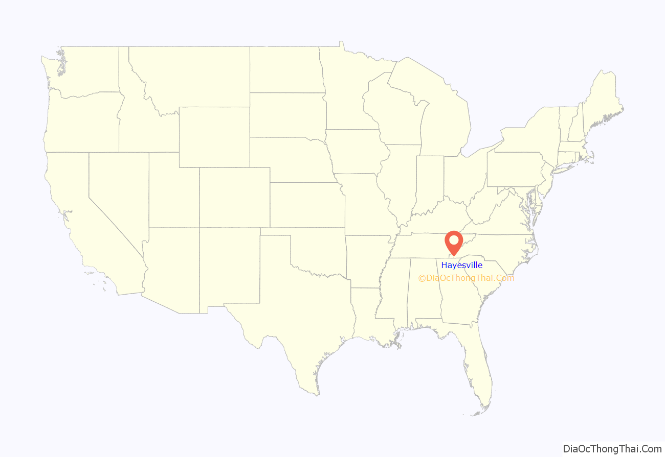
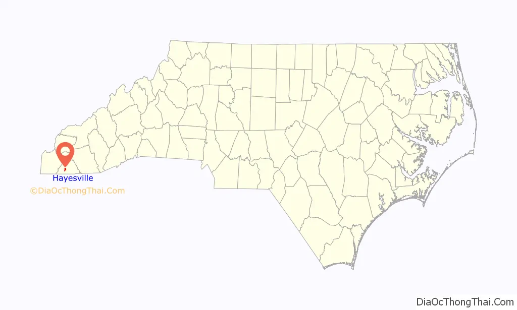
Hayesville location map. Where is Hayesville town?
History
This was long an area of indigenous settlement along the Hiwassee River. An earthwork platform mound was built here, likely by people of the South Appalachian Mississippian culture about 1000 CE. It would have been the center of their village.
Later, the historic Cherokee developed a town known as Quanassee at this site. They built their townhouse on top of the mound, to provide a place for communal discussion and reaching consensus. The town is shown on a 1725 colonial map as Qunassee; it was one of the numerous “Valley Towns” located along the Hiwassee River in Western North Carolina. It was also along the Trading Path (also called the “Unicoi Turnpike”). That road led from Quanassee west to another town at present-day Murphy, North Carolina, then over the Unicoi Range at Unicoi Gap and down to the Cherokee town of Great Tellico (today Tellico Plains, Tennessee) (Duncan 2003:245).
After the Cherokee were forced to cede their land, European Americans settled in this rural area and took over what is now known as the Spikebuck Town Mound and Village Site. They cultivated much of the village site, disturbing the topsoil layers. Some excavations were conducted in the 1960s and 1970s. The town mound and village site was listed in 1982 on the National Register of Historic Places as an archeological site.
Clay County acquired the mound site in 2000 and protects it; the Archeological Conservancy acquired the town/village site and farmsteads in 2011.
The town was named Hayesville after 19th-century politician George Hayes. When running for representative from Cherokee County in the fall election of 1860, he learned that residents in the southeast end wanted to separate from Cherokee County and get their own county seat, because of the difficulty of traveling to the distant location. With the promise to introduce legislation to this effect, Hayes won a seat in the legislature. In February 1861 the legislation to organize a new county was introduced and passed by the North Carolina General Assembly. The county was named in honor of Kentucky statesman Henry Clay, and the county seat Hayesville, for Hayes.
The town of Hayesville was incorporated on March 12, 1913. The first mayor of Hayesville was S.E. Hogsed.
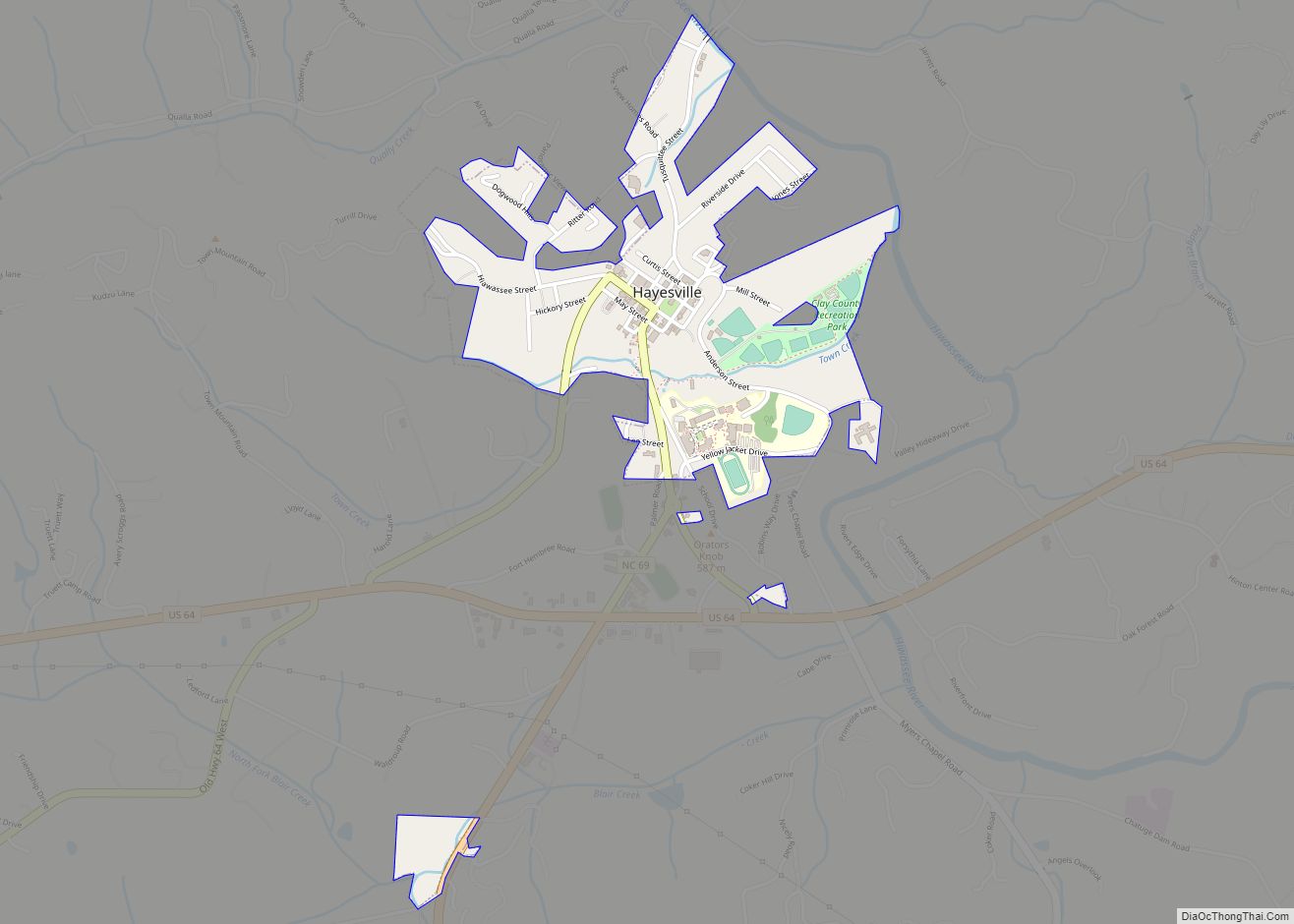
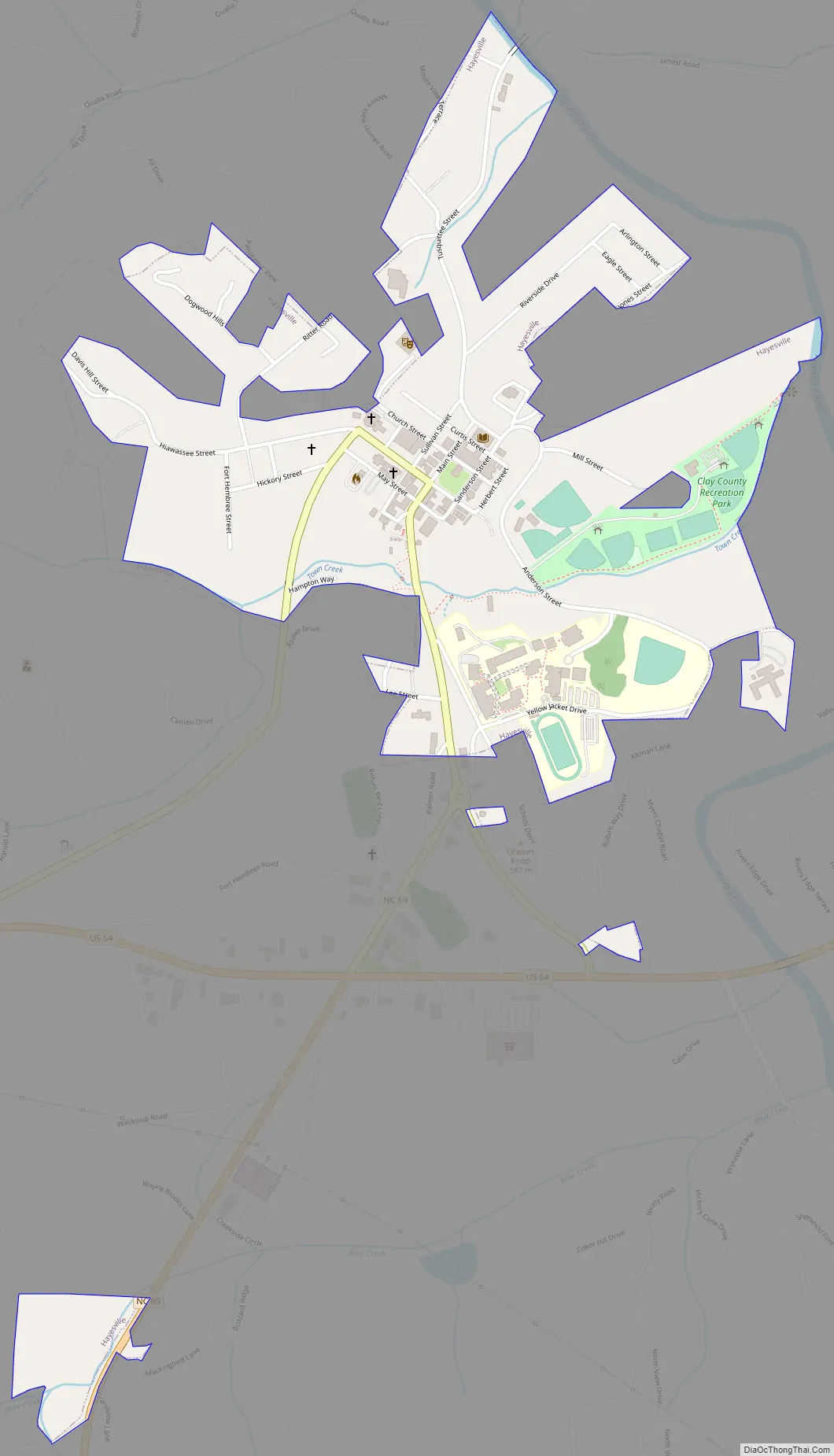
Hayesville Road Map
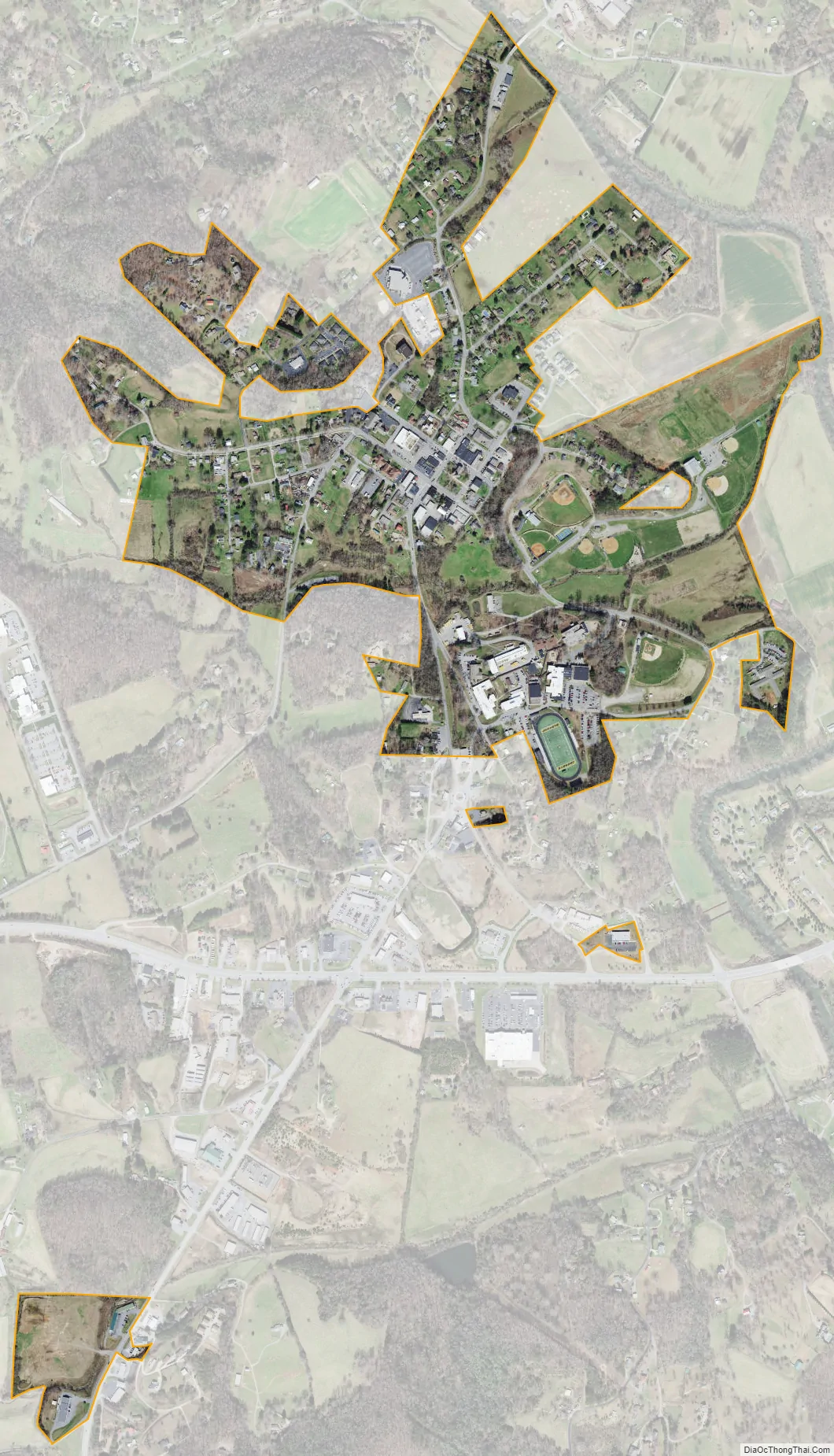
Hayesville city Satellite Map
Geography
Hayesville is located at 35°2′48″N 83°49′4″W / 35.04667°N 83.81778°W / 35.04667; -83.81778 (35.046630, −83.817883).
According to the United States Census Bureau, the town has a total area of 0.4 square miles (1.0 km), all land.
The Hiwassee River flows along the outskirts of Hayesville.
See also
Map of North Carolina State and its subdivision:- Alamance
- Alexander
- Alleghany
- Anson
- Ashe
- Avery
- Beaufort
- Bertie
- Bladen
- Brunswick
- Buncombe
- Burke
- Cabarrus
- Caldwell
- Camden
- Carteret
- Caswell
- Catawba
- Chatham
- Cherokee
- Chowan
- Clay
- Cleveland
- Columbus
- Craven
- Cumberland
- Currituck
- Dare
- Davidson
- Davie
- Duplin
- Durham
- Edgecombe
- Forsyth
- Franklin
- Gaston
- Gates
- Graham
- Granville
- Greene
- Guilford
- Halifax
- Harnett
- Haywood
- Henderson
- Hertford
- Hoke
- Hyde
- Iredell
- Jackson
- Johnston
- Jones
- Lee
- Lenoir
- Lincoln
- Macon
- Madison
- Martin
- McDowell
- Mecklenburg
- Mitchell
- Montgomery
- Moore
- Nash
- New Hanover
- Northampton
- Onslow
- Orange
- Pamlico
- Pasquotank
- Pender
- Perquimans
- Person
- Pitt
- Polk
- Randolph
- Richmond
- Robeson
- Rockingham
- Rowan
- Rutherford
- Sampson
- Scotland
- Stanly
- Stokes
- Surry
- Swain
- Transylvania
- Tyrrell
- Union
- Vance
- Wake
- Warren
- Washington
- Watauga
- Wayne
- Wilkes
- Wilson
- Yadkin
- Yancey
- Alabama
- Alaska
- Arizona
- Arkansas
- California
- Colorado
- Connecticut
- Delaware
- District of Columbia
- Florida
- Georgia
- Hawaii
- Idaho
- Illinois
- Indiana
- Iowa
- Kansas
- Kentucky
- Louisiana
- Maine
- Maryland
- Massachusetts
- Michigan
- Minnesota
- Mississippi
- Missouri
- Montana
- Nebraska
- Nevada
- New Hampshire
- New Jersey
- New Mexico
- New York
- North Carolina
- North Dakota
- Ohio
- Oklahoma
- Oregon
- Pennsylvania
- Rhode Island
- South Carolina
- South Dakota
- Tennessee
- Texas
- Utah
- Vermont
- Virginia
- Washington
- West Virginia
- Wisconsin
- Wyoming