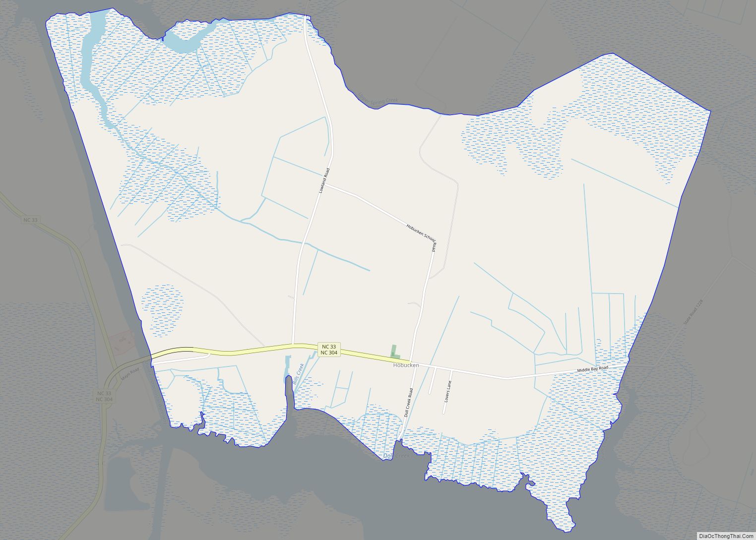
Map of Holly Ridge town
Holly Ridge is a town in Onslow County, North Carolina, United States. The 2010 population was 1,268. It is part of the Jacksonville, North Carolina Metropolitan Statistical Area. It is considered the gateway to Topsail Island. Population Boom: In 1940, the town had 28 residents. Just three years later in 1943, the town had ballooned ... Read more
Map of Holly Ridge town
Map of JAARS CDP
Jaars, capitalized as JAARS on some maps, is a census-designated place (CDP) in Union County, North Carolina, United States. The population was 597 at the 2010 census. The region’s name comes from JAARS, a non-profit organization that is located there. JAARS CDP overview: Name: JAARS CDP LSAD Code: 57 LSAD Description: CDP (suffix) State: North ... Read more
Map of JAARS CDP
Map of Ivanhoe CDP, North Carolina
Ivanhoe is a census-designated place (CDP) in Sampson County, North Carolina, United States. The population was 198 at the 2020 census. Ivanhoe CDP overview: Name: Ivanhoe CDP LSAD Code: 57 LSAD Description: CDP (suffix) State: North Carolina County: Sampson County Elevation: 30 ft (10 m) Total Area: 5.03 sq mi (13.03 km²) Land Area: 5.02 sq mi (13.01 km²) Water Area: 0.01 sq mi (0.02 km²) ... Read more
Map of Ivanhoe CDP, North Carolina
Map of Iron Station CDP
Iron Station is an unincorporated community and census-designated place (CDP) in Lincoln County, North Carolina, United States. A primarily industrial town, Iron Station’s population was 755 as of the 2010 census. It also serves as a bedroom community for the larger cities of Charlotte, Hickory, and Lincolnton. The Iron Station post office has a ZIP ... Read more
Map of Iron Station CDP
Map of Ingold CDP
Ingold is a census-designated place (CDP) in Sampson County, North Carolina, United States. The population was 484 at the 2000 census. Ingold CDP overview: Name: Ingold CDP LSAD Code: 57 LSAD Description: CDP (suffix) State: North Carolina County: Sampson County Elevation: 102 ft (31 m) Total Area: 5.19 sq mi (13.44 km²) Land Area: 5.18 sq mi (13.42 km²) Water Area: 0.01 sq mi (0.03 km²) ... Read more
Map of Ingold CDP
Map of Indian Trail town
Indian Trail is a suburban town in Union County, North Carolina, United States. A part of the Charlotte metropolitan area, Indian Trail has grown rapidly in the 21st century, going from 1,942 residents in 1990 to 39,997 in 2020. Every Fourth of July the town holds an annual parade which is one of the biggest ... Read more
Map of Indian Trail town
Map of Indian Beach town
Indian Beach is a town in Carteret County, North Carolina, United States. The population was 112 as of the 2010 census. Indian Beach town overview: Name: Indian Beach town LSAD Code: 43 LSAD Description: town (suffix) State: North Carolina County: Carteret County Elevation: 7 ft (2 m) Total Area: 0.59 sq mi (1.53 km²) Land Area: 0.57 sq mi (1.47 km²) Water Area: ... Read more
Map of Indian Beach town
Map of Icard CDP
Icard CDP overview: Name: Icard CDP LSAD Code: 57 LSAD Description: CDP (suffix) State: North Carolina County: Burke County FIPS code: 3733320 Online Interactive Map Icard online map. Source: Basemap layers from Google Map, Open Street Map (OSM), Arcgisonline, Wmflabs. Boundary Data from Database of Global Administrative Areas. Icard location map. Where is Icard CDP? ... Read more
Map of Icard CDP
Map of Huntersville town, North Carolina
Huntersville is a large suburban town in Mecklenburg County, North Carolina, United States. At the 2020 census, its population was 61,376, making Huntersville the 15th largest municipality in North Carolina. It is located in the Charlotte metropolitan area and 14 mi (23 km) north of Charlotte. Huntersville town overview: Name: Huntersville town LSAD Code: 43 LSAD Description: ... Read more
Map of Huntersville town, North Carolina
Map of Hudson town, North Carolina
Hudson is a town in Caldwell County, North Carolina, United States. The population was 3,776 at the 2010 census. It is part of the Hickory–Lenoir–Morganton Metropolitan Statistical Area. Hudson town overview: Name: Hudson town LSAD Code: 43 LSAD Description: town (suffix) State: North Carolina County: Caldwell County Elevation: 1,263 ft (385 m) Total Area: 3.66 sq mi (9.47 km²) Land ... Read more
Map of Hudson town, North Carolina
Map of Hot Springs town, North Carolina
Hot Springs is a town in Madison County, North Carolina, United States. The population was 560 at the 2010 census. It is part of the Asheville Metropolitan Statistical Area. It is a resort town, reliant on the tourist economy of its namesake springs, and being situated near the Appalachian Trail and the French Broad River. ... Read more
Map of Hot Springs town, North Carolina
Map of Keener CDP
Keener is a census-designated place (CDP) in Sampson County, North Carolina, United States. The population was 508 at the 2000 census. Keener CDP overview: Name: Keener CDP LSAD Code: 57 LSAD Description: CDP (suffix) State: North Carolina County: Sampson County Elevation: 177 ft (54 m) Total Area: 11.18 sq mi (28.96 km²) Land Area: 11.17 sq mi (28.94 km²) Water Area: 0.01 sq mi (0.02 km²) ... Read more
Map of Keener CDP