Hudson is a town in Caldwell County, North Carolina, United States. The population was 3,776 at the 2010 census. It is part of the Hickory–Lenoir–Morganton Metropolitan Statistical Area.
| Name: | Hudson town |
|---|---|
| LSAD Code: | 43 |
| LSAD Description: | town (suffix) |
| State: | North Carolina |
| County: | Caldwell County |
| Elevation: | 1,263 ft (385 m) |
| Total Area: | 3.66 sq mi (9.47 km²) |
| Land Area: | 3.66 sq mi (9.47 km²) |
| Water Area: | 0.00 sq mi (0.00 km²) |
| Total Population: | 3,780 |
| Population Density: | 1,033.35/sq mi (398.99/km²) |
| ZIP code: | 28638 |
| Area code: | 828 |
| FIPS code: | 3732980 |
| GNISfeature ID: | 0987211 |
| Website: | www.townofhudsonnc.com |
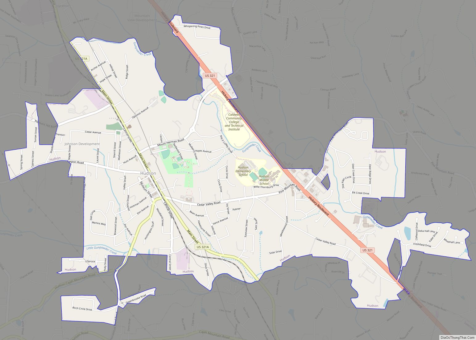
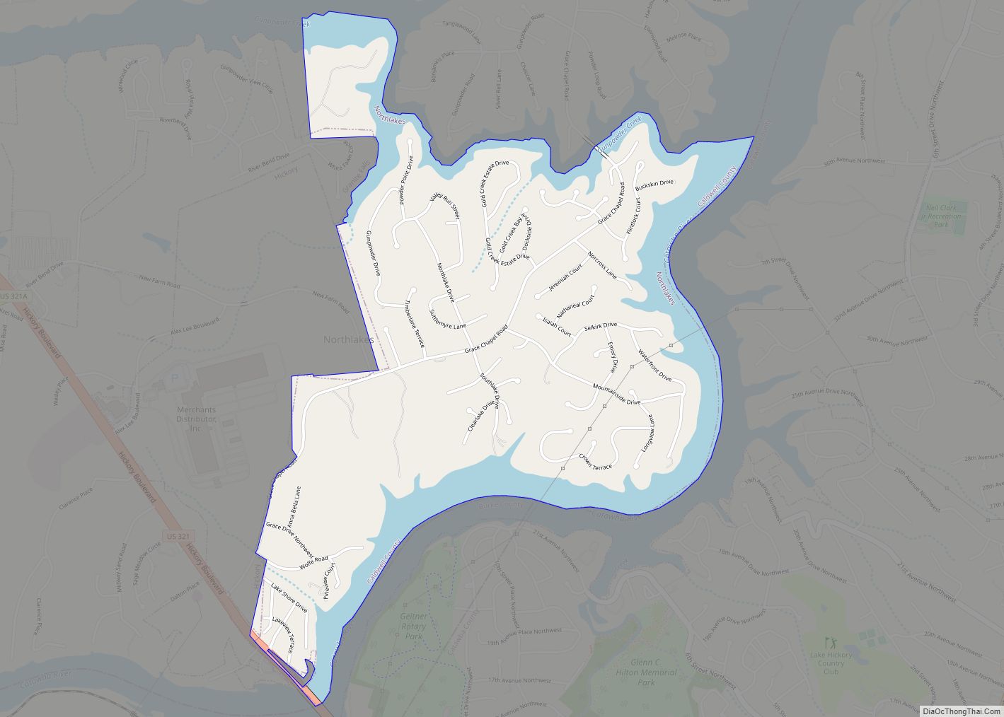
Online Interactive Map
Click on ![]() to view map in "full screen" mode.
to view map in "full screen" mode.
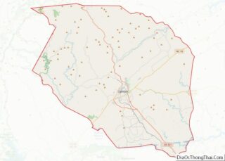
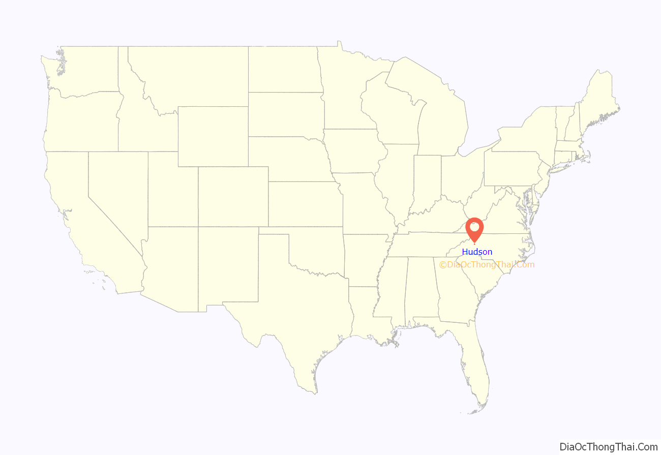
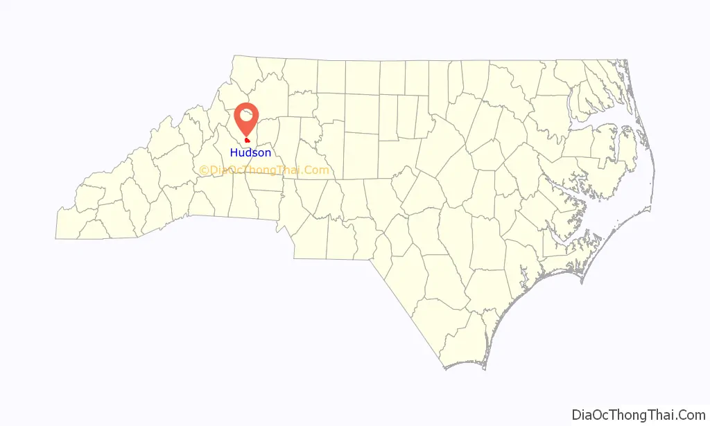
Hudson location map. Where is Hudson town?
History
Hudson originated as a sawmill camp, with timber being the initial attraction to the area. Among early settlers to Hudson, were the Hudson brothers, Monroe and Johnny. The name Hudson was selected honoring these two brothers as the name of the community. “Hudsonville” would come into being in 1880, with the “ville” being dropped in 1889 due to mail confusion with Hendersonville. In 1905, Hudson was incorporated as a town.
In 1904, businessman B.B. Hayes of the textile business came to Hudson and established the first big industry, the Hudson Cotten Mill (known as Shuford Mills). The Hudson Cotton Manufacturing Company was listed on the National Register of Historic Places in 2013.
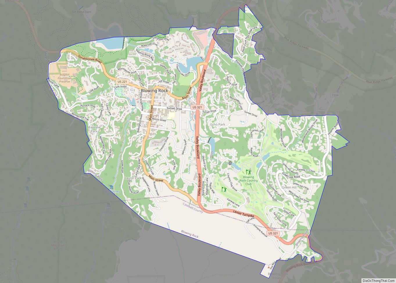
Hudson Road Map

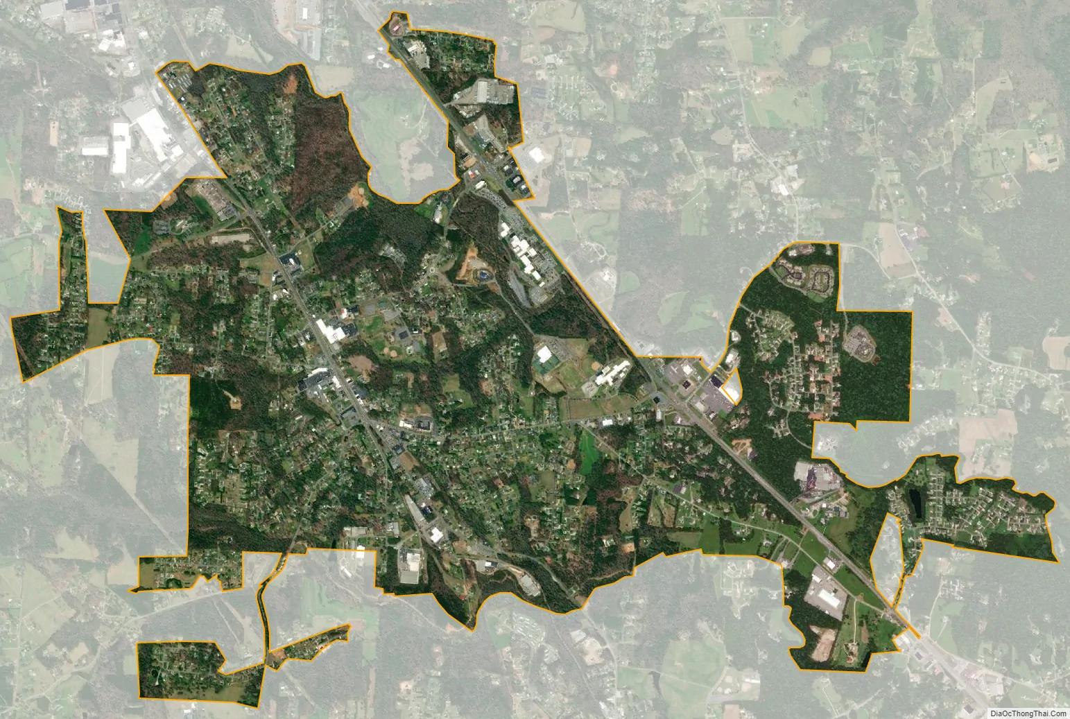
Hudson city Satellite Map
Geography
Hudson is located in southern Caldwell County at 35°50′44″N 81°29′25″W / 35.84556°N 81.49028°W / 35.84556; -81.49028 (35.845476, -81.490337). It is bordered to the north by the city of Lenoir, the county seat, and to the south by the town of Sawmills. U.S. Route 321, a four-lane highway, runs along the eastern edge of the town, leading northwest into Lenoir and southeast 11 miles (18 km) to Hickory. US 321 Alternate passes through the center of the town as Main Street.
According to the United States Census Bureau, the town of Hudson has a total area of 3.7 square miles (9.7 km), all land.
See also
Map of North Carolina State and its subdivision:- Alamance
- Alexander
- Alleghany
- Anson
- Ashe
- Avery
- Beaufort
- Bertie
- Bladen
- Brunswick
- Buncombe
- Burke
- Cabarrus
- Caldwell
- Camden
- Carteret
- Caswell
- Catawba
- Chatham
- Cherokee
- Chowan
- Clay
- Cleveland
- Columbus
- Craven
- Cumberland
- Currituck
- Dare
- Davidson
- Davie
- Duplin
- Durham
- Edgecombe
- Forsyth
- Franklin
- Gaston
- Gates
- Graham
- Granville
- Greene
- Guilford
- Halifax
- Harnett
- Haywood
- Henderson
- Hertford
- Hoke
- Hyde
- Iredell
- Jackson
- Johnston
- Jones
- Lee
- Lenoir
- Lincoln
- Macon
- Madison
- Martin
- McDowell
- Mecklenburg
- Mitchell
- Montgomery
- Moore
- Nash
- New Hanover
- Northampton
- Onslow
- Orange
- Pamlico
- Pasquotank
- Pender
- Perquimans
- Person
- Pitt
- Polk
- Randolph
- Richmond
- Robeson
- Rockingham
- Rowan
- Rutherford
- Sampson
- Scotland
- Stanly
- Stokes
- Surry
- Swain
- Transylvania
- Tyrrell
- Union
- Vance
- Wake
- Warren
- Washington
- Watauga
- Wayne
- Wilkes
- Wilson
- Yadkin
- Yancey
- Alabama
- Alaska
- Arizona
- Arkansas
- California
- Colorado
- Connecticut
- Delaware
- District of Columbia
- Florida
- Georgia
- Hawaii
- Idaho
- Illinois
- Indiana
- Iowa
- Kansas
- Kentucky
- Louisiana
- Maine
- Maryland
- Massachusetts
- Michigan
- Minnesota
- Mississippi
- Missouri
- Montana
- Nebraska
- Nevada
- New Hampshire
- New Jersey
- New Mexico
- New York
- North Carolina
- North Dakota
- Ohio
- Oklahoma
- Oregon
- Pennsylvania
- Rhode Island
- South Carolina
- South Dakota
- Tennessee
- Texas
- Utah
- Vermont
- Virginia
- Washington
- West Virginia
- Wisconsin
- Wyoming