Map of Plain View CDP
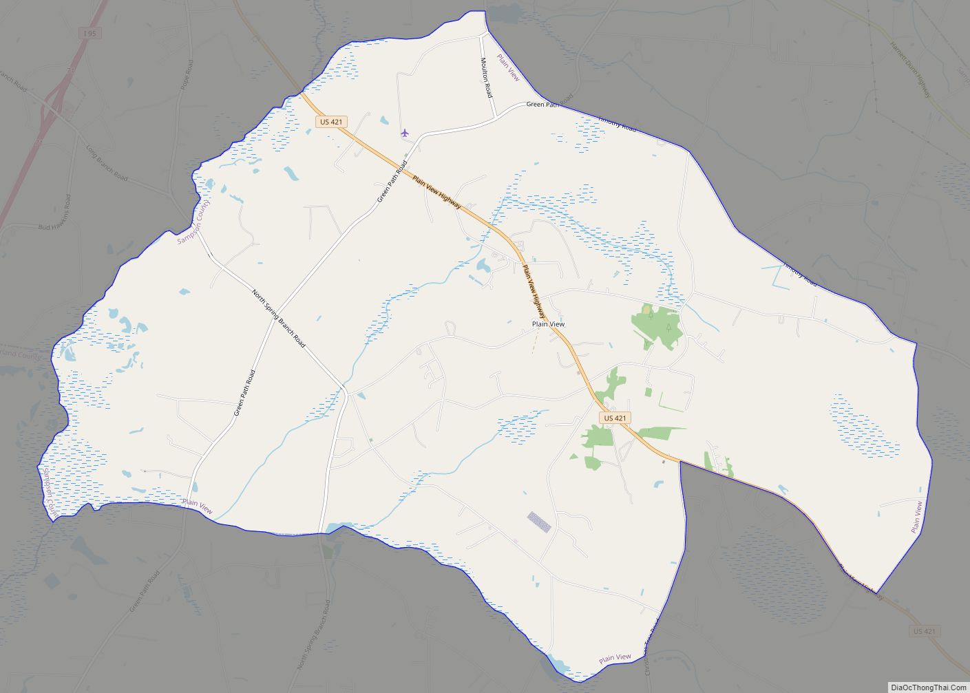
Plain View is a census-designated place (CDP) in Sampson County, North Carolina, United States. The population was 1,820 at the 2000 census. Plain View CDP overview: Name: Plain View CDP LSAD Code: 57 LSAD Description: CDP (suffix) State: North Carolina County: Sampson County Elevation: 203 ft (62 m) Total Area: 16.69 sq mi (43.22 km²) Land Area: 16.65 sq mi (43.13 km²) Water ... Read more
Map of Plain View CDP
Map of Pittsboro town, North Carolina
Pittsboro is a town in Chatham County, North Carolina, United States. The population was 3,743 at the 2010 census and 4,537 at the 2020 census. It is the county seat of Chatham County. The town was established in the late 18th century, shortly after the American Revolution, as the county seat for the newly formed ... Read more
Map of Pittsboro town, North Carolina
Map of Pinnacle CDP
Pinnacle is an unincorporated community and census-designated place in southwestern Stokes County, North Carolina, United States, approximately 5 miles (8.0 km) SSE of the town of Pilot Mountain, between Pilot Mountain State Park and Hanging Rock State Park. As of March 2015, the exact population is 855. Pinnacle CDP overview: Name: Pinnacle CDP LSAD Code: 57 ... Read more
Map of Pinnacle CDP
Map of Porters Neck CDP
Porters Neck is an unincorporated community and census-designated place in New Hanover County, North Carolina, United States. Its population was 6,204 as of the 2010 census. Porters Neck CDP overview: Name: Porters Neck CDP LSAD Code: 57 LSAD Description: CDP (suffix) State: North Carolina County: New Hanover County Elevation: 20 ft (6 m) Total Area: 5.78 sq mi (14.98 km²) ... Read more
Map of Porters Neck CDP
Map of Pollocksville town
Pollocksville is a town in Jones County, North Carolina, United States. The population was 268 at the 2020 census. It is part of the New Bern, North Carolina Micropolitan Statistical Area. It is situated on US 17 and Highway 58. Pollocksville town overview: Name: Pollocksville town LSAD Code: 43 LSAD Description: town (suffix) State: North ... Read more
Map of Pollocksville town
Map of Polkville city, North Carolina
Polkville is a small town in Cleveland County, North Carolina, United States. The population was 545 at the 2010 census. Polkville city overview: Name: Polkville city LSAD Code: 25 LSAD Description: city (suffix) State: North Carolina County: Cleveland County Elevation: 1,093 ft (333 m) Total Area: 1.86 sq mi (4.83 km²) Land Area: 1.86 sq mi (4.83 km²) Water Area: 0.00 sq mi (0.00 km²) Total ... Read more
Map of Polkville city, North Carolina
Map of Polkton town
Polkton is a town in Anson County, North Carolina, United States. As of the 2020 census, the town population was 1,881 down from 3,375 in 2010. The town is named after its founder, Leonidas L. Polk. Polkton town overview: Name: Polkton town LSAD Code: 43 LSAD Description: town (suffix) State: North Carolina County: Anson County ... Read more
Map of Polkton town
Map of Plymouth town, North Carolina
Plymouth is the largest town in Washington County, North Carolina, United States. The population was 3320 at the 2020 Census. It is the county seat of Washington County. Plymouth is located on the Roanoke River about seven miles (11 km) upriver from its mouth into the Albemarle Sound in North Carolina’s Inner Banks region. Plymouth town ... Read more
Map of Plymouth town, North Carolina
Map of Pleasant Hill CDP, North Carolina
Pleasant Hill is a census-designated place (CDP) in Wilkes County, North Carolina, United States. The population was 1,109 at the 2000 census. Pleasant Hill CDP overview: Name: Pleasant Hill CDP LSAD Code: 57 LSAD Description: CDP (suffix) State: North Carolina County: Wilkes County Elevation: 1,135 ft (346 m) Total Area: 2.59 sq mi (6.70 km²) Land Area: 2.58 sq mi (6.69 km²) Water ... Read more
Map of Pleasant Hill CDP, North Carolina
Map of Pleasant Garden town
Pleasant Garden is a town in Guilford County, North Carolina, United States. The population was 4,489 at the 2010 census. Pleasant Garden town overview: Name: Pleasant Garden town LSAD Code: 43 LSAD Description: town (suffix) State: North Carolina County: Guilford County Elevation: 850 ft (259 m) Total Area: 15.16 sq mi (39.25 km²) Land Area: 15.04 sq mi (38.95 km²) Water Area: 0.12 sq mi ... Read more
Map of Pleasant Garden town
Map of Raemon CDP
Raemon is a census-designated place (CDP) in Robeson County, North Carolina, United States. The population was 212 at the 2000 census. Raemon CDP overview: Name: Raemon CDP LSAD Code: 57 LSAD Description: CDP (suffix) State: North Carolina County: Robeson County Elevation: 164 ft (50 m) Total Area: 4.34 sq mi (11.24 km²) Land Area: 4.31 sq mi (11.17 km²) Water Area: 0.03 sq mi (0.07 km²) ... Read more
Map of Raemon CDP
Map of Raeford city
Raeford is a city in Hoke County, North Carolina, United States. Its population was 4,611 at the 2010 census, and in 2018, the estimated population was 4,962. It is the county seat of Hoke County. Raeford city overview: Name: Raeford city LSAD Code: 25 LSAD Description: city (suffix) State: North Carolina County: Hoke County Elevation: ... Read more
Map of Raeford city