Map of Hainesburg CDP
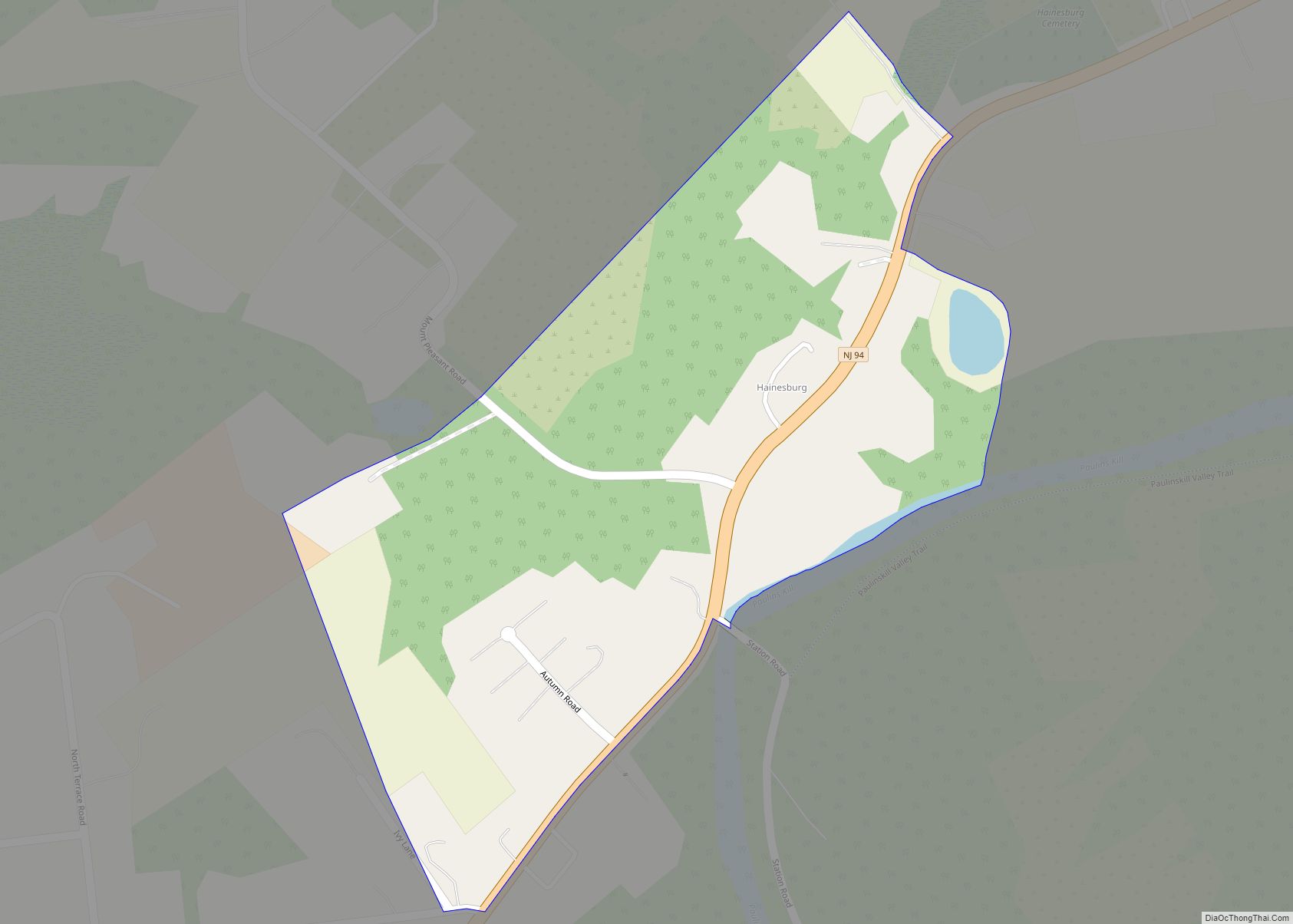
Hainesburg is an unincorporated community and census-designated place (CDP) located within Knowlton Township in Warren County, New Jersey, United States. While the community has existed for over a century, the CDP was designated as part of the 2010 United States Census. As of the 2010 Census, the CDP’s population was 91. Hainesburg CDP overview: Name: ... Read more
Map of Hainesburg CDP
Map of Haddonfield borough
Haddonfield is a borough located in Camden County, in the U.S. state of New Jersey. As of the 2020 United States census, the borough’s population was 12,550, an increase of 957 (+8.3%) from the 2010 census count of 11,593, which in turn reflected a decline of 66 (−0.6%) from the 11,659 counted in the 2000 ... Read more
Map of Haddonfield borough
Map of Haddon Heights borough
Haddon Heights is a borough in Camden County, in the U.S. state of New Jersey. As of the 2020 United States census, the borough’s population was 7,495, an increase of 22 (+0.3%) from the 2010 census count of 7,473, which in turn reflected a decline of 74 (−1.0%) from the 7,547 counted in the 2000 ... Read more
Map of Haddon Heights borough
Map of Hackettstown town
Hackettstown is a town in Warren County, in the U.S. state of New Jersey. It is perhaps best known as the home to the world headquarters of the Mars, Incorporated. As of the 2020 United States census, the town’s population was 10,248, an increase of 524 (+5.4%) from the 2010 census count of 9,724, which ... Read more
Map of Hackettstown town
Map of Harrison town, New Jersey
Harrison is a town in the western part of Hudson County in the U.S. state of New Jersey. It is part of the New York metropolitan area. It is a suburb of the nearby city of Newark, New Jersey, and is located 8 miles (13 km) from New York City. Once considered “the beehive of industry”, ... Read more
Map of Harrison town, New Jersey
Map of Harrington Park borough
Harrington Park is a borough in Bergen County, in the U.S. state of New Jersey. As of the 2020 United States census, the borough’s population was 4,741, an increase of 77 (+1.7%) from the 2010 census count of 4,664, which in turn reflected a decrease of 76 (−1.6%) from the 4,740 counted in the 2000 ... Read more
Map of Harrington Park borough
Map of Harmony CDP, New Jersey
Harmony is an unincorporated community and census-designated place (CDP) located within Harmony Township in Warren County, New Jersey, United States, that was defined as part of the 2010 United States Census. As of the 2010 Census, the CDP’s population was 441. Harmony CDP overview: Name: Harmony CDP LSAD Code: 57 LSAD Description: CDP (suffix) State: ... Read more
Map of Harmony CDP, New Jersey
Map of Harlingen CDP, New Jersey
Harlingen is an unincorporated community and census-designated place (CDP) located within Montgomery Township, in Somerset County, New Jersey, United States. As of the 2010 United States Census, the CDP’s population was 297. It is adjacent to the historical areas of Dutchtown and Bridgepoint. Harlingen Road and U.S. Route 206 intersect in the center of Harlingen. ... Read more
Map of Harlingen CDP, New Jersey
Map of Hancocks Bridge CDP
Hancocks Bridge CDP overview: Name: Hancocks Bridge CDP LSAD Code: 57 LSAD Description: CDP (suffix) State: New Jersey County: Salem County FIPS code: 3429520 Online Interactive Map Hancocks Bridge online map. Source: Basemap layers from Google Map, Open Street Map (OSM), Arcgisonline, Wmflabs. Boundary Data from Database of Global Administrative Areas. Hancocks Bridge location map. ... Read more
Map of Hancocks Bridge CDP
Map of Hampton borough, New Jersey
Hampton borough overview: Name: Hampton borough LSAD Code: 21 LSAD Description: borough (suffix) State: New Jersey County: Hunterdon County FIPS code: 3429460 Online Interactive Map Hampton online map. Source: Basemap layers from Google Map, Open Street Map (OSM), Arcgisonline, Wmflabs. Boundary Data from Database of Global Administrative Areas. Hampton location map. Where is Hampton borough? ... Read more
Map of Hampton borough, New Jersey
Map of Hammonton town
Hammonton is a town in Atlantic County, in the U.S. state of New Jersey, that has been referred to as the “Blueberry Capital of the World”. As of the 2020 United States census, the town’s population was 14,711, a decrease of 80 (−0.5%) from the 2010 census count of 14,791, which in turn reflected an ... Read more
Map of Hammonton town
Map of Hamilton Square CDP
Hamilton Square is an unincorporated community and census-designated place (CDP) located within Hamilton Township, in Mercer County, New Jersey, United States, that is the site of a historic colonial village. Until the 2000 Census the area was part of the Mercerville-Hamilton Square CDP, which was split into two CDPs as of 2010: Mercerville and Hamilton ... Read more
Map of Hamilton Square CDP