Hammonton is a town in Atlantic County, in the U.S. state of New Jersey, that has been referred to as the “Blueberry Capital of the World”. As of the 2020 United States census, the town’s population was 14,711, a decrease of 80 (−0.5%) from the 2010 census count of 14,791, which in turn reflected an increase of 2,187 (+17.4%) from the 12,604 counted in the 2000 census. Geographically, the town, and all of Atlantic County, is part of the South Jersey region of the state and of the Atlantic City-Hammonton metropolitan statistical area, which in turn is included in the Philadelphia–Reading–Camden combined statistical area and the Delaware Valley.
The first European settlement of Hammonton was in 1812. It was named for John Hammond Coffin, a son of one of the community’s earliest settlers, William Coffin, with the “d” in what was originally Hammondton disappearing over time. It was incorporated as a town by an act of the New Jersey Legislature on March 5, 1866, from portions of Hamilton Township and Mullica Township.
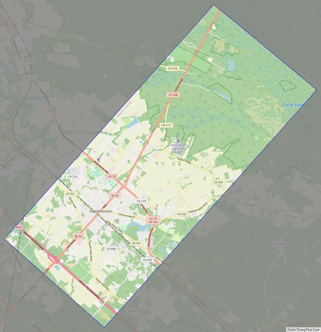
The town is located directly between Philadelphia and the resort town of Atlantic City, along a former route of the Pennsylvania Railroad with Hammonton station directly in the downtown area. The route is now used by NJ Transit’s Atlantic City Line.
| Name: | Hammonton town |
|---|---|
| LSAD Code: | 43 |
| LSAD Description: | town (suffix) |
| State: | New Jersey |
| County: | Atlantic County |
| Incorporated: | March 5, 1866 |
| Elevation: | 62 ft (19 m) |
| Total Area: | 41.32 sq mi (107.01 km²) |
| Land Area: | 40.75 sq mi (105.54 km²) |
| Water Area: | 0.57 sq mi (1.46 km²) 1.37% |
| Total Population: | 14,711 |
| Population Density: | 361.0/sq mi (139.4/km²) |
| ZIP code: | 08037 |
| Area code: | 609 |
| FIPS code: | 3429430 |
| GNISfeature ID: | 0885242 |
| Website: | www.townofhammonton.org |
Online Interactive Map
Click on ![]() to view map in "full screen" mode.
to view map in "full screen" mode.
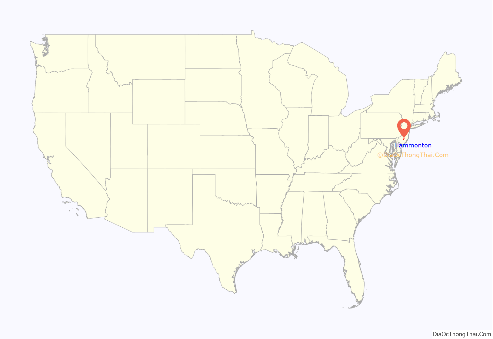
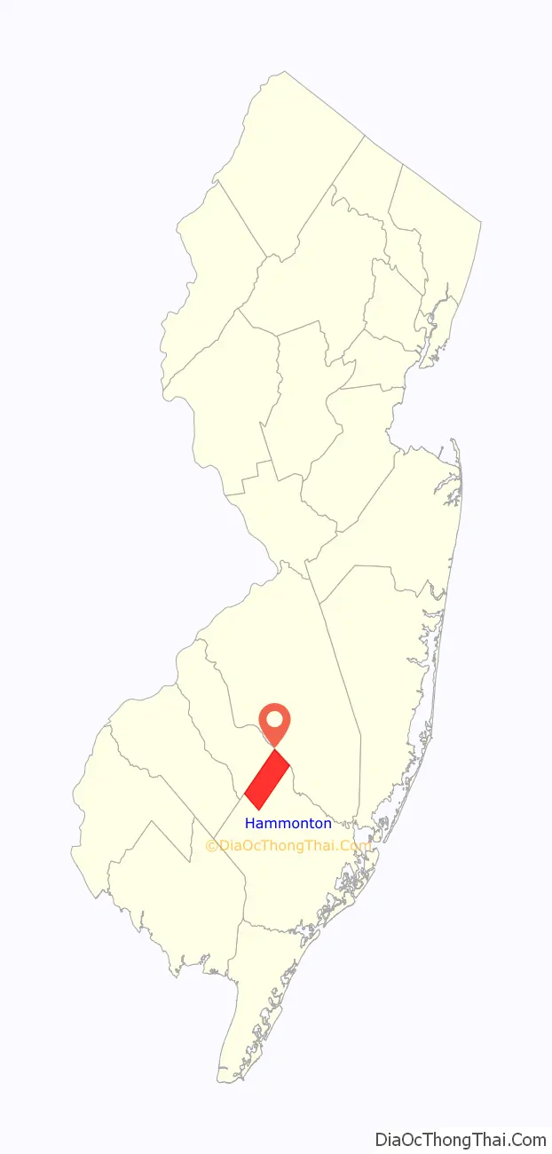
Hammonton location map. Where is Hammonton town?
History
Little is known of the area of Hammonton before European contact. Stone tools have been found in digs in the area probably dating from the Woodland period, so there was some population, but further details have not been ascertained. At the time of European contact, the general area was inhabited by the Unalachtigo Lenape. As European settlement continued, the Lenape in the area declined from disease, loss of land to Europeans, and emigration elsewhere. The West Jersey Society was granted rights over a large tract of land in the English Province of New Jersey to parcel out in 1748, including the territory of future Hammonton. The Society sold a parcel of what would become future Hammonton in 1805, with the territory passing through several hands. William Coffin and his family came to the land in 1812 to build a home and operate a sawmill for John R. Coates; Coffin purchased the land and mill outright in 1814. The mill was not in the exact location of the modern downtown, but rather by the shore of Hammonton Lake and stretching to the north and east of the current town. The town was initially called “Hammondton” after Coffin’s son John Hammond Coffin; later town governments would drop the “d”, leading to the modern name of Hammonton. In 1817, Coffin opened a glass factory in the area, as the glass industry was a major South Jersey industry at the time due to the availability of cheap timber and bog iron; the Mullica River was used to transport the finished products in an era before railroads. Trading stores and homes for workers were built as well.
The early Old Hammonton settlement was still quite tiny, and the glass industry began to fade in importance. It was replaced by farming, especially of strawberries and blueberries. The Camden and Atlantic Railroad began service in 1854, running to the west of Old Hammonton. Developer Charles K. Landis and Philadelphia banker Richard Byrnes formed a partnership in 1856, Landis & Byrnes, which purchased large tracts of land near the recently built railroad; they then advertised the town of Hammonton and began to sell off small parcels for development. This had the result of moving the settlement to the modern location of Hammonton, away from the river, the old method of bulk transportation; it was now closer to the railroad, with the Hammonton Railroad Station was established in 1858. In 1861, Landis and Byrnes had a falling-out; Byrnes remained in Hammonton while Landis left to found the cities of Vineland and Sea Isle City. In 1866, Hammonton’s leaders petitioned the legislature to separate Hammonton from Mullica Township and Hamilton Township which it was then part of. Hammonton was directly incorporated by act of the New Jersey Legislature on March 5, 1866 as a “Town”, an unusual form of government of which Hammonton is the only example in Atlantic County. A census taken at time of incorporation counted 1422 inhabitants of the town.
A major factor in the history of Hammonton after incorporation was a wave of Italian immigration to the town. Salvador Calabrasce, an Italian immigrant who served in the Union Navy in the Civil War, married a New Jerseyite and moved to Hammonton. He sent letters back to his friends in Gesso on Sicily which attracted immigrants to come to Hammonton. The efforts of Calabrasce and others saw a growing population of Italian-Americans in the town who would go on to make up a substantial portion of the town’s overall population.
Hammonton was briefly host to a major racing track, the Atlantic City Speedway. Races were held from 1926–1928 on the wooden track built, complete with a direct rail connection. The owners had hoped to compete with the major racetracks of the era, but were unable to continue. The track served as a test track for Studebaker from 1928 to 1933 before it was demolished and the timber used to build it repurposed for other buildings.
The first Hammonton Blueberry Festival was held in 1953, embracing the area’s identity as a grower of blueberries.
Hammonton Road Map
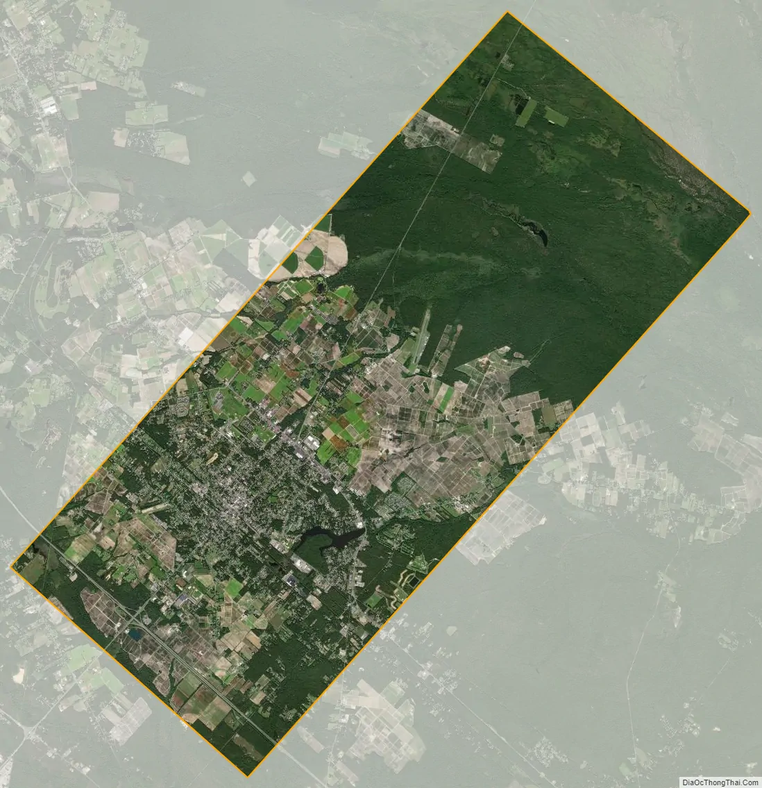
Hammonton city Satellite Map
Geography
According to the U.S. Census Bureau, Hammonton had a total area of 41.32 square miles (107.01 km), including 40.75 square miles (105.54 km) of land and 0.57 square miles (1.46 km) of water (1.37%).
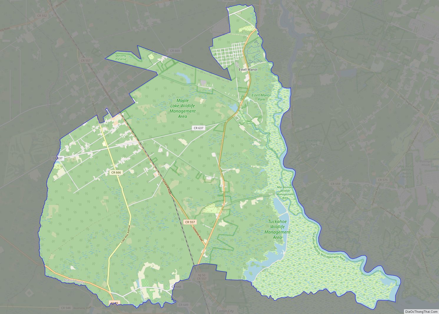
The town borders Folsom borough, to the southwest, and both Hamilton and Mullica townships to the southeast in Atlantic County; Shamong Township and Washington Township in Burlington County to the northeast; and Waterford Township and Winslow Township in Camden County to the northwest. It is located in the Atlantic Coastal Plain, so is largely flat, though the highest point in Atlantic County is located along the Pennsylvania Railroad within the borders of Hammonton. The town is located almost exactly halfway between Philadelphia and Atlantic City.
Unincorporated communities, localities and place names located completely or partially within the town include Barnard, Bellhurst, Caldwell Crossing, Dacosta, Dutchtown, Great Swamp, Murphy, Rockford, Rockwood, Rosedale and West Mills.
Pine Barrens
The town is one of 56 South Jersey municipalities that are included within the New Jersey Pinelands National Reserve, a protected natural area of unique ecology covering 1,100,000 acres (450,000 ha), that has been classified as a United States Biosphere Reserve and established by Congress in 1978 as the nation’s first National Reserve. All of the town is included in the state-designated Pinelands Area, which includes portions of Atlantic County, along with areas in Burlington, Camden, Cape May, Cumberland, Gloucester and Ocean counties.
Due to its location in the Pine Barrens, the soil is largely sandy, making it ideal for growing blueberries. Low, marshy areas, often within the Pine Barrens are also used for cranberry cultivation.
On June 19, 2022 a fire broke out in the Wharton State Forest in a remote area in the northern part of Hammonton. The Mullica River Fire consumed more than 15,000 acres of protected land and became the largest wildfire in the state in 15 years. The cause of the fire is believed to be caused by an illegal campfire.
Climate
Hammonton lies in the northern reaches of the humid subtropical climate zone, and, similar to inland southern New Jersey, is characterized by brisk winters, hot summers, and plentiful precipitation spread evenly throughout the year. According to the Köppen Climate Classification system, Hammonton’s climate is abbreviated “Cfa” on climate maps.
See also
Map of New Jersey State and its subdivision: Map of other states:- Alabama
- Alaska
- Arizona
- Arkansas
- California
- Colorado
- Connecticut
- Delaware
- District of Columbia
- Florida
- Georgia
- Hawaii
- Idaho
- Illinois
- Indiana
- Iowa
- Kansas
- Kentucky
- Louisiana
- Maine
- Maryland
- Massachusetts
- Michigan
- Minnesota
- Mississippi
- Missouri
- Montana
- Nebraska
- Nevada
- New Hampshire
- New Jersey
- New Mexico
- New York
- North Carolina
- North Dakota
- Ohio
- Oklahoma
- Oregon
- Pennsylvania
- Rhode Island
- South Carolina
- South Dakota
- Tennessee
- Texas
- Utah
- Vermont
- Virginia
- Washington
- West Virginia
- Wisconsin
- Wyoming