Map of Chili CDP, New Mexico
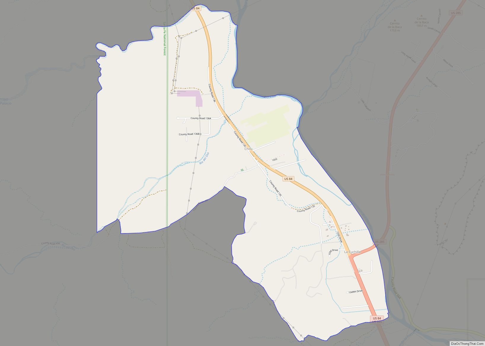
Chili is an unincorporated community and census-designated place in Rio Arriba County, New Mexico. Its population was 654 as of the 2010 census. U.S. Route 84 passes through the community. The name comes from a station of the D&RG railroad that was known locally as the “Chili Line.” Chili CDP overview: Name: Chili CDP LSAD ... Read more
Map of Chili CDP, New Mexico
Map of Chical CDP
Chical is a census-designated place in Valencia County, New Mexico, United States. Its population was 107 as of the 2010 census. Chical CDP overview: Name: Chical CDP LSAD Code: 57 LSAD Description: CDP (suffix) State: New Mexico County: Valencia County Elevation: 4,902 ft (1,494 m) Total Area: 0.81 sq mi (2.10 km²) Land Area: 0.81 sq mi (2.10 km²) Water Area: 0.00 sq mi (0.00 km²) ... Read more
Map of Chical CDP
Map of Chaparral CDP
Chaparral is an unincorporated community and census-designated place (CDP) in Doña Ana and Otero counties, New Mexico. The population was 14,631 at the 2010 census. Chaparral is primarily a bedroom community for the neighboring city of El Paso, Texas, and the neighboring military installations of White Sands Missile Range and Fort Bliss. It is officially ... Read more
Map of Chaparral CDP
Map of Chamizal CDP
Chamizal is an unincorporated community and census-designated place in Socorro County, New Mexico, United States. Its population was 101 as of the 2010 census. New Mexico State Road 408 passes through the community. Chamizal CDP overview: Name: Chamizal CDP LSAD Code: 57 LSAD Description: CDP (suffix) State: New Mexico County: Socorro County Elevation: 4,665 ft (1,422 m) ... Read more
Map of Chamizal CDP
Map of Clayton town, New Mexico
Clayton is a town and county seat of Union County, New Mexico, United States. As of the 2010 census, the city population was 2,980. Clayton town overview: Name: Clayton town LSAD Code: 43 LSAD Description: town (suffix) State: New Mexico County: Union County Elevation: 5,056 ft (1,541 m) Total Area: 7.79 sq mi (20.19 km²) Land Area: 7.77 sq mi (20.12 km²) Water ... Read more
Map of Clayton town, New Mexico
Map of Cordova CDP, New Mexico
Cordova is a census-designated place in Rio Arriba County, New Mexico, United States. Cordova CDP overview: Name: Cordova CDP LSAD Code: 57 LSAD Description: CDP (suffix) State: New Mexico County: Rio Arriba County Elevation: 6,955 ft (2,120 m) Total Area: 1.66 sq mi (4.31 km²) Land Area: 1.66 sq mi (4.31 km²) Water Area: 0.00 sq mi (0.00 km²) Total Population: 380 Population Density: 228.50/sq mi (88.21/km²) ... Read more
Map of Cordova CDP, New Mexico
Map of Conchas Dam CDP
Conchas Dam is a census-designated place in San Miguel County, New Mexico, United States. As of the 2010 census, its population was 186. It includes the Conchas Dam Historic District, which is listed on the National Register of Historic Places. All this is on the Canadian River. Conchas Dam CDP overview: Name: Conchas Dam CDP ... Read more
Map of Conchas Dam CDP
Map of Columbus village, New Mexico
Columbus is a village in Luna County, New Mexico, United States, about 3 miles (5 km) north of the Mexican border. It is considered a place of historical interest, as the scene of a 1916 attack by Mexican general Francisco “Pancho” Villa that caused America to send 10,000 troops there in the Mexican Expedition (originally referred ... Read more
Map of Columbus village, New Mexico
Map of Cochiti CDP
Cochiti (/ˈkoʊtʃəti/; Eastern Keresan: Kotyit [kʰocʰi̥tʰ]; Western Keresan K’úutìim’é [kʼúːtʰìːm̰é], Navajo: Tǫ́ʼgaaʼ /tʰṍʔkɑ̀ːʔ/) is a census-designated place (CDP) in Sandoval County, New Mexico, United States. A historic pueblo of the Cochiti people, one of the Keresan Nations, it is part of the Albuquerque Metropolitan Statistical Area. The population was 528 at the 2010 census. Located ... Read more
Map of Cochiti CDP
Map of Cochiti Lake CDP
Cochiti Lake is a census-designated place in Sandoval County, New Mexico, United States. Its population was 569 as of the 2010 census. Cochiti Lake CDP overview: Name: Cochiti Lake CDP LSAD Code: 57 LSAD Description: CDP (suffix) State: New Mexico County: Sandoval County Elevation: 5,584 ft (1,702 m) Total Area: 1.24 sq mi (3.22 km²) Land Area: 1.24 sq mi (3.22 km²) Water ... Read more
Map of Cochiti Lake CDP
Map of Cobre CDP
Cobre is a census-designated place in Grant County, New Mexico, United States. Its population was 39 as of the 2010 census. New Mexico State Road 356 passes through the community. Cobre CDP overview: Name: Cobre CDP LSAD Code: 57 LSAD Description: CDP (suffix) State: New Mexico County: Grant County Elevation: 5,994 ft (1,827 m) Total Area: 0.07 sq mi ... Read more
Map of Cobre CDP
Map of Clovis city, New Mexico
Clovis is a city in and the county seat of Curry County, New Mexico. The city had a population of 37,775 as of the 2010 census, and a 2019 estimated population of 38,319. Clovis is located in the New Mexico portion of the Llano Estacado, in the eastern part of the state. A largely agricultural ... Read more
Map of Clovis city, New Mexico