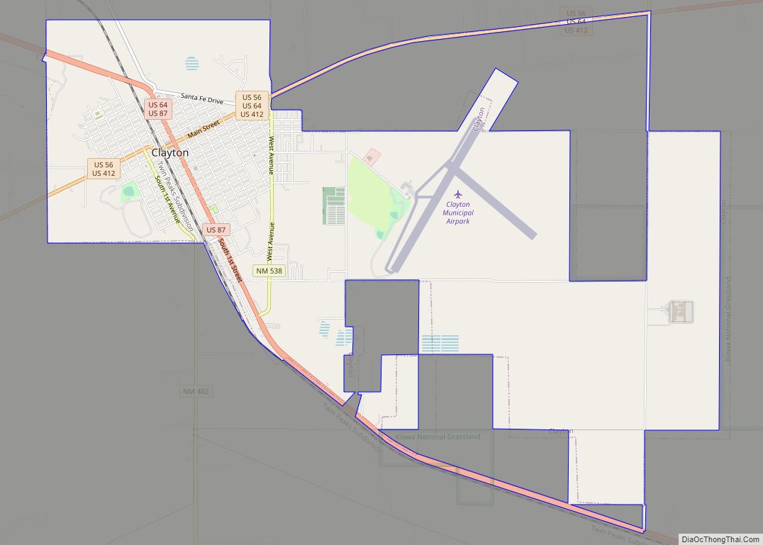
Clayton is a town and county seat of Union County, New Mexico, United States. As of the 2010 census, the city population was 2,980.
| Name: | Clayton town |
|---|---|
| LSAD Code: | 43 |
| LSAD Description: | town (suffix) |
| State: | New Mexico |
| County: | Union County |
| Elevation: | 5,056 ft (1,541 m) |
| Total Area: | 7.79 sq mi (20.19 km²) |
| Land Area: | 7.77 sq mi (20.12 km²) |
| Water Area: | 0.03 sq mi (0.07 km²) |
| Total Population: | 2,643 |
| Population Density: | 340.15/sq mi (131.34/km²) |
| ZIP code: | 88415 |
| Area code: | 575 |
| FIPS code: | 3515720 |
| Website: | claytonnm.org |
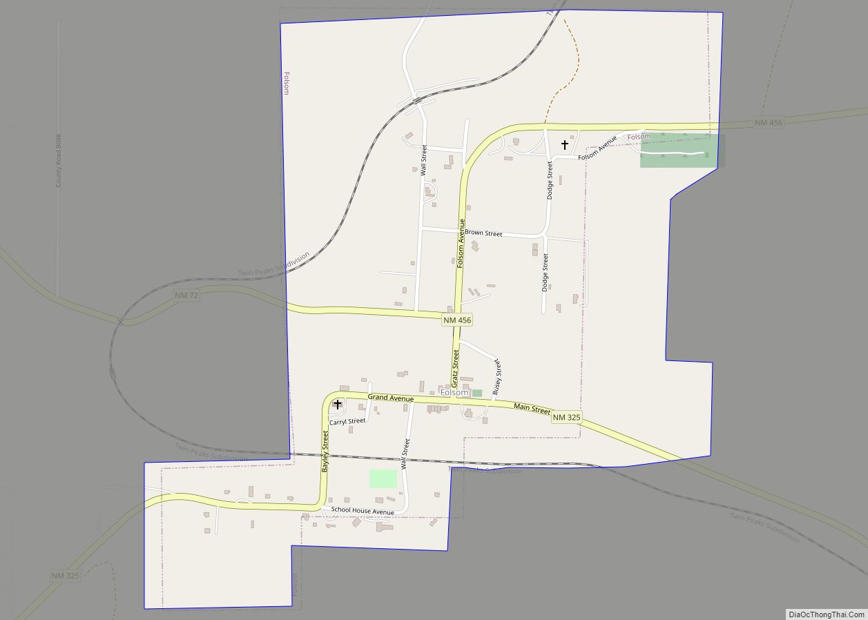
Online Interactive Map
Click on ![]() to view map in "full screen" mode.
to view map in "full screen" mode.
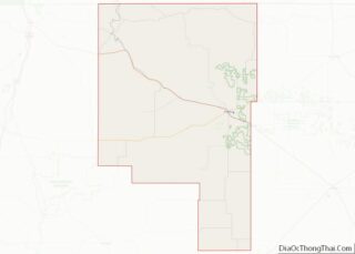
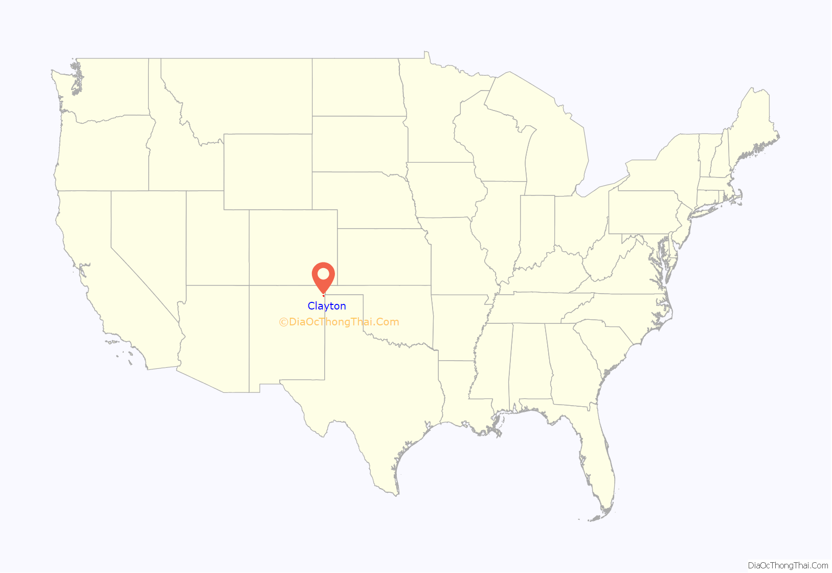
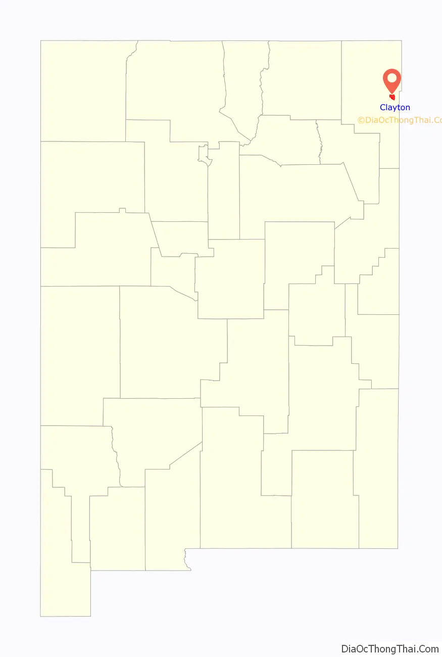
Clayton location map. Where is Clayton town?
History
Early history
Native Americans were present in the area of Clayton for at least 10,000 years, as evidenced by the findings at the Folsom site about 55 miles northwest of Clayton, near the village of Folsom. Later the area was part of Comancheria.
The Cimarron Cutoff of the Santa Fe Trail brought some of the first Americans through the Clayton region. The Santa Fe Trail was first established in 1821 after Spanish rule was evicted from Mexico which opened up trade between Santa Fe and the United States. William Becknell, also known as the Father of the Santa Fe Trail, became the first person to utilize the Santa Fe Trail as a trade route between the state of Missouri and Santa Fe. He established the Cimarron Cutoff, also known as the Cimarron Route, as a faster route between countries as the Cimarron Route shortened the Trail by more than 100 miles. The Cimarron Cutoff went straight through the Clayton region where travelers used the Rabbit Ear Mountain as a guiding landmark. Eventually travelers along the trail began to appreciate the rich soil around Clayton and the rolling green hills which were perfect for raising livestock.
The Goodnight-Loving Trail also passed through the area (bringing cattle north from Texas) starting in the late 1860s, but eventually cattle ranchers and sheepherders established ranches in the Clayton area itself, though they were large and far apart. That changed when the Fort Worth and Denver City Railroad came to the area in 1888 and Stephen Dorsey, a nearby rancher, received the rights to the area where the railroad ran. He soon laid out a town site.
In 1892, the saloon of what would later become the Hotel Eklund was built, and by 1894 the saloon featured a front and back bar, pool and carom tables, monte game tables, a crap table, and a poker table. By 1898, the building was further expanded to add a hotel.
Twentieth Century
US President Theodore Roosevelt visited Clayton on April 14, 1905.
In 1928 the main street of Clayton was paved and street lighting was added.
Clayton and the rest of Northeastern New Mexico was hit hard by the Dust Bowl of the 1930s; however, the era was also a time of renewal and rebuilding in the community, in large part due to the work of the Works Project Administration in the community.
Clayton was hit by a “black roller” (giant dust cloud) that measured 1500 feet high and a mile across on May 28, 1937.
In 1999, the dining room and saloon of the old Eklund Hotel was reopened.
Twenty-first century
The Eklund hotel reopened on July 3, 2011.
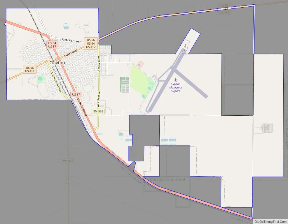
Clayton Road Map
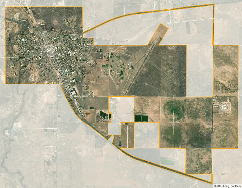
Clayton city Satellite Map
Geography
According to the United States Census Bureau, the town has a total area of 4.7 square miles (12 km), all land. Clayton has an elevation of approximately 5,050 feet (1,540 m) above sea level. It is located about 130 miles (210 km) northwest of Amarillo, Texas. Clayton is considered to be in the Plains region of New Mexico. This region stretches to the Sangre de Cristo Mountains down to the Guadalupe Mountains. Clayton is located in the northeast corner of New Mexico, 10 miles (16 km) from the border of Texas and 11 miles (18 km) from the border of the Oklahoma panhandle. Clayton is also located near two parks, Clayton Lake State Park, and Capulin Volcano National Monument. Not far away is Black Mesa State Park in Oklahoma. A carbon dioxide field called Bravo Dome can be found near Clayton and stretches nearly 1 million acres.
Climate
Clayton has a typical New Mexico cool semi-arid climate (Köppen BSk) with hot summers and cool, dry winters. The normal monthly mean temperature ranges from 34.8 °F (1.6 °C) in December to 74.7 °F (23.7 °C) in July; on average, annually, there are 41 days with a maximum at or above 90 °F (32.2 °C), 13 days with a maximum that remains at or below freezing, and 2.2 days with a minimum at or below 0 °F (−17.8 °C). Precipitation is low and usually confined to the monsoon season from June to September when thunderstorms are frequent; the annual mean precipitation is 15.8 in (400 mm). Winter weather can vary greatly from warm and windy due to the influence of the chinook, to frigid and snowy when Arctic air moved southward from Canada. The seasonal (July through June of the following year) normal total snowfall accumulation is 28 in (71 cm), mostly occurring from November to March, occasionally in April, and very rarely does measurable snowfall occur in September, October or May.
Record temperatures range from −21 °F (−29 °C) on January 4, 1959 to 105 °F (41 °C) on July 30, 1934 and June 27, 1924; the record cold maximum is −1 °F (−18 °C) on January 11, 1963 and the day preceding the all-time record low, while, conversely, the record warm minimum is 74 °F (23 °C) on July 26, 1917.
- ^ Mean monthly maxima and minima (i.e. the expected highest and lowest temperature readings at any point during the year or given month) calculated based on data at said location from 1981 to 2010.
See also
Map of New Mexico State and its subdivision: Map of other states:- Alabama
- Alaska
- Arizona
- Arkansas
- California
- Colorado
- Connecticut
- Delaware
- District of Columbia
- Florida
- Georgia
- Hawaii
- Idaho
- Illinois
- Indiana
- Iowa
- Kansas
- Kentucky
- Louisiana
- Maine
- Maryland
- Massachusetts
- Michigan
- Minnesota
- Mississippi
- Missouri
- Montana
- Nebraska
- Nevada
- New Hampshire
- New Jersey
- New Mexico
- New York
- North Carolina
- North Dakota
- Ohio
- Oklahoma
- Oregon
- Pennsylvania
- Rhode Island
- South Carolina
- South Dakota
- Tennessee
- Texas
- Utah
- Vermont
- Virginia
- Washington
- West Virginia
- Wisconsin
- Wyoming