Map of Notchietown CDP
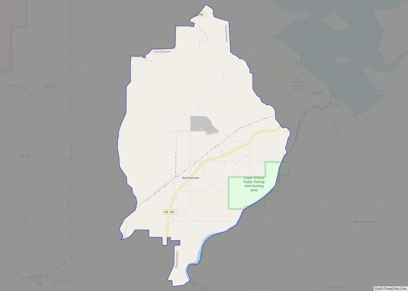
Notchietown is a census-designated place (CDP) in Sequoyah County, Oklahoma, United States. It is part of the Fort Smith, Arkansas-Oklahoma Metropolitan Statistical Area. The population was 430 at the 2000 census. Notchietown CDP overview: Name: Notchietown CDP LSAD Code: 57 LSAD Description: CDP (suffix) State: Oklahoma County: Sequoyah County Elevation: 0 ft (0 m) Total Area: 7.91 sq mi ... Read more
Map of Notchietown CDP
Map of North Miami town, Oklahoma
North Miami is a town in Ottawa County, Oklahoma, United States. The population was 290 at the 2020 census. North Miami is part of the Joplin, Missouri metropolitan area. The town is primarily a bedroom community for several larger towns in the county. North Miami town overview: Name: North Miami town LSAD Code: 43 LSAD ... Read more
Map of North Miami town, Oklahoma
Map of North Enid town
North Enid is a town in Garfield County, Oklahoma, United States. The population was 860 at the 2010 census. The town is served by the Chisholm school district. North Enid was the original railroad town site in the Enid–Pond Creek Railroad War. North Enid town overview: Name: North Enid town LSAD Code: 43 LSAD Description: ... Read more
Map of North Enid town
Map of Norge town
Norge is a town in Grady County, Oklahoma, United States. The population was 129 at the 2020 census, a 11% decrease from 2010. Norge town overview: Name: Norge town LSAD Code: 43 LSAD Description: town (suffix) State: Oklahoma County: Grady County Elevation: 1,270 ft (387 m) Total Area: 0.32 sq mi (0.83 km²) Land Area: 0.32 sq mi (0.83 km²) Water Area: 0.00 sq mi ... Read more
Map of Norge town
Map of Noble city, Oklahoma
Noble is a city in Cleveland County, Oklahoma, United States, and is part of the Oklahoma City Metropolitan Area. The population was 6,985 at the 2020 census, a 7.8% increase from 2010. Noble is Cleveland County’s third-largest city behind Norman and Moore. Noble city overview: Name: Noble city LSAD Code: 25 LSAD Description: city (suffix) ... Read more
Map of Noble city, Oklahoma
Map of Ninnekah town
Ninnekah is a town in Grady County, Oklahoma, United States. The population was 775 at the 2020 census, a 22.7% decrease from 2010. Ninnekah town overview: Name: Ninnekah town LSAD Code: 43 LSAD Description: town (suffix) State: Oklahoma County: Grady County Elevation: 1,112 ft (339 m) Total Area: 10.18 sq mi (26.36 km²) Land Area: 10.18 sq mi (26.36 km²) Water Area: 0.00 sq mi ... Read more
Map of Ninnekah town
Map of Nicut CDP
Nicut is an unincorporated community and census-designated place in Sequoyah County, Oklahoma, United States. Its population was 360 as of the 2010 census. Nicut CDP overview: Name: Nicut CDP LSAD Code: 57 LSAD Description: CDP (suffix) State: Oklahoma County: Sequoyah County Elevation: 581 ft (177 m) Total Area: 16.32 sq mi (42.27 km²) Land Area: 16.19 sq mi (41.94 km²) Water Area: 0.13 sq mi ... Read more
Map of Nicut CDP
Map of Nicoma Park city
Nicoma Park is a city in Oklahoma County, Oklahoma, United States, and a part of the Oklahoma City metropolitan area. The name Nicoma is a portmanteau of the first three letters of Nichols, for G.A. Nichols, and the last three letters of Oklahoma. The population was 2,313 at the 2020 census, a 3.3% decrease from ... Read more
Map of Nicoma Park city
Map of Nichols Hills city
Nichols Hills is a city in Oklahoma County, Oklahoma, United States, and a part of the Oklahoma City metropolitan area. The population was 3,870 as of the 2020 census, a 4.3% increase from 2010. Nichols Hills city overview: Name: Nichols Hills city LSAD Code: 25 LSAD Description: city (suffix) State: Oklahoma County: Oklahoma County Elevation: ... Read more
Map of Nichols Hills city
Map of Newkirk city, Oklahoma
Newkirk is a city and county seat of Kay County, Oklahoma, United States. The population was 2,172 at the 2020 census. Newkirk city overview: Name: Newkirk city LSAD Code: 25 LSAD Description: city (suffix) State: Oklahoma County: Kay County Elevation: 1,152 ft (351 m) Total Area: 1.35 sq mi (3.51 km²) Land Area: 1.35 sq mi (3.51 km²) Water Area: 0.00 sq mi (0.00 km²) Total ... Read more
Map of Newkirk city, Oklahoma
Map of Oakland town, Oklahoma
Oakland is a town in Marshall County, Oklahoma, United States. The population was 674 at the 2000 census and grew to a population of 1,057 as of the 2010 census, an increase of 56.8%. Oakland town overview: Name: Oakland town LSAD Code: 43 LSAD Description: town (suffix) State: Oklahoma County: Marshall County Elevation: 810 ft (247 m) ... Read more
Map of Oakland town, Oklahoma
Map of Oakhurst CDP, Oklahoma
Oakhurst is an unincorporated community and census-designated place (CDP) in Creek and Tulsa counties in the U.S. state of Oklahoma. The population was 2,185 at the 2010 census, a loss of 20 percent from 2,731 at the 2000 census. Oakhurst CDP overview: Name: Oakhurst CDP LSAD Code: 57 LSAD Description: CDP (suffix) State: Oklahoma County: ... Read more
Map of Oakhurst CDP, Oklahoma