Map of Oilton city, Oklahoma
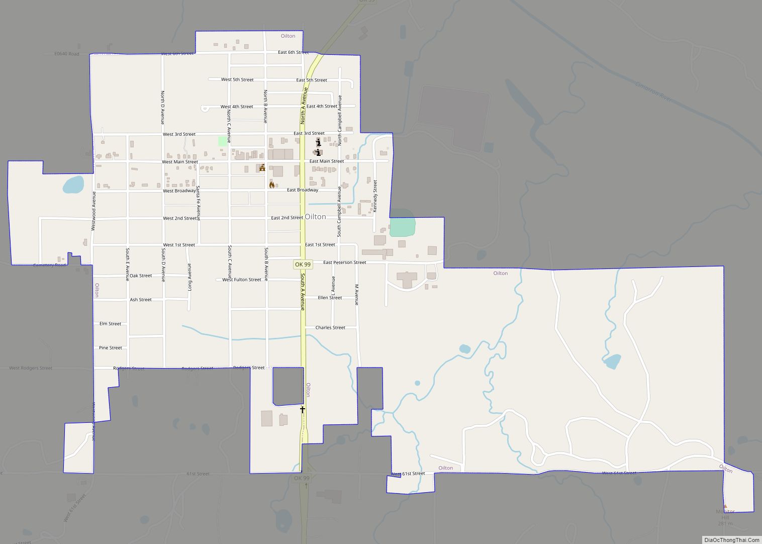
Oilton is a city in Creek County, Oklahoma, United States. The population was 885 at the 2020 census, a 12.6% decline from the 1,013 recorded in 2010. Oilton city overview: Name: Oilton city LSAD Code: 25 LSAD Description: city (suffix) State: Oklahoma County: Creek County Elevation: 787 ft (240 m) Total Area: 1.13 sq mi (2.93 km²) Land Area: 1.13 sq mi ... Read more
Map of Oilton city, Oklahoma
Map of Ochelata town
Ochelata /oʊʃəˈleɪtə/ is a town in Washington County, Oklahoma, United States. The population was 424 at the 2010 census, a decline of 14.2 percent from the figure of 494 recorded in 2000. Ochelata town overview: Name: Ochelata town LSAD Code: 43 LSAD Description: town (suffix) State: Oklahoma County: Washington County Elevation: 738 ft (225 m) Total Area: ... Read more
Map of Ochelata town
Map of Oakwood town, Oklahoma
Oakwood is a town in Dewey County, Oklahoma, United States. The population was 65 at the 2010 census. Oakwood town overview: Name: Oakwood town LSAD Code: 43 LSAD Description: town (suffix) State: Oklahoma County: Dewey County Elevation: 1,834 ft (559 m) Total Area: 0.24 sq mi (0.61 km²) Land Area: 0.24 sq mi (0.61 km²) Water Area: 0.00 sq mi (0.00 km²) Total Population: 74 Population ... Read more
Map of Oakwood town, Oklahoma
Map of Oaks town, Oklahoma
Oaks is a town in Cherokee and Delaware counties in the U.S. state of Oklahoma. The population was 288 at the 2010 census, a decrease from the figure of 412 recorded in 2000. Oaks town overview: Name: Oaks town LSAD Code: 43 LSAD Description: town (suffix) State: Oklahoma County: Cherokee County, Delaware County Elevation: 1,030 ft ... Read more
Map of Oaks town, Oklahoma
Map of Oakland town, Oklahoma
Oakland is a town in Marshall County, Oklahoma, United States. The population was 674 at the 2000 census and grew to a population of 1,057 as of the 2010 census, an increase of 56.8%. Oakland town overview: Name: Oakland town LSAD Code: 43 LSAD Description: town (suffix) State: Oklahoma County: Marshall County Elevation: 810 ft (247 m) ... Read more
Map of Oakland town, Oklahoma
Map of Oakhurst CDP, Oklahoma
Oakhurst is an unincorporated community and census-designated place (CDP) in Creek and Tulsa counties in the U.S. state of Oklahoma. The population was 2,185 at the 2010 census, a loss of 20 percent from 2,731 at the 2000 census. Oakhurst CDP overview: Name: Oakhurst CDP LSAD Code: 57 LSAD Description: CDP (suffix) State: Oklahoma County: ... Read more
Map of Oakhurst CDP, Oklahoma
Map of Oak Grove town, Oklahoma
Oak Grove town overview: Name: Oak Grove town LSAD Code: 43 LSAD Description: town (suffix) State: Oklahoma County: Pawnee County FIPS code: 4053210 Online Interactive Map Oak Grove online map. Source: Basemap layers from Google Map, Open Street Map (OSM), Arcgisonline, Wmflabs. Boundary Data from Database of Global Administrative Areas. Oak Grove location map. Where ... Read more
Map of Oak Grove town, Oklahoma
Map of Nowata city
Nowata (Lenape: Nuwatu, Nuwi ta ) is a city and county seat of Nowata County, Oklahoma, United States. The population was 3,731 at the United States Census, 2010, a 6.0 percent decline from the figure of 3,971 recorded in 2000. The area where it was established was then part of the Cherokee Nation in Indian ... Read more
Map of Nowata city
Map of Okemah city
Okemah (/ˌoʊˈkiːmə/ or /ˈʌkimə/) is the largest city in and the county seat of Okfuskee County, Oklahoma, United States. It is the birthplace of folk music legend Woody Guthrie. Thlopthlocco Tribal Town, a federally recognized Muscogee Indian tribe, is headquartered in Okemah. The population was 3,078 at the 2020 census, a 6.1 percent decline from ... Read more
Map of Okemah city
Map of Okeene town
Okeene is a town in Blaine County, Oklahoma, United States. The population was 1,204 at the 2010 census. The name was created by combining the last letters of Cherokee and Cheyenne. Okeene town overview: Name: Okeene town LSAD Code: 43 LSAD Description: town (suffix) State: Oklahoma County: Blaine County Elevation: 1,217 ft (371 m) Total Area: 2.26 sq mi ... Read more
Map of Okeene town
Map of Orlando town, Oklahoma
Orlando is a town in Logan and Payne counties in the U.S. state of Oklahoma. The population was 148 at the 2010 census, compared to the figure of 201 in 2000. It is part of the Oklahoma City Metropolitan Statistical Area. Orlando town overview: Name: Orlando town LSAD Code: 43 LSAD Description: town (suffix) State: ... Read more
Map of Orlando town, Oklahoma
Map of Optima town
Optima is a town in Texas County, Oklahoma, United States. The population was 356 at the 2010 census. Optima town overview: Name: Optima town LSAD Code: 43 LSAD Description: town (suffix) State: Oklahoma County: Texas County Elevation: 3,022 ft (921 m) Total Area: 0.53 sq mi (1.38 km²) Land Area: 0.53 sq mi (1.38 km²) Water Area: 0.00 sq mi (0.00 km²) Total Population: 338 Population ... Read more
Map of Optima town