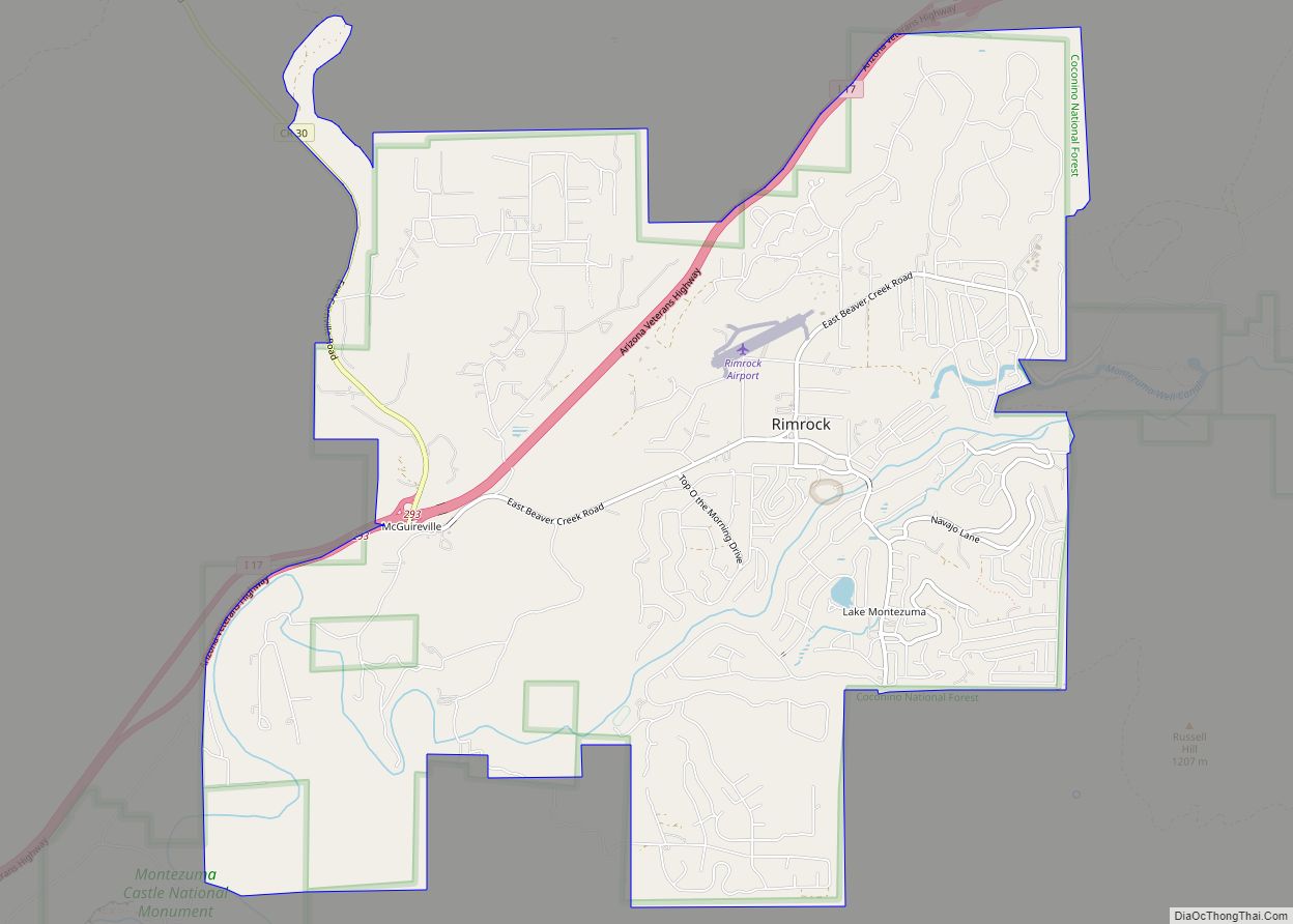
Lake Montezuma is a census-designated place (CDP) in Yavapai County in the U.S. state of Arizona. The population was 5,111 at the 2020 census. The CDP includes the communities of Rimrock and McGuireville. Located along Interstate 17, it is 20 miles (32 km) south of Sedona and 8 miles (13 km) north of Camp Verde in central ... Read more
Map of US Cities and Places
Lazy Y U is an unincorporated community and census-designated place (CDP) in Mohave County, Arizona, United States. The population was 474 at the 2020 census, up from 428 at the 2010 census. Lazy Y U CDP overview: Name: Lazy Y U CDP LSAD Code: 57 LSAD Description: CDP (suffix) State: Arizona County: Mohave County Elevation: ... Read more
Linden is an unincorporated community located in Navajo County, Arizona, United States, just west of the city of Show Low. It is situated atop the Mogollon Rim at an elevation of over 6,000 feet. The community was evacuated in June 2002 due to the Rodeo-Chediski fire, which eventually consumed part of Linden, destroying a number ... Read more
Leupp /luːp/ LOOP (Navajo: Tsiizizii) is a census-designated place (CDP) in Coconino County, Arizona, on the Navajo Nation, United States. The population was 951 at the 2010 census. In 1902 an Indian boarding school was constructed here, administered by the Bureau of Indian Affairs. It had been closed before the US entry into World War ... Read more
LeChee (Navajo: Łichíiʼii) is a census-designated place (CDP) in Coconino County, Arizona, United States. The population was 1,443 at the 2010 census. LeChee CDP overview: Name: LeChee CDP LSAD Code: 57 LSAD Description: CDP (suffix) State: Arizona County: Coconino County Elevation: 4,982 ft (1,519 m) Total Area: 16.62 sq mi (43.05 km²) Land Area: 16.62 sq mi (43.05 km²) Water Area: 0.00 sq mi (0.00 km²) ... Read more
Low Mountain is a census-designated place (CDP) in Navajo County, Arizona, United States. The population was 757 at the 2010 census. Low Mountain CDP overview: Name: Low Mountain CDP LSAD Code: 57 LSAD Description: CDP (suffix) State: Arizona County: Navajo County Elevation: 1,880 ft (570 m) Total Area: 36.90 sq mi (95.58 km²) Land Area: 36.90 sq mi (95.56 km²) Water Area: 0.01 sq mi ... Read more
Littlefield is an unincorporated community and census-designated place in Mohave County, Arizona, United States, that is located in the Arizona Strip region. As of the 2020 census, its population was 256, down from 308 in 2010. It lies just south of Interstate 15, next to the Virgin River, approximately 10 miles (16 km) northeast of Mesquite, ... Read more
Litchfield Park is a city in Maricopa County, Arizona, United States. It is located 19 miles (31 km) west of Phoenix. As of the 2020 census, the population of the city was 6,847, up from 5,476 in 2010. Litchfield Park city overview: Name: Litchfield Park city LSAD Code: 25 LSAD Description: city (suffix) State: Arizona County: ... Read more
Lupton (Navajo: Tsé Siʼání) is an unincorporated community and census-designated place (CDP) in Apache County, Arizona, United States. Lupton is located along Interstate 40 at the New Mexico border, 21 miles (34 km) southwest of Gallup, New Mexico. Lupton has a post office with ZIP code 86508. As of the 2010 census, the Lupton CDP had ... Read more
Lukachukai (Navajo: Lókʼaaʼchʼégai) is a census-designated place (CDP) in Apache County, Arizona, United States. The population was 1,701 at the 2010 census. It is within the Navajo Nation. Lukachukai CDP overview: Name: Lukachukai CDP LSAD Code: 57 LSAD Description: CDP (suffix) State: Arizona County: Apache County Elevation: 6,550 ft (2,000 m) Total Area: 22.02 sq mi (57.03 km²) Land Area: ... Read more
Lower Santan Village is a census-designated place (CDP) in Pinal County, Arizona, United States. The population was 374 at the 2010 census. Lower Santan Village CDP overview: Name: Lower Santan Village CDP LSAD Code: 57 LSAD Description: CDP (suffix) State: Arizona County: Pinal County Elevation: 1,234 ft (376 m) Total Area: 4.16 sq mi (10.78 km²) Land Area: 4.16 sq mi (10.78 km²) ... Read more
Many Farms (Navajo: Dáʼákʼeh Halání) is a census-designated place (CDP) in Apache County, Arizona, United States. The population was 1,348 at the 2010 census. Many Farms CDP overview: Name: Many Farms CDP LSAD Code: 57 LSAD Description: CDP (suffix) State: Arizona County: Apache County Elevation: 5,307 ft (1,618 m) Total Area: 8.18 sq mi (21.18 km²) Land Area: 8.15 sq mi (21.12 km²) ... Read more