Litchfield Park is a city in Maricopa County, Arizona, United States. It is located 19 miles (31 km) west of Phoenix. As of the 2020 census, the population of the city was 6,847, up from 5,476 in 2010.
| Name: | Litchfield Park city |
|---|---|
| LSAD Code: | 25 |
| LSAD Description: | city (suffix) |
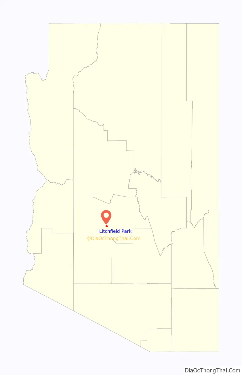
| State: | Arizona |
| County: | Maricopa County |
| Elevation: | 1,053 ft (321 m) |
| Total Area: | 3.31 sq mi (8.57 km²) |
| Land Area: | 3.28 sq mi (8.49 km²) |
| Water Area: | 0.03 sq mi (0.08 km²) |
| Total Population: | 6,847 |
| Population Density: | 2,088.14/sq mi (806.18/km²) |
| ZIP code: | 85340 |
| Area code: | 623 |
| FIPS code: | 0441330 |
| GNISfeature ID: | 2410842 |
| Website: | www.litchfield-park.org |
Online Interactive Map
Click on ![]() to view map in "full screen" mode.
to view map in "full screen" mode.
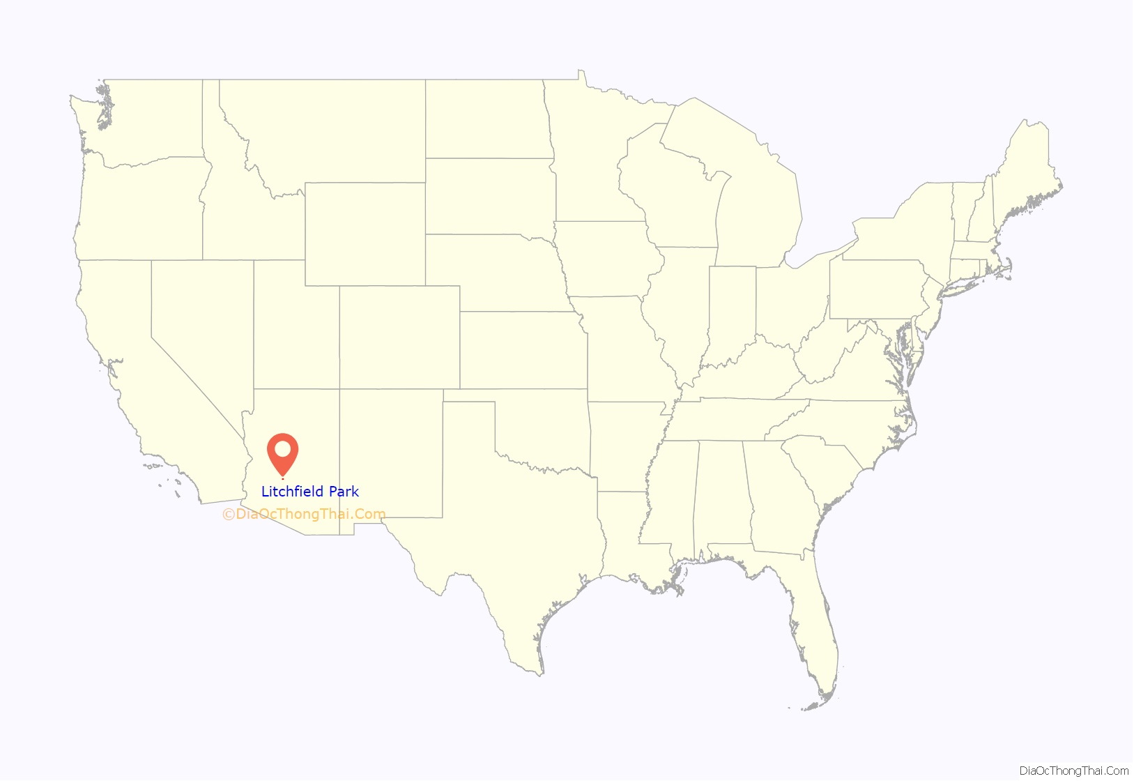
Litchfield Park location map. Where is Litchfield Park city?
History
The town of Litchfield Park is a historically affluent community outside of Phoenix named after its founder, Paul Weeks Litchfield (1875–1959). He was an executive of the Goodyear Tire & Rubber Company who came to the Phoenix area in 1916 in search of suitable land to farm a long-staple cotton that had previously been available only from the Sea Islands off the coast of Georgia and from Egypt. This cotton was needed to strengthen the rubber in the pneumatic tire, of which Goodyear was the world’s largest producer. The East Coast cotton supply had been devastated by the boll weevil, and the African supply had been greatly reduced by World War I attacks from German U-boats. Litchfield went to the Phoenix area at the suggestion of the US Department of Agriculture, but was not successful in motivating local farmers to grow his cotton. Instead, he got Goodyear to form the Southwest Cotton Company in Phoenix, with Litchfield as its president, eventually purchasing some 36,000 acres (15,000 ha) in the general Salt River Valley area, including 5,000 acres (2,000 ha) around the present site of Litchfield Park, then known as Litchfield Ranch. Much of the land was bought for as little as $25 per acre. The cotton was cultivated with a workforce of mostly Mexican and Native American men. The U.S. Postal Service agreed to the name “Litchfield Park” in 1926. In 1929, the Wigwam Resort was opened to the public. In 1926, Litchfield went on to become the president of the Goodyear-Zeppelin Corporation, and then chairman of the board in 1930. He retired from the company in 1958, and spent the final months of his life as a resident of Litchfield Park at his home on Fairway Drive.
In 1964, Goodyear created Litchfield Park Land and Development Co. to expand Litchfield Park into a 90,000-resident community. Arden E. Goodyear was the head of the company, Patrick Cusick was vice president and general manager, and Victor Gruen was hired to design some of the buildings. Emanuel Cartsonis, who had worked with Cusick, became city planner. The plan called for 25,000 homes, a college, a junior college, eighteen elementary schools, ten junior high schools, and six high schools, as well as improvements to the town’s golf course and Phoenix Trotting Park at an expense of at least $750 million. Goodyear made many mistakes during development, including selling properties right up to the curb line, which means that the city must get permission from property owners before they can put in a sidewalk. They abandoned their plans for expanding Litchfield Park before they were completed and sold whatever land they could.
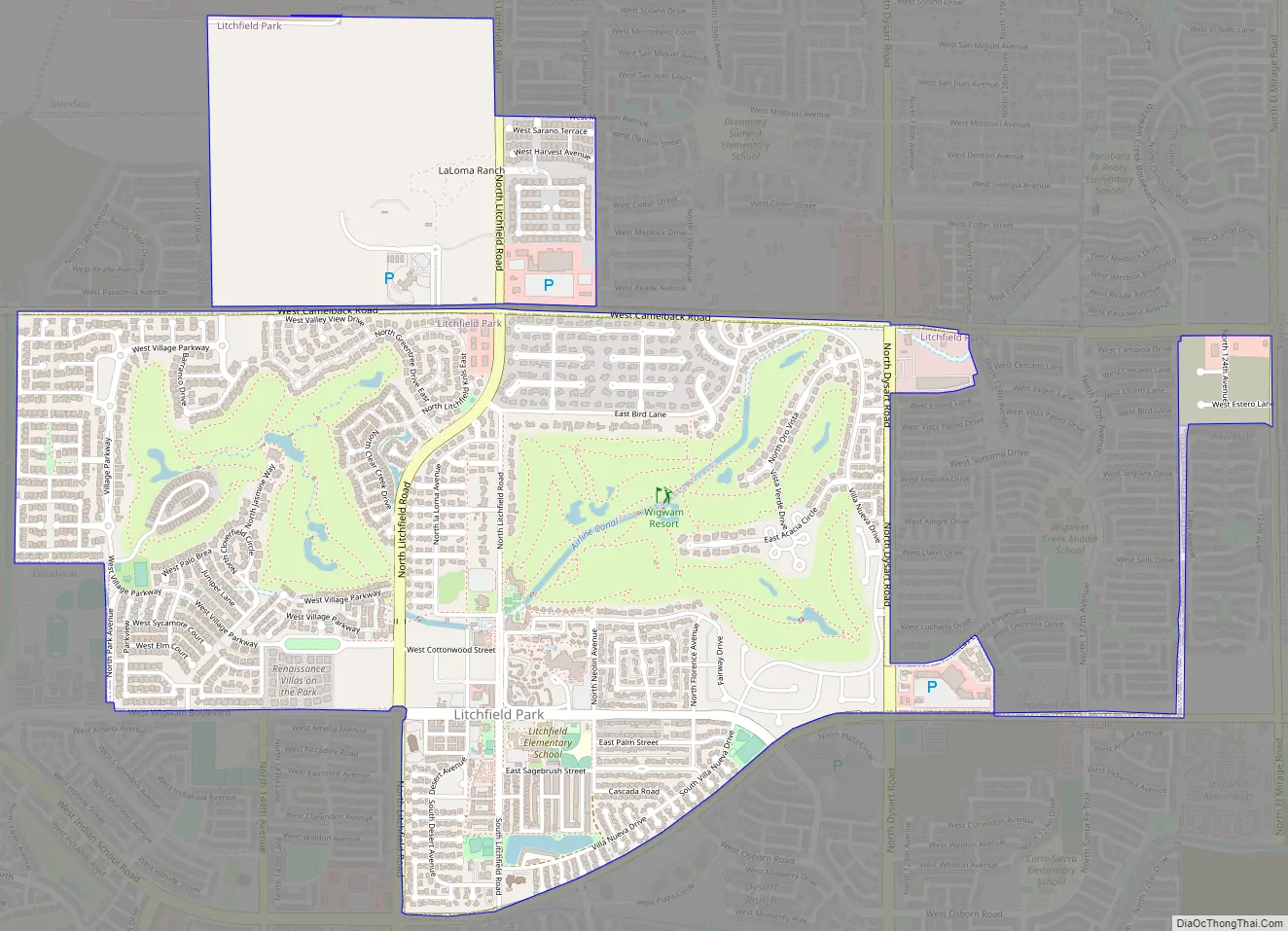
Litchfield Park Road Map
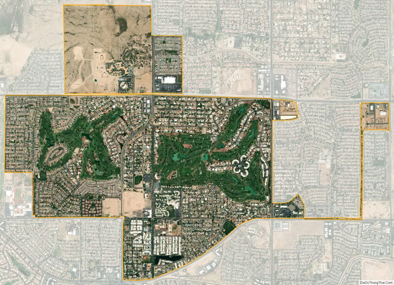
Litchfield Park city Satellite Map
Geography
Litchfield Park is bordered to the southeast by Avondale, to the west by Goodyear, and to the north by Glendale.
According to the United States Census Bureau, the city has a total area of 3.3 square miles (8.5 km), of which 0.03 square miles (0.08 km), or 0.94%, are water.
Climate
Litchfield Park has a hot desert climate (Köppen BWh).
See also
Map of Arizona State and its subdivision: Map of other states:- Alabama
- Alaska
- Arizona
- Arkansas
- California
- Colorado
- Connecticut
- Delaware
- District of Columbia
- Florida
- Georgia
- Hawaii
- Idaho
- Illinois
- Indiana
- Iowa
- Kansas
- Kentucky
- Louisiana
- Maine
- Maryland
- Massachusetts
- Michigan
- Minnesota
- Mississippi
- Missouri
- Montana
- Nebraska
- Nevada
- New Hampshire
- New Jersey
- New Mexico
- New York
- North Carolina
- North Dakota
- Ohio
- Oklahoma
- Oregon
- Pennsylvania
- Rhode Island
- South Carolina
- South Dakota
- Tennessee
- Texas
- Utah
- Vermont
- Virginia
- Washington
- West Virginia
- Wisconsin
- Wyoming


