Map of Round Rock CDP, Arizona
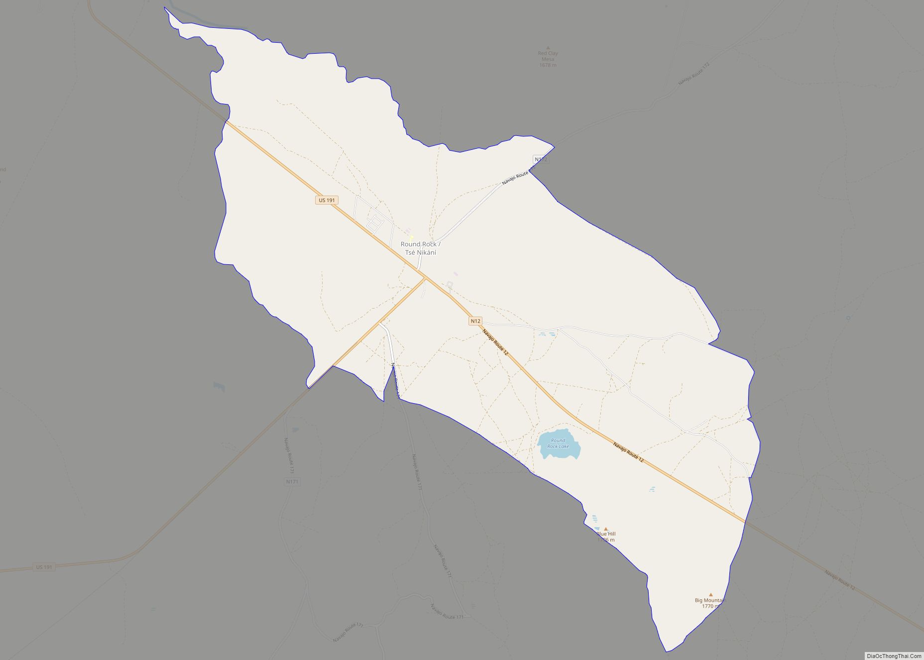
Round Rock (Navajo: Tsé Nikání) is a Navajo community and census-designated place (CDP) in Apache County, Arizona, United States. The population was 789 at the 2010 census. It is named after a nearby mesa. Round Rock CDP overview: Name: Round Rock CDP LSAD Code: 57 LSAD Description: CDP (suffix) State: Arizona County: Apache County Elevation: ... Read more
Map of Round Rock CDP, Arizona
Map of Rough Rock CDP
Rough Rock (Navajo: Tséchʼízhí) is a census-designated place (CDP) in Apache County, Arizona, United States. The population was 414 at the 2010 census. Rough Rock CDP overview: Name: Rough Rock CDP LSAD Code: 57 LSAD Description: CDP (suffix) State: Arizona County: Apache County Elevation: 6,280 ft (1,914 m) Total Area: 12.75 sq mi (33.03 km²) Land Area: 12.75 sq mi (33.02 km²) Water ... Read more
Map of Rough Rock CDP
Map of Sacaton Flats Village CDP
Sacaton Flats Village (O’odham: Ha:shañ Ke:k) is a census-designated place (CDP) in Pinal County, Arizona, United States, located in the Gila River Indian Community. The population was 621 at the 2010 census. Sacaton Flats Village CDP overview: Name: Sacaton Flats Village CDP LSAD Code: 57 LSAD Description: CDP (suffix) State: Arizona County: Pinal County Total ... Read more
Map of Sacaton Flats Village CDP
Map of Sacate Village CDP
Sacate Village is a census-designated place in Pinal County, in the U.S. state of Arizona. The population was 169 at the 2010 census. Sacate Village CDP overview: Name: Sacate Village CDP LSAD Code: 57 LSAD Description: CDP (suffix) State: Arizona County: Pinal County Total Area: 2.97 sq mi (7.68 km²) Land Area: 2.97 sq mi (7.68 km²) Water Area: 0.00 sq mi (0.00 km²) ... Read more
Map of Sacate Village CDP
Map of Rye CDP, Arizona
Rye is an unincorporated community and census-designated place (CDP) in Gila County, Arizona, United States. As of the 2010 census, it had a population of 77. Rye is located along Arizona State Route 87, 10 miles (16 km) south of Payson. Rye CDP overview: Name: Rye CDP LSAD Code: 57 LSAD Description: CDP (suffix) State: Arizona ... Read more
Map of Rye CDP, Arizona
Map of Safford city
Safford (Western Apache: Ichʼįʼ Nahiłtį́į́) is a city in Graham County, Arizona, United States. According to the 2020 Census, the population of the city is 10,129. The city is the county seat of Graham County. Safford is the principal city of the Safford Micropolitan Statistical Area, which includes all of Graham County. Safford city overview: ... Read more
Map of Safford city
Map of Saddlebrooke CDP, Arizona
Saddlebrooke is a census-designated place (CDP) and retirement community in Pinal County, Arizona, United States. The population was 12,574 at the United States 2020 Census There are two communities managed by homeowner associations within the retirement development; SaddleBrooke One, and SaddleBrooke Two, the latter includes the Preserve subdivision. Eagle Crest is a smaller all age ... Read more
Map of Saddlebrooke CDP, Arizona
Map of Sacaton CDP
Sacaton (Pima: Geʼe Ki:) is a census-designated place (CDP) in Pinal County, Arizona, United States. The population was 3,254 at the 2020 census. It is the capital of the Gila River Indian Community. Sacaton CDP overview: Name: Sacaton CDP LSAD Code: 57 LSAD Description: CDP (suffix) State: Arizona County: Pinal County Elevation: 1,283 ft (391 m) Total ... Read more
Map of Sacaton CDP
Map of San Carlos CDP, Arizona
San Carlos (Western Apache: Sengaah) is a census-designated place (CDP) in Gila County, Arizona, United States. The population was 4,038 at the 2010 census, up from 3,716 in 2000. San Carlos is the largest community in and the seat of government for the San Carlos Apache Indian Reservation. San Carlos’ economy is underdeveloped and is ... Read more
Map of San Carlos CDP, Arizona
Map of Salome CDP
Salome (locally /səˈloʊm/, Tolkepaya Yavapai: Wiltaika) is an unincorporated community and census-designated place (CDP) in La Paz County, Arizona, United States. The population was 1,530 at the 2010 census. It was established in 1904 by Dick Wick Hall, Ernest Hall and Charles Pratt, and was named after Pratt’s wife, Grace Salome Pratt. Salome CDP overview: ... Read more
Map of Salome CDP
Map of Sahuarita town
Sahuarita /sɑːwəˈriːtə/ is a town in Pima County, Arizona, United States. Sahuarita is located south of the Tohono O’odham Nation and abuts the north end of Green Valley, 15 miles (24 km) south of Tucson. The population was 34,134 at the 2020 census. Sahuarita town overview: Name: Sahuarita town LSAD Code: 43 LSAD Description: town (suffix) ... Read more
Map of Sahuarita town
Map of San Manuel CDP
San Manuel is a census-designated place (CDP) in Pinal County, Arizona, United States. The population was 3,551 at the 2010 census. San Manuel was built in 1953 by Del E. Webb Construction Company as a company town to serve the then-new San Manuel copper mine, mill and smelter complex. In 1955 the San Manuel Arizona ... Read more
Map of San Manuel CDP