Safford (Western Apache: Ichʼįʼ Nahiłtį́į́) is a city in Graham County, Arizona, United States. According to the 2020 Census, the population of the city is 10,129. The city is the county seat of Graham County.
Safford is the principal city of the Safford Micropolitan Statistical Area, which includes all of Graham County.
| Name: | Safford city |
|---|---|
| LSAD Code: | 25 |
| LSAD Description: | city (suffix) |
| State: | Arizona |
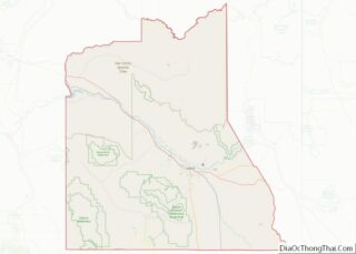
| County: | Graham County |
| Elevation: | 2,917 ft (889 m) |
| Total Area: | 9.30 sq mi (24.07 km²) |
| Land Area: | 9.27 sq mi (24.00 km²) |
| Water Area: | 0.03 sq mi (0.07 km²) |
| Total Population: | 10,129 |
| Population Density: | 1,093.02/sq mi (422.03/km²) |
| ZIP code: | 85546, 85548 |
| Area code: | 928 |
| FIPS code: | 0462000 |
| GNISfeature ID: | 10657 |
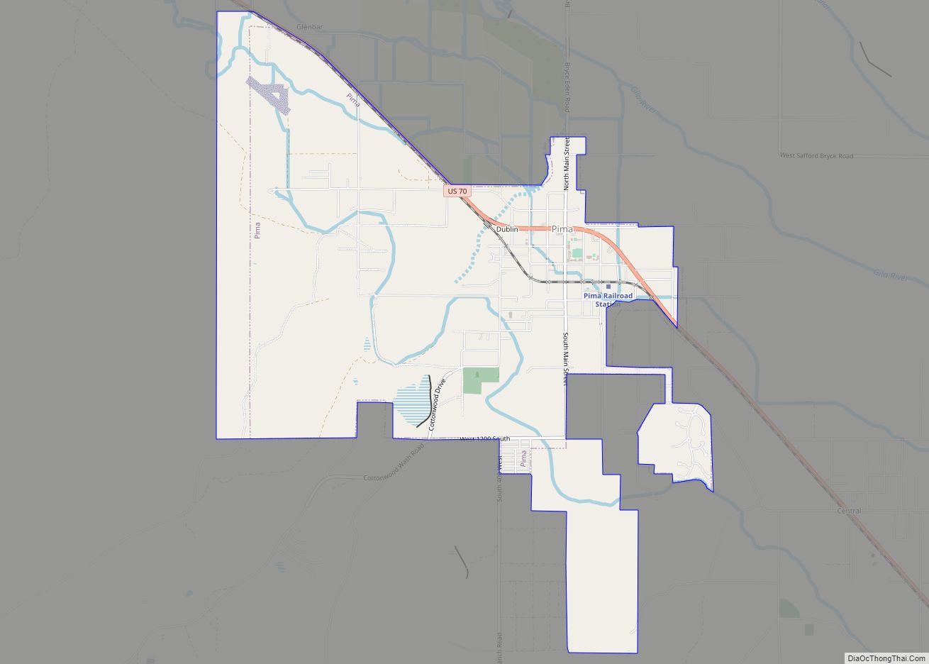
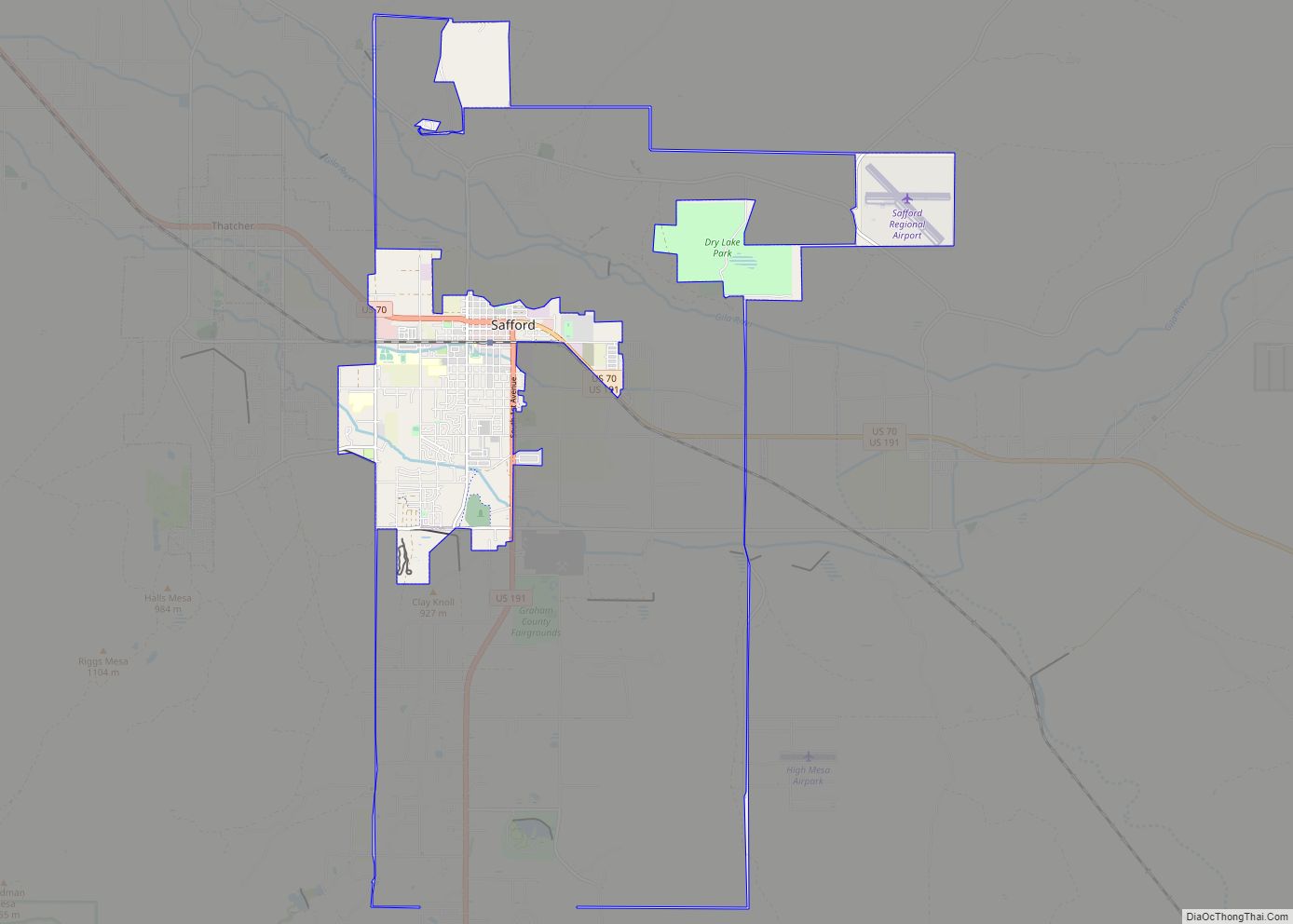
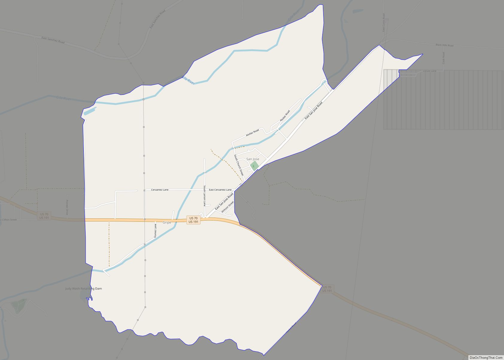
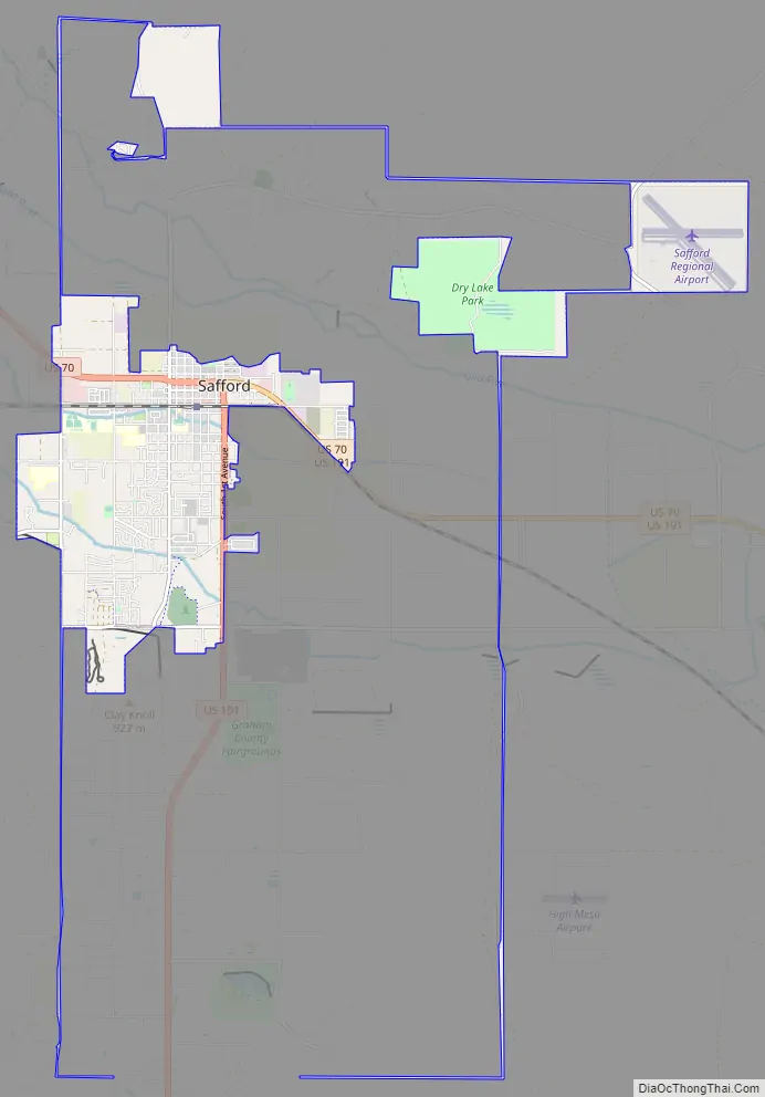
Online Interactive Map
Click on ![]() to view map in "full screen" mode.
to view map in "full screen" mode.
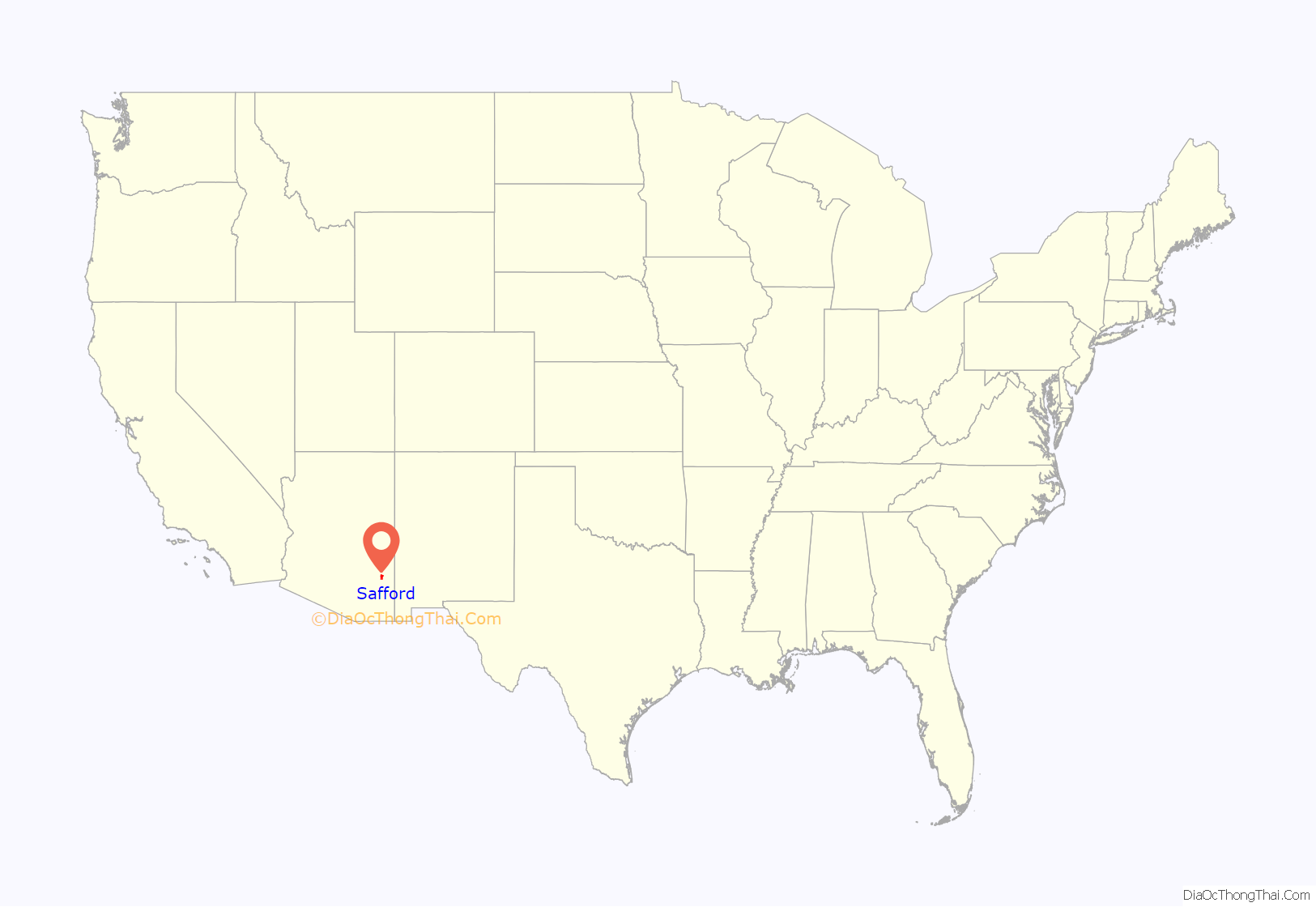
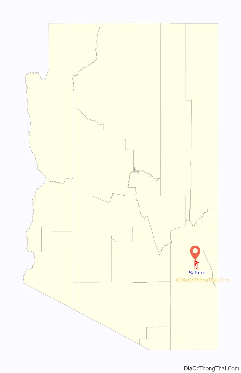
Safford location map. Where is Safford city?
History
Safford was founded by Joshua Eaton Bailey, Hiram Kennedy, and Edward Tuttle, who came from Gila Bend, in southwestern Arizona. They left Gila Bend in the winter of 1873-74 because their work on canals and dams had been destroyed by high water the previous summer. Upon arrival early in 1874, the villagers laid out the town site, including a few crude buildings.
The town is named after Arizona Territorial Governor Anson P. K. Safford.
The Town of Safford was incorporated October 10, 1901, and changed to City of Safford in 1955.
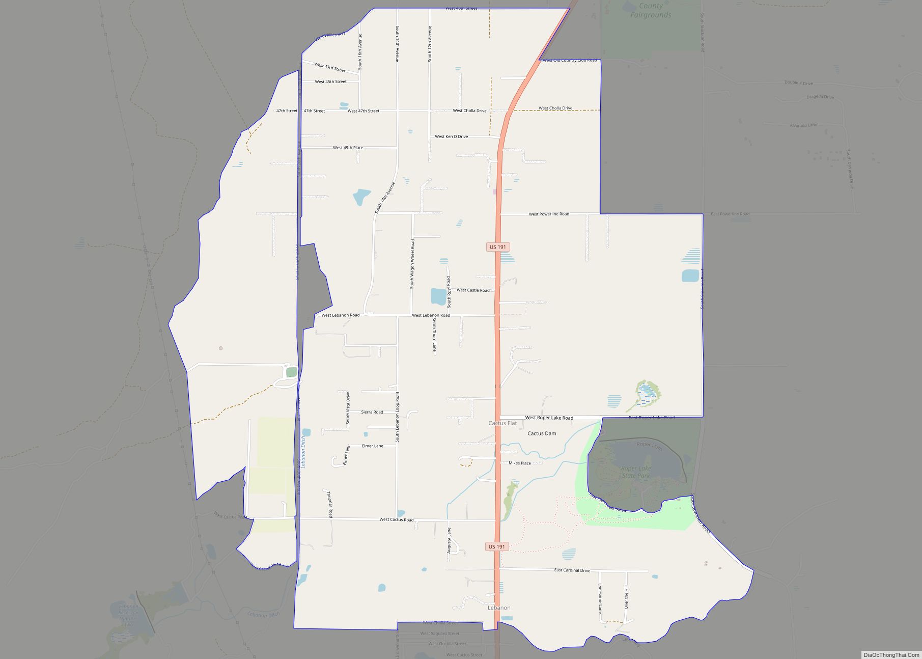
Safford Road Map
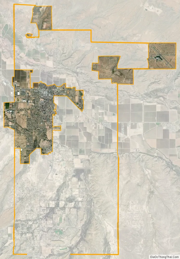
Safford city Satellite Map
Geography
Safford is located at 32°49′24″N 109°42′53″W / 32.82333°N 109.71472°W / 32.82333; -109.71472 (32.823266, -109.714613). The Pinaleno Mountains sit prominently to the southwest of town. The Pinalenos have the greatest vertical relief of any mountain range in Arizona.
According to the United States Census Bureau, the city has a total area of 8.6 square miles (22 km), of which 8.6 square miles (22 km) is land and 0.03 square miles (0.078 km) (0.18%) is water.
See also
Map of Arizona State and its subdivision: Map of other states:- Alabama
- Alaska
- Arizona
- Arkansas
- California
- Colorado
- Connecticut
- Delaware
- District of Columbia
- Florida
- Georgia
- Hawaii
- Idaho
- Illinois
- Indiana
- Iowa
- Kansas
- Kentucky
- Louisiana
- Maine
- Maryland
- Massachusetts
- Michigan
- Minnesota
- Mississippi
- Missouri
- Montana
- Nebraska
- Nevada
- New Hampshire
- New Jersey
- New Mexico
- New York
- North Carolina
- North Dakota
- Ohio
- Oklahoma
- Oregon
- Pennsylvania
- Rhode Island
- South Carolina
- South Dakota
- Tennessee
- Texas
- Utah
- Vermont
- Virginia
- Washington
- West Virginia
- Wisconsin
- Wyoming