Map of San Augustine city
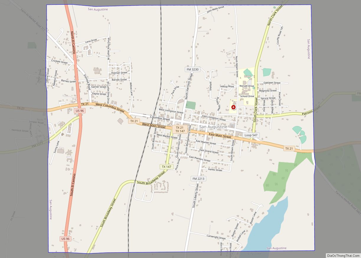
San Augustine is the county seat city of San Augustine County, Texas, in East Texas, United States. The population was 1,920 at the 2020 census. San Augustine city overview: Name: San Augustine city LSAD Code: 25 LSAD Description: city (suffix) State: Texas County: San Augustine County Elevation: 371 ft (113 m) Total Area: 4.80 sq mi (12.44 km²) Land Area: ... Read more
Map of San Augustine city
Map of San Angelo city
San Angelo (/sæn ˈændʒəloʊ/ SAN AN-jə-loh) is a city in and the county seat of Tom Green County, Texas, United States. Its location is in the Concho Valley, a region of Central Texas between the Permian Basin to the northwest, Chihuahuan Desert to the southwest, Osage Plains to the northeast, and Central Texas to the ... Read more
Map of San Angelo city
Map of Samnorwood CDP
Samnorwood is a census-designated place (CDP) in Collingsworth County, Texas, United States. It was designated in or after 1980. The population was 51 at the 2010 census, up from 39 at the 2000 census. The hamlet of Samnorwood, for which the CDP was named, is located within the CDP. Samnorwood CDP overview: Name: Samnorwood CDP ... Read more
Map of Samnorwood CDP
Map of Sammy Martinez CDP
Sammy Martinez is a census-designated place (CDP) in Starr County, Texas, United States. This was a new CDP for the 2010 census with a population of 110. Sammy Martinez CDP overview: Name: Sammy Martinez CDP LSAD Code: 57 LSAD Description: CDP (suffix) State: Texas County: Starr County Total Area: 0.3 sq mi (0.8 km²) Land Area: 0.3 sq mi (0.8 km²) ... Read more
Map of Sammy Martinez CDP
Map of Sam Rayburn CDP
Sam Rayburn is a census-designated place and unincorporated community in Jasper County, Texas, United States. Its population was 1,273 as of the 2020 census. The community, which is also known as Rayburn Country, is located on the south shore of the Sam Rayburn Reservoir at the junction of Texas Recreational Road 255 and Farm to ... Read more
Map of Sam Rayburn CDP
Map of San Diego city, Texas
San Diego is a city in Duval and Jim Wells counties, Texas, United States. The population was 3,748 at the 2020 census and 4,488 at the 2010 census. It is located primarily in Duval County, of which it is the county seat. San Diego city overview: Name: San Diego city LSAD Code: 25 LSAD Description: ... Read more
Map of San Diego city, Texas
Map of San Pedro CDP, Texas
San Pedro is a census-designated place (CDP) in Cameron County, Texas, United States. The population was 530 at the 2010 census. It is part of the Brownsville–Harlingen Metropolitan Statistical Area. San Pedro CDP overview: Name: San Pedro CDP LSAD Code: 57 LSAD Description: CDP (suffix) State: Texas County: Cameron County Elevation: 46 ft (14 m) Total Area: ... Read more
Map of San Pedro CDP, Texas
Map of San Patricio city
San Patricio is a city in Nueces and San Patricio counties in the U.S. state of Texas. The population was 384 at the 2020 census. San Patricio city overview: Name: San Patricio city LSAD Code: 25 LSAD Description: city (suffix) State: Texas County: San Patricio County Elevation: 43 ft (13 m) Total Area: 3.89 sq mi (10.07 km²) Land Area: ... Read more
Map of San Patricio city
Map of San Marcos city, Texas
San Marcos (/ˌsæn ˈmɑːrkəs/ SAN MAR-kOs) is a city and the county seat of Hays County, Texas, United States. The city is a part of the Greater Austin Metropolitan Area. San Marcos’s limits extend into Caldwell and Guadalupe Counties, as well. San Marcos is on the Interstate 35 corridor between Austin and San Antonio. Its ... Read more
Map of San Marcos city, Texas
Map of San Leon CDP
San Leon is a census-designated place (CDP) in Galveston County, Texas, United States. The population was 4,970 at the 2010 census. San Leon CDP overview: Name: San Leon CDP LSAD Code: 57 LSAD Description: CDP (suffix) State: Texas County: Galveston County Elevation: 10 ft (3 m) Total Area: 5.2 sq mi (13.4 km²) Land Area: 4.9 sq mi (12.6 km²) Water Area: 0.3 sq mi ... Read more
Map of San Leon CDP
Map of San Leanna village
San Leanna is a village in Travis County, Texas, United States. The population was 497 at the 2010 census. San Leanna village overview: Name: San Leanna village LSAD Code: 47 LSAD Description: village (suffix) State: Texas County: Travis County Elevation: 669 ft (204 m) Total Area: 0.45 sq mi (1.15 km²) Land Area: 0.44 sq mi (1.15 km²) Water Area: 0.00 sq mi (0.00 km²) Total ... Read more
Map of San Leanna village
Map of San Juan CDP, Texas
San Juan is a census-designated place (CDP) in Starr County, Texas, United States. It is a new CDP formed from part of the Garceno CDP prior to the 2010 census with a population of 129. San Juan CDP overview: Name: San Juan CDP LSAD Code: 57 LSAD Description: CDP (suffix) State: Texas County: Starr County ... Read more
Map of San Juan CDP, Texas