San Marcos (/ˌsæn ˈmɑːrkəs/ SAN MAR-kOs) is a city and the county seat of Hays County, Texas, United States. The city is a part of the Greater Austin Metropolitan Area. San Marcos’s limits extend into Caldwell and Guadalupe Counties, as well. San Marcos is on the Interstate 35 corridor between Austin and San Antonio. Its population was 44,894 at the 2010 census and 67,553 at the 2020 census. Founded on the banks of the San Marcos River, the area is thought to be among the oldest continuously inhabited sites in the Americas. San Marcos is home to Texas State University and the Meadows Center for Water and the Environment.
In 2010, San Marcos was listed in Business Week‘s fourth annual survey of the “Best Places to Raise your Kids”. In 2013 and 2014, the United States Census Bureau named it the fastest-growing city in the United States. In December 2013, it was named number nine on Business Insider‘s list of the “10 Most Exciting Small Cities In America”.
| Name: | San Marcos city |
|---|---|
| LSAD Code: | 25 |
| LSAD Description: | city (suffix) |
| State: | Texas |
| County: | Caldwell County, Guadalupe County, Hays County |
| Elevation: | 617 ft (188 m) |
| Total Area: | 35.71 sq mi (92.50 km²) |
| Land Area: | 35.59 sq mi (92.18 km²) |
| Water Area: | 0.12 sq mi (0.32 km²) |
| Total Population: | 67,553 |
| Population Density: | 1,820.01/sq mi (702.70/km²) |
| ZIP code: | 78666–78667 |
| Area code: | 512 and 737 |
| FIPS code: | 4865600 |
| GNISfeature ID: | 1375971 |
| Website: | www.sanmarcostx.gov |
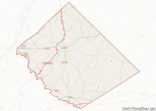
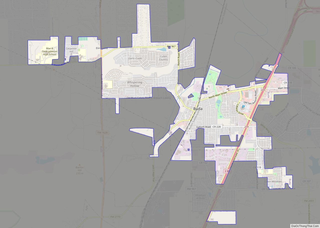
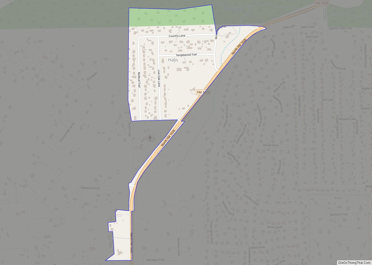
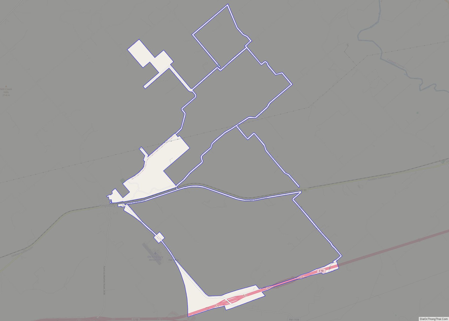
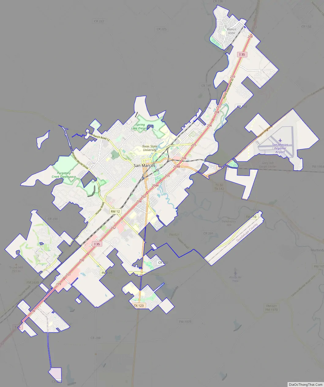
Online Interactive Map
Click on ![]() to view map in "full screen" mode.
to view map in "full screen" mode.
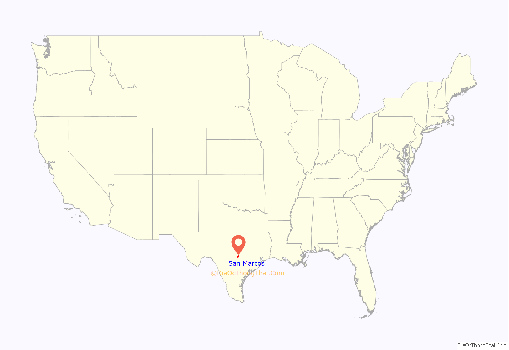
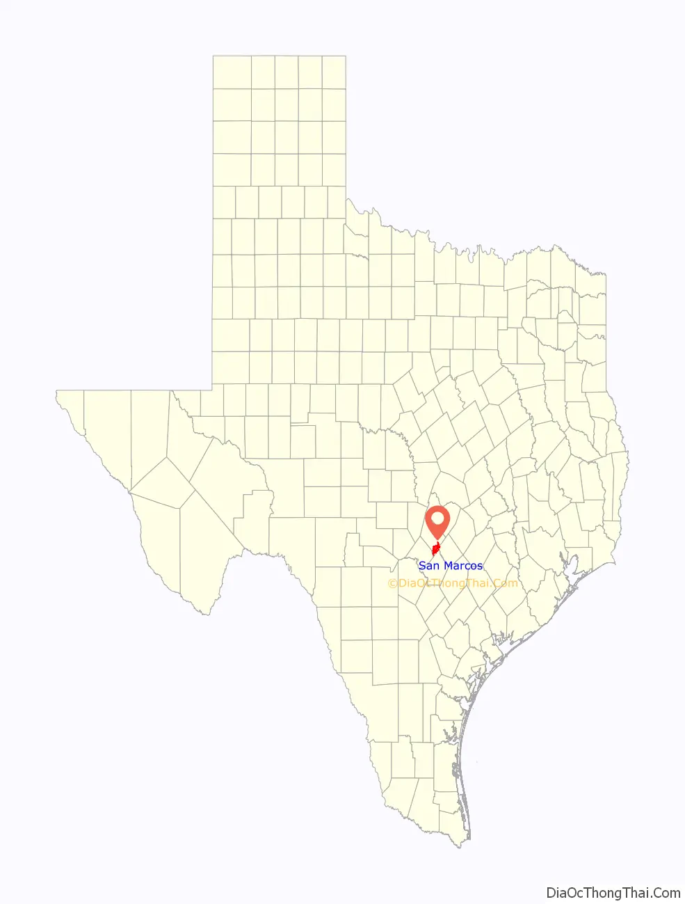
San Marcos location map. Where is San Marcos city?
History
Archeologists have found evidence at the San Marcos River associated with the Clovis culture, which suggests that the river has been the site of human habitation for more than 10,000 years. The San Marcos Springs are the third-largest collection of springs in Texas. Never in recorded history has the river run dry.
In 1689, Spaniard Alonso de León led an expedition from Mexico to explore Texas and establish missions and presidios in the region. De León’s party helped blaze the Camino Real (later known as the Old San Antonio Road), which followed present-day Hunter Road, Hopkins Street, and Aquarena Springs Drive (the route later shifted four miles to the south; it is now followed by County Road 266, known locally as Old Bastrop Highway). De León’s party reached the river on April 25, the feast day of St. Mark the Evangelist; the river was thus named the San Marcos.
In January 1808, a small group of Spanish-Mexican families settled at the Old Bastrop Highway crossing of the river, and named the settlement Villa de San Marcos de Neve. The settlers were plagued by floods and Indian raids, and the settlement was abandoned in 1812.
In November 1846, the first Anglo-American settlers moved into the vicinity of the San Marcos Springs. The Texas Legislature organized Hays County on March 1, 1848, and designated San Marcos as the county seat. In 1851, a town center was laid out about a mile southwest of the headwaters of the river. The town became a center for ginning and milling local agricultural products. The town’s most notable founder and early settler was Gen. Edward Burleson, a hero of the Texas Revolution and former vice president of the Republic of Texas. Burleson built a dam on the upper reaches of the river in 1849. The dam powered several mills, including one within present-day Sewell Park.
In the decade following the arrival of the International-Great Northern Railroad on September 30, 1880, cattle and cotton provided the basis for the growth of San Marcos as a center for commerce and transportation.
In 1866, the Coronal Institute was established as an early private high school. In 1899, Southwest Texas State Normal School (now known as Texas State University) was established as a teacher’s college to meet demand for public school teachers in Texas. In 1907, the San Marcos Baptist Academy was established, furthering education as an important industry for the town. The demands of World War II forced the town’s industry to diversify, and with the emergence of a manufacturing and light industrial sector, the town began to experience growth.
In the late 1940s, former Hollywood director Shadrack Graham produced a documentary about daily life in San Marcos as part of his “Our Hometown” series of films that encouraged commerce and civic activity in small communities. The film highlights several local businesses from the era, including Smith’s Flowers, Waldrin’s Cleaners, Lack’s Furniture, and the Palace Movie Theater.
Gary Air Force Base, just east of town, was opened in 1942 as San Marcos Army Airfield, renamed San Marcos Air Force Base in 1947, and renamed finally in 1953 in honor of Lieutenant Arthur Edward Gary, killed at Clark Field in the Philippines on December 7, 1941, the first San Martian to die in World War II. During the war, the base trained over 10,000 navigators, and in the following years was the largest center of Air Force and Army helicopter training for pilots and mechanics in the United States, with 21 squadrons and 4800 personnel stationed there. The base was handed over to the Army in 1956, renamed Camp Gary, and was closed in 1963. Subsequently, part of the base was taken over by the city for use as San Marcos Airport, while another part was reopened in 1966 as the Gary Job Corps Center.
In the 1960s, with the establishment of Aquarena Springs and Wonder World as attractions, the tourist industry became a growing part of the city’s economy. By the 1960s, what was then named Southwest Texas State University had grown into an important regional institution, and when coupled with the creation of Gary Job Corps Training Center in 1965, education became the largest industry in San Marcos. The remarkable growth explosion of Austin further allowed San Marcos to prosper.
By 1973, San Marcos and Hays County were included by the U. S. Census Bureau in the Austin metropolitan statistical area. By that year, the city’s population had grown to 25,000 citizens, along with an additional Southwest Texas State University student body of 20,000.
By 1990, the city’s population had grown to 28,743, by 2000, it reached 34,733, and by 2010, it was 44,894. A report, released by the U.S. Census Bureau in May 2013, stated that San Marcos had the highest rate of growth among all U.S. cities and towns with at least 50,000 people. Its population rose 6.9% between 2011 and 2012. The university, now known as Texas State University, boasts a student body of 34,225.
In 1991, protestors advocating for legalization of marijuana conducted a civil disobedience action and were arrested; they became known as the San Marcos Seven.
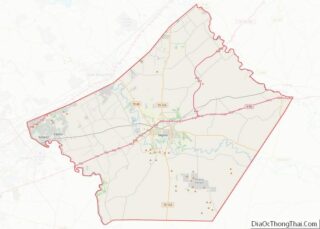
San Marcos Road Map
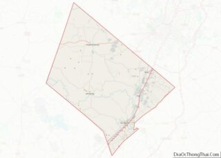
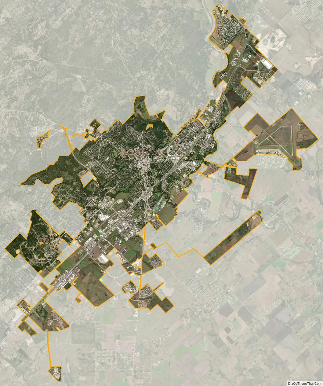
San Marcos city Satellite Map
Geography
San Marcos is in Central Texas. It is 30 miles (48 km) southwest of Austin and 51 miles (82 km) northeast of San Antonio. According to the United States Census Bureau, in 2010, it had a total area of 30.3 square miles (78.6 km), of which 0.1 square miles (0.3 km), or 0.44%, was covered by water. Interstate 35 is the main highway through it, with access from exits 199 through 208. It is situated on the Balcones Fault, the boundary between the Hill Country to the west and the Coastal Plains to the east. Along the fault, many springs emerge, such as San Marcos Springs, which forms Spring Lake and is the source of the San Marcos River. The eastern part is Blackland Prairie. The western part consists of forested or grassy rolling hills, often marked with cacti.
The San Marcos River and the Blanco River, part of the Guadalupe watershed, flow through the city, along with Cottonwood Creek, Purgatory Creek, Sink Creek, and Willow Springs Creek.
Climate
The climate in this area is characterized by hot, humid summers and generally mild to cool winters, with some winter frost at night. Annual precipitation is about 34 inches (864 mm). According to the Köppen climate classification, San Marcos has a humid subtropical climate, Cfa on climate maps.
See also
Map of Texas State and its subdivision:- Anderson
- Andrews
- Angelina
- Aransas
- Archer
- Armstrong
- Atascosa
- Austin
- Bailey
- Bandera
- Bastrop
- Baylor
- Bee
- Bell
- Bexar
- Blanco
- Borden
- Bosque
- Bowie
- Brazoria
- Brazos
- Brewster
- Briscoe
- Brooks
- Brown
- Burleson
- Burnet
- Caldwell
- Calhoun
- Callahan
- Cameron
- Camp
- Carson
- Cass
- Castro
- Chambers
- Cherokee
- Childress
- Clay
- Cochran
- Coke
- Coleman
- Collin
- Collingsworth
- Colorado
- Comal
- Comanche
- Concho
- Cooke
- Coryell
- Cottle
- Crane
- Crockett
- Crosby
- Culberson
- Dallam
- Dallas
- Dawson
- Deaf Smith
- Delta
- Denton
- Dewitt
- Dickens
- Dimmit
- Donley
- Duval
- Eastland
- Ector
- Edwards
- El Paso
- Ellis
- Erath
- Falls
- Fannin
- Fayette
- Fisher
- Floyd
- Foard
- Fort Bend
- Franklin
- Freestone
- Frio
- Gaines
- Galveston
- Garza
- Gillespie
- Glasscock
- Goliad
- Gonzales
- Gray
- Grayson
- Gregg
- Grimes
- Guadalupe
- Hale
- Hall
- Hamilton
- Hansford
- Hardeman
- Hardin
- Harris
- Harrison
- Hartley
- Haskell
- Hays
- Hemphill
- Henderson
- Hidalgo
- Hill
- Hockley
- Hood
- Hopkins
- Houston
- Howard
- Hudspeth
- Hunt
- Hutchinson
- Irion
- Jack
- Jackson
- Jasper
- Jeff Davis
- Jefferson
- Jim Hogg
- Jim Wells
- Johnson
- Jones
- Karnes
- Kaufman
- Kendall
- Kenedy
- Kent
- Kerr
- Kimble
- King
- Kinney
- Kleberg
- Knox
- La Salle
- Lamar
- Lamb
- Lampasas
- Lavaca
- Lee
- Leon
- Liberty
- Limestone
- Lipscomb
- Live Oak
- Llano
- Loving
- Lubbock
- Lynn
- Madison
- Marion
- Martin
- Mason
- Matagorda
- Maverick
- McCulloch
- McLennan
- McMullen
- Medina
- Menard
- Midland
- Milam
- Mills
- Mitchell
- Montague
- Montgomery
- Moore
- Morris
- Motley
- Nacogdoches
- Navarro
- Newton
- Nolan
- Nueces
- Ochiltree
- Oldham
- Orange
- Palo Pinto
- Panola
- Parker
- Parmer
- Pecos
- Polk
- Potter
- Presidio
- Rains
- Randall
- Reagan
- Real
- Red River
- Reeves
- Refugio
- Roberts
- Robertson
- Rockwall
- Runnels
- Rusk
- Sabine
- San Augustine
- San Jacinto
- San Patricio
- San Saba
- Schleicher
- Scurry
- Shackelford
- Shelby
- Sherman
- Smith
- Somervell
- Starr
- Stephens
- Sterling
- Stonewall
- Sutton
- Swisher
- Tarrant
- Taylor
- Terrell
- Terry
- Throckmorton
- Titus
- Tom Green
- Travis
- Trinity
- Tyler
- Upshur
- Upton
- Uvalde
- Val Verde
- Van Zandt
- Victoria
- Walker
- Waller
- Ward
- Washington
- Webb
- Wharton
- Wheeler
- Wichita
- Wilbarger
- Willacy
- Williamson
- Wilson
- Winkler
- Wise
- Wood
- Yoakum
- Young
- Zapata
- Zavala
- Alabama
- Alaska
- Arizona
- Arkansas
- California
- Colorado
- Connecticut
- Delaware
- District of Columbia
- Florida
- Georgia
- Hawaii
- Idaho
- Illinois
- Indiana
- Iowa
- Kansas
- Kentucky
- Louisiana
- Maine
- Maryland
- Massachusetts
- Michigan
- Minnesota
- Mississippi
- Missouri
- Montana
- Nebraska
- Nevada
- New Hampshire
- New Jersey
- New Mexico
- New York
- North Carolina
- North Dakota
- Ohio
- Oklahoma
- Oregon
- Pennsylvania
- Rhode Island
- South Carolina
- South Dakota
- Tennessee
- Texas
- Utah
- Vermont
- Virginia
- Washington
- West Virginia
- Wisconsin
- Wyoming