Map of Yoakum city
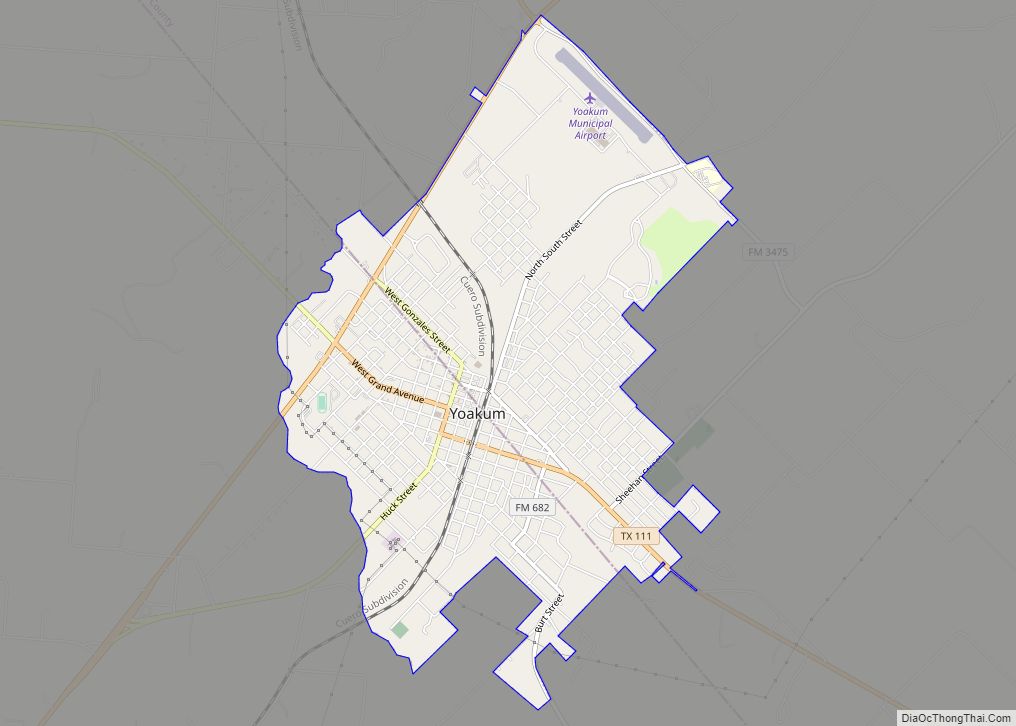
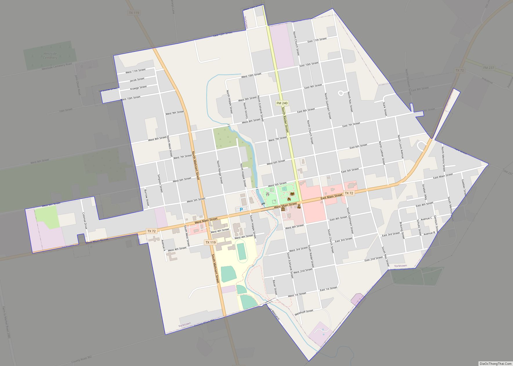
Yoakum is a city in Lavaca and DeWitt counties in the U.S. state of Texas. The population was 5,908 at the 2020 census. Yoakum city overview: Name: Yoakum city LSAD Code: 25 LSAD Description: city (suffix) State: Texas County: DeWitt County, Lavaca County Incorporated: May 13, 1889 Elevation: 365 ft (111.3 m) Total Area: 4.59 sq mi (11.89 km²) Land ... Read more
Map of Yoakum city
Map of Wylie city
Wylie is a city and northeastern suburb of Dallas, that was once solely located in Collin County, but now extends into neighboring Dallas and Rockwall counties in the U.S. state of Texas. It is located on State Route 78 about 24 miles (39 km) northeast of central Dallas and centrally located between nearby Lavon Lake and ... Read more
Map of Wylie city
Map of Wyldwood CDP
Wyldwood is a census-designated place (CDP) in Bastrop County, Texas, United States. The population was 3,694 at the 2020 census. Wyldwood CDP overview: Name: Wyldwood CDP LSAD Code: 57 LSAD Description: CDP (suffix) State: Texas County: Bastrop County Elevation: 512 ft (156 m) Total Area: 12.1 sq mi (31.4 km²) Land Area: 12.1 sq mi (31.2 km²) Water Area: 0.1 sq mi (0.2 km²) Total Population: ... Read more
Map of Wyldwood CDP
Map of Wortham town, Texas
Wortham is a town in Freestone County, Texas, United States. The population was 980 at the 2020 census. Wortham town overview: Name: Wortham town LSAD Code: 43 LSAD Description: town (suffix) State: Texas County: Freestone County Elevation: 476 ft (145 m) Total Area: 1.99 sq mi (5.15 km²) Land Area: 1.99 sq mi (5.15 km²) Water Area: 0.00 sq mi (0.00 km²) Total Population: 980 Population ... Read more
Map of Wortham town, Texas
Map of Woodway city, Texas
Woodway is a city in McLennan County, Texas, United States. The population was 9,383 at the 2020 census. It is part of the Waco Metropolitan Statistical Area. Woodway city overview: Name: Woodway city LSAD Code: 25 LSAD Description: city (suffix) State: Texas County: McLennan County Elevation: 633 ft (193 m) Total Area: 6.58 sq mi (17.05 km²) Land Area: 6.57 sq mi ... Read more
Map of Woodway city, Texas
Map of Woodson town, Texas
Woodson is a town in Throckmorton County, Texas, United States. As of 2014, the population was estimated to be 258. Woodson town overview: Name: Woodson town LSAD Code: 43 LSAD Description: town (suffix) State: Texas County: Throckmorton County Elevation: 1,227 ft (374 m) Total Area: 0.65 sq mi (1.68 km²) Land Area: 0.65 sq mi (1.68 km²) Water Area: 0.00 sq mi (0.00 km²) Total Population: ... Read more
Map of Woodson town, Texas
Map of Woodsboro town, Texas
Woodsboro is a town in Refugio County, Texas, United States. The population was 1,512 at the 2010 census. Woodsboro town overview: Name: Woodsboro town LSAD Code: 43 LSAD Description: town (suffix) State: Texas County: Refugio County Elevation: 43 ft (13 m) Total Area: 0.76 sq mi (1.96 km²) Land Area: 0.76 sq mi (1.96 km²) Water Area: 0.00 sq mi (0.00 km²) Total Population: 1,512 Population ... Read more
Map of Woodsboro town, Texas
Map of Woodloch town
Woodloch is a town in Montgomery County, Texas, United States. The population was 207 at the 2010 census. As of October 2022, the mayor is Donald Nichols. Woodloch town overview: Name: Woodloch town LSAD Code: 43 LSAD Description: town (suffix) State: Texas County: Montgomery County Incorporated: 1974 Elevation: 108 ft (33 m) Total Area: 0.08 sq mi (0.22 km²) Land ... Read more
Map of Woodloch town
Map of Yorktown city, Texas
Yorktown is a city in DeWitt County, Texas, United States. The population was 1,810 at the 2020 census. Yorktown city overview: Name: Yorktown city LSAD Code: 25 LSAD Description: city (suffix) State: Texas County: DeWitt County Elevation: 276 ft (84 m) Total Area: 1.73 sq mi (4.47 km²) Land Area: 1.73 sq mi (4.47 km²) Water Area: 0.00 sq mi (0.00 km²) Total Population: 1,810 Population ... Read more
Map of Yorktown city, Texas
Map of Altamont town, Utah
Altamont is a town in Duchesne County, Utah, United States. The population was 225 at the 2010 census, an increase over the 2000 figure of 178. Altamont town overview: Name: Altamont town LSAD Code: 43 LSAD Description: town (suffix) State: Utah County: Duchesne County Incorporated: 1953 Elevation: 6,388 ft (1,947 m) Total Area: 0.21 sq mi (0.55 km²) Land Area: ... Read more
Map of Altamont town, Utah
Map of Alta town, Utah
Alta is a town in eastern Salt Lake County, Utah, United States. It is part of the Salt Lake City, Utah Metropolitan Statistical Area. The population was 383 at the 2010 census, a slight increase from the 2000 figure of 370. Alta is centered in the Alta Ski Area, a ski resort that has 500,000 ... Read more
Map of Alta town, Utah
Map of Zuehl CDP
Zuehl (/ziːl/ zeel) is an unincorporated area and census-designated place in western Guadalupe County, Texas, United States. It is part of the San Antonio Metropolitan Statistical Area. Located on Cibolo Creek, it lies 13 miles (21 km) southwest of Seguin. The population was 362 at the 2010 census. Once known as “Perryman’s Crossing”, it was a ... Read more
Map of Zuehl CDP