Yoakum is a city in Lavaca and DeWitt counties in the U.S. state of Texas. The population was 5,908 at the 2020 census.
| Name: | Yoakum city |
|---|---|
| LSAD Code: | 25 |
| LSAD Description: | city (suffix) |
| State: | Texas |
| County: | DeWitt County, Lavaca County |
| Incorporated: | May 13, 1889 |
| Elevation: | 365 ft (111.3 m) |
| Total Area: | 4.59 sq mi (11.89 km²) |
| Land Area: | 4.58 sq mi (11.86 km²) |
| Water Area: | 0.01 sq mi (0.02 km²) |
| Total Population: | 5,908 |
| Population Density: | 1,296.66/sq mi (500.70/km²) |
| ZIP code: | 77995 |
| Area code: | 361 |
| FIPS code: | 4880560 |
| GNISfeature ID: | 1377671 |
| Website: | www.cityofyoakum.org |
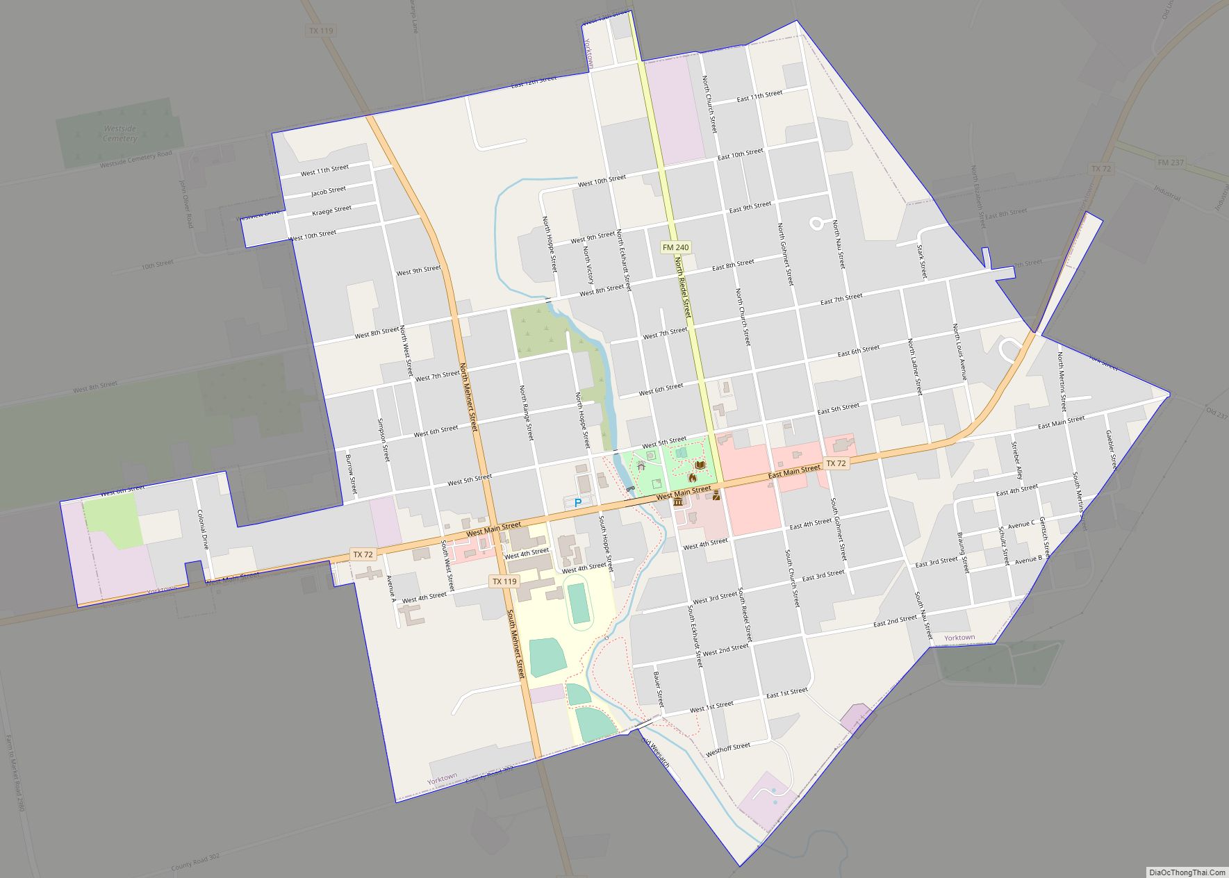
Online Interactive Map
Click on ![]() to view map in "full screen" mode.
to view map in "full screen" mode.
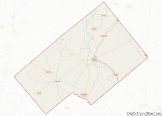
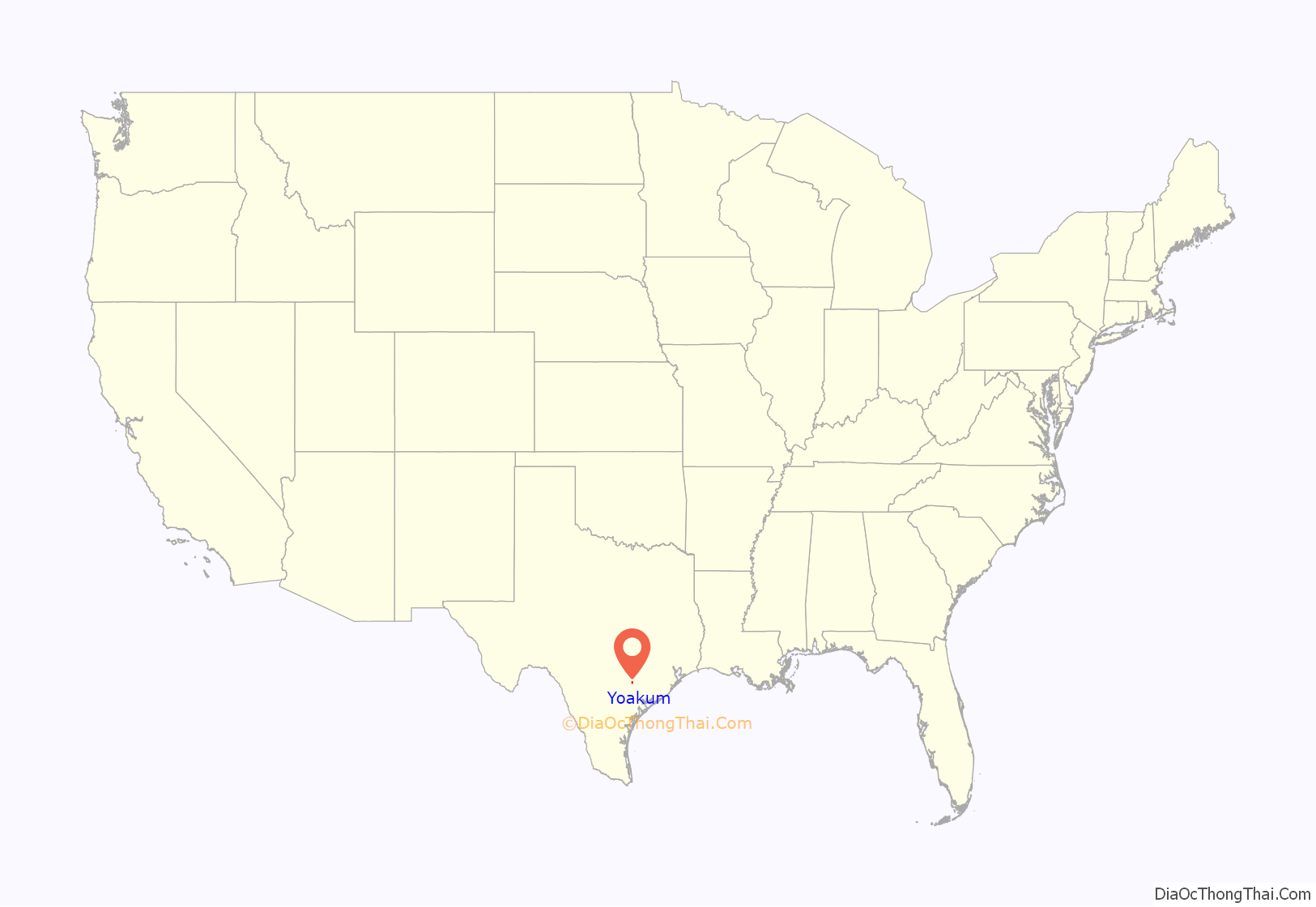
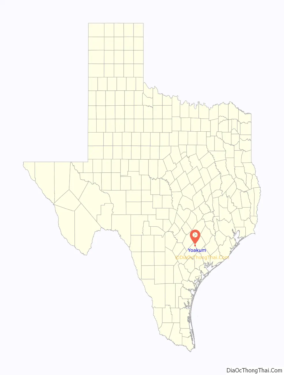
Yoakum location map. Where is Yoakum city?
History
The area was sparsely settled until a townsite was laid out with the construction of the San Antonio and Aransas Pass Railway in 1887, and named for Benjamin F. Yoakum, a vice president of the line. The railroad built a roundhouse and maintenance shops there, employing hundreds of workers. The town was incorporated in 1889. According to the Handbook of Texas Online, “By 1896 Yoakum had a cotton mill, three cotton gins, a compress, several churches, a bank, an ice factory, specialty and general stores, two weekly newspapers and one daily, a school system with 700 pupils, and a population of 3,000. By 1914 the number of residents had reached 7,500.” In the early 20th century, the Tex-Tan company, later part of the Tandy Corporation, manufactured saddles, bridles, harnesses, belts, and wallets. Other industries included a dairy, a cannery, meat-packing and food-processing plants, and a metalworking shop. Beginning in 1926, tomato farming in the surrounding area became a major agricultural business, with Yoakum being known as “the tomato capital of south central Texas.”
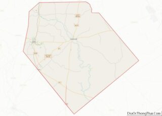
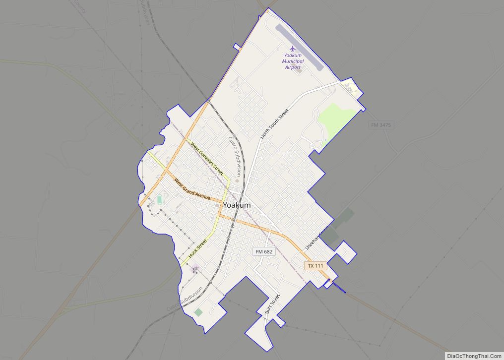
Yoakum Road Map
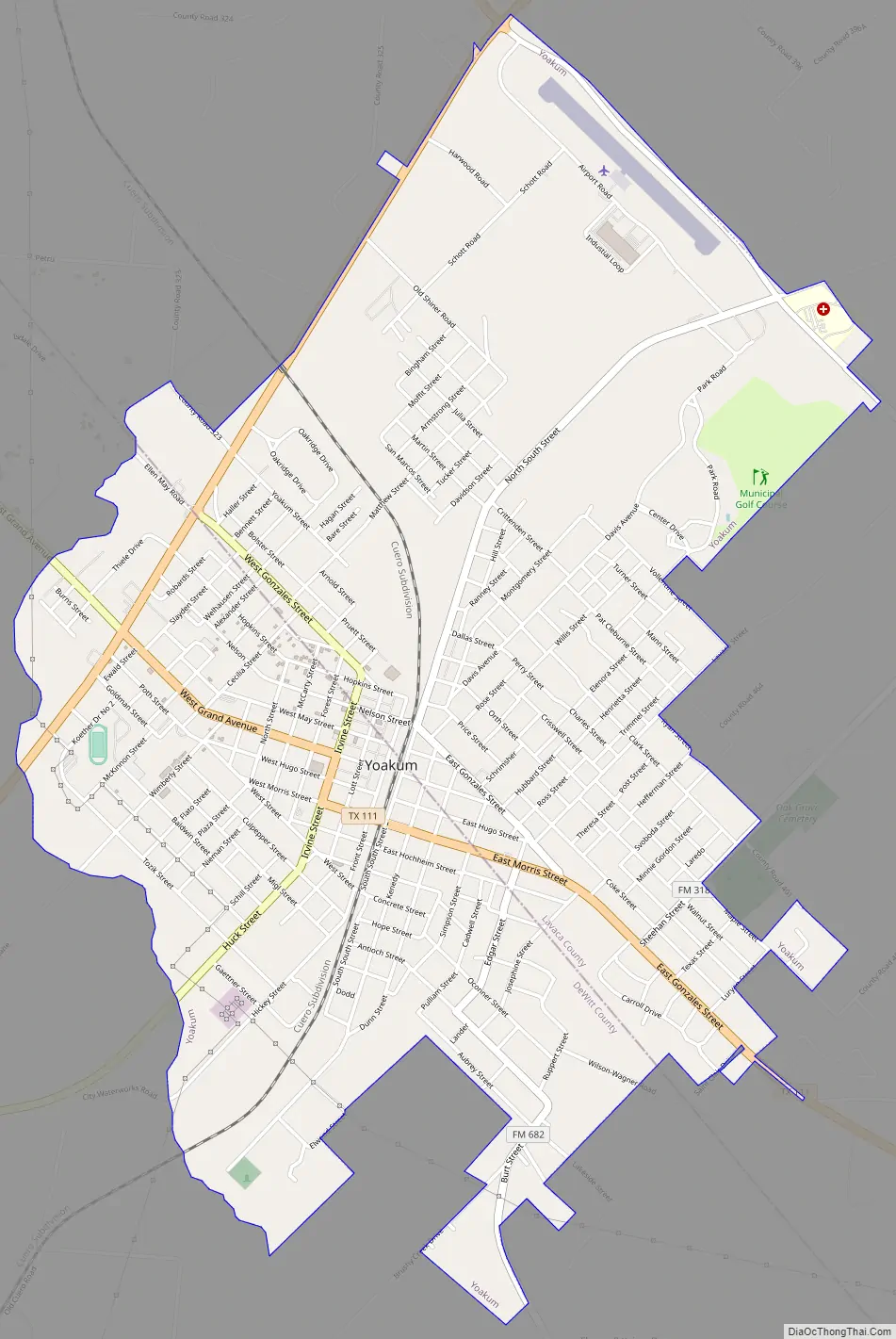
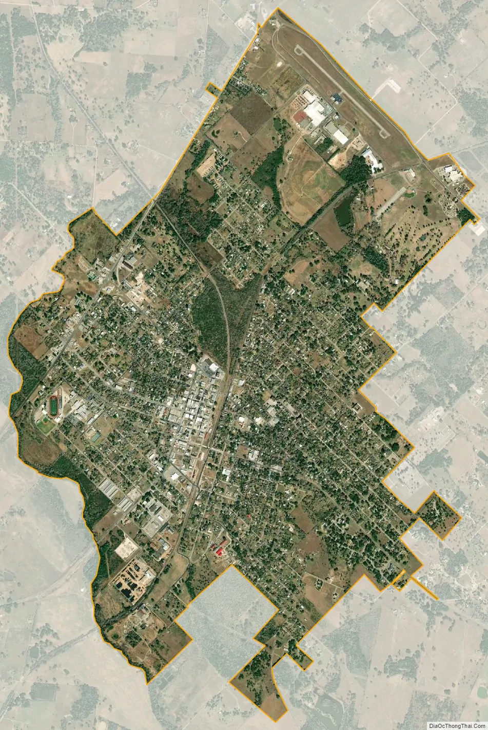
Yoakum city Satellite Map
Geography
Yoakum is located on the border of Lavaca and DeWitt counties at 29°17′28″N 97°8′50″W / 29.29111°N 97.14722°W / 29.29111; -97.14722 (29.291052, -97.147315). U.S. Route 77 Alternate forms the northwest boundary of the city and leads northeast 17 miles (27 km) to Hallettsville and southwest 16 miles (26 km) to Cuero. Texas State Highway 111 passes through the center of Yoakum, leading southeast 39 miles (63 km) to Edna and west 9 miles (14 km) to Hochheim. Texas State Highway 95 leaves US 77A at the north end of Yoakum and leads north 8 miles (13 km) to Shiner.
According to the United States Census Bureau, Yoakum has a total area of 4.6 square miles (11.9 km), of which 0.01 square miles (0.02 km), or 0.20%, is covered by water.
See also
Map of Texas State and its subdivision:- Anderson
- Andrews
- Angelina
- Aransas
- Archer
- Armstrong
- Atascosa
- Austin
- Bailey
- Bandera
- Bastrop
- Baylor
- Bee
- Bell
- Bexar
- Blanco
- Borden
- Bosque
- Bowie
- Brazoria
- Brazos
- Brewster
- Briscoe
- Brooks
- Brown
- Burleson
- Burnet
- Caldwell
- Calhoun
- Callahan
- Cameron
- Camp
- Carson
- Cass
- Castro
- Chambers
- Cherokee
- Childress
- Clay
- Cochran
- Coke
- Coleman
- Collin
- Collingsworth
- Colorado
- Comal
- Comanche
- Concho
- Cooke
- Coryell
- Cottle
- Crane
- Crockett
- Crosby
- Culberson
- Dallam
- Dallas
- Dawson
- Deaf Smith
- Delta
- Denton
- Dewitt
- Dickens
- Dimmit
- Donley
- Duval
- Eastland
- Ector
- Edwards
- El Paso
- Ellis
- Erath
- Falls
- Fannin
- Fayette
- Fisher
- Floyd
- Foard
- Fort Bend
- Franklin
- Freestone
- Frio
- Gaines
- Galveston
- Garza
- Gillespie
- Glasscock
- Goliad
- Gonzales
- Gray
- Grayson
- Gregg
- Grimes
- Guadalupe
- Hale
- Hall
- Hamilton
- Hansford
- Hardeman
- Hardin
- Harris
- Harrison
- Hartley
- Haskell
- Hays
- Hemphill
- Henderson
- Hidalgo
- Hill
- Hockley
- Hood
- Hopkins
- Houston
- Howard
- Hudspeth
- Hunt
- Hutchinson
- Irion
- Jack
- Jackson
- Jasper
- Jeff Davis
- Jefferson
- Jim Hogg
- Jim Wells
- Johnson
- Jones
- Karnes
- Kaufman
- Kendall
- Kenedy
- Kent
- Kerr
- Kimble
- King
- Kinney
- Kleberg
- Knox
- La Salle
- Lamar
- Lamb
- Lampasas
- Lavaca
- Lee
- Leon
- Liberty
- Limestone
- Lipscomb
- Live Oak
- Llano
- Loving
- Lubbock
- Lynn
- Madison
- Marion
- Martin
- Mason
- Matagorda
- Maverick
- McCulloch
- McLennan
- McMullen
- Medina
- Menard
- Midland
- Milam
- Mills
- Mitchell
- Montague
- Montgomery
- Moore
- Morris
- Motley
- Nacogdoches
- Navarro
- Newton
- Nolan
- Nueces
- Ochiltree
- Oldham
- Orange
- Palo Pinto
- Panola
- Parker
- Parmer
- Pecos
- Polk
- Potter
- Presidio
- Rains
- Randall
- Reagan
- Real
- Red River
- Reeves
- Refugio
- Roberts
- Robertson
- Rockwall
- Runnels
- Rusk
- Sabine
- San Augustine
- San Jacinto
- San Patricio
- San Saba
- Schleicher
- Scurry
- Shackelford
- Shelby
- Sherman
- Smith
- Somervell
- Starr
- Stephens
- Sterling
- Stonewall
- Sutton
- Swisher
- Tarrant
- Taylor
- Terrell
- Terry
- Throckmorton
- Titus
- Tom Green
- Travis
- Trinity
- Tyler
- Upshur
- Upton
- Uvalde
- Val Verde
- Van Zandt
- Victoria
- Walker
- Waller
- Ward
- Washington
- Webb
- Wharton
- Wheeler
- Wichita
- Wilbarger
- Willacy
- Williamson
- Wilson
- Winkler
- Wise
- Wood
- Yoakum
- Young
- Zapata
- Zavala
- Alabama
- Alaska
- Arizona
- Arkansas
- California
- Colorado
- Connecticut
- Delaware
- District of Columbia
- Florida
- Georgia
- Hawaii
- Idaho
- Illinois
- Indiana
- Iowa
- Kansas
- Kentucky
- Louisiana
- Maine
- Maryland
- Massachusetts
- Michigan
- Minnesota
- Mississippi
- Missouri
- Montana
- Nebraska
- Nevada
- New Hampshire
- New Jersey
- New Mexico
- New York
- North Carolina
- North Dakota
- Ohio
- Oklahoma
- Oregon
- Pennsylvania
- Rhode Island
- South Carolina
- South Dakota
- Tennessee
- Texas
- Utah
- Vermont
- Virginia
- Washington
- West Virginia
- Wisconsin
- Wyoming