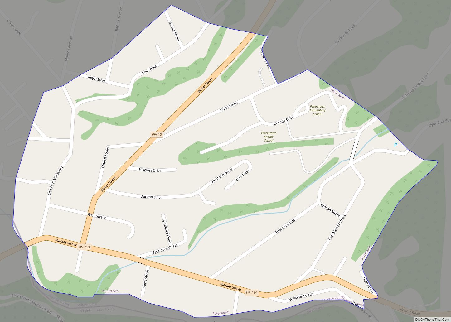
Peterstown is a town in Monroe County, West Virginia, United States. The population was 456 at the 2020 census. The town was named after Christian Peters, a pioneer settler. The town is the site of the 1928 discovery of the 34.48 carat (6.896 g) Jones Diamond by Grover C. Jones and his son, William “Punch” ... Read more
Map of US Cities and Places
Petersburg is a city in Grant County, West Virginia, United States. The population was 2,251 at the 2020 census. It is the county seat of Grant County. Petersburg city overview: Name: Petersburg city LSAD Code: 25 LSAD Description: city (suffix) State: West Virginia County: Grant County Elevation: 935 ft (285 m) Total Area: 1.62 sq mi (4.19 km²) Land Area: ... Read more
Pentress is a census-designated place (CDP) in northern Monongalia County, West Virginia, United States. It lies along West Virginia Route 7 northwest of the city of Morgantown, the county seat of Monongalia County. Its elevation is 951 feet (290 m). “Pentress” is not the only name the community has had; at various times in its history, it ... Read more
Prichard is a census-designated place (CDP) in Wayne County, West Virginia, United States. As of the 2020 census, its population was 461. It is located along the Big Sandy River and U.S. Route 52. It is part of the Huntington–Ashland, WV–KY–OH, Metropolitan Statistical Area (MSA), which had a population of 287,702 according to the US ... Read more
Pennsboro is a city in Ritchie County, West Virginia, United States. The population was 1,050 at the 2020 census. The city is located at the junction of U.S. Route 50 and West Virginia Route 74; the North Bend Rail Trail also passes through the city. The town was platted circa 1820 by Charles Penn, and ... Read more
Reedsville is a town in western Preston County, West Virginia, United States. The population was 530 at the 2020 census. It is part of the Morgantown metropolitan area. Reedsville town overview: Name: Reedsville town LSAD Code: 43 LSAD Description: town (suffix) State: West Virginia County: Preston County Elevation: 1,818 ft (554 m) Total Area: 0.65 sq mi (1.68 km²) Land ... Read more
Raysal is a census-designated place (CDP) in McDowell County, West Virginia, United States. Raysal is located along West Virginia Route 83, 1 mile (1.6 km) southeast of Bradshaw. Raysal has a post office with ZIP code 24879. As of the 2010 census, its population was 465. The community’s name is an amalgamation of Raymond Salvati, a ... Read more
Ravenswood is a city in Jackson County, West Virginia, United States, along the Ohio River. The population was 3,865 at the 2020 census. Ravenswood city overview: Name: Ravenswood city LSAD Code: 25 LSAD Description: city (suffix) State: West Virginia County: Jackson County Elevation: 607 ft (185 m) Total Area: 1.89 sq mi (4.89 km²) Land Area: 1.82 sq mi (4.71 km²) Water Area: ... Read more
Rand is a census-designated place (CDP) on the Kanawha River in Kanawha County, West Virginia, United States. As of the 2010 census, its population was 1,631. It is surrounded by the communities of Malden and DuPont City. Rand CDP overview: Name: Rand CDP LSAD Code: 57 LSAD Description: CDP (suffix) State: West Virginia County: Kanawha ... Read more
Racine is a census-designated place (CDP) in Boone County, West Virginia, United States. As of the 2010 census, its population was 256. The community was named after Racine, Ohio, the native home of first settlers. Racine is home to the Racine Volunteer Fire Department which covers 174 square miles (450 km) in its first response area. ... Read more
Rachel is a census-designated place (CDP) in Marion County, West Virginia, United States. It is located along Buffalo Creek, 2 miles (3.2 km) east-southeast of Mannington. Rachel has a post office with ZIP code 26587. As of the 2010 census, its population was 248. Rachel is located on U.S. 250 between Farmington and Mannington. Rachel CDP ... Read more
Ripley is a city in and the county seat of Jackson County, West Virginia, United States. The population was 3,074 at the 2020 census. Ripley city overview: Name: Ripley city LSAD Code: 25 LSAD Description: city (suffix) State: West Virginia County: Jackson County Elevation: 614 ft (187 m) Total Area: 3.29 sq mi (8.51 km²) Land Area: 3.18 sq mi (8.23 km²) Water ... Read more