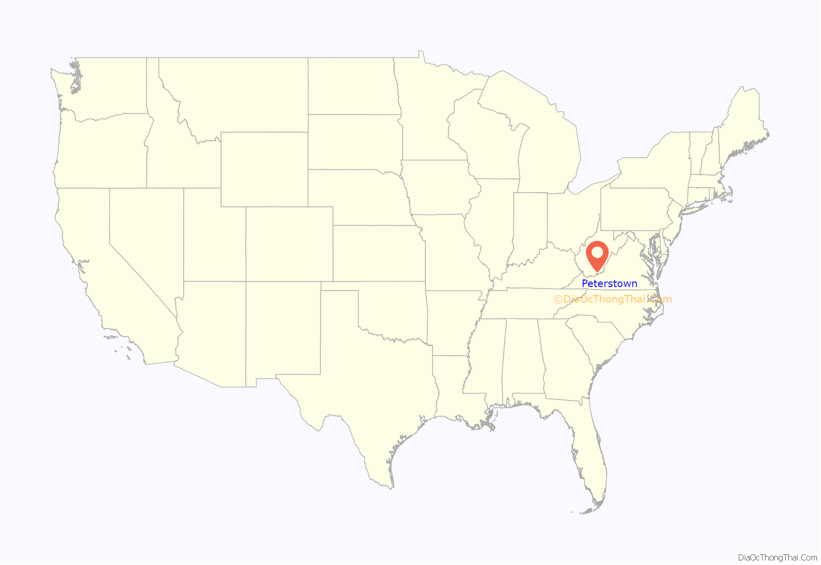
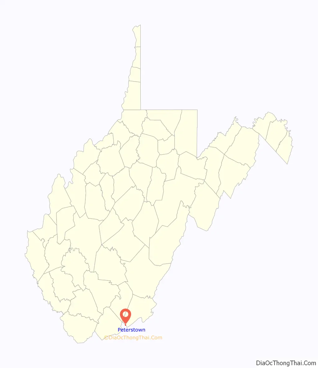
Peterstown is a town in Monroe County, West Virginia, United States. The population was 456 at the 2020 census.
The town was named after Christian Peters, a pioneer settler. The town is the site of the 1928 discovery of the 34.48 carat (6.896 g) Jones Diamond by Grover C. Jones and his son, William “Punch” Jones.
| Name: | Peterstown town |
|---|---|
| LSAD Code: | 43 |
| LSAD Description: | town (suffix) |
| State: | West Virginia |
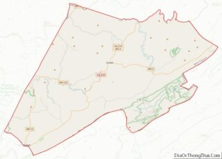
| County: | Monroe County |
| Elevation: | 1,624 ft (495 m) |
| Total Area: | 0.32 sq mi (0.82 km²) |
| Land Area: | 0.32 sq mi (0.82 km²) |
| Water Area: | 0.00 sq mi (0.00 km²) |
| Total Population: | 456 |
| Population Density: | 1,965.19/sq mi (757.68/km²) |
| ZIP code: | 24963 |
| Area code: | 304 |
| FIPS code: | 5463052 |
| GNISfeature ID: | 1552465 |
Online Interactive Map
Click on ![]() to view map in "full screen" mode.
to view map in "full screen" mode.
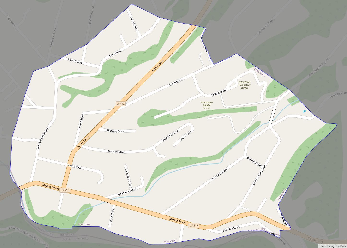
Peterstown location map. Where is Peterstown town?
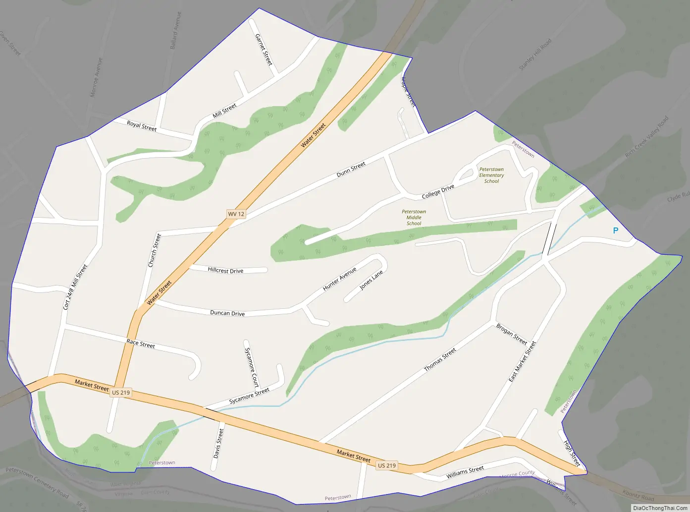
Peterstown Road Map
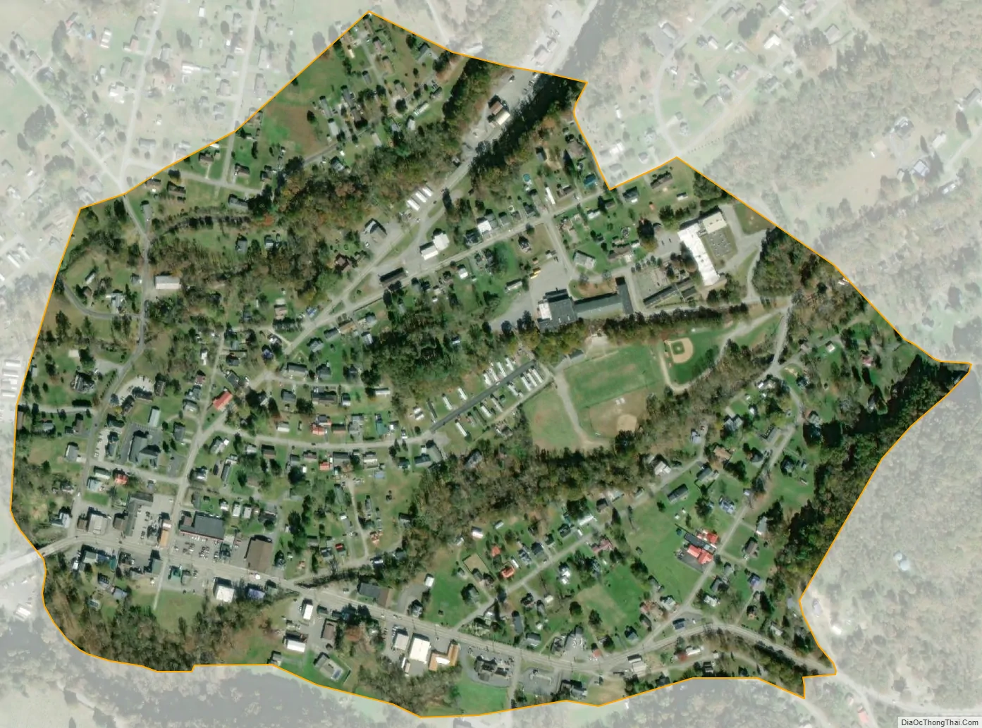
Peterstown city Satellite Map
Geography
Peterstown is located at 37°23′55″N 80°47′42″W / 37.398638°N 80.795102°W / 37.398638; -80.795102 (37.398638, -80.795102). It lies along the border with Virginia and is located directly across Rich Creek from Midway, Giles County, Virginia.
According to the United States Census Bureau, the town has a total area of 0.32 square miles (0.83 km), all land.
See also
Map of West Virginia State and its subdivision:- Barbour
- Berkeley
- Boone
- Braxton
- Brooke
- Cabell
- Calhoun
- Clay
- Doddridge
- Fayette
- Gilmer
- Grant
- Greenbrier
- Hampshire
- Hancock
- Hardy
- Harrison
- Jackson
- Jefferson
- Kanawha
- Lewis
- Lincoln
- Logan
- Marion
- Marshall
- Mason
- McDowell
- Mercer
- Mineral
- Mingo
- Monongalia
- Monroe
- Morgan
- Nicholas
- Ohio
- Pendleton
- Pleasants
- Pocahontas
- Preston
- Putnam
- Raleigh
- Randolph
- Ritchie
- Roane
- Summers
- Taylor
- Tucker
- Tyler
- Upshur
- Wayne
- Webster
- Wetzel
- Wirt
- Wood
- Wyoming
- Alabama
- Alaska
- Arizona
- Arkansas
- California
- Colorado
- Connecticut
- Delaware
- District of Columbia
- Florida
- Georgia
- Hawaii
- Idaho
- Illinois
- Indiana
- Iowa
- Kansas
- Kentucky
- Louisiana
- Maine
- Maryland
- Massachusetts
- Michigan
- Minnesota
- Mississippi
- Missouri
- Montana
- Nebraska
- Nevada
- New Hampshire
- New Jersey
- New Mexico
- New York
- North Carolina
- North Dakota
- Ohio
- Oklahoma
- Oregon
- Pennsylvania
- Rhode Island
- South Carolina
- South Dakota
- Tennessee
- Texas
- Utah
- Vermont
- Virginia
- Washington
- West Virginia
- Wisconsin
- Wyoming