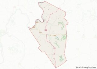
Ravenswood is a city in Jackson County, West Virginia, United States, along the Ohio River. The population was 3,865 at the 2020 census.
| Name: | Ravenswood city |
|---|---|
| LSAD Code: | 25 |
| LSAD Description: | city (suffix) |
| State: | West Virginia |
| County: | Jackson County |
| Elevation: | 607 ft (185 m) |
| Total Area: | 1.89 sq mi (4.89 km²) |
| Land Area: | 1.82 sq mi (4.71 km²) |
| Water Area: | 0.07 sq mi (0.18 km²) |
| Total Population: | 3,865 |
| Population Density: | 2,004.95/sq mi (774.00/km²) |
| ZIP code: | 26164 |
| Area code: | 304 |
| FIPS code: | 5467108 |
| GNISfeature ID: | 1555445 |
| Website: | cityofravenswood.com, www.facebook.com/cityofravenswood |
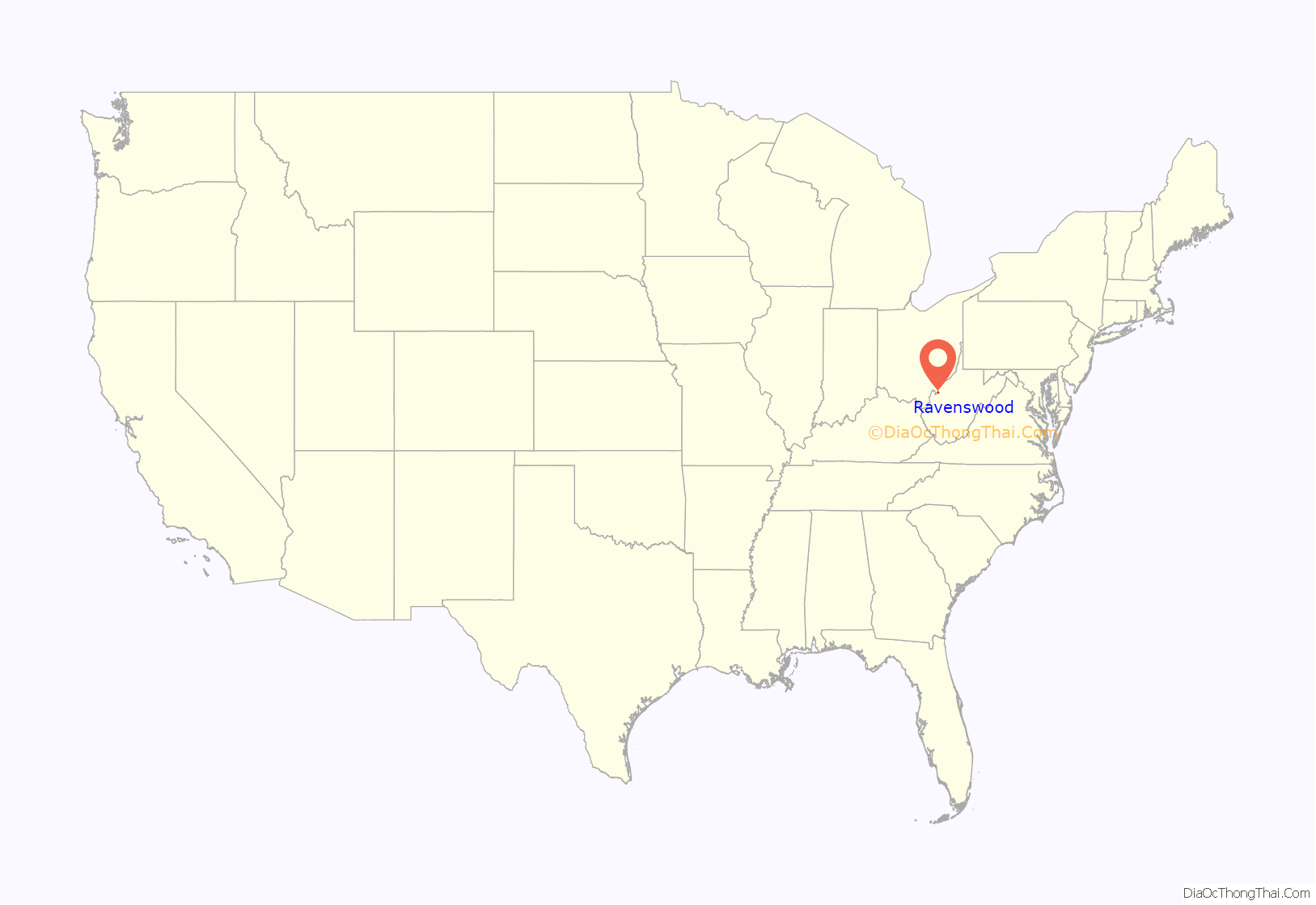
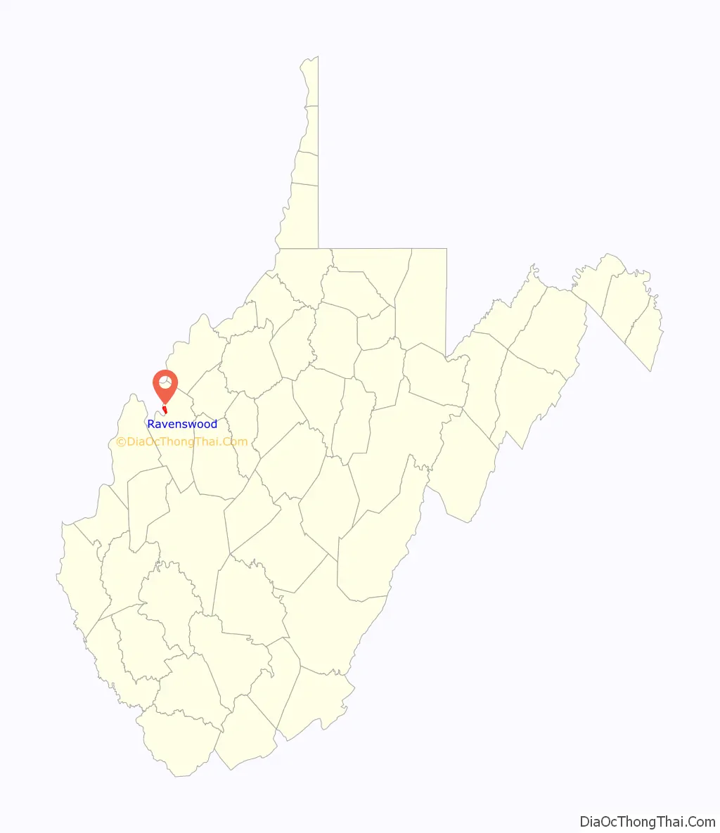
Online Interactive Map
Click on ![]() to view map in "full screen" mode.
to view map in "full screen" mode.
Ravenswood location map. Where is Ravenswood city?
History
Ravenswood is sited on land once owned by George Washington. Washington acquired the 2,448-acre (10 km) parcel in 1770, and designated Colonel William Crawford to survey the lands in 1771. A permanent settlement was first established in 1810, and the town streets and lots were laid out in their current pattern by descendants of Washington in 1835. The first town election was held in the home of Bartholomew Fleming in 1840. Ravenswood was incorporated in 1852.
During the American Civil War, the 1863 Battle of Buffington Island took place one mile (1.6 km) north of Ravenswood. In 1886, the Ohio River Rail Road reached Ravenswood.
In 1931, the Ravenswood Glass Novelty Company (“The Marble Factory”) opened. When Kaiser Aluminum planned a new facility with 12,000 workers, Bill Finley was hired to plan a “company town” of 25,000. He went on to become a planner with the National Capital Planning Commission, and develop the community of Columbia, Maryland, for the Rouse Company. Henry J. Kaiser opened what was then the world’s largest aluminum refinery six miles south of Ravenswood in 1957. The Kaiser facility is now owned by Constellium and Century Aluminum. John F. Kennedy visited Ravenswood during the 1960 Democratic Party presidential primaries. The Ravenswood exit of Interstate 77 opened in 1964.
In February 2010, USA Today referred to Ravenswood as “teetering on a ghost town”. Mayor Lucy Harbert responded by bringing in sponsorships from several Silicon Valley-based companies like ScanCafe.com and StartUps.com. On March 26, 2010, Mike Ruben, a reporter with the State Journal newspaper, announced that Ravenswood was “transforming” the town into “Aluminum City, U.S.A.” to help attract local tourism revenue: “L.A. Promoter Plans to Market ‘Aluminum City’.” None of these developments came to fruition.
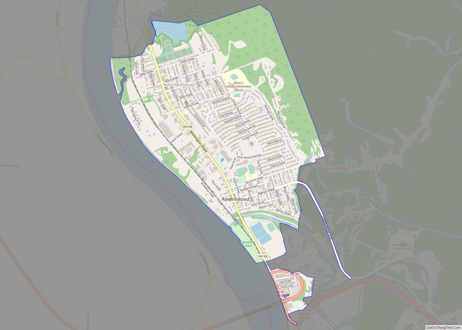
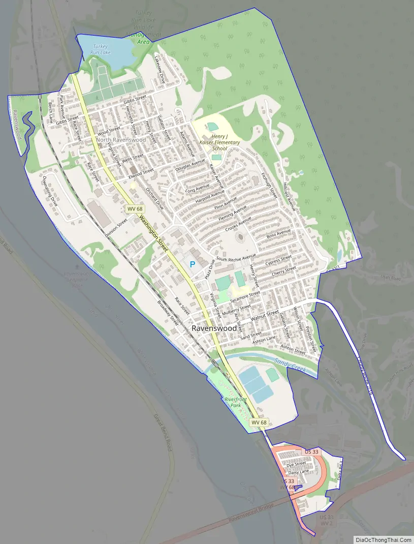
Ravenswood Road Map
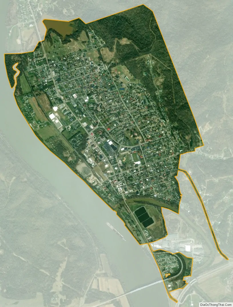
Ravenswood city Satellite Map
Geography
Ravenswood is located at 38°57′11″N 81°45′41″W / 38.95306°N 81.76139°W / 38.95306; -81.76139 (38.952922, -81.761357), along the Ohio River at the mouth of Sandy Creek.
According to the United States Census Bureau, the city has a total area of 1.90 square miles (4.92 km), of which 1.83 square miles (4.74 km) is land and 0.07 square miles (0.18 km) is water.
Climate
The climate in this area is characterized by relatively high temperatures and evenly distributed precipitation throughout the year. According to the Köppen Climate Classification system, Ravenswood has a Humid subtropical climate, abbreviated “Cfa” on climate maps.
See also
Map of West Virginia State and its subdivision:- Barbour
- Berkeley
- Boone
- Braxton
- Brooke
- Cabell
- Calhoun
- Clay
- Doddridge
- Fayette
- Gilmer
- Grant
- Greenbrier
- Hampshire
- Hancock
- Hardy
- Harrison
- Jackson
- Jefferson
- Kanawha
- Lewis
- Lincoln
- Logan
- Marion
- Marshall
- Mason
- McDowell
- Mercer
- Mineral
- Mingo
- Monongalia
- Monroe
- Morgan
- Nicholas
- Ohio
- Pendleton
- Pleasants
- Pocahontas
- Preston
- Putnam
- Raleigh
- Randolph
- Ritchie
- Roane
- Summers
- Taylor
- Tucker
- Tyler
- Upshur
- Wayne
- Webster
- Wetzel
- Wirt
- Wood
- Wyoming
- Alabama
- Alaska
- Arizona
- Arkansas
- California
- Colorado
- Connecticut
- Delaware
- District of Columbia
- Florida
- Georgia
- Hawaii
- Idaho
- Illinois
- Indiana
- Iowa
- Kansas
- Kentucky
- Louisiana
- Maine
- Maryland
- Massachusetts
- Michigan
- Minnesota
- Mississippi
- Missouri
- Montana
- Nebraska
- Nevada
- New Hampshire
- New Jersey
- New Mexico
- New York
- North Carolina
- North Dakota
- Ohio
- Oklahoma
- Oregon
- Pennsylvania
- Rhode Island
- South Carolina
- South Dakota
- Tennessee
- Texas
- Utah
- Vermont
- Virginia
- Washington
- West Virginia
- Wisconsin
- Wyoming