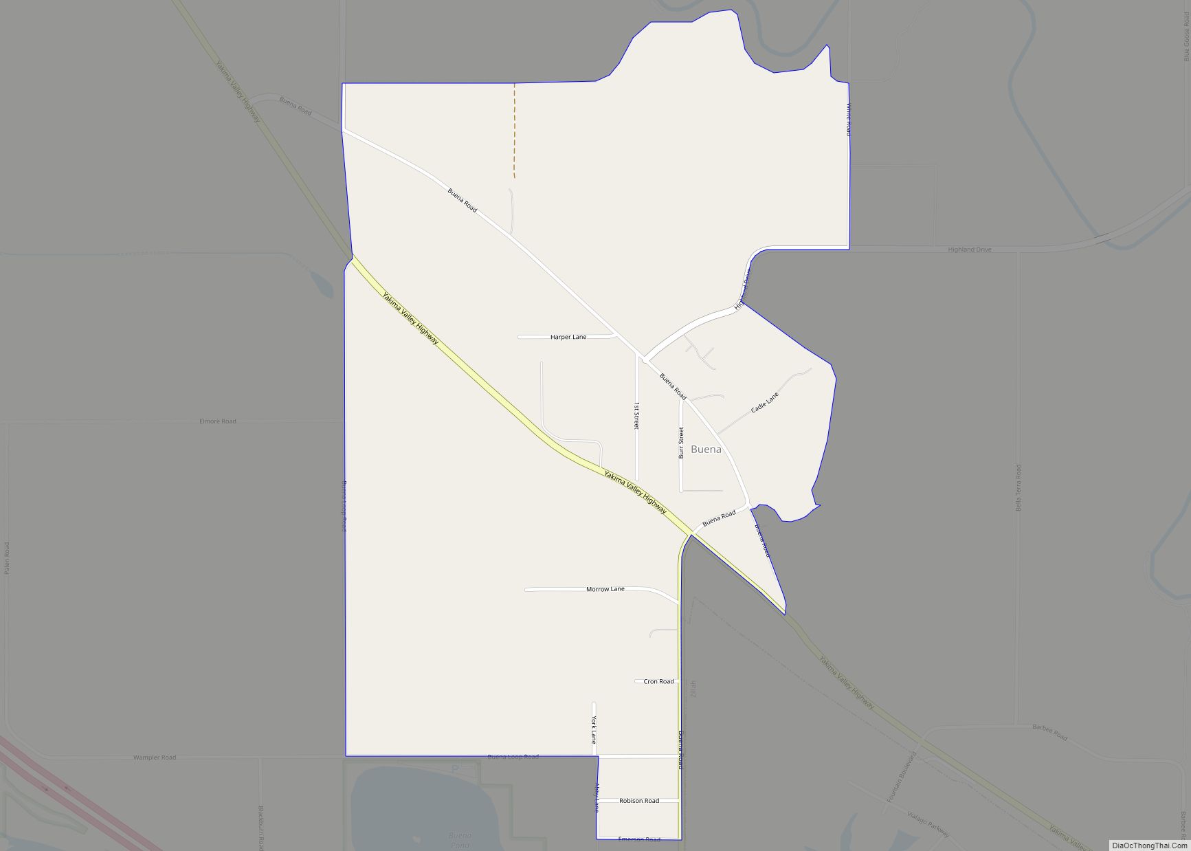
Buena (/bjuːˈɛnə/) is an unincorporated community in Yakima County, with a 2010 census population of 990. The community was not recognized in the 2000 census figures. Washington, United States. Buena is 3.5 miles (5.6 km) north of Toppenish. Buena has a post office with ZIP code 98921. Its name originates from Spanish bueno “good”. Buena CDP ... Read more
Map of US Cities and Places
Bucoda town overview: Name: Bucoda town LSAD Code: 43 LSAD Description: town (suffix) State: Washington County: Thurston County FIPS code: 5308605 Online Interactive Map Bucoda online map. Source: Basemap layers from Google Map, Open Street Map (OSM), Arcgisonline, Wmflabs. Boundary Data from Database of Global Administrative Areas. Bucoda location map. Where is Bucoda town? Bucoda ... Read more
Buckley is a city in Pierce County, Washington, United States, founded in 1882. The population was 5,114 at the 2020 census. Buckley sits below Mount Rainier and is well known for hosting the annual Log Show. Buckley city overview: Name: Buckley city LSAD Code: 25 LSAD Description: city (suffix) State: Washington County: Pierce County Incorporated: ... Read more
Bryant is a census-designated place (CDP) in Snohomish County, Washington, United States. The population was 1,870 at the 2010 census. A post office called Bryant was established in 1893, and remained in operation until 1954. The community most likely took its name from the Bryant Lumber and Shingle Company. Bryant CDP overview: Name: Bryant CDP ... Read more
Burlington is a city in Skagit County, Washington, United States. Its population was recorded as 9,152 in the 2020 census. Burlington is located approximately halfway between Seattle and Vancouver, B.C. The city is included in the Mount Vernon–Anacortes, Washington Metropolitan Statistical Area. Burlington city overview: Name: Burlington city LSAD Code: 25 LSAD Description: city (suffix) ... Read more
Burley is an unincorporated community and census-designated place (CDP) in Kitsap County, Washington, United States. It is located just north of the boundary with Pierce County, about halfway between Gig Harbor to the south and Port Orchard to the north. It is located at the head of the Burley Lagoon in Henderson Bay. Burley is ... Read more
Burbank is a census-designated place (CDP) in Walla Walla County, Washington, United States, where the Snake River meets the Columbia. The population was 3,291 at the 2010 census. Named for Luther Burbank, the city is located just east of Pasco and Kennewick, across the Snake and Columbia Rivers, respectively. Burbank is part of the Tri-Cities, ... Read more
Cascade Valley is a census-designated place (CDP) in Grant County, Washington, United States. The population was 2,246 at the 2010 census, up from 1,811 at the 2000 census. Cascade Valley CDP overview: Name: Cascade Valley CDP LSAD Code: 57 LSAD Description: CDP (suffix) State: Washington County: Grant County Elevation: 1,060 ft (323 m) Total Area: 4.60 sq mi (11.92 km²) ... Read more
Carlsborg is an unincorporated community and census-designated place (CDP) in Clallam County, Washington, United States. The population was 995 at the 2010 census, up from 855 at the 2000 census. Carlsborg CDP overview: Name: Carlsborg CDP LSAD Code: 57 LSAD Description: CDP (suffix) State: Washington County: Clallam County Elevation: 180 ft (55 m) Total Area: 1.0 sq mi (2.7 km²) ... Read more
Camas /ˈkæməs/ is a city in Clark County, Washington, with a population of 26,065 at the 2020 census. The east side of town borders the city of Washougal, Washington, and the west side of town borders Vancouver, Washington. Camas lies along the Washington side of the Columbia River, across from Troutdale, Oregon, and is part ... Read more
Camano Island /kəˈmeɪnoʊ/ is a large island in Possession Sound, a section of Puget Sound. It is part of Island County, Washington, and is located between Whidbey Island and the mainland (Snohomish County) by the Saratoga Passage to the west and Port Susan and Davis Slough to the east. The island has one road connection ... Read more
Central Park is a census-designated place (CDP) in Grays Harbor County, Washington, United States. The population was 2,841 at the 2020 census. Central Park CDP overview: Name: Central Park CDP LSAD Code: 57 LSAD Description: CDP (suffix) State: Washington County: Grays Harbor County Elevation: 138 ft (42 m) Total Area: 3.5 sq mi (9.1 km²) Land Area: 3.5 sq mi (9.1 km²) Water ... Read more